- Home
- :
- All Communities
- :
- Services
- :
- Esri Technical Support
- :
- Esri Technical Support Blog
- :
- The Thin Road Network tool in ArcGIS 10
The Thin Road Network tool in ArcGIS 10
- Subscribe to RSS Feed
- Mark as New
- Mark as Read
- Bookmark
- Subscribe
- Printer Friendly Page
GIS analysts have become the default cartographers for some organizations. The primary task of a cartographer is to simplify reality in such a way that maps can convey the maximum amount of information with a minimum amount of clutter. Accordingly, analysts have been required to develop datasets and layers that work at a variety of scales. Street datasets are particularly troublesome. Detailed road inventories are ideal for large scale mapping, but individual roads quickly turn into indecipherable blobs during the visualization of large cities and regions. Over the years, a combination of definition queries, scale range settings, and creative uses of symbology have been employed to create road basemaps that work at a variety of scales.
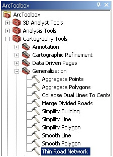
Figure 1:The Thin Road Network tool</FONT></CAPTION>
The Thin Road Network tool (Cartography Tools/Generalization), available in ArcGIS 10, provides another method for the digital cartographer to simplify a street feature class, while maintaining the integrity and connectivity of the street network. The tool can pare a detailed street’s datasets for medium scale mapping of urban areas. The tool does not actually delete features—instead it identifies road segments that could be removed from the map without compromising connectivity or removing high-order routes.
Preparing the Streets
Slight modifications are necessary to prepare the street data for use as an input to the Thin Road Network tool.
- Add an Invisibility field
Create a new integer field and use the Field Calculator to set the field to 0. After the tool is executed roads that should be removed from the display are assigned a value of 1. - Add a Hierarchy field
The street feature class must have a Hierarchy field. If this attribute needs to be created, speed limit is a decent corollary. For instance, roads with a speed limit of 65 are generally more important than roads with a speed limit of 45. Number of lanes or functional class could also be used to define hierarchy. The Hierarchy field should be an integer field with values from 0 through 5. Roads where Hierarchy = 0 will be considered “locked” and will remain visible.
Executing the Thin Road Network Tool
Running the Thin Road Network tool requires a Minimum Length parameter to be defined. This parameter defines a “sense of the resolution or granularity of the resulting simplified road collection (ArcGIS 10 Webhelp).” This value should represent the minimum length of road that is significant enough to include in the final map. The value is dependent on the desired scale at which the road layer is meant to be viewed. The tool will place a value of 1 in the Invisibility field based on an analysis of hierarchy, visibility locking, resolution, and the morphology and connectivity of the road geometry.
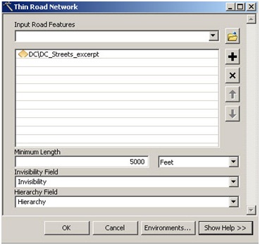
Figure 2: Tool Dialog Box
Time Considerations
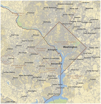
The structure and size of the street's feature class that is used as an input, in tandem with computer specifications, will determine the time it takes to run the tool. With large datasets, it can take quite a while. For instance, in recent testing, the Thin Road Network tool ran for 30 minutes on 170,000 road features representing the greater Washington DC urban area.
| Minimum Distance | Improvement* | Time | Segments |
|---|---|---|---|
| 200ft | 6% | 27 minutes | 10,254 |
| 300ft | 10% | 29 minutes | 17,205 |
| 500ft | 17% | 29 minutes | 28,217 |
| 1000ft | 27% | 31 minutes | 46,654 |
| 1500ft | 34% | 31 minutes | 58,559 |
| 5000ft | 40% | 40 minutes | 67,362 |
You must be a registered user to add a comment. If you've already registered, sign in. Otherwise, register and sign in.
-
Announcements
70 -
ArcGIS Desktop
87 -
ArcGIS Enterprise
43 -
ArcGIS Mobile
7 -
ArcGIS Online
21 -
ArcGIS Pro
14 -
ArcPad
4 -
ArcSDE
16 -
CityEngine
9 -
Geodatabase
25 -
High Priority
9 -
Location Analytics
4 -
People
3 -
Raster
17 -
SDK
29 -
Support
3 -
Support.Esri.com
60
- « Previous
- Next »