- Home
- :
- All Communities
- :
- Products
- :
- ArcGIS Field Maps
- :
- ArcGIS Field Maps Questions
- :
- Re: field map designer: related records not curren...
- Subscribe to RSS Feed
- Mark Topic as New
- Mark Topic as Read
- Float this Topic for Current User
- Bookmark
- Subscribe
- Mute
- Printer Friendly Page
field map designer: related records not currently supported on mobile
- Mark as New
- Bookmark
- Subscribe
- Mute
- Subscribe to RSS Feed
- Permalink
- Report Inappropriate Content
My coworker is getting this error:
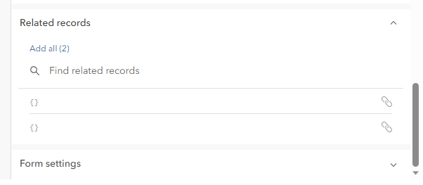
Related Records not currently supported on mobile.
It is my role to help her troubleshoot when she has issues. How do I know if there is an issue with her data or the field map designer tool?
In field maps she can see the related table and can edit it and the edits are syncing to her online map.
But she can't view or modify the related table in the field map designer tool. She said that it was working this morning.
I had her create a new map that only had the point layer with the related table and open it in field maps designer and it had the same error.
I'm not sure what to try next. I told her that maybe there is an issue with the tool and to wait an hour and check again then to see if it is resolved.
If you have any troubleshooting suggestions please let me know.
Also, does anyone know if there is a place where I can read about current bugs with field maps designer or field maps mobile app? We are using these tools daily now so it would be nice to look for bugs so we will know if there is something wrong with our data or something wrong with our tools.
Thank you!
Solved! Go to Solution.
- Mark as New
- Bookmark
- Subscribe
- Mute
- Subscribe to RSS Feed
- Permalink
- Report Inappropriate Content
Okay, got it. I'm still in the process rebuilding a couple tables, but do you know if more than one table relate per feature layer will work in the map viewer? I think I may have to use groups or logic to keep the fields from opening all at once if it will work. Thank you!
Office of Conservation Planning
- Mark as New
- Bookmark
- Subscribe
- Mute
- Subscribe to RSS Feed
- Permalink
- Report Inappropriate Content
Here's my schema with relates as the lines. The point/line/polygon features are all a 1:1 relate to the monitoring notes and the tables under the monitoring notes are all 1:many. The related records will show in the pop-ups under their appropriate tables, but I don't think you can add them to the forms for data collection yet.
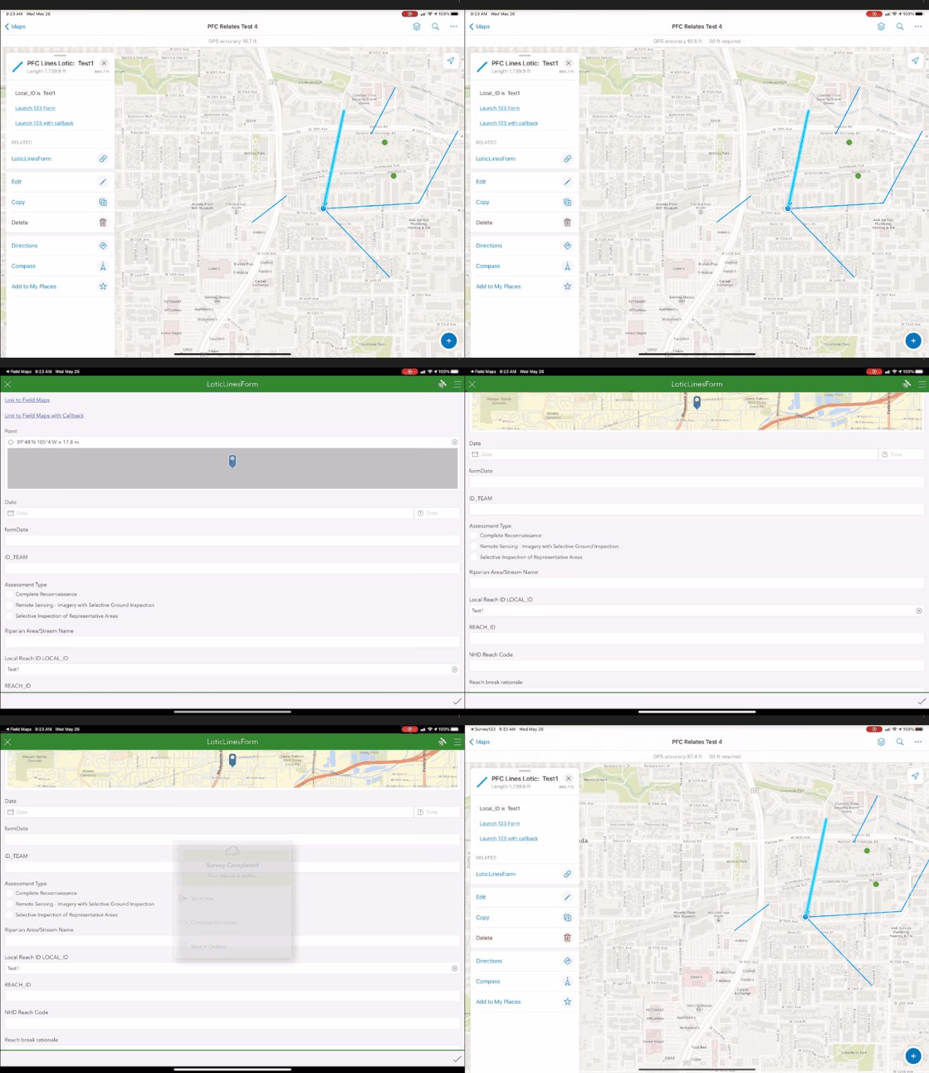
My setup that I'm currently testing is to enter the point/line/polygon data in Field Maps, then you open the pop-up for that feature and tap a link that launches Survey123 with a blank survey if there is no related monitoring note record or if it finds one, it opens it for editing. The tables related to monitoring notes are all handled as repeats in Survey123.
If you go that route, the related tables aliases cannot have spaces or other special characters not allowed in the Survey123 Connect xlsx 'name' column. When you publish a hosted feature service in Pro 3.1, it uses the aliases of feature classes and tables as the name of the hosted feature layers and tables. So for example "Monitoring Notes" should have the alias as something like "MonitoringNotes" or "Monitoring_Notes".
There's also an issue with Field Maps and Arcade for passing q:queryparameters to the custom URL schema to find matching records from Integrate with other apps. The query has to be formatted a very particular way and passing it through UrlEncode() will mess it up. I appended the query for the global id after encoding the rest of the URL, which worked with web maps. Field Maps however would generate the URL with everything in the query except the global id value. It will only pass it through UrlEncode(). I've got a solution that I figured out yesterday. It works well and Esri tech support liked it too. If you're interested in pursuing Field Maps/Survey123 integration let me know and I'll be happy to share it.
- Mark as New
- Bookmark
- Subscribe
- Mute
- Subscribe to RSS Feed
- Permalink
- Report Inappropriate Content
Thanks for posting your schema diagram and the part about the aliases. I'm a bit confused about "The related records will show in the pop-ups under their appropriate tables, but I don't think you can add them to the forms for data collection yet." I've added related records to the form in the map viewer but I haven't gotten to the testing phase in field maps yet. So this is a new one. 😞 My schema diagram is much more complicated with many 1:many relates so this all just tells me I need to start small and take it all the way through to Field Maps to see what's gonna work. I also have not thought about using Survey 123 because of the 1:many relates. I would welcome the solution on Field Maps/Survey123. I may be headed back to the drawing board on this.
This has been working on a much smaller scale for one region of Florida but was built before form designer or the new map viewer etc. etc. and it worked great in Field Maps. Oh well. Thank you so much.
Office of Conservation Planning
- Mark as New
- Bookmark
- Subscribe
- Mute
- Subscribe to RSS Feed
- Permalink
- Report Inappropriate Content
It seems to list them all yes. My names just look blank since 123 has been creating relationship classes with no name still, which I hope they fix some day. Note only related tables are given as options since still no support for related layers. Which is weird tables usually come last.
- Mark as New
- Bookmark
- Subscribe
- Mute
- Subscribe to RSS Feed
- Permalink
- Report Inappropriate Content
@DougBrowning If you go to the REST admin page for the feature layers/tables it will show the relationship names there if you need it for arcade expressions. I have some feature services published through Connect with repeat tables and it shows a relationship name for each of those. The relationship name excludes the number in () after the name. So if you have a relationship named like Dougs_GIS_table_chairs (1) and wanted to test it with FeatureSetByRelationshipName() you would enter 'Dougs_GIS_table_chairs' for the relationship name.
- Mark as New
- Bookmark
- Subscribe
- Mute
- Subscribe to RSS Feed
- Permalink
- Report Inappropriate Content
This helped me. It had been a few years (pre Field Maps Designer) since I had to publish a feature service with a relationship class. Never had the issue before. Wouldn't have figured out the form button in Web Map Viewer solution on my own.
- Mark as New
- Bookmark
- Subscribe
- Mute
- Subscribe to RSS Feed
- Permalink
- Report Inappropriate Content
@TylerGraham2 could you please share your FieldMaps/Survey123 solution you mentioned above? It would be very helpful. Thank you!
Office of Conservation Planning
- Mark as New
- Bookmark
- Subscribe
- Mute
- Subscribe to RSS Feed
- Permalink
- Report Inappropriate Content
Here you go. This will create a link in a pop-up to open the survey record from the inbox in edit mode.
var urlsource = 'arcgis-survey123://?';
//Custom URL Schema
var item_id = <Survey's ItemID fround on Survey123 website>;
//form item ID, found by going to survey123.arcgis.com and copying from the survey link under collaborate
var guid_field = <guid field name>;
// GUID field in related table, foreign key points back to feature layer
var globalid = $feature.GlobalID;
//pull individual feature's globalid value
var q_exp = guid_field + "='" + globalid +"'";
//query expression to search survey table for guid that matches feature global id, must be passed in UrlEncode()
var linktext = <Put link display text here>;
var params = {
//parameters for UrlEncode()
action: 'edit',
//sets survey123 to edit existing record
folder: 'inbox',
//searches the survey123 inbox
itemID: item_id,
//use form item id here to target specified survey
update: 'true',
"q:where": q_exp
//for query parameters to work in URL encode must be "q:where": to pass the query into the link as q%3Awhere=
//if the '=' after the where is encoded as html the query fails because it doesn't know how to recognize the html encode
//the field name has to be specifically typed here, if it is assigned as a variable elsewhere in the expression and the
//variable is called here it includes the variable name along with the variable and causes the expression to fail.
};
var fullURL = Concatenate([urlsource,UrlEncode(params)]);
//creates the full dynamic url
return {
type: 'text',
text: `<p> <a href="${fullURL}" target="_blank">${linktext}</a></p>`,
//this property supports html tags
};
- Mark as New
- Bookmark
- Subscribe
- Mute
- Subscribe to RSS Feed
- Permalink
- Report Inappropriate Content
Thank you @TylerGraham2! I will be back on this project in the next couple days and really appreciate the help. I'm sure I will be back with an update. Hopefully it will be a success story.
Office of Conservation Planning
- Mark as New
- Bookmark
- Subscribe
- Mute
- Subscribe to RSS Feed
- Permalink
- Report Inappropriate Content
I have a write up on using related layers and tables with 123 and Field Maps here also https://community.esri.com/t5/arcgis-survey123-questions/mapping-with-survey123-within-a-polygon-or-...
If you have several forms it is a great workflow. Field Maps is good at spatial to get the crew to the correct sport. 123 is good at forms so we launch all 15 forms from Field Maps pushing over the Key and other config variables. Then they all link together using relationships classes. Then I have a call back that flips them back to Field Maps on a save. Works slick.


