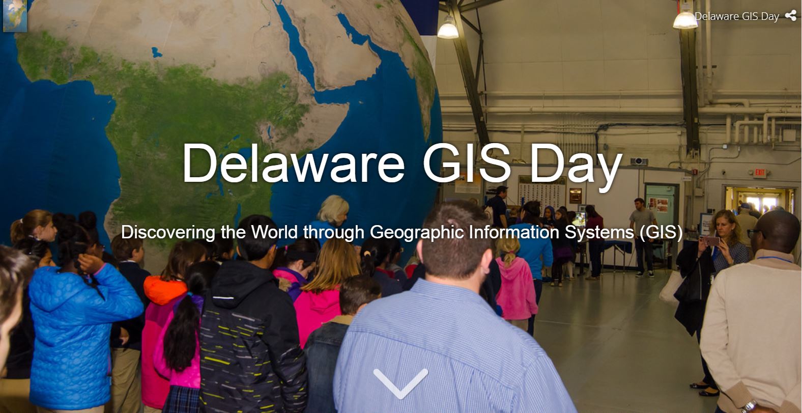
GIS Day Blog

cancel
Showing results for 
Show  only  | Search instead for 
Did you mean: 

Other Boards in This Place

Latest Activity

(8 Posts)
JosephKerski
Esri Notable Contributor

Last week I shared 15 inspiring stories from GIS Day 2018.  These were a joy to write and I hope, for you to read.  Here are 15 more inspiring GIS Day stories from all around the world.  Even with that set and this week's new set of 15, I am just touching the tip of the iceberg, so I invite you to examine the events listed on the GIS Day map as well as this story map. 


Read more...

more
6 2 5,139
JosephKerski
Esri Notable Contributor

Thank you to everyone who celebrated GIS Day in 2018.  I invite you to share your experiences and continue the celebration by sending in your GIS Day memories to gisday@esri.com, share your event on this story map, or share in the GIS Day group on GeoNet.  A total of 1,201 events were held globally.  Here are just a few of the many stories coming in from government agencies, universities, schools, nonprofit organizations, and private companies that clearly demonstrate how GIS is making a positive difference all around the world.

In Argentina, at The National Technological University (UTN), in Tucumán, Alejandro Bascolo shared this story of their event.  One video in the article features Engineer Alejandro Báscolo, Professor of Geographic Information Systems and Chair, who said: "This is the eleventh edition of this open house in which is exposed how geographic information systems can help in the resolution of different problems that are presented to us daily". 

GIS Day celebration in Argentina

GIS Day celebration at UTN - the National Technological University in Tucumán, Argentina.

Professor Stacey Stark shared the event held at the University of Minnesota Duluth:  They held a GIS Fest on campus, attended by 150 people, that included presentations, exhibits, and demonstrations covering a wide range of fields in topics such as GIS in elementary education, fighting the opioid epidemic, learning about mercury distribution in the St Louis River Estuary, solving problems at Minnesota Housing, spatial web services and applications, the future of the geospatial industry, drones, and more.  Participants learned from university GIS student alumni, community partners and faculty as they share their work. 

GIS Fest at University of Minnesota Duluth.

One of the exhibits at GIS Fest at University of Minnesota Duluth.

Pakrad Balabanian shared an event in Armenia organized by his non-profit organization KARDÉS (which means maps in Armenian) in partnership with AGBU AVC (Armenian Virtual College) and in coordination with the Ministry of Education and Science of Republic of Armenia.  It took place in the AGBU headquarters in Yerevan, Armenia. AGBU (Armenian General Benevolent Union) is the largest non-profit Armenian organization, established in 1906.  The purposes of the event were to introduce the importance of GIS and maps to teachers of all levels, the importance of GIS in education and its link with STEM (Science Technology Engineering and Mathematics), present a pilot project of introducing GIS in 25 public schools, to get feedback from teachers about the subjects and topics to be used in the pilot, and to celebrate the GIS Day for the first time officially in Armenia.

First ever GIS Day event in Armenia, focused on education.

First ever GIS Day event in Armenia, focused on education.

Professor David Padgett shared the Tennessee State University and Morgan State University collaborative GIS Day events and forum. The collaborative GIS Day event included the following presentations, all live streamed: Maps of Black Folk: Geospatial Technologies in Professional Practice and Student Career Mapping, Mapping Southwest Asia and South Asia Climate Data using the ESRI Story Maps Platform", GIS Scoping Methods for Health Impact Assessments (HIAs) for Four Gulf Coast Environmental Justice Communities, student GIS project presentations, Geospatial Technologies in Professional Practice, Student Career Mapping in Geospatial Technologies, and using GLOBE Urban Heat Islands - Surface Temperature Field Campaign Data to develop a Research Question.

One of the activities (pictured below) was a GLOBE Atmosphere Protocol outdoor exercise at Stratford STEM Magnet High School. Pre-service teachers enrolled Dr Padgett's World Regional Geography course led Mr. Rodney Donaldson's 9th grade class in completing the data collection. Dr Padgett's students then did a data visualization converting the GLOBE data into map format using ArcGIS online. On GIS Day, Dr Padgett's students engaged in a live interactive discussion on the atmosphere data they collected and how it is symbolized on the map. At a later date we plan to give the 9th graders the opportunity to work with ArcGIS Online hands-on. This is a great example of university students and faculty working with K-12 students!

Dr Padgett works with students to collect data in the field.

Dr David Padgett explains field data collection procedures to students in Tennessee.

Samuel Macedo shared their 2nd annual event at the Universidade Estadual de Santa Cruz, in Ilhéus, Brazil. The entire event can be seen on YouTube, including five presentations given during the day.  

GIS Day events in Brazil.

GIS Day events in Brazil. 

Janaki Gattu, Manager at GeoSys Enterprise Solutions in India, shared this story:   They held an event for employees who work on smart city projects, focusing on the role of GIS in the digital transformation of society focusing on the web GIS platform, on 17 November in Hyderabad.   A video of the event touches on the highlights

GIS Day event at GeoSys Enterprise Solutions in Hyderabad, India.

GIS Day event at GeoSys Enterprise Solutions in Hyderabad, India.

Hayleigh Conway, Geomatics Technician, Western Arctic Field Unit for Parks Canada, shared their story from way up in Inuvik Northwest Territories (NWT), Canada, where she, Celtie Ferguson from the Aurora Research Institute, William Woodley and Nanar Hakobyan from the NWT Centre for Geomatics, Alice Wilson from Environment and Natural Resources, and Annika Trimble, Garfield Giff, and Amir Zeb from the Aurora Research Institute organized a whole "Geo-Week". This included a 3-hour public event at Aurora College where members of the community visited tables highlighting research performed using GIS in the Mackenzie Delta region, including a scavenger hunt around town!

The next day, the organizers spent the day at East Three High School presenting to grades 7, 8, 9 and one grade 11 science class. This included topographic map work, a remote sensing activity, wildlife collars and telemetry to track caribou movements, and a demonstration of different GIS apps (including the Gwich’in Place Name and Story Atlas. Then over the following two days, they presented to all the grade 4, 5 and 6 classes (9 classes total) at the East Three Elementary School. Said Hayleigh, "It was bananas but a lot of fun." It included activities on a huge Canadian Geographic floor map of the Boreal Forest, learning about scale and legends and had some fun scavenger hunts looking for different cities and towns. Students also traced sections of a map of the Mackenzie Delta and put them all together to make a complete map.

Team organizing the GIS Day event in Inuvik, Canada.

Team organizing the GIS Day event in Inuvik, Canada.

In Côte d'Ivoire, the Youth Mappers of the Centre Universitaire de Recherche et d'Application en Télédétection (Research Centre for Applied Remote Sensing) (CURAT) participated in GIS Day on 17 November 2018. It brought together students and professionals.  This included a Mapathon on Abobo project task 4921, initiated by three main organizations: AidData, Development Gateway, the Ministry’s Direction de l'Informatique et de l'Information Sanitaire (DIIS), and USAID/CIV

Presentations included those from Gerard Allali, GIS Engineer and working for a commercial company on various geospatial projects in Ivory Coast and Mali, and Nesit Abedje, GIS Consultant for an International Foundation. His main tasks are implementing the project OpenDCH is Ivory Coast and training Ivorian staff in the health area.  Traoré Salim, GIS Analyst, Marius Guede, Geographer, and Chérif Aïdara, Data Analyst, also shared their experiences. Another professional (Kouakou Ulrich Franck) who is working for a telecommunication company shared his work with using big data and machine learning in spatial analysis. 

GIS Day activities in Cote de Ivorie.

GIS Day activities from the Youth Mappers of CURAT - Centre Universitaire de Recherche et d'Application en Télédétection (Research Centre for Applied Remote Sensing) in the Côte d'Ivoire.

I participated in a GIS Day Live Chat on Friday 9 November.  It was great fun, with more than 5,000 views and 95 comments between the GIS Day Live Chat guests and GeoNet members posting their questions.  I salute my colleagues Nicole Minni from the University of Delaware, Luis Olivieri from Hopeworks, the GeoNet team, and all who participated, for making it a great success.   Plus, the poster that my GeoNet colleagues put together made us look like we had recorded our own multi-platinum album!

GIS Day Live Chat

Live Chat GIS Day flyer. 

Dr Patricia Carbajales-Dale from Clemson University shared their event, which included drones, Lidar, a mapathon, pizza, and cupcakes (pictured below). 

Clemson University GIS Day event flyer

Clemson University GIS Day event flyer.

I also found it fascinating to read about the major event hosted by Esri France (with photos and videos included), incredible speakers that Stacy Curry-Johnson and her colleagues lined up for GIS Day at Vanderbilt Universitywhat geography instructor Bob Lang at the King Edward VI Camp Hill School for Girls did to celebrate GIS Day, as seen in his story map, and the innovative quiz that the Port of Tacoma put together in their story map of ports around the world

Last but not least for this GeoNet post, Janet Reyes, Geospatial Information Librarian at the University of California Riverside, shared their GIS Day event, which included a poster contest, presentations on Mapping Wildfires in Mediterranean Ecosystems in California (quite appropriate given recent events), the use of GIS in the “Along the Chaparral: Memorializing the Enshrined” project, a Web-based GIS Application for Longitudinal Neighborhood Analysis, Modeling Neighborhoods Through Time and Space with the Open Source Neighborhood Analysis Package, and on GIS in Local Government.  Janet also reported that her GIS Day table received a visit from Scotty the Bear, the UCR mascot! 

 GIS Day at University of California Riverside.

GIS Day table at the University of California Riverside receives a visit from the university mascot, Scotty the Bear!

more
7 1 9,666
Abdulhadi_alialzawi
New Contributor II

Hello i,am Abdulhadi alzawi from Libya

I would like to share with you our celebration of World GIS Day yesterday from Libya in the municipality of Tripoli Center
There was a presentation talking about GIS and its importance in private and public institutions and a view of the layers that were created and the data were entered and we also talked about sharing this data and layers through the web portal for the public to see .
There was also a map gallery for some areas within the municipal boundaries .
The attendees were members of the municipal council, the dean of the municipality, some employees and guests from outside the municipality

more
2 1 1,204
JosephKerski
Esri Notable Contributor

We’re excited to celebrate GIS Day 2018 with you here on GeoNet! Join in the worldwide geo-festivities and let us know how you’re celebrating this year by sharing your GIS Day stories and experiences (pictures, videos, comments or links to other content) and answering one of the questions below.  


  • How have you helped others learn about and apply GIS in their work or lives this year?
  • What personal GIS projects are you most proud of?
  • What areas GIS would you like to explore more this year? What GIS skills would you like to improve in?
  • What is one way you’d like to see GIS change the world?

--Joseph Kerski 

Spelling GIS Day on the beach!

 Spelling GIS Day in the sand on a beach!

more
6 0 3,199
JosephKerski
Esri Notable Contributor

GIS Day in the Classroom: An Implementation Guide for GIS Professionals and Teachers.  This resource is filled with activities and strategies that you can use on GIS Day and far beyond, to enable educators and students to effectively use GIS in a wide variety of subjects and levels of education:

https://assets.esri.com/content/dam/esrisites/media/pdf/GIS%20Day%20in%20the%20Classroom%20-%20An%20...

more
0 0 1,176
JosephKerski
Esri Notable Contributor

The Delaware GIS Day event is a great example of collaboration among different organizations to celebrate and educate about the value that GIS brings to education and society.  The Delaware event will be held on Wednesday, November 14, 2018 at the Air Command Mobility Museum in Dover. Approximately 300 students plus the general public attend this event from around the state, traveling through 18 stations to learn how GIS is used in different industries. There is even an enormous Earth balloon!  The content of these stations is tied to the 5th grade state curriculum.  Delaware Geographic Data Committee partners with several organizations to host this event.  They have even created a wonderfully detailed story map, here.  

For more information, see the event website: http://www.mygeoworld.org/delaware-gis-day-2018/   

If you are looking for ideas for your own GIS Day event, I invite you to examine the plans that Delaware has, and be encouraged and inspired!

Delaware GIS Day story map

The first section of the wonderfully detailed Delaware GIS Day story map.

more
0 0 1,765
JerenPortillo
Esri Contributor

GIS Day 2017 – Certification Voucher Giveaway

The certification team is kicking off GIS Day in a major way.

As part of the GIS Day festivities, we are sponsoring our annual Esri Technical Certification giveaway where you can enter to win a free exam voucher (valued at $225). Whether you are a student just starting out with GIS or a working GIS professional, achieving a technical certification lets everyone know that you are accomplished using Esri software.

We offer a variety of exams at different levels and versions of AcgGIS.  And, this giveaway is a great opportunity to take the next step in achieving your personal and professional development goals.

Visit our certification giveaway website to enter the contest.

*Only one entry per person.  Four entries will be randomly selected for the free vouchers.  The contest is open from November 14th through November 24th.  Contact cerification@esri.com for complete rules.

Good Luck!!

esricert technical certification esri technical certification

Jessi Mielke‌ Jessica Rosales‌ Suzanne Boden

more
6 2 1,526
JosephKerski
Esri Notable Contributor

GIS Day is drawing near!  This year, it will be held on 15 November 2017.  I wanted to share 6 things about GIS Day with you.


  1. What is GIS Day?  The theme of GIS Day is "Discovering the World Through GIS".  GIS Day provides an international forum for users of geographic information systems (GIS) technology to demonstrate real-world applications that are making a difference in our society.  The first formal GIS Day took place in 1999. Esri president and co-founder Jack Dangermond credits Ralph Nader with being the person who inspired the creation of GIS Day. He considered GIS Day a good initiative for people to learn about geography and the uses of GIS. He wanted GIS Day to be a grassroots effort and open to everyone to participate.

  2. Host an event at your organization -- school, community or technical college, university, nonprofit organization, library, private company, government agency, or even in a park outside--sometime during or close to GIS Day week (15 November 2017).  Post an announcement about your event on www.gisday.com.  It doesn’t have to be elaborate or something that consumes a lot of your employees’ time, but something where you open a section of your organization to the community, other departments in your organizations, or local schools, universities, community colleges, and clubs, to showcase what GIS is and what you are doing to make a positive difference in the world using GIS.  It doesn’t have to even be on the actual GIS Day; the point is that your event is promoting the benefits GIS brings to communities, your organization, and society.  Or, look at the map on the GIS Day website to find an event near you that you can attend!

  3. Find resources on the website www.gisday.com.  Together with a few other good people at Esri, I have made about 75 changes to the website since last GIS Day.  The resources improved on the website include story maps, hands-on activities, videos, strategies on how to work with students and the general public, and much more. Stay tuned for updates of the press releases, and so on.
  4. Get some geo-swag!  The first 250 organizations that register for GIS Day this year around the world will receive 1 box of some wonderful GIS-related items that you can use for promoting your event.  
  5. Be a GIS champion!  I am seeking organizations who are GIS and GIS Day champions around the world to highlight the good things they are doing, to be featured in articles on GeoNetArcNews, and other outlets.  Videos too!  If you know of an organization that should be included, or think that yours should be, please let me know via gisday@esri.com
  6. Questions?  Please email gisday@esri.com.  I am on the receiving end of those emails and respond to these on a daily basis.


I hope this is helpful.  Thank you for promoting and supporting GIS Day!


--Joseph Kerski 

more
4 0 3,387
31 Subscribers