- Home
- :
- All Communities
- :
- Products
- :
- Geoprocessing
- :
- Geoprocessing Questions
- :
- Creating Points Based Off Angles From Intersection...
- Subscribe to RSS Feed
- Mark Topic as New
- Mark Topic as Read
- Float this Topic for Current User
- Bookmark
- Subscribe
- Mute
- Printer Friendly Page
Creating Points Based Off Angles From Intersections
- Mark as New
- Bookmark
- Subscribe
- Mute
- Subscribe to RSS Feed
- Permalink
I am trying to automate a process within ArcGIS that can create points at relatively specific angles at intersections. I am going to use these points to perform spatial analysis based on address points. I only have an ArcGIS Standard license, so tools like Near aren't available (if they were to work at all).
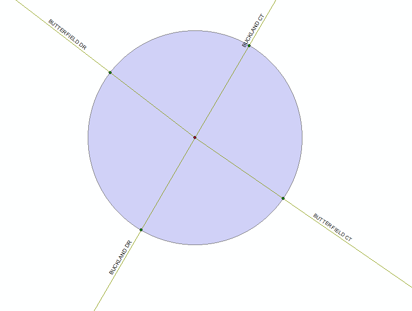
Here is my work flow: I have streets that I have already created intersections for using the method outlined here - https://community.esri.com/thread/21850. I then performed a 2 meter Buffer on every intersection. I created a unique ID field for each circle created [str(!OBJECTID!)+"xCIR"]. I then performed an Intersect between the street centerlines and the Buffer layer.
This is an example of what I've done:
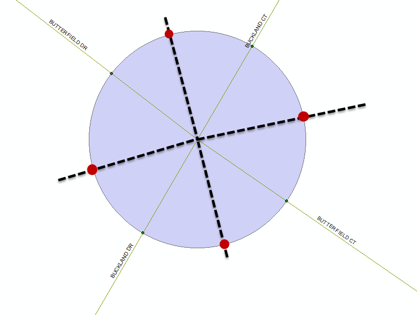
What I want to be able to do is create points that will basically an offset of the intersection points. I figure I would get the angles the points lie on the buffer's edge and simply take the average to get the angle halfway between the two points (or some method along those lines):
I would then like to be able to create two fields and populate the first street is to the left of the point and populate the second with whatever street is to the right.
Like I said, I'm trying to automate this (specifically through Model Builder). I have done some research but I am not strong when using Python. However, I am absolutely willing to give anything a shot.
Thanks to anyone for any suggestions or even points in the right direction.
Solved! Go to Solution.
Accepted Solutions
- Mark as New
- Bookmark
- Subscribe
- Mute
- Subscribe to RSS Feed
- Permalink
intersections are popular this year... see this thread and Darren's code sample
https://community.esri.com/message/585487#comment-585487
I am moving this thread to Geoprocessing since the Spatial Analyst Place is for the Spatial Analyst extension, not spatial analysis