- Home
- :
- All Communities
- :
- Products
- :
- Geoprocessing
- :
- Geoprocessing Questions
- :
- Clip tool will not clip raster layer
- Subscribe to RSS Feed
- Mark Topic as New
- Mark Topic as Read
- Float this Topic for Current User
- Bookmark
- Subscribe
- Mute
- Printer Friendly Page
- Mark as New
- Bookmark
- Subscribe
- Mute
- Subscribe to RSS Feed
- Permalink
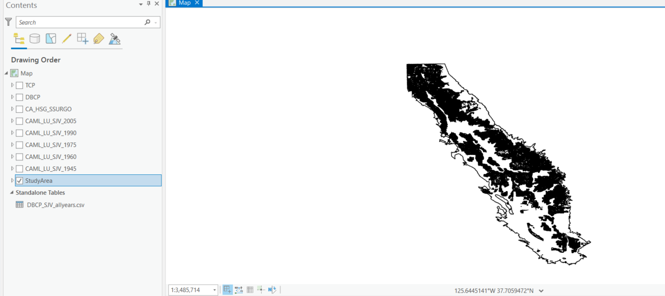
I am trying to clip a raster layer with a polygon layer using the "clip raster" tool. I've clipped other raster layers with the same polygon layer (study area) but this raster layer will not clip? I am attaching the SSURGO raster to be clipped and the clip area (StudyArea) here. Thank you.
Solved! Go to Solution.
Accepted Solutions
- Mark as New
- Bookmark
- Subscribe
- Mute
- Subscribe to RSS Feed
- Permalink
Here's another thing to try: the raster is really really big, so something to try is to clip out just the area of the soil map you are interested in with right click the raster layer > Export. The clip tool may be more friendly with a smaller raster.
Beyond that if you have no local resources to help you, you pay for your Esri software license for a reason - contact support.esri.com and see if they can help you.
- Mark as New
- Bookmark
- Subscribe
- Mute
- Subscribe to RSS Feed
- Permalink
Does that raster have the same coordinate system as the study area polygon?
Do the extents overlap.
(ps, *.lyrx files aren't going to be useful because they reference the data. A screen grab of the layers and the properties of the raster and the polygon would be useful)
... sort of retired...
- Mark as New
- Bookmark
- Subscribe
- Mute
- Subscribe to RSS Feed
- Permalink
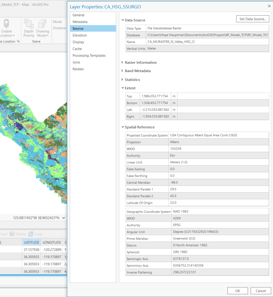
Hi - the coordinate systems are not the same (see below). I'm not sure how to change that and which one to pick.
NAD 1983 California (Teale) Albers (Meters)
USA Contiguous Albers Equal Area Conic USGS
- Mark as New
- Bookmark
- Subscribe
- Mute
- Subscribe to RSS Feed
- Permalink
Use the Project tool (not Define Projection) to convert the polygon layer to the same coordinate system as the soils layer. Then try clipping by the new polygon that has the same CS as the soil raster.
- Mark as New
- Bookmark
- Subscribe
- Mute
- Subscribe to RSS Feed
- Permalink
I am changing the coordinate system with Project tool but it has been running for nearly an hour. For the future should I always change the coordinate system of all layers to match one another? I have not been doing this with my projects... If so, which coordinate system do you choose.
- Mark as New
- Bookmark
- Subscribe
- Mute
- Subscribe to RSS Feed
- Permalink
What coordinate system do you normally work with?
Project other files to match it, however.... the first layer you add to a map sets the coordinate system for the map all others should "project-on-the-fly" if they have a properly "defined" coordinate system (that is... it is not "unknown" for the layers properties.
If it is taking an inordinate length of time, it may be due to a number of reasons, and you would have to provide information on what the file is that you are projecting and whether it resides on your local computer or on some network elsewhere, etcetera.
... sort of retired...
- Mark as New
- Bookmark
- Subscribe
- Mute
- Subscribe to RSS Feed
- Permalink
I ended up quitting after two hors of letting it run and then tried again overnight. The file is on my local computer and is located in a GBD file. I also have made a tiff copy of the raster to be clipped per suggestion by Brooks_SummitGeo.
If I understood your last post, when adding new layers, I should make sure the coordinate systems all match? Thank you so much for the help.
- Mark as New
- Bookmark
- Subscribe
- Mute
- Subscribe to RSS Feed
- Permalink
Your clip polygon is a small dataset and should project right away, seconds not hours. My guess is you have a massive soil raster and you tried to project that which could take days if it is big enough.
- Mark as New
- Bookmark
- Subscribe
- Mute
- Subscribe to RSS Feed
- Permalink
What's the raster format? Can you share a map package of the data?
If it's a raster loaded into a File GDB, then try exporting to Tif and clipping that instead. I often have failed raster geoorocesses with rasters in FGDB, and then the GP tool works as a tif.
David
..Maps with no limits..
- Mark as New
- Bookmark
- Subscribe
- Mute
- Subscribe to RSS Feed
- Permalink
That's a really good suggestion. TIFF is a much better format for processing data, fgdb rasters are a better choice for view only of your final product (in my experience).