Turn on suggestions
Auto-suggest helps you quickly narrow down your search results by suggesting possible matches as you type.
Cancel
- Home
- :
- All Communities
- :
- Industries
- :
- Education
- :
- Education Blog
- :
- Understanding the Digital Generation: Further Conn...
Understanding the Digital Generation: Further Connections to GIS in Education
Subscribe
2375
0
03-28-2013 10:59 PM
- Subscribe to RSS Feed
- Mark as New
- Mark as Read
- Bookmark
- Subscribe
- Printer Friendly Page
03-28-2013
10:59 PM
In my last post, I made the case that Jukes, McCain, Crocket, and Prensky's book Understanding the Digital Generation holds key lessons for those of us who are involved in teaching with GIS and teaching about GIS. Yet the characteristics of these digital learners that I described in that post are not the only instructive elements of the book. The authors' discussion of changes in the 21st Century world of work I believe are helpful for curriculum developers, instructors, and administrators who seek to embed the geographic perspective, spatial content, and geotechnology skills into instruction at all levels.
Jukes et al. say that to prepare for the 21st Century world of work, while we will continue to teach many traditional skills, there will be a shift in emphasis on the importance of those skills. The authors go on to say that we must adjust teaching to match the new world of technology. New skills must be considered as part of the basic literacy skills of any student. Why have these skills received a promotion? Quite simply, because of technology.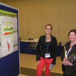
The authors prefer the word "fluency" over literacy because for them it conveys a sense of lifelong learning, such as becoming fluent in a language--in this case, the language of technology. There are five types of fluencies that are important: (1) Solution fluency: This is whole brain thinking, including creativity and problem solving applied in real time. (2) Information fluency: The ability to access digital information sources to retrieve desired information and assess and critically evaluate the quality of information. (3) Collaboration fluency: This "teamworking proficiency" is the "ability to work cooperatively with virtual and real partners in an online environment to create original digital products." (4) Creativity fluency: The "process by which artistic proficiency adds meaning through design, art, and storytelling." (5) Media fluency: The ability to look analytically at any communication media to interpret the real message, determine how the chosen media is being used to shape thinking, evaluate the efficacy of the message, and the ability to publish original digital products to match the media to the intended message.
Space does not permit me to make all of the connections between these fluencies and what students do when they use GIS and geographic inquiry to grapple with problems. However, in short, I have witnessed thousands of times over the past 20 years that students doing so engage in all five of these fluencies. Using GIS has never "just been about the tools" but rather engages and depends upon creativity, collaborative problem-solving, accessing and using data online and in the field, working with a wide variety of media from spreadsheets to geodatabases to image files to HTML and JavaScript, assessing an increasing array of spatial data sources, and communicating process and results. Jukes et al.'s statement that "Students must be able to artistically create stories using technology" seems to capture a large part of what students do with GIS. The communication may include verbal and written descriptions of the problem tackled, the creation of a story map, ArcGIS Online presentations, embedding a map as part of a descriptive web page, and a myriad of other methods. All of this prepares students well for the 21st Century world of work.
My question for instructors: How have you observed students acquiring these five fluencies when you have taught GIS? My question for students: How has using GIS enabled you to prepare for the world of work?
Jukes et al. say that to prepare for the 21st Century world of work, while we will continue to teach many traditional skills, there will be a shift in emphasis on the importance of those skills. The authors go on to say that we must adjust teaching to match the new world of technology. New skills must be considered as part of the basic literacy skills of any student. Why have these skills received a promotion? Quite simply, because of technology.

Student discussing GIS based project.
The authors prefer the word "fluency" over literacy because for them it conveys a sense of lifelong learning, such as becoming fluent in a language--in this case, the language of technology. There are five types of fluencies that are important: (1) Solution fluency: This is whole brain thinking, including creativity and problem solving applied in real time. (2) Information fluency: The ability to access digital information sources to retrieve desired information and assess and critically evaluate the quality of information. (3) Collaboration fluency: This "teamworking proficiency" is the "ability to work cooperatively with virtual and real partners in an online environment to create original digital products." (4) Creativity fluency: The "process by which artistic proficiency adds meaning through design, art, and storytelling." (5) Media fluency: The ability to look analytically at any communication media to interpret the real message, determine how the chosen media is being used to shape thinking, evaluate the efficacy of the message, and the ability to publish original digital products to match the media to the intended message.
Space does not permit me to make all of the connections between these fluencies and what students do when they use GIS and geographic inquiry to grapple with problems. However, in short, I have witnessed thousands of times over the past 20 years that students doing so engage in all five of these fluencies. Using GIS has never "just been about the tools" but rather engages and depends upon creativity, collaborative problem-solving, accessing and using data online and in the field, working with a wide variety of media from spreadsheets to geodatabases to image files to HTML and JavaScript, assessing an increasing array of spatial data sources, and communicating process and results. Jukes et al.'s statement that "Students must be able to artistically create stories using technology" seems to capture a large part of what students do with GIS. The communication may include verbal and written descriptions of the problem tackled, the creation of a story map, ArcGIS Online presentations, embedding a map as part of a descriptive web page, and a myriad of other methods. All of this prepares students well for the 21st Century world of work.
My question for instructors: How have you observed students acquiring these five fluencies when you have taught GIS? My question for students: How has using GIS enabled you to prepare for the world of work?
You must be a registered user to add a comment. If you've already registered, sign in. Otherwise, register and sign in.
About the Author
I believe that spatial thinking can transform education and society through the application of Geographic Information Systems for instruction, research, administration, and policy.
I hold 3 degrees in Geography, have served at NOAA, the US Census Bureau, and USGS as a cartographer and geographer, and teach a variety of F2F (Face to Face) (including T3G) and online courses. I have authored a variety of books and textbooks about the environment, STEM, GIS, and education. These include "Interpreting Our World", "Essentials of the Environment", "Tribal GIS", "The GIS Guide to Public Domain Data", "International Perspectives on Teaching and Learning with GIS In Secondary Education", "Spatial Mathematics" and others. I write for 2 blogs, 2 monthly podcasts, and a variety of journals, and have created over 6,500 videos on my Our Earth YouTube channel.
Yet, as time passes, the more I realize my own limitations and that this is a lifelong learning endeavor: Thus I actively seek mentors and collaborators.
Labels
-
Administration
91 -
Announcements
88 -
Career & Tech Ed
1 -
Curriculum-Learning Resources
289 -
Education Facilities
24 -
Events
78 -
GeoInquiries
1 -
Higher Education
621 -
Informal Education
287 -
Licensing Best Practices
104 -
National Geographic MapMaker
44 -
Pedagogy and Education Theory
245 -
Schools (K - 12)
282 -
Schools (K-12)
313 -
Spatial data
40 -
STEM
3 -
Students - Higher Education
261 -
Students - K-12 Schools
150 -
Success Stories
46 -
TeacherDesk
1 -
Tech Tips
130
- « Previous
- Next »