Turn on suggestions
Auto-suggest helps you quickly narrow down your search results by suggesting possible matches as you type.
Cancel
- Home
- :
- All Communities
- :
- Industries
- :
- Education
- :
- Education Blog
- :
- New Book: The GIS Guide to Public Domain Data
New Book: The GIS Guide to Public Domain Data
Subscribe
279
0
06-28-2017 11:27 PM
- Subscribe to RSS Feed
- Mark as New
- Mark as Read
- Bookmark
- Subscribe
- Printer Friendly Page
- Report Inappropriate Content
06-28-2017
11:27 PM
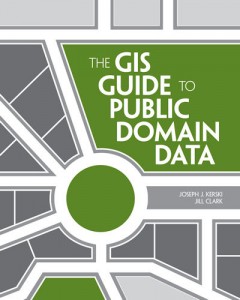
Central to the interest of the GIS community is spatial data: Where to find it, how to use it, how to gauge its quality, its scale, format, and resolution, privacy issues, copyright and licensing, the policies that govern the use of data, the role of data in the evolution of spatial data infrastructures, fee vs. free issues, cloud vs. desktop, downloading vs. streaming, crowdsourcing and citizen science, and a host of related issues. I am pleased to report that a book that Jill Clark and I co-authored on this subject has been published by Esri Press, entitled The GIS Guide to Public Domain Data.

This book [website] is accompanied by a blog that we update weekly with data sources and news on the issues explored in the book. The book is also accompanied by 10 activities free to use that involve the access and use of public domain data to solve problems. These problems range from selecting the most suitable locations for tea cultivation in Kenya, investigating the Gulf Oil Spill, siting a café in a metropolitan area, assessing citizen science portals, creating an ecotourism map in New Zealand, analyzing sustainable land use in Brazil, analyzing floodplains in Colorado, and much more. These activities are linked to the concepts presented in each chapter, and are accompanied by quizzes and answer keys, designed for easy use by an instructor, students, or the individual GIS practitioner. All of these resources are linked to the Spatial Reserves site and reside on ArcGIS Online. Our goal for the text and the activities is to provide GIS practitioners and instructors with the essential skills to find, acquire, format, and analyze public domain spatial data.
“This book fills a very big gap in the literature of GIS and brings together for the first time discussions of issues users of public domain data are likely to confront,” says Michael F. Goodchild, professor of geography at the University of California, Santa Barbara (UCSB), and director of UCSB’s Center for Spatial Studies. “It will prove useful to GIS practitioners in any area of GIS application, including students anxious to learn the skills needed to become GIS practitioners and data producers who want their data to be as useful as possible.”
How might you use this book and its associated resources in your own GIS journey or instruction?
- Joseph Kerski, Esri Education Manager
You must be a registered user to add a comment. If you've already registered, sign in. Otherwise, register and sign in.
About the Author
I believe that spatial thinking can transform education and society through the application of Geographic Information Systems for instruction, research, administration, and policy.
I hold 3 degrees in Geography, have served at NOAA, the US Census Bureau, and USGS as a cartographer and geographer, and teach a variety of F2F (Face to Face) (including T3G) and online courses. I have authored a variety of books and textbooks about the environment, STEM, GIS, and education. These include "Interpreting Our World", "Essentials of the Environment", "Tribal GIS", "The GIS Guide to Public Domain Data", "International Perspectives on Teaching and Learning with GIS In Secondary Education", "Spatial Mathematics" and others. I write for 2 blogs, 2 monthly podcasts, and a variety of journals, and have created over 6,500 videos on my Our Earth YouTube channel.
Yet, as time passes, the more I realize my own limitations and that this is a lifelong learning endeavor: Thus I actively seek mentors and collaborators.
Labels
-
Administration
57 -
Announcements
65 -
Career & Tech Ed
1 -
Curriculum-Learning Resources
225 -
Education Facilities
24 -
Events
59 -
GeoInquiries
1 -
Higher Education
556 -
Informal Education
272 -
Licensing Best Practices
63 -
National Geographic MapMaker
25 -
Pedagogy and Education Theory
205 -
Schools (K - 12)
282 -
Schools (K-12)
227 -
Spatial data
28 -
STEM
3 -
Students - Higher Education
240 -
Students - K-12 Schools
114 -
Success Stories
33 -
TeacherDesk
1 -
Tech Tips
92
- « Previous
- Next »