- Home
- :
- All Communities
- :
- Industries
- :
- Education
- :
- Education Blog
- :
- My 10 takeaways from the 2024 Esri UC and Educatio...
My 10 takeaways from the 2024 Esri UC and Education Summit
- Subscribe to RSS Feed
- Mark as New
- Mark as Read
- Bookmark
- Subscribe
- Printer Friendly Page
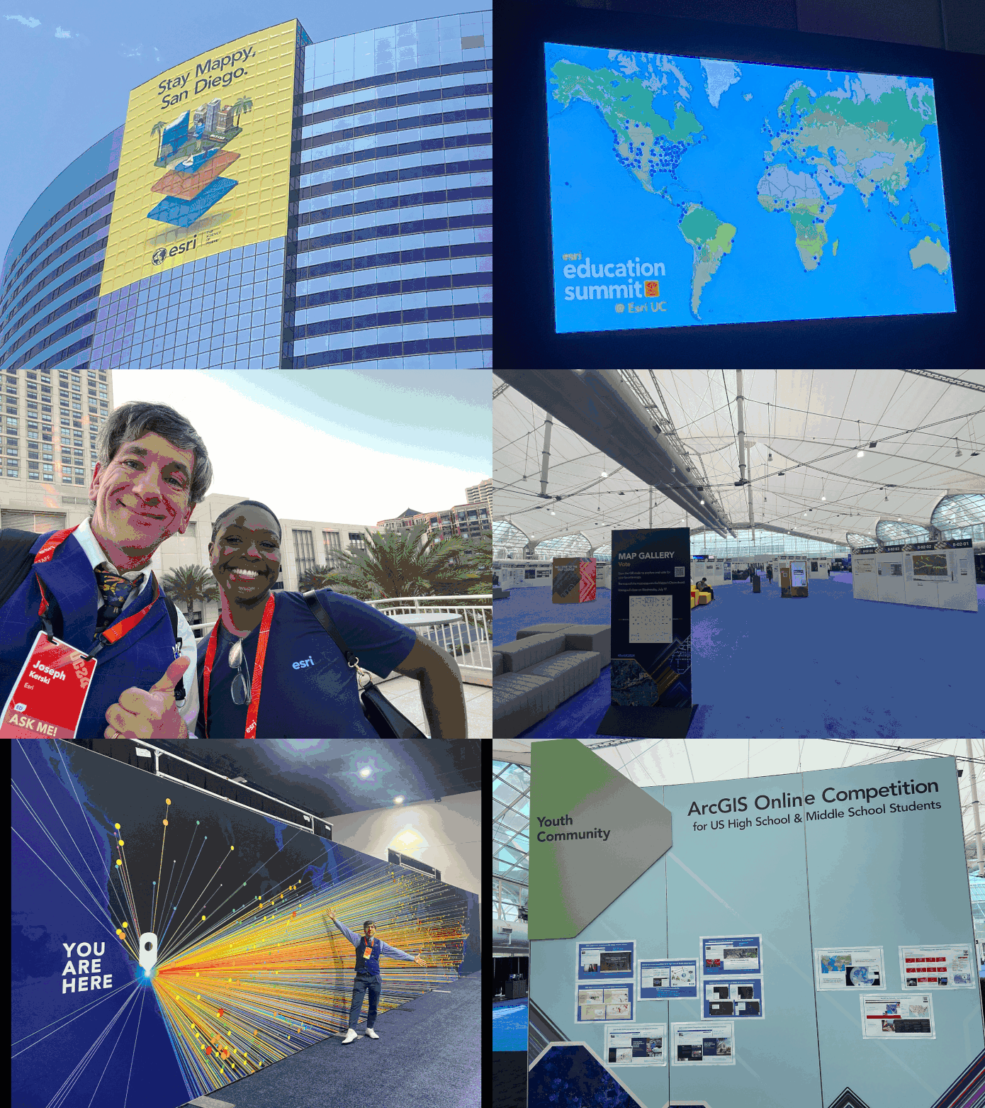
Having just returned from the 2024 Esri Education Summit and User Conference, I wish to highlight 10 takeaway lessons and impressions with the community (and in video format here).
1. Now more than ever, GIS work is tied to the higher, more noble goals of sustainability, resilience, equity, and others, detailed in plans for building national spatial data infrastructures, university goals of learning, the UN Sustainable Development Goals (SDGs), and more. GIS tools, workflows, and maps are important, but throughout the conference I noticed a focus on "the bigger picture" that we are all a part of. And for good reason--it is a technology that can positively impact people, communities, and the planet. For more on this theme, visit the GIS For Good site: https://www.esri.com/en-us/gis-for-good
2. Uniting The World was the theme of this year's conference: Consider all of the facets of that phrase--GIS is used across scales (local to global), organizations (nonprofits, government agencies, academia, and nonprofit organizations), countries (over 120 countries were represented at this year's UC), and disciplines (literally from A to Z - architecture, anthropology, archaeology, and astronomy--to zoology, and everything in between--planning, health, business, sociology, biology, and many many more).
3. The notion that GIS has become a platform has really taken hold--a platform that people can depend on and build solutions upon.
4. The action component of GIS work has never been stronger: People are actively building and doing in the world of GIS--building data portals, applications, maps, and taking action to improve their communities with the insights that GIS brings.
5. The energy, dedication, and work of the education community from primary-secondary to university level, after-school programs, and beyond, continues to expand and make a difference: We had 850 educators at the Education Summit, for example, sharing their work, participating and conducting workshops, networking, and much more.
6. The students at the Education Summit and the User Conference hailed from different levels of education (secondary, university, lifelong learners), and different places around the world, but included 4H, student assistants, young scholar award winners, the Esri YPN Young Professionals Network, and the 3 amazing and eloquent high school students on the plenary stage with their inspiring teacher, explaining not only their GIS project but the struggles and challenges and growth that they experienced along their journey.
7. Maps are still the focus of the event: Thousands of digital and print maps were on display for 4 days in the Map Gallery, and Jack Dangermond and others showed hundreds more during the plenary on Monday. Why? Because maps help communicate issues and solutions, they serve as a gathering point for people to make decisions. They bring together people who may have different opinions at a place where discussion can begin and solutions offered.
8. Artificial Intelligence (AI) in GIS, or GeoAI, continues to expand, at a careful and thoughtful pace. Feature extraction and field survey generative AI workflows were just two GeoAI capabilities that attracted much interest at the event.
9. Editing in ArcGIS Online was one of the many new tools and capabilities shown at the plenary and in technical workshops. GIS continues to expand in depth but also is opening up new doors to others outside the GIS community who are attracted to it in part because it is easier to use than ever before, and they can use pieces of it that are appropriate to their own work and not have to "learn the whole platform."
10. GIS is here to stay. Despite its integration into mainstream IT flows and architecture, and despite the expanding reach of GIS into hundreds of disciplines, it is still 'special and spatial' - it has its own research base, it provides an engaging, holistic, and insightful way of looking at the whole world and everything in it--which is increasingly important to solve our world's challenges.
I have been attending the Esri UC since 1998 and the Education Summit since its inception in 2000, and they both continue to inspire and encourage me. If you were able to attend, I hope that you have the same impression. If you were not able to attend, I encourage you to watch the plenary recording (here: https://mediaspace.esri.com/channel/2024%2BEsri%2BUser%2BConference%2B%257C%2BPlenary/346994422) and connect with the authors of the sessions you missed.
Wish to share this with others in a different format? https://youtu.be/IZWZagui45c?si=P-fhEX6cGDvuO32Z is a video with some fun pictures and these messages. I look forward to hearing about your time at the Esri Education Summit and the Esri User Conference !
You must be a registered user to add a comment. If you've already registered, sign in. Otherwise, register and sign in.
-
Administration
79 -
Announcements
80 -
Career & Tech Ed
1 -
Curriculum-Learning Resources
259 -
Education Facilities
24 -
Events
72 -
GeoInquiries
1 -
Higher Education
597 -
Informal Education
281 -
Licensing Best Practices
92 -
National Geographic MapMaker
33 -
Pedagogy and Education Theory
226 -
Schools (K - 12)
282 -
Schools (K-12)
273 -
Spatial data
35 -
STEM
3 -
Students - Higher Education
246 -
Students - K-12 Schools
129 -
Success Stories
36 -
TeacherDesk
1 -
Tech Tips
121
- « Previous
- Next »
