- Home
- :
- All Communities
- :
- Industries
- :
- Education
- :
- Education Blog
- :
- Mapping Businesses using a Crowdsource Story Map
Mapping Businesses using a Crowdsource Story Map
- Subscribe to RSS Feed
- Mark as New
- Mark as Read
- Bookmark
- Subscribe
- Printer Friendly Page
Teaching about economics and business location has a long tradition in geography. Planning the optimal site for a business or service in a community, examining the demographics and behavior of a certain target market, studying supply chain management to build a specific product such as a mobile phone or a piece of furniture, examining median income by neighborhood, state, or country, are all inherently geographic problems and tasks. They all involve considerations of location, scale, and patterns over space and time. These geographic tasks can be understood and solved through the use of today’s web-based maps, data, and tools. In the hands of geography educators and students, these maps, data, and tools can engage learners in central issues of economics and business using the geographic perspective in tandem with a problem-based approach. Web GIS such as ArcGIS Online provides the ability to examine the above issues from local to global scale, using any device, using only a web browser and an internet connection. Exploring these topics with web mapping tools builds content knowledge, skills, and the geographic perspective; it also fosters numeric competencies and computer fluency.
In conjunction with an article I wrote for The Geography Teacher journal focused on practical resources and approaches to teach economics and business themes in geography, I created a story map of different types of businesses in selected places around the world, shown below. I invite you and your students to add your own photographs and descriptive text to this map that describe a business in your own community, and place it in its correct location on the map.
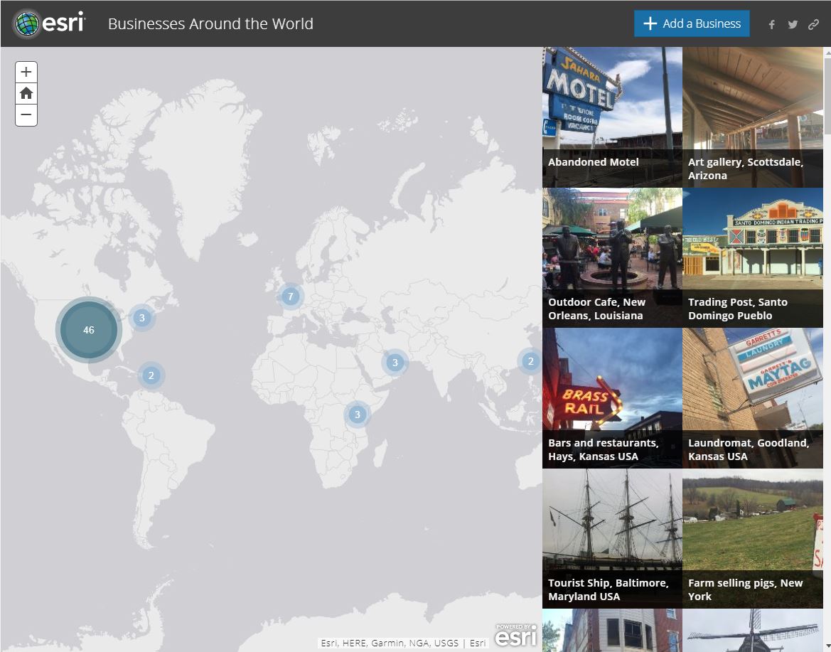
Businesses Around the World Crowdsource Story Map. The image at the top of this blog is a business in downtown Hays, Kansas, which I took while working at Fort Hays State University last year, and it also appears in the story map.
Describe how the types and appearance of businesses are similar and are different in selected countries of your choice. Describe the spatial patterns that are shown on the story map at the local, city, regional, and global level. Ask students to write a one page paper comparing five types of businesses and where they are located in each community. Include the three most important factors that the owners most likely considered to locate each type of business. Then, ask students to create a table where they classify 10 types of businesses shown on the map by their function. This classification could be by product or service offered, and could include such categories as food, vehicles, building materials, home products, clothing, financial services, sports equipment, and so on. To extend this activity, create your own story map of businesses (using the Story Maps tools and your ArcGIS Online account) in your own community on a specific business type of your choosing; for example, check cashing facilities or coffee shops.
There are many other things you could do with GIS, such as mapping specific business types in your community. See the results of a project where I did this two different business in a metropolitan area (Oklahoma City) using ArcGIS Online. What differences and similarities do you notice between the two very different types of businesses, and why?
You must be a registered user to add a comment. If you've already registered, sign in. Otherwise, register and sign in.
Mapping Businesses using a Crowdsource Story Map
-
Administration
91 -
Announcements
88 -
Career & Tech Ed
1 -
Curriculum-Learning Resources
289 -
Education Facilities
24 -
Events
78 -
GeoInquiries
1 -
Higher Education
621 -
Informal Education
287 -
Licensing Best Practices
104 -
National Geographic MapMaker
44 -
Pedagogy and Education Theory
245 -
Schools (K - 12)
282 -
Schools (K-12)
313 -
Spatial data
40 -
STEM
3 -
Students - Higher Education
261 -
Students - K-12 Schools
150 -
Success Stories
46 -
TeacherDesk
1 -
Tech Tips
130
- « Previous
- Next »