Turn on suggestions
Auto-suggest helps you quickly narrow down your search results by suggesting possible matches as you type.
Cancel
- Home
- :
- All Communities
- :
- Industries
- :
- Education
- :
- Education Blog
- :
- Investigating Land Use Change using Historical USG...
Investigating Land Use Change using Historical USGS Maps and Satellite Imagery in ArcGIS Online
Subscribe
915
0
10-30-2015 12:00 AM
- Subscribe to RSS Feed
- Mark as New
- Mark as Read
- Bookmark
- Subscribe
- Printer Friendly Page
10-30-2015
12:00 AM
An article I wrote in NASA's Geographia invites exploration of land use change using USGS historical topographic maps and historical and cur.... Humans have modified the landscape of Planet Earth in many ways. This modification is nothing new—it began as the earliest humans began burning of local grasslands to encourage new growth, tilling the soil for the first agricultural experiments, and building small dams to ensure a water source. Yet today’s changes are more frequent and also larger in area, from the construction of cities, reservoirs, and tunnels, to widespread land use change through the conversion of the natural land cover to cropland, grazing pastures, mining sites, and other uses.
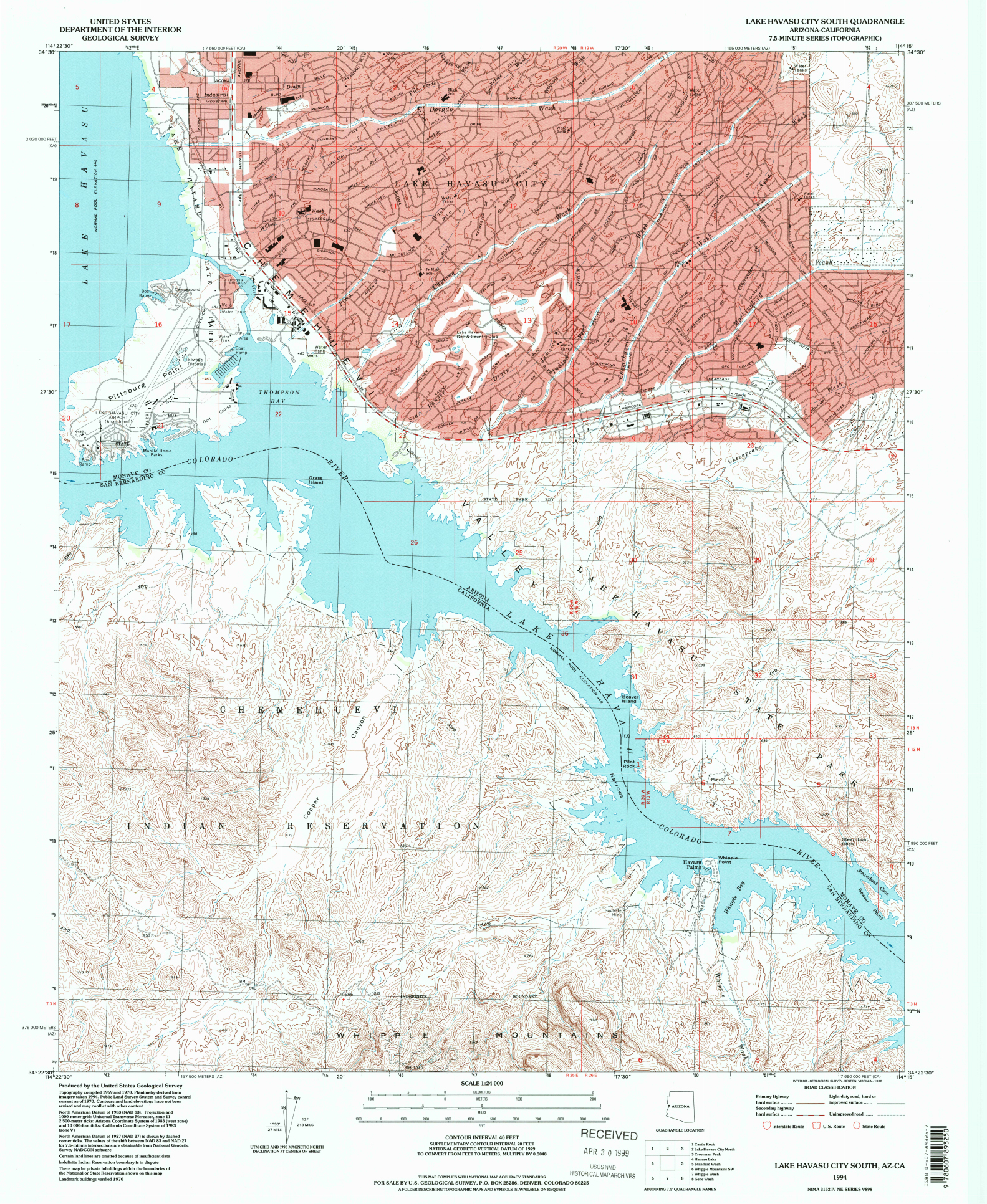
One of the ways that humans have modified the landscape is in their attempt to make parts of deserts more habitable. Some of the most famous examples include the transformation of coastal fishing villages in the United Arab Emirates into major world cities, and the creation of resort areas around the world in Australia’s outback, Namibia, Morocco, and in the USA, including the cities of Las Vegas, Palm Springs, and Lake Havasu City, shown on the series of topographic maps below.
Use the Esri USGS Historical Map viewer, the Change Matters Landsat viewer, and the Landsat Look viewer to examine land use change in your own area of interest!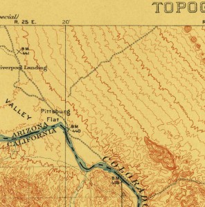
1911 USGS map at 1:125,000 scale of Parker.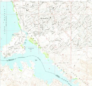
1970 map at 1:24,000 scale, Lake Havasu City South.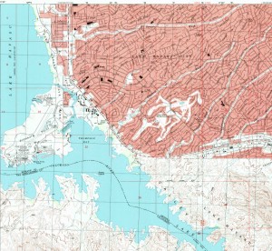
1994 map at 1:24,000 scale, Lake Havasu City South.
One of the ways that humans have modified the landscape is in their attempt to make parts of deserts more habitable. Some of the most famous examples include the transformation of coastal fishing villages in the United Arab Emirates into major world cities, and the creation of resort areas around the world in Australia’s outback, Namibia, Morocco, and in the USA, including the cities of Las Vegas, Palm Springs, and Lake Havasu City, shown on the series of topographic maps below.
Use the Esri USGS Historical Map viewer, the Change Matters Landsat viewer, and the Landsat Look viewer to examine land use change in your own area of interest!

1911 USGS map at 1:125,000 scale of Parker.
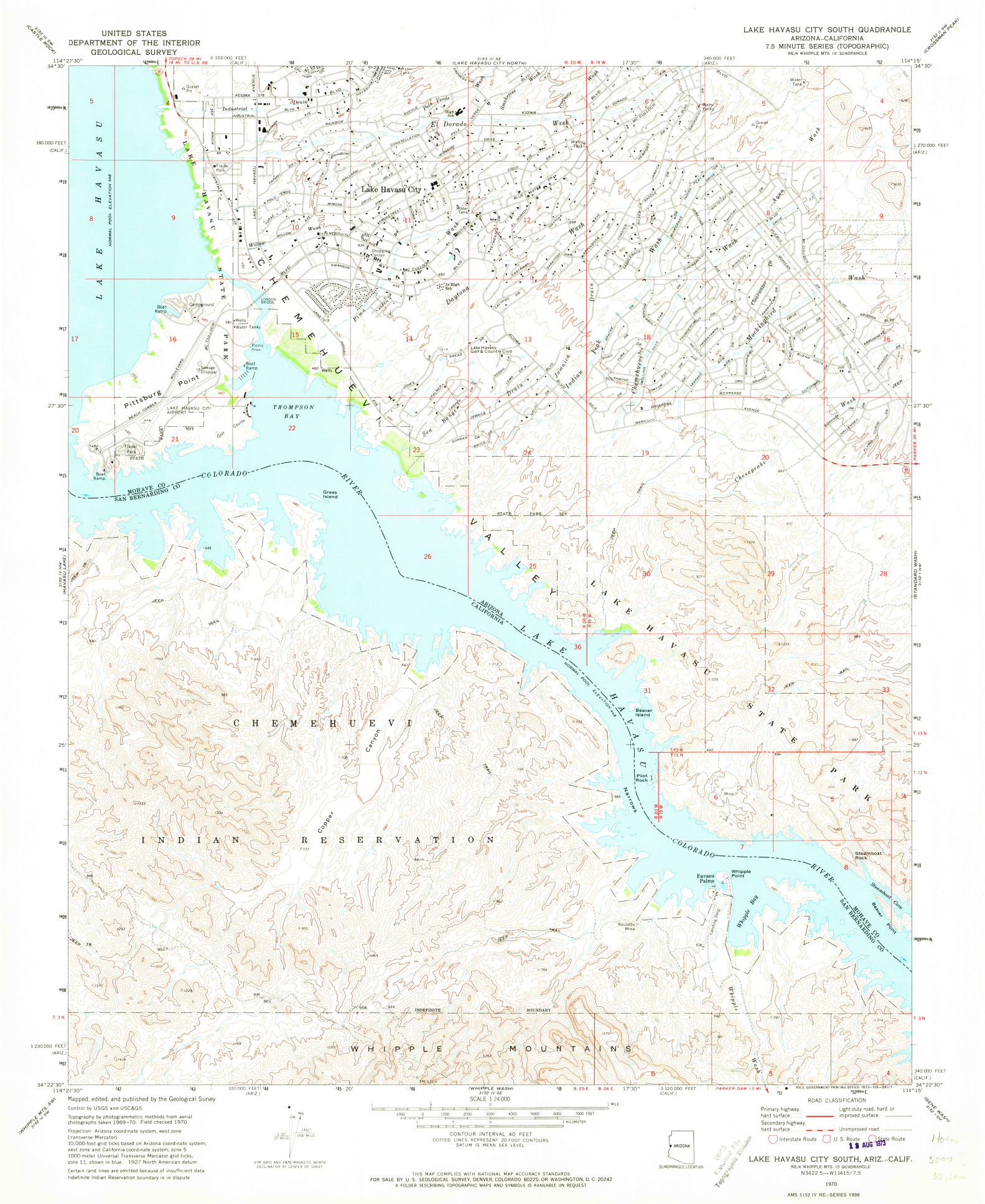
1970 map at 1:24,000 scale, Lake Havasu City South.
1994 map at 1:24,000 scale, Lake Havasu City South.
You must be a registered user to add a comment. If you've already registered, sign in. Otherwise, register and sign in.
About the Author
I believe that spatial thinking can transform education and society through the application of Geographic Information Systems for instruction, research, administration, and policy.
I hold 3 degrees in Geography, have served at NOAA, the US Census Bureau, and USGS as a cartographer and geographer, and teach a variety of F2F (Face to Face) (including T3G) and online courses. I have authored a variety of books and textbooks about the environment, STEM, GIS, and education. These include "Interpreting Our World", "Essentials of the Environment", "Tribal GIS", "The GIS Guide to Public Domain Data", "International Perspectives on Teaching and Learning with GIS In Secondary Education", "Spatial Mathematics" and others. I write for 2 blogs, 2 monthly podcasts, and a variety of journals, and have created over 6,500 videos on my Our Earth YouTube channel.
Yet, as time passes, the more I realize my own limitations and that this is a lifelong learning endeavor: Thus I actively seek mentors and collaborators.
Labels
-
Administration
89 -
Announcements
86 -
Career & Tech Ed
1 -
Curriculum-Learning Resources
282 -
Education Facilities
24 -
Events
77 -
GeoInquiries
1 -
Higher Education
618 -
Informal Education
285 -
Licensing Best Practices
102 -
National Geographic MapMaker
39 -
Pedagogy and Education Theory
240 -
Schools (K - 12)
282 -
Schools (K-12)
303 -
Spatial data
39 -
STEM
3 -
Students - Higher Education
258 -
Students - K-12 Schools
142 -
Success Stories
44 -
TeacherDesk
1 -
Tech Tips
125
- « Previous
- Next »