- Home
- :
- All Communities
- :
- Industries
- :
- Education
- :
- Education Blog
- :
- Fun with GIS 236: Competition and Challenge
Fun with GIS 236: Competition and Challenge
- Subscribe to RSS Feed
- Mark as New
- Mark as Read
- Bookmark
- Subscribe
- Printer Friendly Page
- Report Inappropriate Content
The 2018-19 school year marks the third year for Esri's "ArcGIS Online Competition for High School and Middle School Students." It is also the second year for Esri's "Teacher Video Challenge." Both "tests" deserve serious consideration.
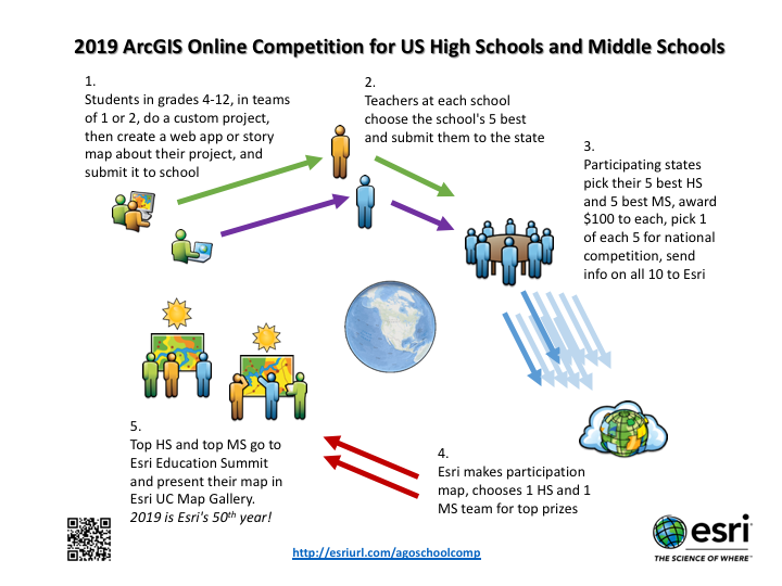
The student competition offers a lot of opportunity. In participating states, students (singly or as a team of two) do research and submit a presentation in the form of a Story Map or other web app. This can be done as part of school or outside of school (e.g. individually or through a club), but gets submitted through the school (high school for grades 9-12, middle school for grades 4-8). A school can submit up to five entries to the state, which chooses up to five each HS+MS projects to receive $100. These ten get national recognition, and one each at HS+MS get entered into a final competition, and a trip to Esri's User Conference in San Diego, CA, to present to GIS users from around the world.
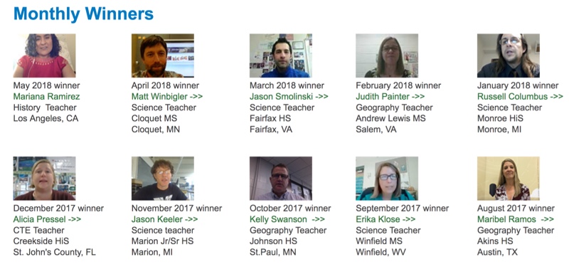
The teacher challenge lets K12 educators describe their use of ArcGIS Online. Teachers create and share their own one-minute video as an entry, and Esri chooses one story per month for a more in-depth video interview, with a $500 honorarium. This collection shows the breadth of content areas, grade levels, teaching styles, school environments, and implementation strategies through which teachers can engage ArcGIS Online. Past awardees range from more traditional to decidedly non-traditional situations, but all teachers demonstrate real craftsmanship as educators.
ArcGIS Online has vast capacity, but even at its most basic it can be enormously powerful. In both the student and teacher challenges, what matters is implementation. It's far more impressive doing powerful things with basic tools than basic things with powerful tools. Learners and leaders who understand their focus area deeply make impact. See how by looking at the collection of student winners and teacher challenge awardees. Then plan your entries!
You must be a registered user to add a comment. If you've already registered, sign in. Otherwise, register and sign in.
-
Administration
39 -
Announcements
45 -
Career & Tech Ed
1 -
Curriculum-Learning Resources
180 -
Education Facilities
24 -
Events
47 -
GeoInquiries
1 -
Higher Education
520 -
Informal Education
266 -
Licensing Best Practices
47 -
National Geographic MapMaker
17 -
Pedagogy and Education Theory
187 -
Schools (K - 12)
282 -
Schools (K-12)
185 -
Spatial data
24 -
STEM
3 -
Students - Higher Education
232 -
Students - K-12 Schools
86 -
Success Stories
22 -
TeacherDesk
1 -
Tech Tips
83
- « Previous
- Next »