- Home
- :
- All Communities
- :
- Industries
- :
- Education
- :
- Education Blog
- :
- Esri Poster Contest Winners Announced at AAG Annua...
Esri Poster Contest Winners Announced at AAG Annual Meeting
- Subscribe to RSS Feed
- Mark as New
- Mark as Read
- Bookmark
- Subscribe
- Printer Friendly Page
Esri and AAG hosted a poster contest entitled Innovative Applications of Esri GIS Technology at the recent American Association of Geographers (AAG) Annual Meeting in Washington, DC, in April 2019. The goal of the competition was to encourage students to create their own creative application of Esri's GIS software to understand and resolve problems from the local to the global scale. The AAG annual meeting, which attracted over 8,500 attendees from all over the world, was the perfect venue for these students to display the results of their research and development.
I had the honor of organizing this event with AAG and my Esri colleagues, and it was a pleasure to interact with the participants before the conference and to meet them during the poster session. The session was held at the front of the exhibit hall, and I enjoyed watching the students interact with hundreds of people who toured the posters, including Jack Dangermond, Esri founder and president. "It was wonderful to see the passion and creativity that people poured into their entry posters," said Jack. "I had the opportunity to have a few really illuminating conversations with the contestants, many of whom are students. It's truly exciting to see that the future development of GIS application is in such inspired hands."
The winners are listed below; they and the other posters illustrate the diversity of problems, issues, and scales that GIS is able to address. Tools included 3D analysis, Python scripting, ArcGIS Dashboards, remote sensing analysis including with UAVs, spatial statistics and analysis, story maps, and much more.
- 1st Place: Nicholas Bogen, Central Michigan University; The US In 11 Zip Codes. Cash prize $500.00
- 2nd Place: Carly Robbins, Clark University; Warming’s Impact on Bird Distributions. Cash prize $450.00
- 3rd Place: Tetyana Pecherska, Tufts University; US Offshore Aquaculture Potential. Cash prize $350.00
- 4th Place: Douglas Stow, San Diego State University; Remote Sensing-Wildfire. Cash prize $200.00
- 5th Place: Yaping Xu, Louisiana State University; Stepwise Soil Moisture Data. Cash prize $200.00
To see a sample of the posters, visit the following links: On traffic sign detection and extraction, on estimating wildfire rate of spread, on legislative districts, on assessing urban structures, and on blending 3D and story maps.
To view the press release for this event, read this. To explore additional ways that Esri uses GIS to support higher education, visit www.esri.com/education.
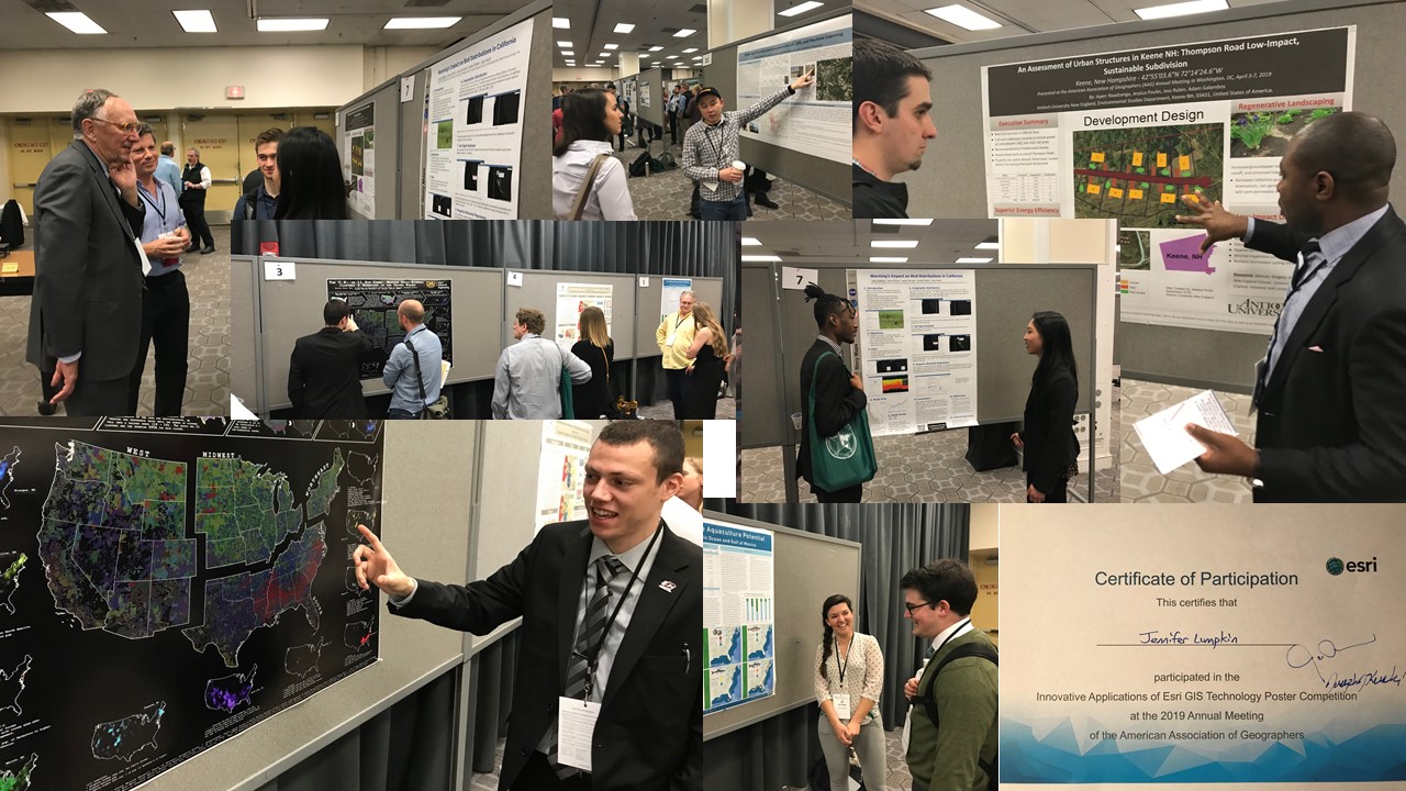
Photo collage of the wonderful participants of the Esri AAG GIS poster competition and their work. I salute not only the winners, but all those who participated in the event, as well as all those who are using GIS in education and beyond to make a positive difference in our world. --Joseph Kerski
You must be a registered user to add a comment. If you've already registered, sign in. Otherwise, register and sign in.
-
Administration
79 -
Announcements
80 -
Career & Tech Ed
1 -
Curriculum-Learning Resources
259 -
Education Facilities
24 -
Events
72 -
GeoInquiries
1 -
Higher Education
597 -
Informal Education
281 -
Licensing Best Practices
92 -
National Geographic MapMaker
33 -
Pedagogy and Education Theory
226 -
Schools (K - 12)
282 -
Schools (K-12)
273 -
Spatial data
35 -
STEM
3 -
Students - Higher Education
246 -
Students - K-12 Schools
129 -
Success Stories
36 -
TeacherDesk
1 -
Tech Tips
121
- « Previous
- Next »