Turn on suggestions
Auto-suggest helps you quickly narrow down your search results by suggesting possible matches as you type.
Cancel
- Home
- :
- All Communities
- :
- Industries
- :
- Education
- :
- Education Blog
- :
- Creating and Giving a Presentation Using ArcGIS On...
Creating and Giving a Presentation Using ArcGIS Online
Subscribe
847
0
06-28-2017 11:54 PM
- Subscribe to RSS Feed
- Mark as New
- Mark as Read
- Bookmark
- Subscribe
- Printer Friendly Page
06-28-2017
11:54 PM
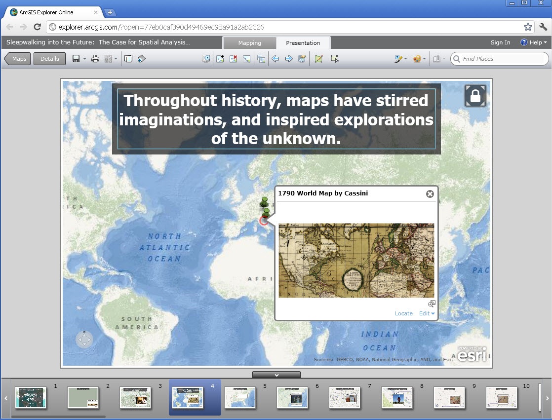
Recently I was invited to give a keynote address at the 2011 GI-Forum at the University of Salzburg, and created a map in ArcGIS Online that I used as my guide to the local physical and cultural geography. I shared it so that the other conference attendees could also use it, on http://esriurl.com/giforumsalzburg. I described this procedure in a recent blog entry but then went one step further: I used the same tool to create the keynote presentation that I gave at the conference. This presentation contains 57 slides and by searching for “GI-Forum” on ArcGIS Online, you can view it and use it to spark your own presentation ideas.
I varied the basemaps and methods throughout the presentation to keep the audience interested, and I found that ArcGIS Online offered a number of significant advantages. First, since ArcGIS Online is map-based, I could tie each of the points in my presentation to points on the maps. Second, the dynamic nature of the tool meant that at any point during the presentation, I could respond to questions from the audience and zoom to any location on the Earth, changing the basemaps or adding new content to respond to the question. After responding, I could easily resume the slides I had set up ahead of time. Third, I can now respond to those who are contacting me to find out if they can view it, simply by pointing them to ArcGIS Online. Fourth, I could easily go back and forth between my presentation and the local map with points of interest that I had created using the same tool.
Fifth, as we all know when working with technology, the unexpected can and will happen. On a practical level, using ArcGIS Online for the presentation saved the day when my computer would not communicate with the projector in the lecture hall at the University of Salzburg. At the last minute, we substituted a computer from one of the faculty, and because the presentation used ArcGIS Online, I did not have to worry about transferring files or whatever presentation software they might have had on the university’s computer. Rather, I was able to access and give my presentation right away!
How might you or your students use ArcGIS Online for an upcoming presentation or report, and how might you assess that presentation in the classroom?
- Joseph Kerski, Education Manager
You must be a registered user to add a comment. If you've already registered, sign in. Otherwise, register and sign in.
About the Author
I believe that spatial thinking can transform education and society through the application of Geographic Information Systems for instruction, research, administration, and policy.
I hold 3 degrees in Geography, have served at NOAA, the US Census Bureau, and USGS as a cartographer and geographer, and teach a variety of F2F (Face to Face) (including T3G) and online courses. I have authored a variety of books and textbooks about the environment, STEM, GIS, and education. These include "Interpreting Our World", "Essentials of the Environment", "Tribal GIS", "The GIS Guide to Public Domain Data", "International Perspectives on Teaching and Learning with GIS In Secondary Education", "Spatial Mathematics" and others. I write for 2 blogs, 2 monthly podcasts, and a variety of journals, and have created over 6,500 videos on my Our Earth YouTube channel.
Yet, as time passes, the more I realize my own limitations and that this is a lifelong learning endeavor: Thus I actively seek mentors and collaborators.
Labels
-
Administration
69 -
Announcements
73 -
Career & Tech Ed
1 -
Curriculum-Learning Resources
241 -
Education Facilities
24 -
Events
63 -
GeoInquiries
1 -
Higher Education
577 -
Informal Education
277 -
Licensing Best Practices
78 -
National Geographic MapMaker
29 -
Pedagogy and Education Theory
216 -
Schools (K - 12)
282 -
Schools (K-12)
247 -
Spatial data
34 -
STEM
3 -
Students - Higher Education
242 -
Students - K-12 Schools
119 -
Success Stories
34 -
TeacherDesk
1 -
Tech Tips
106
- « Previous
- Next »
