Championing GIS in Belize
- Subscribe to RSS Feed
- Mark as New
- Mark as Read
- Bookmark
- Subscribe
- Printer Friendly Page
--by Diana Stuart Sinton, PhD
Belize is a small country, about the size of Massachusetts. But its GIS activity is large, thanks in part to their energetic and enthusiastic Esri distributor, Loretta Palacios. For several years, the company that Ms. Palacio runs, TBSL Inc., has organized and hosted both a country-wide GIS Conference as well as a large Expo on GIS Day. In November 2016, over 900 students from across Belize attended the GIS Day activities, to learn about the role of GIS in their education and to interact with organizations from the private and public sectors, who were demonstrating diverse GIS applications.
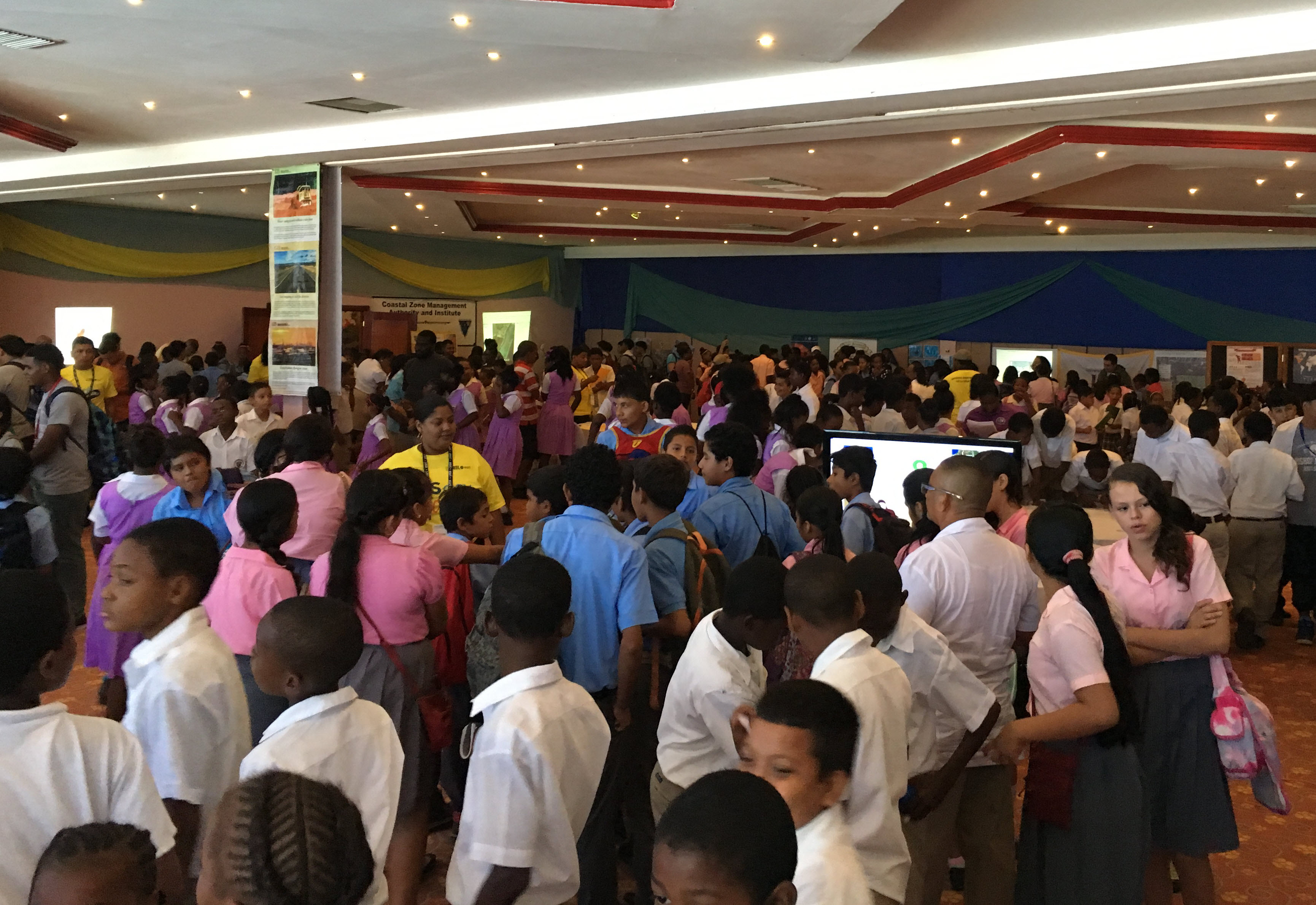
Figure 1. Students from dozens of Belizean schools experience GIS at GIS Day 2016
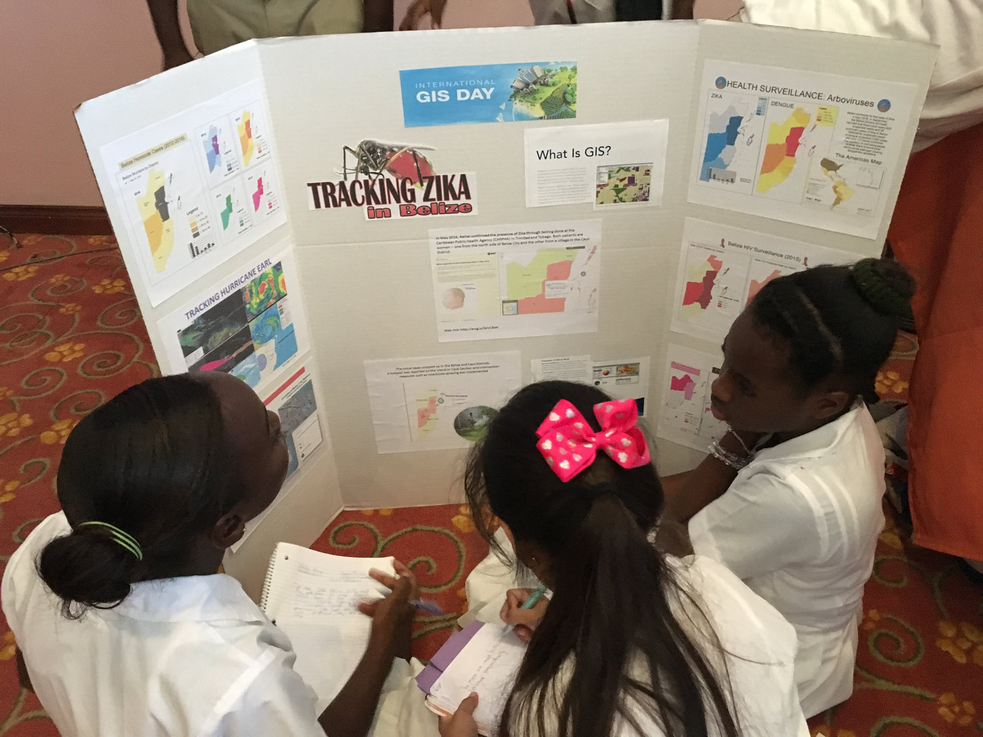
Figure 2. Multiple stations set up around the room offered students that chance to see how GIS helps people understand problems that are both local and global.
TBSL took it one step further in 2016 by coordinating with Esri to bring an Esri Educational Ambassador to visit. Diana Sinton, of UCGIS and Cornell University, is well-known for her commitment to the role that GIS&T can play in teaching and learning. While she was in Belize, she delivered two workshops for teachers and teacher educators to demonstrate how GIS can be incorporated into Belize’s education curricula. They began with a simple hands-on activity for a site suitability task, using plastic sheets that represented data layers, to explain the notion of overlay and demonstrate how the features of the natural and social world are represented through a GIS. The participants then used ArcGIS Online activities, such as ones from the GeoInquiries collection, to explore how student audiences could learn through digital mapping. Additionally, several exercises were modified to include Belizean data sets and local contexts. TBSL produced a video about the workshops that can be viewed online.
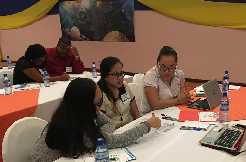
Figure 3. Teachers used both analog and digital tools to learn about GIS.
The workshop participants appreciated having greater awareness of the available resources and were inspired to see how their learning objectives and standards could be linked with and supported by these mapping activities. One particularly exciting ideas was to imagine how GIS content could be developed to target needs of broad sectors of students. For example, students from many Caribbean countries must take a qualifying exam (similar to the SATs) to be considered for entrance to a regional university. The teachers appreciated how GIS could be used – by a teacher and by the students – to practice and reinforce the relevant curricular content in preparation for that exam.
Educators in countries such as Belize are increasingly aware of the opportunities that GIS presents as a tool for teaching and learning. They are also realistic about the challenges that accompany integration of the technologies, such as inconsistent and unreliable internet access and shortfalls in access to computers themselves. Significant amounts of inequality exist across the schools, towns and cities, and students’ households. Teachers expressed concerns about developing data or exercises that some of their students couldn’t access or complete. But they also know that such situations are likely to improve over time and their students are eager to learn, now and later.
You must be a registered user to add a comment. If you've already registered, sign in. Otherwise, register and sign in.
-
Administration
90 -
Announcements
87 -
Career & Tech Ed
1 -
Curriculum-Learning Resources
285 -
Education Facilities
24 -
Events
77 -
GeoInquiries
1 -
Higher Education
618 -
Informal Education
286 -
Licensing Best Practices
102 -
National Geographic MapMaker
42 -
Pedagogy and Education Theory
241 -
Schools (K - 12)
282 -
Schools (K-12)
307 -
Spatial data
39 -
STEM
3 -
Students - Higher Education
259 -
Students - K-12 Schools
146 -
Success Stories
44 -
TeacherDesk
1 -
Tech Tips
128
- « Previous
- Next »