- Home
- :
- All Communities
- :
- Products
- :
- ArcGIS Spatial Analyst
- :
- ArcGIS Spatial Analyst Questions
- :
- Re: Buffer zone according to the surface
- Subscribe to RSS Feed
- Mark Topic as New
- Mark Topic as Read
- Float this Topic for Current User
- Bookmark
- Subscribe
- Mute
- Printer Friendly Page
- Mark as New
- Bookmark
- Subscribe
- Mute
- Subscribe to RSS Feed
- Permalink
Using ArcGIS (10.3.1), is it possible to create a buffer zone according to the surface with a variable radius (i.e. 5-10-15 Km)? Which means that the buffer zone is not "flat", yet it has a shape that followed the surface.
Thanks
Solved! Go to Solution.
- Mark as New
- Bookmark
- Subscribe
- Mute
- Subscribe to RSS Feed
- Permalink
here I can't upload the data, because they exceed the uploading limit... So, the DTM resolution is 8mt, actually I copied your code changing the folder locations and max distance (because all the rest seems correct, at least)
- Mark as New
- Bookmark
- Subscribe
- Mute
- Subscribe to RSS Feed
- Permalink
If you have a resolution of 8mt, you will want to change the setting on line to 8 instead of 30. This will be better, but does not explain why you don't see any influence of the slopes on the resulting buffer. What is your maximum distance? I assume your coordinate system is projected (no geographic).
If you extract a small rectangle around a point I'm sure it will be below 50MB (when stored in a fgdb) and you will be able to attach it to the thread. It is hard to detect what might be wrong without access to (a sample of) the data.
- Mark as New
- Bookmark
- Subscribe
- Mute
- Subscribe to RSS Feed
- Permalink
Yes, my coordinate system is projected and max distance is 3000mt. I attached the sample files (on top)
- Mark as New
- Bookmark
- Subscribe
- Mute
- Subscribe to RSS Feed
- Permalink
Just ran the script with some minor modifications and it does generate a result:
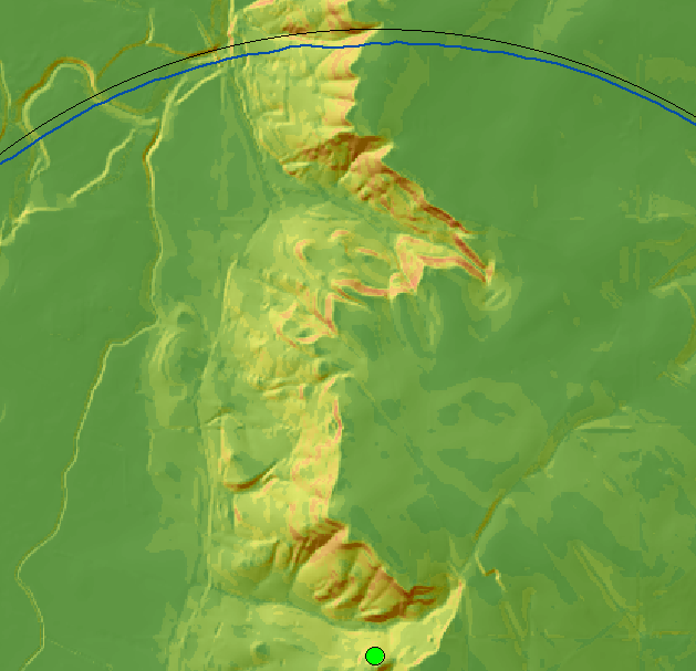
There are some differences in the normal buffer (black line) and the surface buffer (blue line). Will try and check later if the result is really correct.
- Mark as New
- Bookmark
- Subscribe
- Mute
- Subscribe to RSS Feed
- Permalink
As suspected... visual expectation is not the same as reality.
- Mark as New
- Bookmark
- Subscribe
- Mute
- Subscribe to RSS Feed
- Permalink
So, this discrepancy between the visual expectation and the reality to what is due?
- Mark as New
- Bookmark
- Subscribe
- Mute
- Subscribe to RSS Feed
- Permalink
As shown in Xander's figures, if there is not significant elevation change, and more importantly perhaps, undulating change, the difference between a buffer that is simply 2D planar versus 3D is going to be insignificant the larger the buffer radius.
If you want to see dramatic results, pick a hill in your terrain whose 2D radius is small (maybe a couple of 100 m), then buffer that. A buffer radius over many hundreds of meters or kilometers is not going to show any significant difference.
The controlling factors
- the cumulative affect of the elevation differences from the centre to a point on the buffer radius
- the size of the buffer
the greater the first, and the smaller the second is what will produce the most pronounced result
- Mark as New
- Bookmark
- Subscribe
- Mute
- Subscribe to RSS Feed
- Permalink
So, actually the major part of the land, in which I would apply the buffer, has not a huge elevation, it is an hilly terrain. Therefore, the buffer 3d couldn't be the best choice, considering that I should use a radius with a km length
- Mark as New
- Bookmark
- Subscribe
- Mute
- Subscribe to RSS Feed
- Permalink
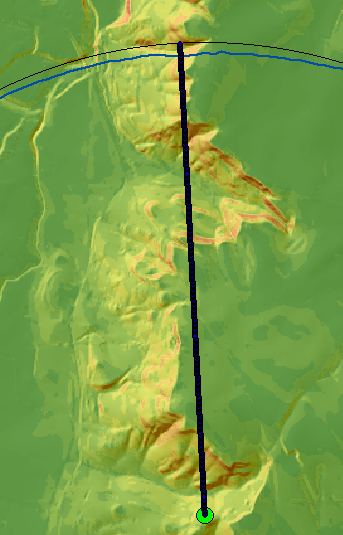
Thanks.... I tried too, changing the pix size in 8. The code worked without any problems, yet the result is still the same which means that it didn't show any changing as in yours. Moreover, the previous result overlapped the new one perfectly.
I attached two pics: the red line is the new datum, while the black line the old one.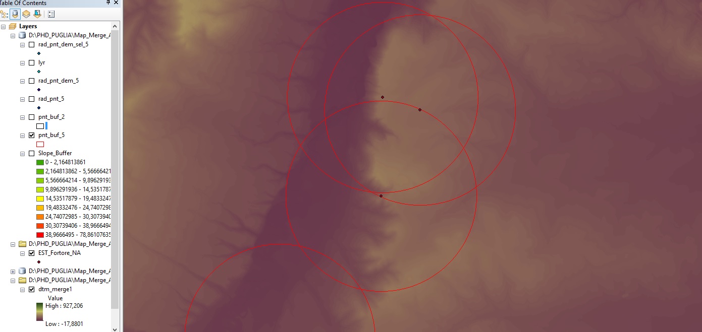
- Mark as New
- Bookmark
- Subscribe
- Mute
- Subscribe to RSS Feed
- Permalink
Are there any buf_3D featureclasses created? This is the actual result of the tool and not the pnt_buf featureclasses. If these are not created the process is not running completely and some error is occurring in the process.
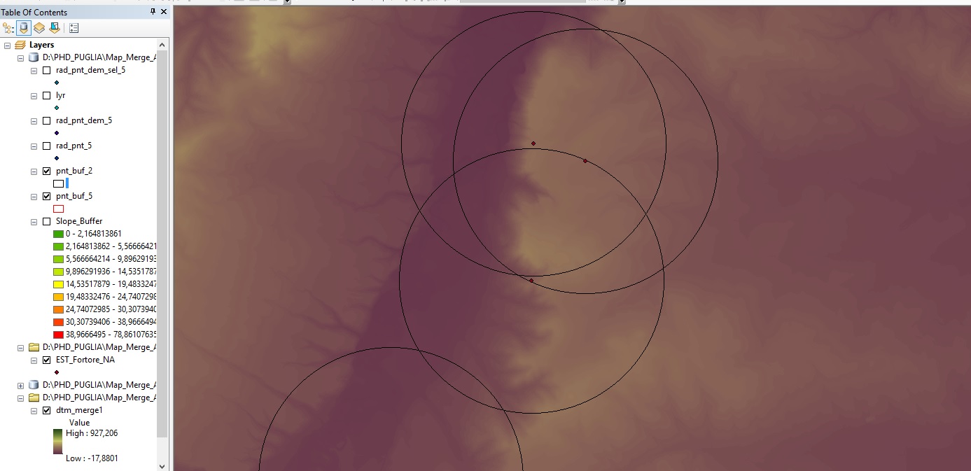
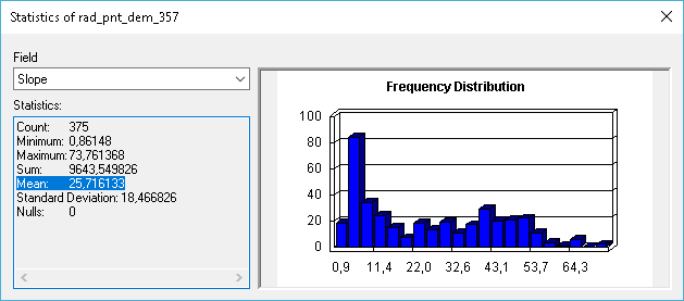
If I select a single line that passes through some relatively steep slopes (line Line_D 357):
... and I extract the slope values, the mean slope is 25.7%:
This would mean that the buffer should pass at 2905 meters from the center point. It passes at 2920. The reason for this difference is that the slope direction is taken into account. If you traverse a steep slope maintaining the same altitude, you will traverse at a slope of 0%. A slope map returns the maximum slope in any direction..