- Home
- :
- All Communities
- :
- Products
- :
- ArcGIS QuickCapture
- :
- ArcGIS QuickCapture Blog
- :
- QuickCapture 1.20 release now available in the app...
QuickCapture 1.20 release now available in the app stores!
- Subscribe to RSS Feed
- Mark as New
- Mark as Read
- Bookmark
- Subscribe
- Printer Friendly Page
- Report Inappropriate Content
We’ve just released an update for QuickCapture mobile and designer. In addition to several bug fixes and enhancements, here are the key highlights:
New level_id Variable
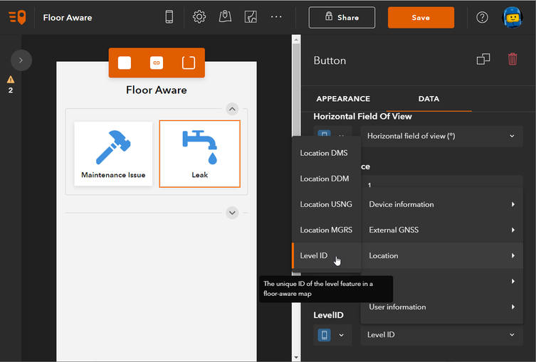
When you set a floor-aware web map as your project map, a floor switcher will appear in the mobile app. This switcher allows users to manually select their current floor and view the corresponding floor plan data. While this feature is not new, version 1.20.22 introduces a new level_id device variable.
In ArcGIS Indoors, the level_id represents the unique ID of the feature’s associated floor level and is used to identify the feature’s level in floor-aware maps. If the level_id is recorded for any QuickCapture captured feature, it can be associated with a floor! This is valuable in a number of applications, including:
- Capturing issues on a multi-floor construction site
- Recording changes to user office assignments in a large building
- Tracking the location of critical assets in a medical facility
To utilize this feature, the project author must apply the level id variable to a text field in the data tab for a project button, and set a floor aware map as the project map. Once the project is downloaded and opened, the mobile user needs to open the map, select the floor that they are on using the floor switcher, and then capture a feature. Each captured feature will automatically have its level_id recorded. If they move to another floor, they just need to update the floor switcher before capturing.
Note: Although QuickCapture does not currently support Indoor Positioning Systems (IPS), users can configure the project button to display the map immediately after capturing a feature. This allows users to verify and, if necessary, update the initial (GPS-derived) location.
For more information on Indoors, see:
Tablet Device Support
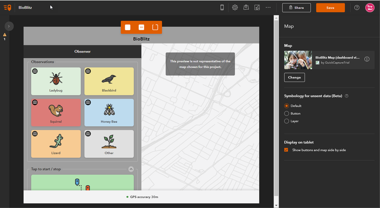
The QuickCapture mobile app supports a side-by-side view of the project buttons and map. To use this feature, authors need to enable side-by-side view in the project map settings, and users must open the project on a tablet device.
Some tablets are mistakenly reported as phones by the QuickCapture framework, which can prevent the side-by-side view from working. To address this, we have whitelisted specific devices to ensure QuickCapture mobile recognizes them as tablets. If your tablet does not show the side-by-side view, please download the project, capture, and upload a feature. This will provide us with the necessary details to support your device in the next app release.
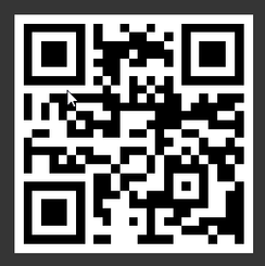
Scan barcode to download the Tablet Whitelisting project
Public Projects on Enterprise
For Enterprise users, you can share your projects publicly for crowdsourcing activities. This means users do not need to sign in to download and use the project. However, a bug in version 1.19 prevented the public project map from loading. This issue has been resolved in version 1.20, but authors need to select a basemap or custom web map and resave the project. If the author does not update the map and uses the organization’s default basemap, the issue may persist.
Please note that sharing projects publicly on ArcGIS Online requires a Hub Premium license.
That is all for 1.20. Please share ant questions in th comments below.
You must be a registered user to add a comment. If you've already registered, sign in. Otherwise, register and sign in.


