ArcGIS QuickCapture Blog

cancel
Showing results for 
Show  only  | Search instead for 
Did you mean: 

Other Boards in This Place

Latest Activity

(54 Posts)
BrandyPerkins
Esri Contributor

Learn how to streamline field data collection using the integrated Arcade editor in the QuickCapture web designer. You can configure Arcade expressions from the Data tab for each capture field in the project.

Read more...

more
3 1 1,052
BrandyPerkins
Esri Contributor

Try out the integrated Arcade editor in the QuickCapture web designer to write Arcade expressions that populate fields for collected data. This workflow is applicable to data collected online and offline.

Read more...

more
2 0 902
Mandy_Li
Esri Contributor

It is important to share your QuickCapture project properly so your mobile workers can access and use it successfully. Here are all of the ways to share that you need to know.

Read more...

more
0 0 2,244
MarikaVertzonis
Esri Regular Contributor

Capture daily patrol records and identify hazards to mitigate, using QuickCapture and Survey123.

Read more...

more
1 1 949
Mandy_Li
Esri Contributor

What is a link button?


A Link button allows you to open other mobile apps or web applications from ArcGIS QuickCapture app by specifying the target URL for the button. You can configure a link button to

  • Open a website
  • Open a PDF file that hosted online
  • Open a dashboard from your device’s browser
  • Launch Survey123 field app
  • Launch other native apps on your device

In short, with the link button, you can use your QuickCapture project as a launchpad to open other apps.


Configure the URL for link button


First and foremost, you’ll need to add a link button to your QuickCapture project. To do this, simply drag the link button and drop it to the project preview in Designer. You will also note there’s a link icon on the top left that indicates this is a link button.

Add link button.gif


Configure link button to open a website/web app


The most basic idea is that you can use link button to launch any URL from QuickCapture, e.g., a website that provides support information for the end-users. 

esri url.png


Moreover, you can include dynamic content into the target URL and pass captured information from QuickCapture to the URL. For example, with the URL parameters, you can define the scale level and center the web map with the captured location, or you can enhance the dashboard app by adding URL parameters and the trigger actions.

In this case, you need to manually construct the link button URL and predefine values for the URL parameters. QuickCapture supports using fixed values, device variables, or a project user input variable to add to the constructed URL. In the steps below, I will configure the link button to open a dashboard app, but also add a URL parameter to have the dashboard always center the map based on user’s captured location when the link button is pressed from QuickCapture.

  1. Create a dashboard app and configure a URL parameter (a geometry parameter named ‘point’) for it. Also, configure actions for the parameter, e.g. flash and zoom when the value of the parameter changes.
  2. In QuickCapture Designer, select the link button and configure it to launch a URL.
  3. Continue constructing the dashboard URL by adding the geometry parameter and assigning QuickCapture variables, i.e. ${longitude} and ${latitude} to this parameter. You can see that the QuickCapture variable is represented with a dollar sign and braces, this means the actual value of it will be automatically filled in by the QuickCapture app when this button is pressed.

dashboard url.gif

Save the project and download it to your device. Press the Dashboard button in the project. Note that the dashboard app is centered at the current location and has a flashing effect that was previously configured in the dashboard app.


Configure link button to launch native apps


Link button can also be used to launch native apps on your device. You can launch communication apps for the end-users to send an email, a text message, or make a phone call to their supervisors. In this manner, the link button enables users to send instant feedback while they are still working in the field. Here are some examples of how you can construct the link (encoding the URL parameters is recommended) to open the messaging apps on your device.

  • Email—mailto:quickcapture@esri.com?subject=Fix%20the%20pipe&body=We%20really%20need%20to%20fix%20the%20pipe
  • SMS—sms:0291920995 (On Android, a message body can also be included: sms:0291920995?body=We%20really%20need%20to%20fix%20the%20pipe)
  • Phone—tel:0291920995

Of course, you can also use the link buttons to launch Field Maps or Collector by providing the app link in the URL editor.


Link to Survey123 from QuickCapture


You can use link buttons to launch Survey123 field app from QuickCapture. In QuickCapture designer, we made the configuration/integration experience as easy as possible. If you want to link to a survey from QuickCapture, you don’t have to manually construct the Survey123 link or custom URL, QuickCapture Designer will do it for you. In Designer, you can not only configure a link button to launch Survey123 field app directly and link to an existing survey, but also add survey questions and pass dynamic content to this selected survey. Again, you can match a fixed value, a device variable, or a project user input variable to the survey question, and the actual value for these variables will be captured and replaced by QuickCapture app through the link button. Optionally, you can pass captured location in QuickCapture as the input for the geopoint question in the survey, and configure the experience to return to QuickCapture after a survey is successfully submitted.

Let’s use the Pipeline Patrol project to demonstrate how to use QuickCapture and Survey123 together to record daily pipeline patrols and document identified hazards. In the project, patrols that encounter no issues are usually recorded with the tap of the Patrol Complete button; If any hazards are identified, they can be captured with additional buttons; For hazards that require detailed reporting, you can launch Survey123  from QuickCapture to collect more information through the smart form in Survey123:

  1. First, add the link button Valve Leak and set it to launch the Survey123 field app.
  2. Select a survey you want to link to.
  3. Select and add questions from the survey and pass predefined values to these questions. When configuring this, Designer is automatically constructing the Survey123 custom URL based on your selection made on the UI.
  4. Toggle on the options to pass location to Survey123 and return to QuickCapture after the survey submission.

s123 link.gif


Save the project and download it to your device. From the video below, you can see the Survey123 field app is automatically opened when pressing the Valve Leak button from the project. You may also notice that the questions we configured from the Designer are already populated with the captured values now in Survey123. Once the survey is submitted, it will jump back to the QuickCapture app to continue data capture. This capability streamlines the field data collection workflow and optimizes different data capture scenarios. For rapid data collection, simply keep tapping the buttons in the QuickCapture project; For detailed data entry, use the link buttons to open Survey123 to add more information.


Let us know if you have any feedback or questions on this.

more
5 11 2,303
IsmaelChivite
Esri Notable Contributor

ArcGIS QuickCapture is Esri's rapid field data collection mobile app. If you are not familiar with QuickCapture, have a look at this short video:

We just updated ArcGIS QuickCapture across all supported platforms. The new build number is 1.7. With this new release, you can build much more powerful field data collection mobile apps, while keeping the end-user experience as simple as the single tap of a button. This video gives summarizes the highlights of this release:

Bigger buttons, of course.

With this update, you can configure your QuickCapture apps with bigger buttons. This is useful when authoring projects for large tablets, with very few or even a single button.  Larger buttons help you take full advantage of the available screen real estate on the device, facilitating data capture. 

ArcGIS QuickCapture Bigger Buttons

Enhanced Project User Inputs (Define lists from designer)

When configuring your QuickCapture app, you can define a Project User Input. A Project User Input presents a dialog  where information can be entered, prior to start capturing data. This information can then be used to automatically populate attributes of collected data. For example, say you are building a Pavement Condition QuickCapture app. You may want to configure a Project User Input for field crews to enter a charge code number or the ID of the field crew.  That charge code or field crew ID can then be automatically added as an attribute to every feature collected. Checkhttps://community.esri.com/community/arcgis-quickcapture/blog/2019/10/06/understanding-user-inputs-i... for more details on Project User Inputs.

Up until this release, you could only create free text Project User Inputs. That is, a dialog with either a single line or a multi line text input control.  Starting with version 1.7, you can also present a list with well defined values.  Using lists makes sense when you want to limit entries to a well known collection of choices. It is easier for users to pick an option than having to type.

The animation below shows you can now create a Project User Input and define a list of values for it.

QuickCapture Creating a User Project Input List

Once you have your project input dialog defined, just as before, you can choose which buttons will make use of that value.

Enhanced Project User Inputs (Remember previous entries)

To facilitate quick data entry from end users, the QuickCapture mobile app now remembers previous Project User Input entries. In the animation on the side, for example, the Police Officer Reporter app presents a dialog for end users to enter the ID of the person that will collect data. Note that the dialog presents two options in a list right below the text input control. The end user can either enter a new ID, or tap on any of the previously entered IDs.

The QuickCapture mobile app will list the three last entries. The idea listing previous entries is to accelerate data capture and reduce errors when entering this information.

Locked Groups

QuickCapture buttons can be logically organized in groups.  Groups help end users navigate across QuickCapture apps that include many buttons.

By default, groups can be collapsed and expanded by end users.With this update, the QuickCapture app author can decide to hide the handle to collapse and expand a group. This is useful when you want to make sure a set of buttons will always be visible to users.  You can control the group properties from QuickCapture designer.

Link buttons (launching any URL)

Link buttons allow you to open other mobile or web apps right from within ArcGIS QuickCapture. For example, you may want to configure a button to open a live dashboard in a web browser, a PDF file or launch a Survey123 smart form.  With link buttons you can convert your QuickCapture project into a launchpad for other applications.

The animation below shows how you can add a new link button into a QuickCapture app, to launch a website.

You can include dynamic content in your target URL. For example, you may want to add custom URL parameters to center a Web AppBuilder application at the user's location, or pass a filter into an ArcGIS Dashboard. For more information about URL parameters in ArcGIS Dashboards and Web AppBuilder, check the following links:

In the animation below, we are passing the current latitude and longitude of the user when the link button is pushed. Note that dynamic content in the URL can be populated from device variables as well as from the Project User Input.

You can really launch any URL from a link button. This includes URLs to launch mobile apps.  For example, using app link syntax you can launch Survey123, Tracker, Collector, Navigator and even third party apps. Here are some links to help you better understand how to build URLs to launch other apps:

Link buttons (launching Survey123)

If you want to launch a Survey123 smart form from QuickCapture, you do not need to figure out how to build the custom URL link yourself. We have added a streamlined user experience so you can more easily launch Survey123 forms and pass parameters to them.

You can select a survey and what dynamic data you want to pass into it.

Once you configure a link button in this manner, Survey123 will be automatically invoked when you press the QuickCapture button.

With link buttons, you can now model much more sophisticated data collection workflows. You can for example configure a few buttons to capture quick field observations and a button to launch Survey123 to do more involved reporting.

More device variables

Device variables in QuickCapture allow you to automatically populate attributes in the GIS features you collect. Device variables let you capture for example the exact time when a button is pushed, the speed and direction of travel, or the horizontal accuracy of your GPS.  The complete list of device variables is available in the Configure a project—ArcGIS QuickCapture | Documentation help topic.  In this release, we are adding the following new variables:

  • Photo: Lat, Lon, Heading
  • Travel: Cardinal direction
  • Location: DMS, DDM, USNG, MGRS
  • Device Info: App Version and Device Operating System
  • Length and Area

EXIF metadata

Starting with version 1.7 of QuickCapture, all photos taken from the mobile app will include EXIF metadata.

more
2 0 3,223
IsmaelChivite
Esri Notable Contributor

So many questions came today through UC Live about QuickCapture that we through we would share the most common questions, and the answers of course! We will be adding more content throughout the week in here.

If you want to join the team at the ArcGIS QuickCapture Virtual Showcase, do not hesitate as we will be there for you.

Will I be able to watch the QuickCapture Tech Session once the UC is over? Most sessions will be available for registered attendees until September and then most sessions will be shared publicly. There is no guarantee that this particular QuickCapture session will be shared. Use the session feedback survey or the Survey123 daily survey to request that this particular session is shared.

Can ArcGIS QuickCapture work while disconnected from the network? Yes!. In short: Once a QuickCapture project has been downloaded into your device, you can use it while offline. All captured data will remain in your device and once you get back online again, it will be sent to ArcGIS. There is nothing special you need to do to get this going, other than simply downloading your project into your device. You can optionally configure your QuickCapture project with offline maps. Check https://community.esri.com/community/arcgis-quickcapture/blog/2020/04/14/configuring-a-map-in-your-a... for details.

What mobile platforms are supported? Android, iOS and Windows. You can download the mobile app from the corresponding app stores or from our download page. Details about the operating system versions supported can be found at Requirements—QuickCapture | Documentation 

For ArcGIS QuickCapture to work, your must configure your device to allow QuickCapture to access your location.

Does ArcGIS QuickCapture work with an ArcGIS Enterprise portal?  Yes, as long as the version of your portal is 10.7.1 or newer. Your data can configure it against a multi-user enterprise geodatabase or the ArcGIS Data Store.

If you have an older version of ArcGIS Server, or do not have a portal installed, you can register your ArcGIS Server feature services as items in ArcGIS Online and have your QuickCapture projects work against them. In this hybrid approach, your data lives in ArcGIS Server, but end users will be authenticated against your ArcGIS Online organization.

Can I use non-hosted feature layers with QuickCapture?  Yes, you can target a layer from a multi-user geodatabase with ArcGIS QuickCapture. However, you must make sure the feature layer resides in an ArcGIS Server instance that is federated with your portal.

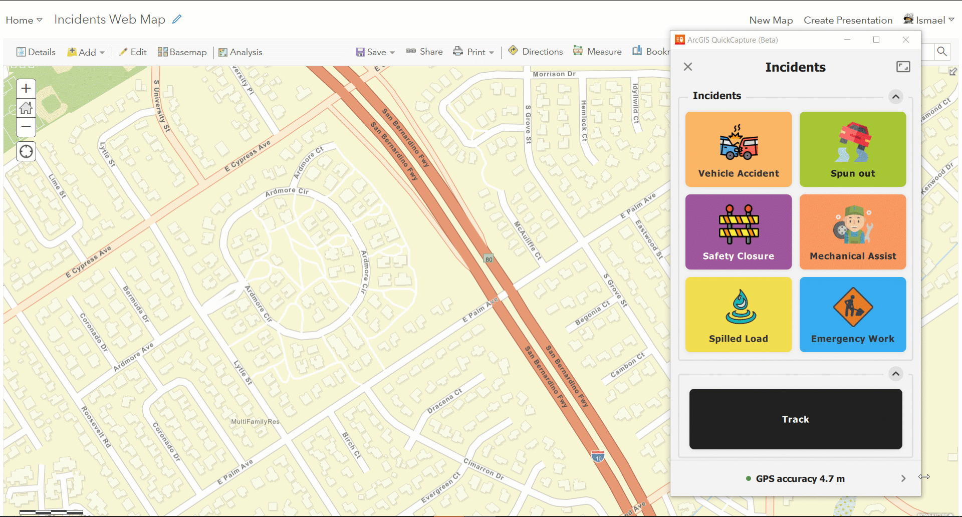
Can I capture lines and polygons?  Yes. And you can capture multiple lines and polygons as the same time too.

When I capture a polygon, how is the polygon closed?  The polygon starts when you activate the button. As long as the button flashes, we capture vertices. When the button is tapped again, then the last vertex is used to close the polygon.

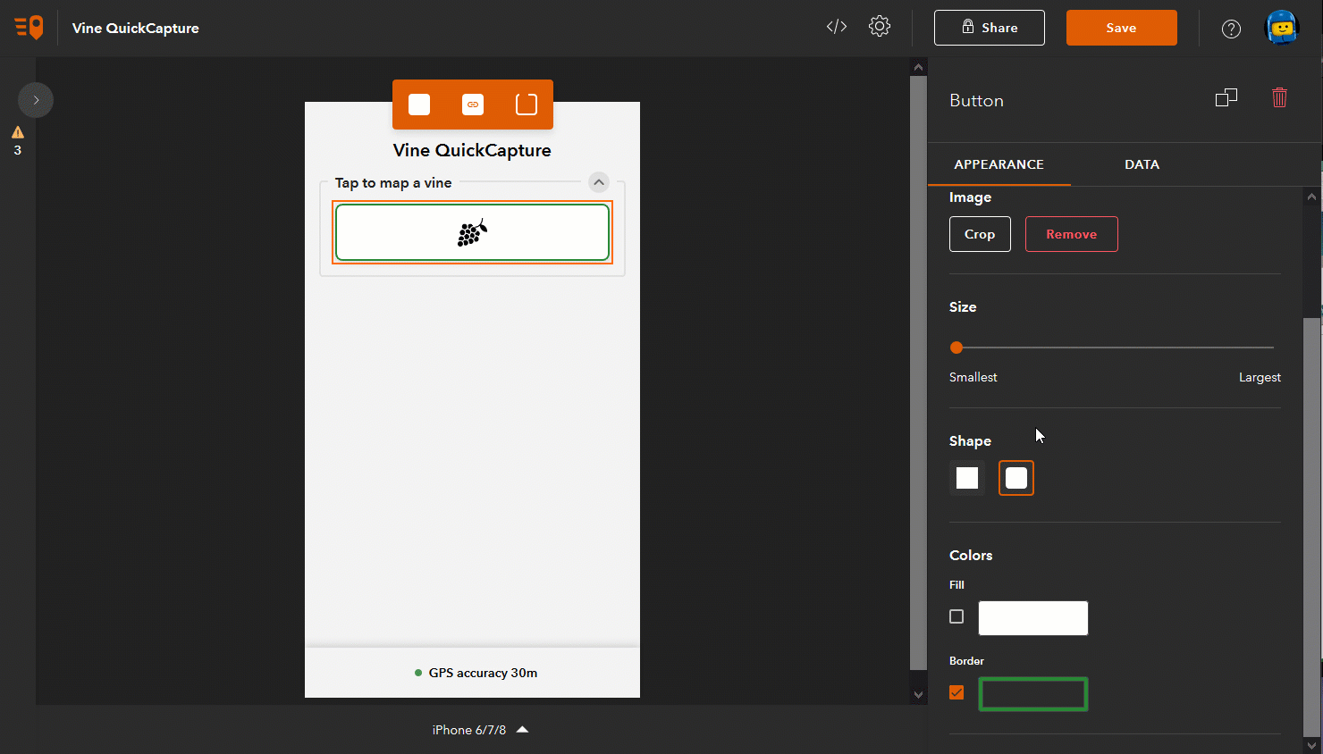
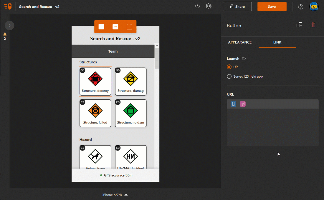
Can I have QuickCapture populate multiple attributes? Yes. When you configure buttons in QuickCapture designer, you can decide what exact values should go into each attribute.

Can I allow users to enter comments after an observation is made? Yes. You do that with user inputs as described here: https://community.esri.com/community/arcgis-quickcapture/blog/2019/10/06/understanding-user-inputs-i... 

If I have multiple people capturing data with QuickCapture, how can I tell who created which feature? You will use editor tracking for this, which is enabled by default. When someone creates a feature, by default the Creator field is automatically populated with the username of the person that submitted the record.

Does QuickCapture work with external GNSS receivers? Yes. You can choose to connect your QuickCapture app to an external GNSS receiver to improve the location accuracy of your data and associate location quality GNSS metadata with your records. The list of supported GNSS receivers is available at Use a high-accuracy receiver—QuickCapture | Documentation If the particular receiver you want to use is not supported yet, feel free to propose support for it throughArcGIS Ideas.

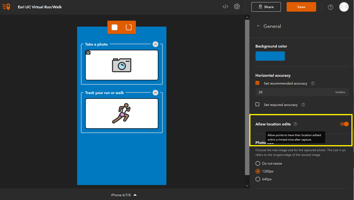
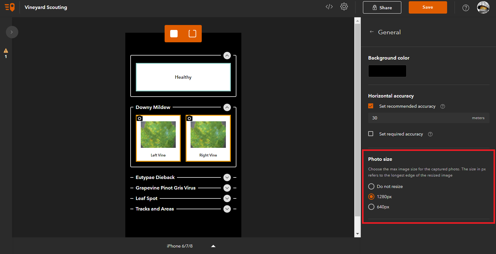
Can I configure QuickCapture to collect information about horizontal accuracy? Yes. You can in fact configure it to capture horizontal and vertical accuracy as well as the name of your external GNSS receiver and many other GNSS metadata. For details, check the Configure a project—ArcGIS QuickCapture | Documentation help topic.

What type of ArcGIS account I need to use ArcGIS QuickCapture? It depends. If you want to create new QuickCapture projects, you will need a Creator (or GIS Professional) user type with privileges to create new content. If you simply want to use the mobile app to collect data, you will need a Field Worker (or Creator, or GIS Professional) user type with privileges to add records into feature layers. Alternatively, the mobile app can also be used with an Editor user type, as long as you buy an add-on license for the QuickCapture mobile app.

Please note that Free ArcGIS Public Accounts are not supported with ArcGIS QuickCapture.

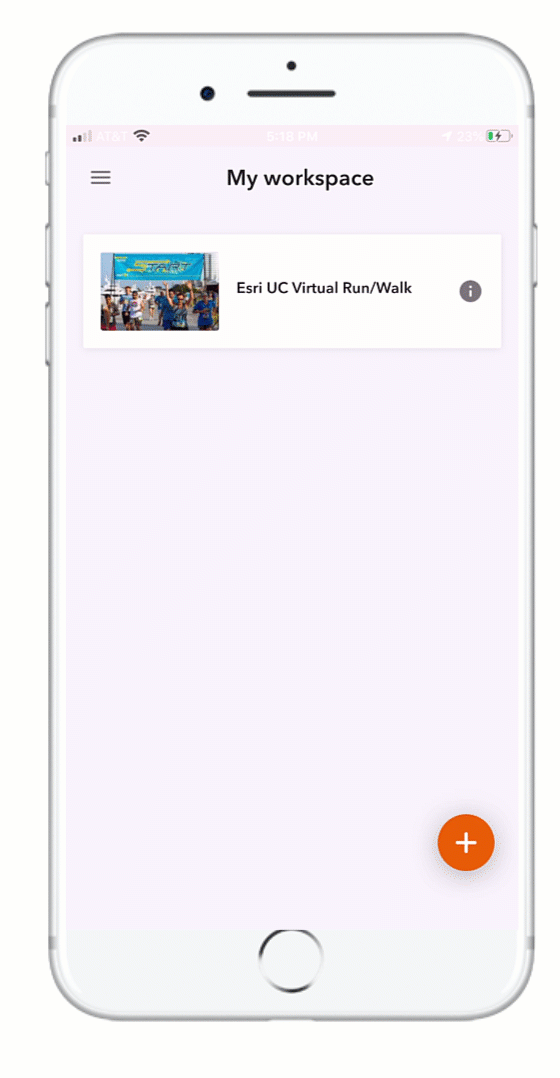
Can I use ArcGIS QuickCapture without an ArcGIS account? Yes, as long as you share your QuickCapture project publicly. For example, to support the Esri Run/Walk event this year, we created a public QuickCapture project so anyone can download the app and map their routes. To learn more, visit: Esri UC Virtual Run/Walk 2020 

Sharing QuickCapture projects publicly requires an ArcGIS Hub Premium license. If you want to learn more check out this blog: https://community.esri.com/community/arcgis-quickcapture/blog/2019/12/16/crowdsourcing-with-quickcap... 

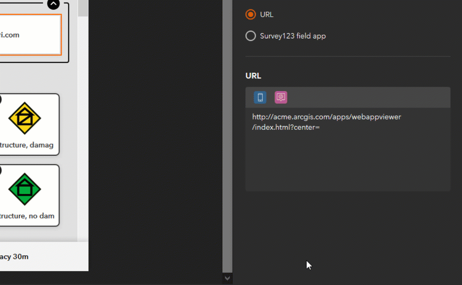
Can I bring up a window after a button is pushed so the end user can add some extra information? Yes. This is done through User Input windows, which you can configure to capture free text, numeric values or a selection from a list. To learn more about configuring User Inputs, check our https://community.esri.com/community/arcgis-quickcapture/blog/2019/10/06/understanding-user-inputs-i... blog post.

Can I capture a point observation while a line button is active? Yes. You can in fact capture multiple lines at the same time and while they are active, you can capture additional points.  This is known as nested field data capture. Say for example you want to map the condition of pedestrian trails within a park as well as park furniture. You can activate the Trail in Good Condition button to capture a line as you walk, and capture benches and other park furniture as you go.

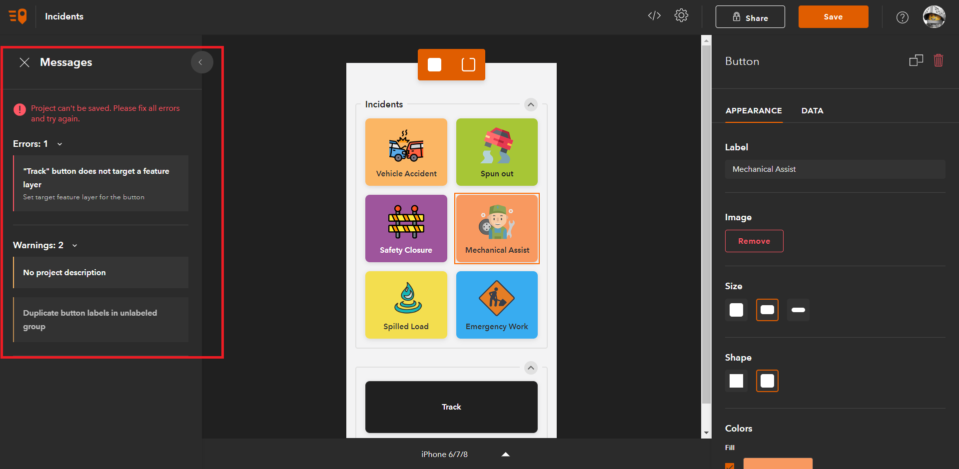
Is it possible for an end-user to create new buttons on the fly? No. Only the author of the QuickCapture project can create and organize data capture buttons. If you want to accommodate your project to the possibility of new feature category types, I would consider adding a new button for a generic 'Other' category. You can use a User Input to let end users type some free text to describe the new category. You can later look at entries in the category 'Other' and decide if more buttons should be added to the project.

Can multiple feature layers be added to a QuickCapture project? Yes. You can combine layers of different geometry types for example. You can also have a mix of layers coming from ArcGIS Online and Enterprise if you like. You can also build multiple QuickCapture projects on top of a single feature layer, and even build Survey123 and Collector projects against the same layers you are using with QuickCapture.

I am a University professor and want to cover field data collection tools. Should I teach QuickCapture, Survey123 or Collector? I would say that an important lesson for your students is to learn that not one single tool is going to serve all possible field data collection workflows. The three apps you mention are all about capturing georeferenced data in the field: they all let you capture points, lines and polygons; they all can be combined with external GNSS receivers, they all let you capture photos, etc. Now, the way they let you capture data is radically different. Choosing the right user experience to meet the way field users work is critical for success.

  • QuickCapture is ideal for rapid and at-speed data collection workflows. It delivers a minimalist user experience where end users can capture observations with minimum distraction and with minimum training. Think aerial patrols, quick reporting of issues and violations, at-speed road asset inventories, etc.
  • Survey123 delivers a form-centric approach to data capture. This is for use cases where you need people to spend a bit more time completing a form to capture multiple aspects of something. Think routine asset inspections, formal damage assessments, documenting code violations, etc.  If people are used to do their work completing a paper form... chances are you in front of a candidate for Survey123.
  • Collector is great when you want the data capture experience driven from a map. This is the way to go when working with multiple GIS layers is needed to provide context to your own editing workflows, or where you want to map assets across multiple layers of a map.

In practice, you will find some workflows where any of the options above could do the job. There are other use cases where one app will be the a best fit.  Choosing wisely between the different options often comes after full understanding of the pros and cons of each in relation to your specific workflow. Your seasoned students will be able to make the right call with experience.  Finally, in some cases it makes sense to combine apps as well.

Can I use QuickCapture to update existing features? No. With QuickCapture you can only submit new records. Survey123 and Collector would be a better fit.

Can I have QuickCapture add a related record to an existing feature? In my scenario, I want to use QuickCapture for a quick inspection and have that inspection record (Pass/Failed) be associated with an asset.  You could automatically add the inspection Pass/Fail information as a related record to the asset closest to the location where the inspection was done. This can be done with webhooks as described here: https://community.esri.com/community/arcgis-quickcapture/blog/2020/06/04/data-enrichment-with-arcgis... 

User in field has a need to collect 4 to 5 attributes such as 1. missing structure in map, 2. storm MH, 3. 7 hole cover.  How many buttons would i need for him to collect this correctly if the next set is 1.missing structure in field, Storm CB MH, 3. vein grate cover?  What is the workflow? You should be using Survey123.

Will I lose data I already collected when updating the app? No.

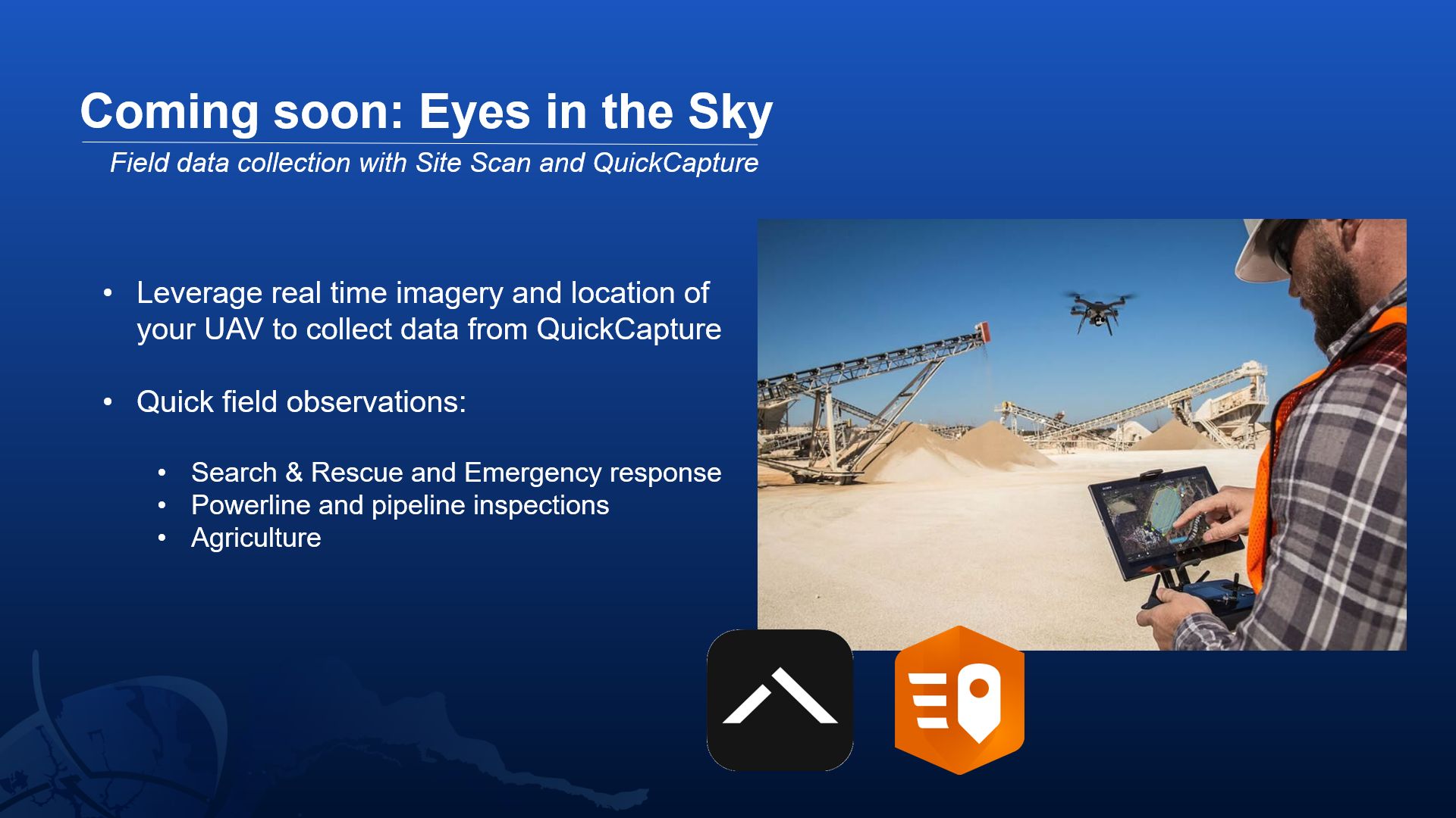
Can you provide instructions to test ArcGIS QuickCapture with Site Scan? Working on it. Stay tuned as we will have something for you shortly. Here is more info: https://community.esri.com/community/arcgis-quickcapture/blog/2020/07/14/site-scan-for-arcgis-integr... 

A few recurring ideas that would make a good entry in ArcGIS Ideas:

  • Can I capture multiple photos at a given location? This would make a good GeoNet Idea.
  • Can I configure a user input to trigger barcode scanning? This would make a good GeoNet Idea.
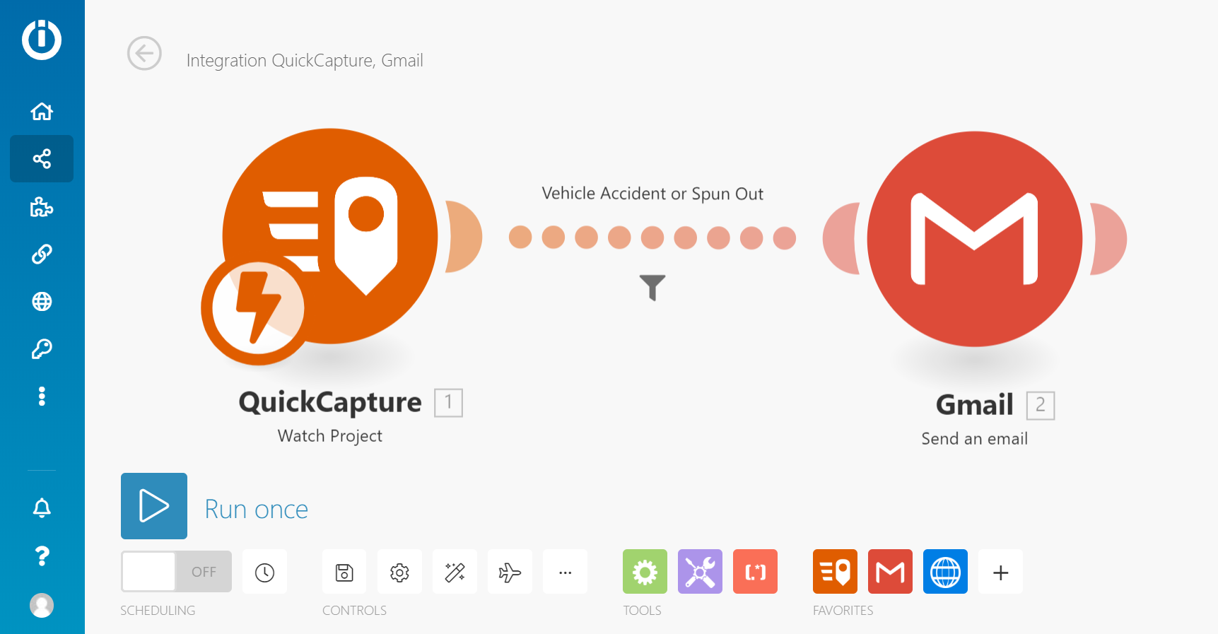
  • Can you launch a Survey123 form from QuickCapture? Coming up soon.

more
0 1 1,054
IsmaelChivite
Esri Notable Contributor

We just updated the ArcGIS QuickCapture mobile app across all supported platforms and refreshed the QuickCapture website and designer. Here is what is new:

ArcGIS QuickCapture mobile app

ArcGIS QuickCapture Share From Device

Share QuickCapture projects from your own device

Starting with this release, you can share your QuickCapture projects with colleagues, right from your device. We added a couple of new handy options so you can quickly share a link to a project you already have, or display a QR code for others to scan.

You can access this new feature from the project details dialog. Note that at the top there is a menu button which will let you obtain the link or QR code.

If you choose to copy the link, you can share it by email, SMS, iOS AirDrop or through other apps installed in your device... think WhatsApp, WeChat, etc.

Whoever is presented with your QR Code or link, will need to be authorized the project you are sharing. This is not about bypassing the ArcGIS security model: this is about making it easier for you to share projects you have already downloaded with people around you, when appropriate.

Note for Android users

In accordance with security requirements by Google for applications that target Android 10, QuickCapture now stores downloaded projects and unsent records in a new location. Up until this release, all application data was stored in Local Storage>ArcGIS>ArcGIS QuickCapture. The new location is Local Storage>Android>data>com.esri.arcgisquickcapture>files>ArcGIS> ArcGIS QuickCapture. Because of this change, you will need to download your QuickCapture projects again. Additionally, you will want to send any records left in your device before installing this release.

All Android users: Before upgrading ArcGIS QuickCapture to version 1.6, it is strongly recommended that you send all records on your device.

We are aware that this is an inconvenience to you, but it is a change that if needed for compatibility with Android 10. Also, note that subsequent upgrades of the QuickCapture app will not require you to send records before the upgrade.

ArcGIS QuickCapture in the Microsoft Store

QuickCapture's support for Windows has been present since its first release. The Windows installer can be downloaded from our resources page. With this release, you can also install the QuickCapture mobile app directly from the Microsoft Store. We know this is important to some of you, so we are pleased to announce it!

Simulate locations in the QuickCapture mobile app

This one may not be of interest to everybody, but if you ever need to simulate locations in the mobile app, now you can!  Since QuickCapture is about field data collection while on the move, we wanted to provide options for you to simulate not just a fixed location but also a track. Essentially, now you can setup a file location provider in the mobile app and feed it with a NMEA file. NMEA files can be easily generated. Once your file location provider is set, you can easily test and demo the QuickCapture mobile app as if you were outside, while sitting on your desk. To learn more about this, check our Simulating Locations in ArcGIS QuickCapture mobile app blog post.

QuickCapture designer enhancements

ArcGIS QuickCapture designer lets you create and manage QuickCapture projects, right from your web browser. In this update, we are adding a handful of productivity enhancements as well as new features for you to better control the data capture experience in the QuickCapture mobile app. Here are the highlights:

Support for shared update groups in QuickCapture designer

ArcGIS shared update groups are designed to allow members of the group to make changes to items in it. Say for example John, Karissa and Anna belong to an ArcGIS group configured with shared update capabilities. If John shares  an ArcGIS QuickCapture project with that group, then Anna and Karissa will be able make changes in that project. For example: change the description, thumbnail, map, device variables, buttons and layout of the project.

Updating sharing, changing ownership, or deleting the project are actions that only the owner of the project or a user with administrative privileges can do.  Support for shared update groups brings more flexibility to the management and design of QuickCapture projects.  To learn more about shared update groups, check  Create groups—ArcGIS Online Help | Documentation 

Disable location editing

While QuickCapture uses the location of your device when you capture a point observation, it is possible for end users to make adjustments right after having pushed the button. For example, if you are documenting a violation of right of way across a power line, you may want to adjust the location of the observation to center it in its actual location, rather than yours.  This is a very handy feature, but in some cases you do not want field users to alter the location of events captured.  Now you can optionally disable location editing from QuickCapture designer as shown in the screenshot below.

Custom template gallery

We introduced the concept of QuickCapture templates in our previous update. QuickCapture templates are ready to use QuickCapture projects which you can use to kick-start your own projects. We have created a small number of templates, but we recognize that many of you would like to create your own and share them within your organization. In this way, you can create relevant templates to your workflows and help standardize field data collection projects within your organization.

With this update, you can configure the QuickCapture template gallery to feed from a group in your own ArcGIS organization. Just like you can define a custom group to set the basemaps in your org, you can also set a group to define your own QuickCapture templates. Like other ArcGIS organizational settings, this property can only be updated by a user with administrative privileges.

As shown in the screenshot below, you can click on your profile to bring the Administrator Settings dialog. Within that dialog you can set the template group and decide if the Esri templates should be shown to users of your organization or not.

Other enhancements

This release includes some additional enhancements and fixes. For details, check out What's New help topic, which also will help you review highlights for previous versions.

We hope all these new features and enhancements are of your interest. We are now heads down working in our next update, which is planned for early October. We want to bring more exciting new features for you!

more
1 0 1,506
IsmaelChivite
Esri Notable Contributor

The whole idea with ArcGIS QuickCapture is to simplify as much as possible the field data collection experience. Now, simplicity for end users, is not in conflict with being able to generate rich GIS data.  I assume you are already familiar with ArcGIS QuickCapture's device variables. Device variables allow you to automatically calculate a good number of GIS attributes such as direction of travel, fix time, username, speed, horizontal accuracy and many others.  Device variables are a great way to enrich the GIS attributes of field observations made with the QuickCapture mobile app.


In this article, we will explore options to enrich your data using Integromat.  Integromat is a workflow automation solution that lets you integrate many applications and services together without writing code. If Integromat is news to you, I recommend you watch the ArcGIS QuickCapture: Automate Workflows with Integromat - YouTube video. You can create an Integromat account at integromat.com for free and then decide if it is worth for you to upgrade to a paid subscription.


Integromat is commonly used to automate notifications when data from QuickCapture is captured. For example, say you want an SMS to be sent to a field coordinator when a high priority issue is reported through the QuickCapture mobile app. That is about one of the most common reasons why people use Integromat.  As I said earlier, our intent in this article is to explore data enrichment with Integromat. This is also a very powerful use!   What if you could automatically populate GIS attributes to field observations from QuickCapture? Say you want to calculate the closest address to a record submitted, or store the current weather conditions at the location where an incident is reported...  What if you want to automatically associate a parcel identifier with data submitted from QuickCapture? All of this can be done. Automatically, and without much effort.


Example 1: Reverse Geocoding


Lets start with a simple example to warm up: A new record is submitted from the QuickCapture mobile app and the closest address to that location is automatically found and stored as a GIS attribute. Something like this:


ArcGIS QuickCapture reverse geocode


To achieve the above an Integromat scenario can be put together so every time a record is submitted, a call to the Esri World Geocoding service is made. The output from the reverse geocoding service call is used to update the new record with the address. A step by step guide is included in this 12 minute video.  This recording should give you enough information for you to build scenarios like this on your own:


Note: At 9:52, the video describes how you need to add curly brackets around the JSON in features. That is necessary, but you ALSO need to enclose the whole thing with square brackets. Do not forget that! Sorry about the omission in the video.

The video references the following links, which will be useful if you plan to do this on your own:


When using the Esri World Geocoding service, keep in mind you should pass forStorage=true as a parameter in your reverse geocode call if you plan to store the output as an attribute in your feature. Alternatively, you can use a similar technique to use your own locator service from ArcGIS Enterprise.  When using your own locator service, you do not have to worry about ArcGIS Online credit consumption or including the forStorage=true parameter.


Custom locator services can also be used to find the closest asset to a location. In this case, you may not be interested in getting an address, but just the identifier of the closest asset to a location. This can be useful, for example, when using QuickCapture to report the condition of an asset. The user taps the button when close enough to the asset and keeps moving; your Integromat scenario will do the rest: associate the condition to the closest asset.


Example 2: Point in Polygon query


You can also enrich field observations using a point in polygon query. Say for example you have a parcel layer and you want to know in which parcel a particular observation was made. As long as the observation was made inside the parcel, a point in polygon query will do the job for you.


The technique to get this done is very similar to what was described in the Reverse Geocoding video.  The HTTP module in Integromat is used to execute the query, and again to update the record.  The query operation is described in the Query (Feature Service/Layer)—ArcGIS REST API: Services Directory | ArcGIS for Developers help topic. However, as a quick reference, here is the bare bones URL pattern you will want to follow:


https://<featurelayerURL>/query?geometry=<x>,<y>&geometryType=esriGeometryPoint&inSR=4326&spatialRel...


You will note that in the documentation for the query operation, the geometry input is a json object, but you can also pass, for points an x,y value. Not officially documented, but it works!


A quick important reminders:


  • Always use https
  • Your feature layer URL must specify the layer index too. The end of it will look something like https://...FeatureServer/0/  Where /0/ is the index of your layer in the feature service.
  • It is important to pass the inSR parameter as 4326, to ensure that the query will work regardless of the spatial reference of your target polygon layer.
  • For the outFields parameter, indicate the exact attributes you want to back from your query. Do not be lazy requesting all the attributes as this will increase the network traffic unnecessarily and will complicate your life when authoring the scenario in Integromat.


Once you have the values you want from the intersecting polygon, you will use the Integromat http module to update your feature attributes. If you have watched the reverse geocoding video above, this should be no secret to you.


Example 3: Weather forecast


Using the Integromat Weather app, you can also enrich incoming QuickCapture records with a weather forecast. The Weather app takes an an input the XY coordinates of the location you are interested in and can report a weather forecast for the following day or days.


Integromat QuickCapture Weather


Example 4: ArcGIS Geoprocessing Services


If you are into ArcGIS geoprocessing services, you can also use the HTTP module in Integromat to pass parameters and run your own gp services.   The great thing about gp services is that they provide great flexibility to do more sophisticated analysis on the QuickCapture record location. In the screenshot below, for example, the HTTP module invokes a service that runs a valve isolation trace against a Utility Network dataset. The output, again, is used to enrich a QuickCapture observation.


When working with Geoprocessing services in this way, it is important to execute the tasks synchronously. The ouptuts from a gp service are processed similarly to how outputs are parsed from the Esri Geocoding service.


more
4 12 4,344
IsmaelChivite
Esri Notable Contributor

QuickCapture 1.5 is now available!  You can download the latest update into your mobile device and enjoy many new enhancements in the QuickCapture website too!  Lets have a quick look at the highlights of this release:

Workflow automation with Integromat

Capturing data quickly is not enough; being able to get that data to people who need it, where they need it, is what makes the real difference. For this reason, we are introducing support for Integromat in QuickCapture. Integromat is a powerful workflow automation solution, allowing you to connect many apps and services together.

With Integromat, you can easily automate tasks when data from QuickCapture is sent. Automatically send SMS or email notifications, copy your data into third party databases, spreadsheets, etc.  The screenshot below, shows an Integromat scenario configured to automatically send an email notification every time a vehicle accident event is reported from the QuickCapture mobile app.

ArcGIS QuickCapture email notification with Integromat

While email and SMS notifications are common tasks you will want to automate, you can do much more:

  • When a new incident is reported, immediately send an SMS to the division manager.
  • Create an ArcGIS Workforce assignment when a new service request is submitted.
  • Use AI algorithms to classify and label photos submitted.
  • Automatically assign the appropriate asset ID to condition assessments sent.

To learn more about ArcGIS QuickCapture and Integromat, check this 4 minute video tutorial:

Support for Integromat is possible because QuickCapture now can work with webhooks. If you want to create webhooks to target your own custom web services, Google Cloud functions or some other workflow automation providers, you can now do it from the QuickCapture designer.  Simply go to the Project Settings panel and scroll down until you find the Webhooks section.

Enhanced App Links

It is not news that you can use a link to launch the QuickCapture mobile app. It is not news either that your link can open any project you want, have QuickCapture target automatically your enterprise portal and even pass a value to a Project User Input. What is new, is that now you can use app link syntax (sometimes also referred to as universal links), rather than through a deep link (custom url scheme). 

Why is this important? Well, it is important because app links are more iOS and Android friendly, allowing you to launch your link from virtually any application in your device.  Through the new app link syntax, for example, you can now launch QuickCapture from other ArcGIS apps, such as as ArcGIS Indoors, Survey123, Collector, Workforce, Explorer, etc.  You can also more safely launch QuickCapture from e-mail clients and even from your own custom mobile apps. The deep link syntax will continue to work as usual. In fact, in Windows deep links are the only supported syntax.

This is what an app link to open a QuickCapture project looks like:

https://quickcapture.arcgis.app/?itemId=dcdb68465fbc4c38a6aba7f5165cdfd4

This is the equivalent deep link:

arcgis-quickcapture://?itemId=dcdb68465fbc4c38a6aba7f5165cdfd4


Deep links and app links are described in detail in the Integrate with other apps—QuickCapture | Documentation help topic.

QuickCapture designer enhancements

There are great new features in the QuickCapture website that will make managing and designing your QuickCapture projects much easier. Lets have a quick tour of the most important:

A new panel on the left side of the QuickCapture designer will now assist you during the design process. Sharing errors, inconsistencies, missing properties, etc.  This new panel will help you follow best practices and fix problems in your project in a heartbeat.

Starting with this update you can also now control the size of the photos to be submitted from your QuickCapture project. Choose to leave photos at full resolution, or reduce their size to facilitate working in low-bandwidth environments:

In our last release we added a ‘Save as’ option to duplicate existing projects easily. Some of you suggested we should add a choice to duplicate the project layers as well, so now you have it!

This update introduces a new template gallery; use it for inspiration or to quick-start your own projects. The gallery features a small collection of templates for now, but we will be adding more in the future. Very soon you will be able to create your own template gallery, so you can help people in your organization get started with templates that are relevant to their own work.

Other work worth highlighting

There are a handful other new features and enhancements that I want to highlight:

  • The QuickCapture mobile app now supports PKI authentication.
  • Users of the mobile app can now change the distance units (US standard vs metric)
  • The source code of the QuickCapture mobile app for this release has been made available as an AppStudio enterprise template.

We are now deep into 1.6 development, which we plan to make available in July 2020. Our development agenda is loaded with user-driven requests. Thanks to all of you who share with us your work and ideas. You are a constant source of inspiration. Your ideas and feedback are shaping this product.

more
7 0 3,673
102 Subscribers
Labels