ArcGIS Maps SDKs Native Blog - Page 16

cancel
Showing results for 
Show  only  | Search instead for 
Did you mean: 

Latest Activity

(237 Posts)
NathanCastle1
Esri Contributor

This release introduces a totally new design inspired by common navigation app design patterns.

Read more...

more
0 0 995
MichaelBranscomb
Esri Frequent Contributor

ArcGIS Runtime Local Server SDK 100.8 is now available for download from the ArcGIS for Developers site.

To update the Local Server version used by your projects you can update the `Esri.ArcGISRuntime.LocalServices` reference from 100.6 to 100.8 via NuGet.org or alternatively download from NuGet.org to the local Esri NuGet source created by the ArcGIS Runtime SDK for .NET Visual Studio extension (`%localappdata%\Esri\NuGet`) and then update your projects.

For more information see ArcGIS Runtime Local Server SDK 100.8 now available! 

more
1 0 1,193
by Anonymous User
Not applicable

Is your GIS data ready for scoped storage in August? Google’s long-hinted (and delayed) changes to local storage will have to be in place for apps hosted on the Google Play store. In this post I'll tell you what we’ve learned about the changes and how we handled them on the Android samples team. 


GIS is fundamentally a data driven science. The ArcGIS Runtime SDK provides the tools you need to manage, analyze and access GIS data in your apps. For mobile devices, that can mean accessing data services over mobile networks, from service endpoints hosted on ArcGIS Online or ArcGIS Enterprise. It can also mean accessing local data on the device, whether that’s because the dataset in question is very large or because user workflows mean devices are likely to be used in areas of poor mobile network coverage.  


Google has fired the final warning shot that developers will need to move to the new scoped storage model for handling data locally on the device, for any apps targeting Android 10. This means any of your apps using the older model, with wide access to the file system exposed through getExternalStorageDirectory on the Environment class, will have to change. Instead, your app will be expected to use the app-specific directory, a dedicated space on the device for persistent files that the application owns. 


This directory is divided into internal, external and shared storage directories. Internal storage is accessed with a call to getFilesDir and is for data which will not be available to any other apps (and will be encrypted from Android 10 onwards). External storage, accessed with a call to getExternalFilesDir, is for data which can be accessed by other apps (and critically, ADB). Both of these storage directories are scoped to the app and will be deleted on uninstallation of the app itself. A third directory, shared storage, is more similar to the old storage format, but is for specific media files and of less relevance to GIS data. 


Internal storage 

getFilesDir 

  • Not accessible to other apps 
  • Encrypted (as of Android 10) 
  • Deleted on app uninstall 

External storage  

getExternalFilesDir 

  • Accessible to other apps with permissions 
  • Deleted on app uninstall 

Shared storage 

MediaStore, Storage Access Framework 

  • Accessible to other apps 
  • Persists on app is uninstalled 


With ArcGIS Runtime, your decision on whether to use internal or external storage should be driven by the intended workflow of your app. If your app is downloading sensitive client map data as a MobileMapPackage with the OfflineMapTask, that data is probably best stored in the internal storage of the app which will use that data. However, a user downloading a mobile map package with the offline map task, or sideloading an .mmpk file onto a device with ADB, may wish to store the data in a place which allows for access by other apps. They might want to use the data in different ArcGIS Runtime apps or simply be able to manipulate those files from a file manager app. If those were expected workflows, external storage would be the best option. 


In the ArcGIS Runtime sample apps repo, we recently migrated just over 30 samples to use the new scoped storage model. We decided to place our data in external storage for easy side-loading of data with ADB. Here’s an example with a point cloud dataset in a scene layer package. 


The right kind of scoped storage solution will ultimately be up to you, the developer. Whichever option you decide, you should have your app ready for scoped storage soon, as it’ll be required for apps targeting Android 10 (API 29). New apps distributed on the Google Play store need to target Android 10 by August of this year. Updates to existing apps will have a little more breathing room though, with Android 10 target requirements by November. 


In the event that you don’t think you’ll have time to get your app ready by then, there’s one final get out of jail free card. Adding the line `requestLegacyExternalStorage=true` to your app’s AndroidManifest.xml file will allow your Android 10 app to use the old storage model. But with plans for Android 11 well under way, it’s best to make the change to the new scoped storage model sooner rather than later! 

more
0 0 5,978
MichaelBranscomb
Esri Frequent Contributor

We are pleased to announce the 100.8 release of ArcGIS Runtime SDK for .NET. This release includes significant new features, enhancements to existing features, performance improvements, and bug fixes. You can read about the topics common to all ArcGIS Runtime SDKs here, but for you - our .NET community - there are several specific details we would like to highlight.

Read more...

more
1 2 2,388
MarkDostal
Esri Regular Contributor

The latest release of the ArcGIS Runtime Toolkit for iOS is here. It has been updated to work with the 100.8 release of the ArcGIS Runtime SDK for iOS.

This release includes:

  • JobManager changes:  Use UIApplication.shared.beginBackgroundTask instead of the background fetch stuff. Background fetch can take hours to get called according to the Apple documentation. Instead, beginBackgroundTask keeps the app alive for up to 10 minutes, giving most jobs the ability to finish or at least get to get out of the process download phase.
  • Auto Layout fixes for JobManagerExample and MeasureToolbar.
  • Updates minimum iOS version to 12.0 and Xcode version to 11.0 to keep inline with the ArcGIS Runtime SDK for iOS.
  • Fixes deprecation of UISearchController.dimsBackgroundDuringPresentation resulting from iOS 12.0 update.
  • Change locationDataSource property of ArcGISARView to be of type AGSLocationDataSource instead of the subclass AGSCLLocationDataSource.

You can find the Toolkit here.
See this blog post for information on the SDK release.

We hope you enjoy the new release! Let us know what you're building with it.

more
0 0 936
Nicholas-Furness
Esri Regular Contributor

The Runtime team is pleased to announce the latest release of the Runtime SDK for iOS (see the release notes, and the overall announcement on the ArcGIS blog).

It continues to follow the track based approach, so there's lots of new functionality for Defense/Public Safety, and Utility customers, as well as improving platform support, but there are some significant things for iOS developers that are worth highlighting:

  • Metal Support: This is a big one! Apple deprecated support for OpenGL ES in iOS and at some point down the line will likely remove support from iOS entirely. Runtime 100.8 for iOS introduces a new Metal based rendering pipeline. It's faster and uses less memory. It also means you can actually use 3D Scenes in the simulator! But it does have an impact on using the simulator on Mojave or running in iOS 12. See this post for more details.
  • Minimum iOS 12: iOS 11 support has been dropped.
  • Minimum Xcode 11: Xcode 10 support has been dropped.
  • Tookit updated: The toolkit has some updates and fixes. See this blog post for more details.

A handful of other highlights:

  • Image overlays (scene views only): Animate weather radar or other imagery.
  • Visual variables for point layers now render in dynamic mode. Smooth zooming, everybody!
  • MMPKs and MSPKs can now include online layers (e.g. traffic). Requires ArcGIS Pro 2.6 to author these.
  • Identify on raster layers (both service based or local raster file based).

Check out the release notes for more details, and as always we hope you enjoy the new capabilities. Please feel free to DM me and let me know what you're building!

more
0 1 1,015
Nicholas-Furness
Esri Regular Contributor

In 2018, Apple announced they were deprecating support for Open GL in macOS and iOS. Here's what we wrote about that at the time: https://community.esri.com/community/developers/native-app-developers/arcgis-runtime-sdk-for-ios/blo... 

We're pleased to let you know that the 100.8 release of the ArcGIS Runtime SDK for iOS, coming soon out now, introduces Metal support. There's nothing you need to do to take advantage of this other than upgrade your version of the Runtime SDK for iOS to version 100.8.

Testing has shown improved performance (especially when displaying scenes in the simulator).

Because OpenGL ES support is no longer included, any development or testing workflow that uses the iOS Simulator must use a simulator that supports Metal to view an AGSMapView or AGSSceneView. What this means in practice is that to use version 100.8 with an iOS Simulator you must meet the following minimum conditions:

  • Developing on macOS Catalina (10.15)
  • Using Xcode 11 (this is a requirement for Runtime 100.8 anyway).
  • Simulating iOS 13

If you need to develop or test with version 100.8 against iOS 12 or using an earlier version of macOS, you need to use a physical device in place of the simulator.

You'll find this information and more in the release notes.

Please note that the Runtime SDKs for Qt, .NET (Xamarin.iOS), and Java will introduce Metal support in future releases.

more
1 1 1,206
NathanCastle1
Esri Contributor

New Mapping Features

This release introduces mapping features that empower your users to work how they want to. This gives you flexibility to author more advanced web maps while being confident that users can access, refine, and understand them. 

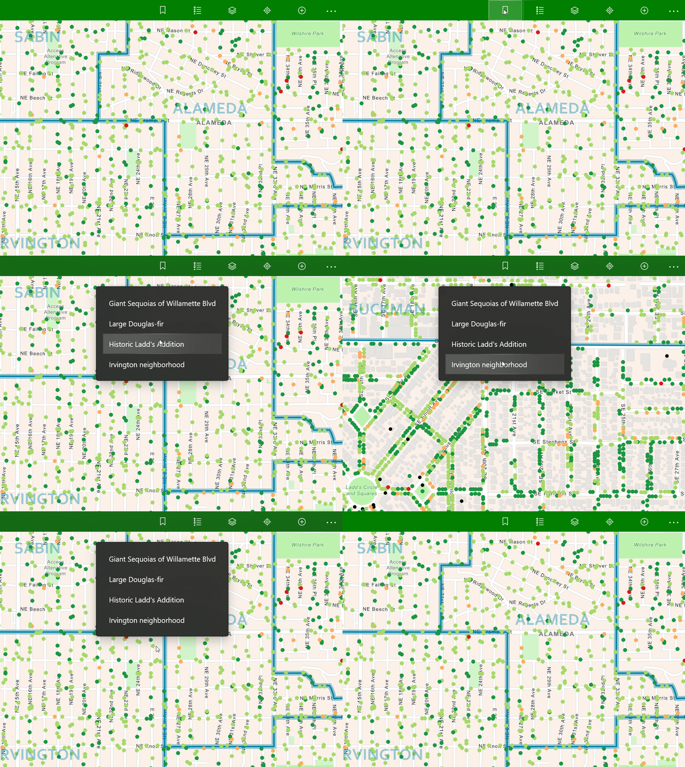
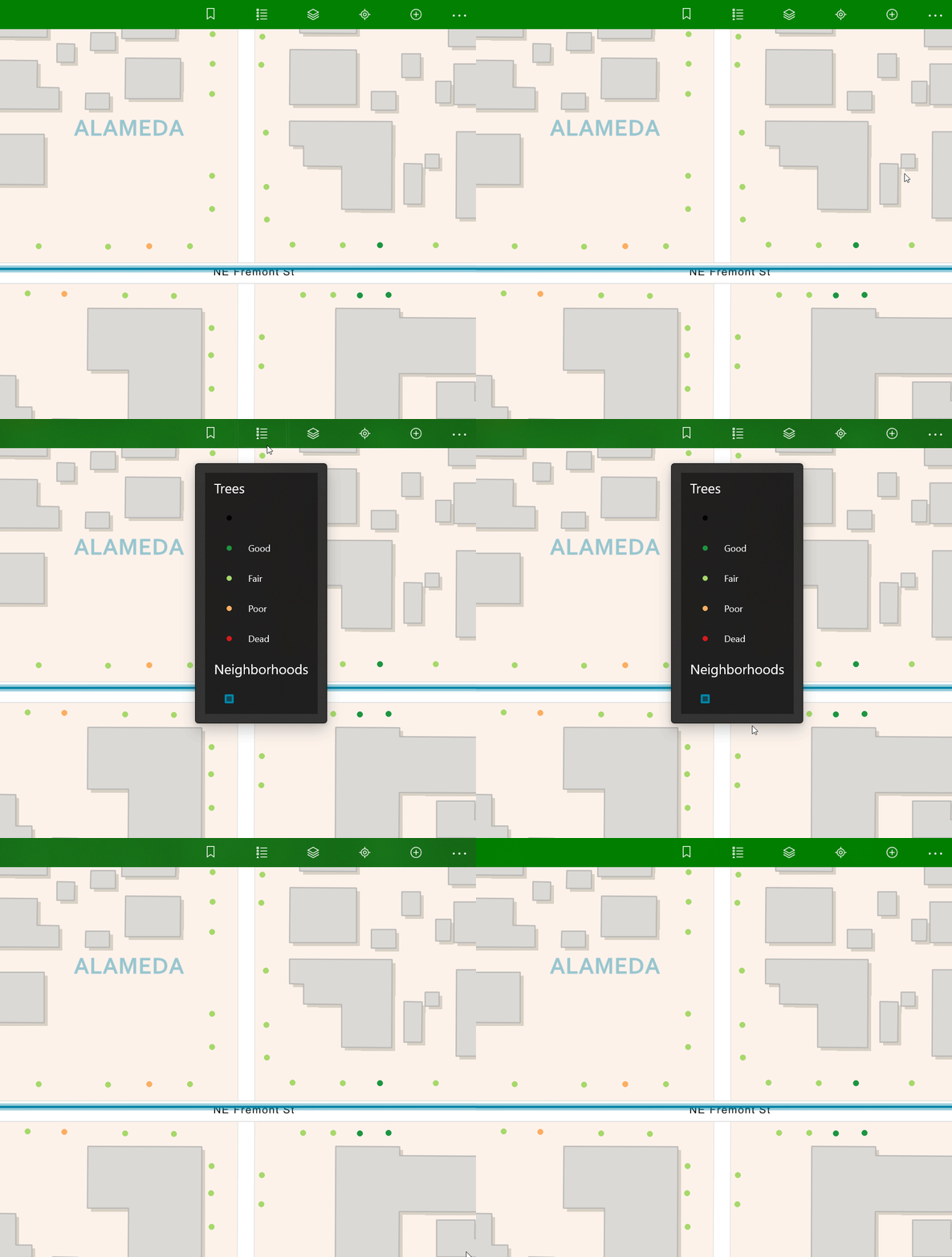
  • Access key areas of the map with bookmarks.
  • Refine the visibility of map content with the table of contents.
  • Understand map content with the legend.
Short video showing navigating to bookmarks in the UWP appShort video showing the TOC control in the UWP appShort video showing the legend in the WPF app
BookmarksTable of ContentsLegend

Design Updates

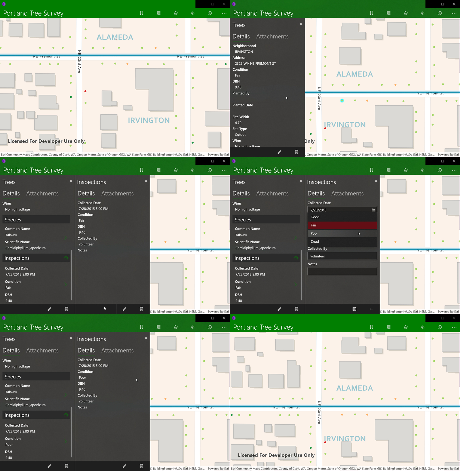
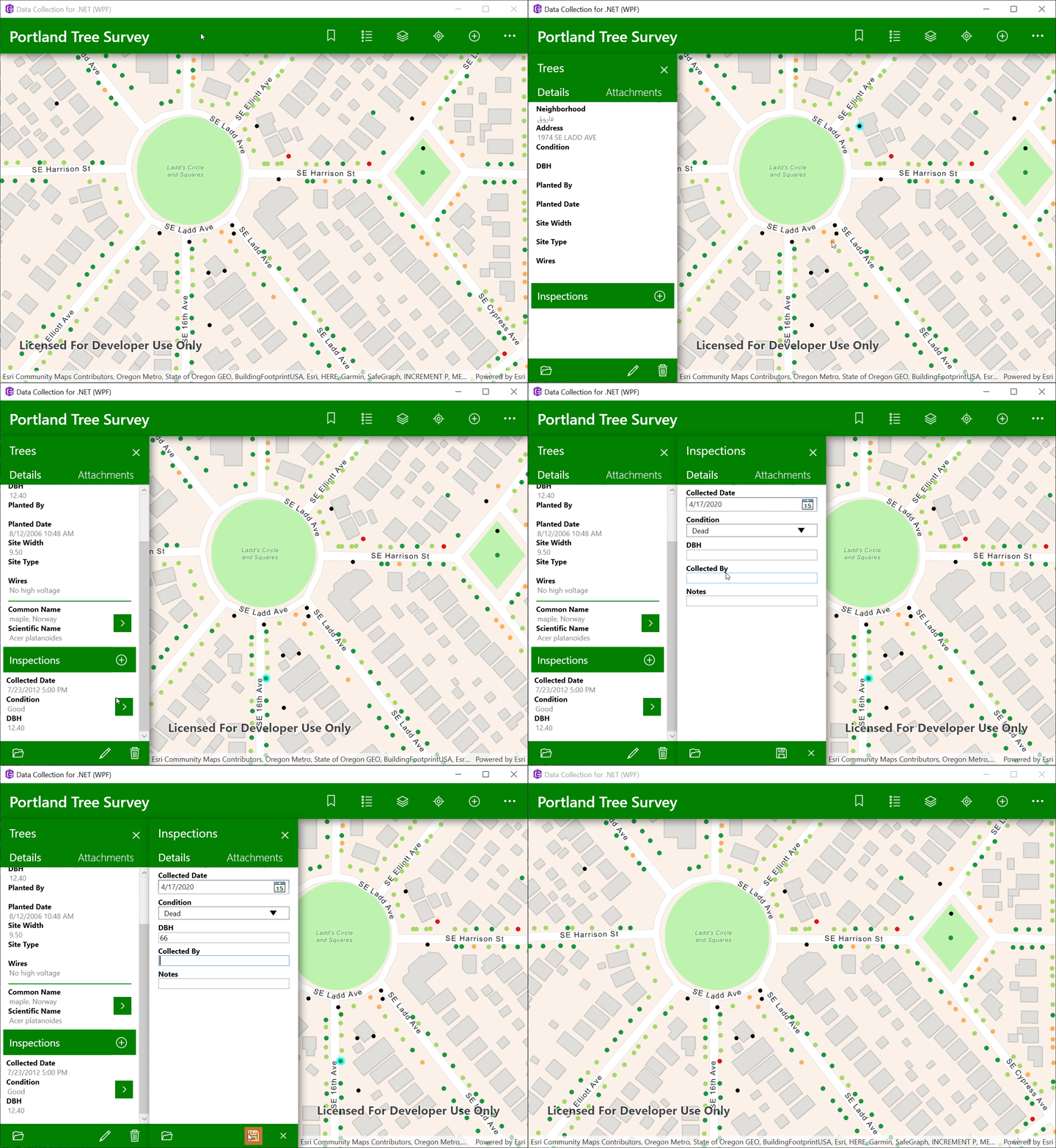
In addition to mapping features, this release includes design updates to improve ease of use: 

  • Refreshed icons based on Esri's Calcite design system.
  • Redesigned UWP interface makes better use of modern Windows 10 design.
  • Updated WPF design now keeps buttons in a consistent location.
All new calcite icons shown in a row
Calcite Icons
Short video showing new UWP app designShort video showing new WPF app design
Updated UWP designUpdated WPF design

Next Steps

You can find the 1.2 release of Data Collection for .NET on GitHub.

more
1 0 1,061
Nicholas-Furness
Esri Regular Contributor

The latest release of the ArcGIS Runtime Toolkit for Android is here. It has been updated to work with the 100.7 release of the ArcGIS Runtime SDK for Android.

This release includes:

  • Support for clipping distance in ARView, which limits the data displayed to a radius around the origin camera.
  • A new BookmarkView component and example.
  • A couple of bug fixes to the Scalebar:
    • When using the Dual-unit-line style, the units are incorrectly placed and overlap one another.
    • When MapView insets are added, the right-hand inset doesn’t seem to be applied properly when the scalebar is right aligned, causing the right-hand end of the bar to be outside the view.

You can find the toolkit release here.

See this blog post for information on the SDK release.

Hope you enjoy the new release. Let us know what you're building with it.

more
0 0 764
MichaelBranscomb
Esri Frequent Contributor

The Runtime .NET team is excited to announce the release of ArcGIS Runtime SDK for .NET 100.7. This release includes significant new features, enhancements to existing features, performance improvements, and bug fixes. You can read about the changes common to all ArcGIS Runtime SDKs here, but for you, our .NET community, there are several items we would like to highlight…

Read more...

more
2 1 2,065
123 Subscribers