- Home
- :
- All Communities
- :
- Developers
- :
- JavaScript Maps SDK
- :
- JavaScript Maps SDK Questions
- :
- Reverse geocode not working,
- Subscribe to RSS Feed
- Mark Topic as New
- Mark Topic as Read
- Float this Topic for Current User
- Bookmark
- Subscribe
- Mute
- Printer Friendly Page
Reverse geocode not working,
- Mark as New
- Bookmark
- Subscribe
- Mute
- Subscribe to RSS Feed
- Permalink
hi all, i use geocoding services, clickmap get address but my code is not working? but in the example given by esri that it working
Reverse geocode | ArcGIS API for JavaScript
mycode:
<!DOCTYPE html>
<html>
<head>
<meta http-equiv="Content-Type" content="text/html; charset=utf-8">
<!--The viewport meta tag is used to improve the presentation and behavior of the samples
on iOS devices-->
<meta name="viewport" content="initial-scale=1, maximum-scale=1,user-scalable=no">
<title>Find Address</title>
<link rel="stylesheet" href="http://js.arcgis.com/3.14/dijit/themes/claro/claro.css">
<link rel="stylesheet" href="http://js.arcgis.com/3.14/esri/css/esri.css">
<style>
html, body { height: 100%; width: 100%; margin: 0; padding: 0; }
#map {
padding: 0;
border: solid 2px #666;
margin: 0 5px 5px 5px;
}
#header {
border: solid 2px #666;
color: #666;
font-family: sans-serif;
font-size: 1.1em;
height: auto;
margin: 5px;
overflow: hidden;
padding: 10px 0 10px 20px;
text-align:left;
}
.roundedCorners {
-webkit-border-radius: 5px;
-moz-border-radius: 5px;
border-radius: 5px;
}
</style>
<script src="http://js.arcgis.com/3.14/"></script>
<script>
var map;
require([
"esri/map", "esri/tasks/locator", "esri/graphic",
"esri/geometry/webMercatorUtils",
"esri/symbols/SimpleMarkerSymbol", "esri/symbols/SimpleLineSymbol",
"esri/InfoTemplate", "esri/Color",
"dojo/number", "dojo/parser", "dojo/dom", "dijit/registry",
"dijit/layout/BorderContainer", "dijit/layout/ContentPane", "dojo/domReady!"
], function (
Map, Locator, Graphic,
webMercatorUtils,
SimpleMarkerSymbol, SimpleLineSymbol,
InfoTemplate, Color,
number, parser, dom, registry
) {
parser.parse();
map = new Map("map", {
zoom: 0
});
var tiled = new esri.layers.ArcGISTiledMapServiceLayer("url");
map.addLayer(tiled);
var locator = new Locator("url");
locator.outSpatialReference = map.spatialReference;
// var infoTemplate = new InfoTemplate("Location", "Address: ${Address}");
var symbol = new SimpleMarkerSymbol(
SimpleMarkerSymbol.STYLE_CIRCLE,
15,
new SimpleLineSymbol(
SimpleLineSymbol.STYLE_SOLID,
new Color([0, 0, 255, 0.5]),
8
),
new Color([0, 0, 255])
);
locator.on("location-to-address-complete", function (evt) {
var abc = "123";
if (evt.address.address) {
var address = evt.address.address;
var location = webMercatorUtils.geographicToWebMercator(evt.address.location);
//this service returns geocoding results in geographic - convert to web mercator to display on map
// var location = webMercatorUtils.geographicToWebMercator(evt.location);
var graphic = new Graphic(location, symbol, address, infoTemplate);
map.graphics.add(graphic);
map.infoWindow.setTitle(graphic.getTitle());
map.infoWindow.setContent(graphic.getContent());
//display the info window with the address information
var screenPnt = map.toScreen(location);
map.infoWindow.resize(200, 100);
map.infoWindow.show(screenPnt, map.getInfoWindowAnchor(screenPnt));
}
});
map.on("click", function (evt) {
locator.outSpatialReference = map.spatialReference;
map.graphics.clear();
// try {
locator.locationToAddress(webMercatorUtils.webMercatorToGeographic(evt.mapPoint), 1000);
locator.outSpatialReference = map.spatialReference;
// }
// catch (ex) {
// var address1 = evt.address.address;
// alert(address1);
// }
});
});
</script>
</head>
<body class="claro">
<div id="mainWindow" data-dojo-type="dijit/layout/BorderContainer"
data-dojo-props="design:'headline', gutters:false"
style="width:100%; height:100%;">
<div id="header" class="roundedCorners"
data-dojo-type="dijit/layout/ContentPane"
data-dojo-props="region:'top'">
<span>Click the map to get the address for the input location.</span>
</div>
<div id="map" class="roundedCorners"
data-dojo-type="dijit/layout/ContentPane"
data-dojo-props="region:'center'">
</div>
</div>
</body>
</html>
- Mark as New
- Bookmark
- Subscribe
- Mute
- Subscribe to RSS Feed
- Permalink
Ia sinh,
The issue you were having is that your GeocodeService is in a different projection that WGS 84 that you where attempting to convert the click geometry to. I also remove the Legacy coding that you were using for ArcGISTiledMapServiceLayer and preformed some other code cleanup.
<!DOCTYPE html>
<html>

<head>
  <meta http-equiv="Content-Type" content="text/html; charset=utf-8">
  <!--The viewport meta tag is used to improve the presentation and behavior of the samples
      on iOS devices-->
  <meta name="viewport" content="initial-scale=1, maximum-scale=1,user-scalable=no">
  <title>Find Address</title>
  <link rel="stylesheet" href="http://js.arcgis.com/3.14/dijit/themes/claro/claro.css">
  <link rel="stylesheet" href="http://js.arcgis.com/3.14/esri/css/esri.css">

  <style>
    html,
    body {
      height: 100%;
      width: 100%;
      margin: 0;
      padding: 0;
    }

    #map {
      padding: 0;
      border: solid 2px #666;
      margin: 0 5px 5px 5px;
    }

    #header {
      border: solid 2px #666;
      color: #666;
      font-family: sans-serif;
      font-size: 1.1em;
      height: auto;
      margin: 5px;
      overflow: hidden;
      padding: 10px 0 10px 20px;
      text-align: left;
    }

    .roundedCorners {
      -webkit-border-radius: 5px;
      -moz-border-radius: 5px;
      border-radius: 5px;
    }
  </style>

  <script src="http://js.arcgis.com/3.14/"></script>

  <script>
    var map;
    require([
        "esri/map", "esri/tasks/locator", "esri/graphic",
        "esri/geometry/webMercatorUtils", "esri/layers/ArcGISTiledMapServiceLayer",
        "esri/symbols/SimpleMarkerSymbol", "esri/symbols/SimpleLineSymbol",
        "esri/InfoTemplate", "esri/Color",
        "dojo/number", "dojo/parser", "dojo/dom", "dijit/registry",
        "dijit/layout/BorderContainer", "dijit/layout/ContentPane", "dojo/domReady!"
      ], function (
      Map, Locator, Graphic,
      webMercatorUtils, ArcGISTiledMapServiceLayer,
      SimpleMarkerSymbol, SimpleLineSymbol,
      InfoTemplate, Color,
      number, parser, dom, registry
    ) {
      parser.parse();

      map = new Map("map", {
        zoom: 0
      });

      var tiled = new ArcGISTiledMapServiceLayer("http://115.79.20.1:6080/arcgis/rest/services/Atlas2015/NEN_KTXH_150715/MapServer");
      map.addLayer(tiled);
      var locator = new Locator("http://115.79.20.1:6080/arcgis/rest/services/Geocode/GEOCODING_SONHA_BH/GeocodeServer");
      locator.outSpatialReference = map.spatialReference;
      var symbol = new SimpleMarkerSymbol(
        SimpleMarkerSymbol.STYLE_CIRCLE,
        15,
        new SimpleLineSymbol(
          SimpleLineSymbol.STYLE_SOLID,
          new Color([0, 0, 255, 0.5]),
          8
        ),
        new Color([0, 0, 255])
      );

      locator.on("location-to-address-complete", function (evt) {
        if (evt.address.address) {
          var infoTemplate = new InfoTemplate("Location", "${*}");
          var address = evt.address.address;
          var graphic = new Graphic(evt.address.location, symbol, address, infoTemplate);
          map.graphics.add(graphic);
          map.infoWindow.setTitle(graphic.getTitle());
          map.infoWindow.setContent(graphic.getContent());

          //display the info window with the address information
          map.infoWindow.resize(200, 100);
          map.infoWindow.show(evt.address.location);
        }
      });

      map.on("click", function (evt) {
        map.graphics.clear();
        locator.locationToAddress(evt.mapPoint, 1000);
      });
    });
  </script>
</head>

<body class="claro">
  <div id="mainWindow" data-dojo-type="dijit/layout/BorderContainer" data-dojo-props="design:'headline', gutters:false" style="width:100%; height:100%;">

    <div id="header" class="roundedCorners" data-dojo-type="dijit/layout/ContentPane" data-dojo-props="region:'top'">
      <span>Click the map to get the address for the input location.</span>
    </div>

    <div id="map" class="roundedCorners" data-dojo-type="dijit/layout/ContentPane" data-dojo-props="region:'center'">
    </div>
  </div>
</body>

</html>
- Mark as New
- Bookmark
- Subscribe
- Mute
- Subscribe to RSS Feed
- Permalink
Thanks Robert, It is working,
But if i change the coordinate system my code obove is working or is not
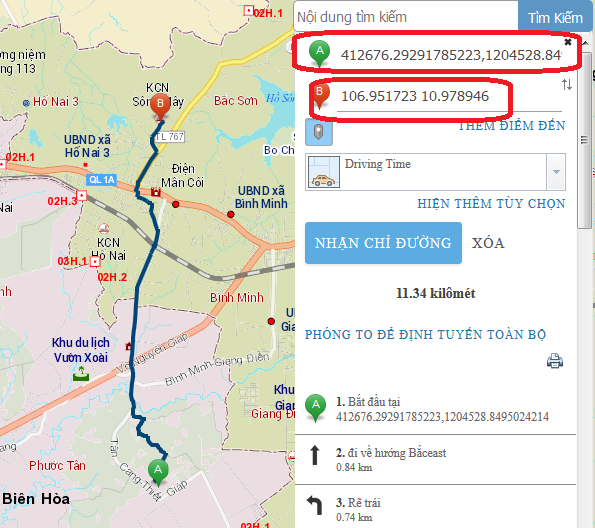
And i used geododeService above in directions widgets, but My code did not work as I expected, when i clickMap to add a point to input parameter of directions widgets also adds at coordinates instead of address. How to adds Address to input directions widgets? thanKYou
My Code:
<!DOCTYPE html>
<html>
<head>
<meta http-equiv="Content-Type" content="text/html; charset=utf-8">
<meta name="viewport" content="initial-scale=1, maximum-scale=1,user-scalable=no">
<title>Directions Widget</title>
<link rel="stylesheet" href="http://js.arcgis.com/3.14/dijit/themes/claro/claro.css">
<link rel="stylesheet" href="http://js.arcgis.com/3.14/esri/css/esri.css">
<style>
html, body, #map {
height:100%;
width:100%;
margin:0;
padding:0;
}
body {
background-color:#FFF;
overflow:hidden;
font-family:"Trebuchet MS";
}
</style>
<script src="http://js.arcgis.com/3.14/"></script>
<script>
require([
"esri/map", "esri/tasks/locator", "esri/dijit/Directions", "esri/dijit/Search", "esri/layers/FeatureLayer",
"dojo/parser",
"dijit/layout/BorderContainer", "dijit/layout/ContentPane", "dojo/domReady!"
], function (
Map, Locator, Directions, Search, FeatureLayer,
parser
) {
parser.parse();
//all requests to route.arcgis.com will proxy to the proxyUrl defined in this object.
map = new Map("map", {
zoom: 0
});
var tiled = new esri.layers.ArcGISTiledMapServiceLayer("http://115.79.20.1:6080/arcgis/rest/services/Atlas2015/NEN_KTXH_150715/MapServer");
map.addLayer(tiled);
var directions = new Directions({
map: map,
mapClickActive: true,
routeTaskUrl: "http://115.79.20.1:6080/arcgis/rest/services/NetworkRouter/network01102015/NAServer/Route",
geometryTaskUrl: "http://115.79.20.1:6080/arcgis/rest/services/Utilities/Geometry/GeometryServer",
// travelModesServiceUrl: "http://utility.arcgis.com/usrsvcs/servers/cdc3efd03ddd4721b99adce219629489/rest/services/World/Utili...",
searchOptions: {
sources: [
{
locator: new Locator("http://115.79.20.1:6080/arcgis/rest/services/Geocode/GEOCODING_SONHA_BH/GeocodeServer"),
singleLineFieldName: "SingleLine",
name: "Custom Geocoding Service",
placeholder: "Search Geocoder",
maxResults: 3,
maxSuggestions: 20,
enableSuggestions: true,
minCharacters: 0
}
]
}
}, "dir");
directions.startup();
});
</script>
</head>
<body class="claro">
<div data-dojo-type="dijit/layout/BorderContainer"
data-dojo-props="design:'headline', gutters:false"
style="width:100%;height:100%;">
<div data-dojo-type="dijit/layout/ContentPane"
data-dojo-props="region:'right'"
style="width:250px;">
<div id="dir"></div>
</div>
<div id="map"
data-dojo-type="dijit/layout/ContentPane"
data-dojo-props="region:'center'">
</div>
</div>
</body>
</html>