- Home
- :
- All Communities
- :
- Products
- :
- ArcGIS Explorer
- :
- ArcGIS Explorer Questions
- :
- Re: Using Locator in Explorer for ArcGIS
- Subscribe to RSS Feed
- Mark Topic as New
- Mark Topic as Read
- Float this Topic for Current User
- Bookmark
- Subscribe
- Mute
- Printer Friendly Page
Using Locator in Explorer for ArcGIS
- Mark as New
- Bookmark
- Subscribe
- Mute
- Subscribe to RSS Feed
- Permalink
I have prepared my feature locator for a layer base on name of features, when i use it in explorer web map in mobile app its not working because the name of what i'm searching for is similar to some places in Esri World geocode so it will return these places instead what i'm searching for. i tried to remove Esri geocode service from my 10.6.1 portal to cancel it from explorer it doesn't work. i tried to put my Locator above esri locator and also dint work .how can cancel Esri geocode service from working in Explorer for Arcgis Mobile App ?
- Mark as New
- Bookmark
- Subscribe
- Mute
- Subscribe to RSS Feed
- Permalink
Hi Mo Mohamad,
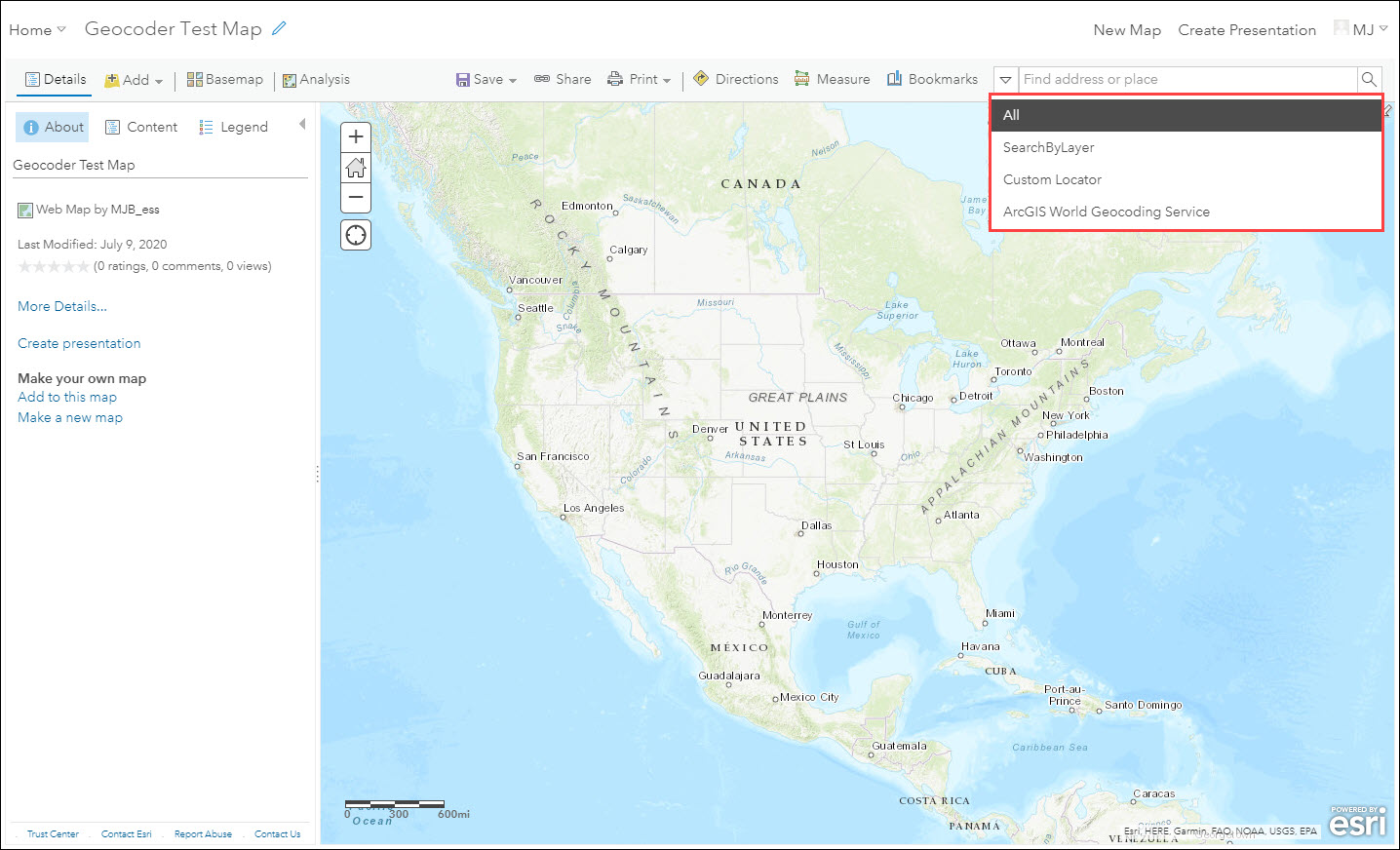
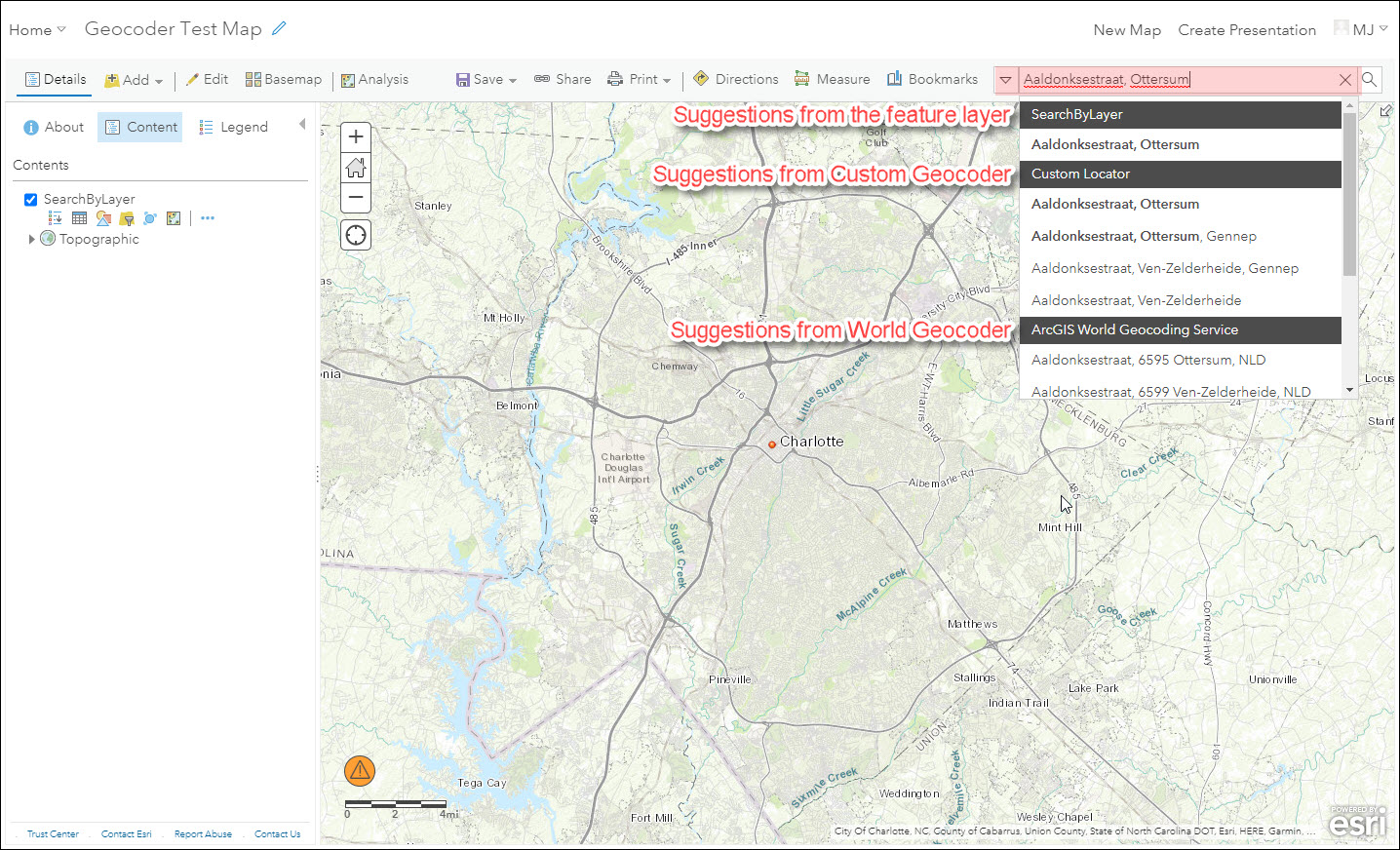
Search function works differently in Map Viewer in AGOL and Explorer app. The main difference is, in Map Viewer, you can pick which Geocoder you want to use to search for an address. If "All" is selected, it will search through all Geocoders and returns the results.
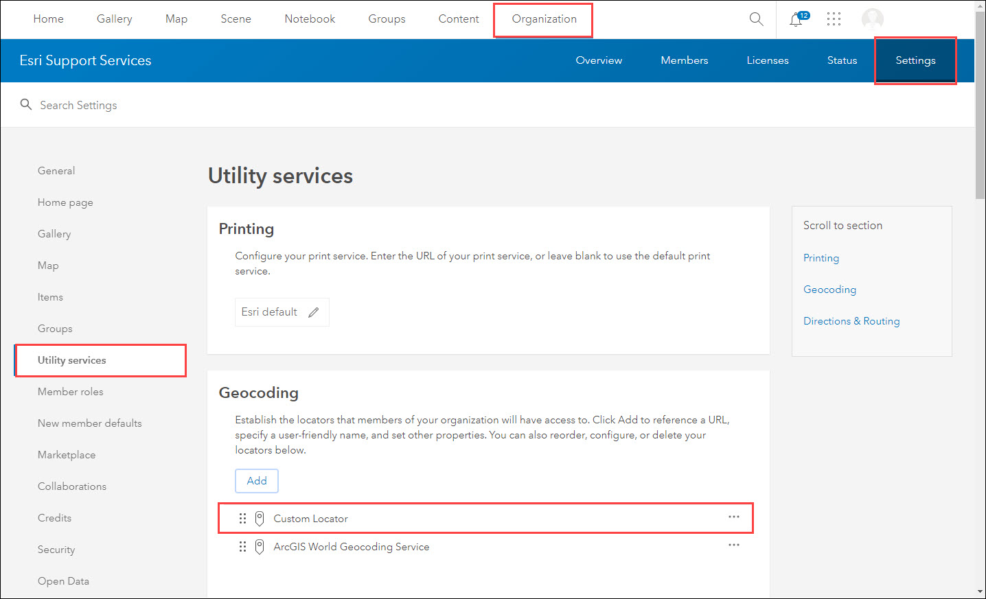
However, Explorer uses the Geocoder that is at the top of the list of locators in AGOL organization settings. If you want Explorer to use a specific Geocoder, you need to re-order your locator lists and bring it to the top.

You can also refer to this GeoNet post: https://community.esri.com/thread/203494-address-search-not-working-in-explorer-for-arcgis
- Mark as New
- Bookmark
- Subscribe
- Mute
- Subscribe to RSS Feed
- Permalink
Hi MJ Biazar thank you for your replay, i tried this to re-order locators in web map in portal 10.6.1 i put my locator to the top and same result it wont search for my features in explorer web map if they are have same name, for example if i searched for feature called "380 New York Street" it wont return my feature it will locate me to this address in ArcGIS World Geocoding Service
- Mark as New
- Bookmark
- Subscribe
- Mute
- Subscribe to RSS Feed
- Permalink
Hey Mo Mohamad
Are you searching via the layers or through your own geocoding service?
If searching through layers, you can disable the address finder by unchecking the "By Address" as seen below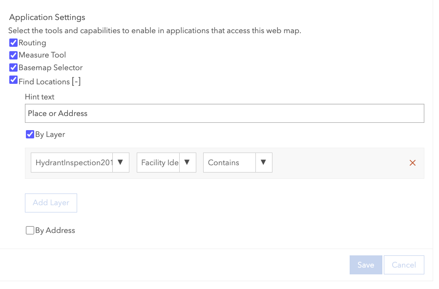
If you're searching through you're own geocoding service you will need to move the service above the ArcGIS World Geocoding Service locator as seen in the picture shared above by MJ Biazar . If this doesn't work there is a chance the locator is failing to load in Explorer and we would request that you open a ticket with support so we can get more details
Joel
- Mark as New
- Bookmark
- Subscribe
- Mute
- Subscribe to RSS Feed
- Permalink
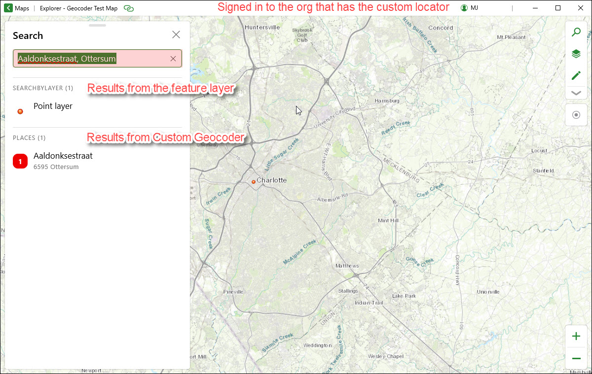
It is important to notice the difference between Map Viewer and Explorer in using geocoders. While Map Viewer can use all available geocoders in your organization (where the order of locators in the drop-down reflects their order in Utility Services list) and will give you the option to choose which locator you want to use to search for an address, Explorer uses either World Geocoder (when not signed in) or the first locator on the organization's locators list (when signed in).
If your web map that is using a custom locator in ArcGIS Online is accessed in Explorer by a public user who is not logged in, they cannot access the custom geocoder through your organization, and therefore, the app uses ArcGIS World Geocoder by default and there is no way to impose using a custom geocoder.. The behavior is different for users who sign in to the org.
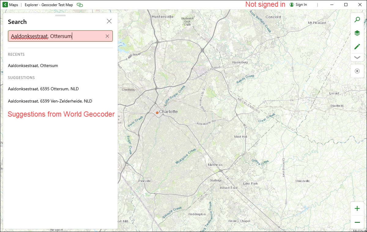
For users who sign in and access the map, Explorer uses the locator that is at the top of the list in organization's Utility Services settings.
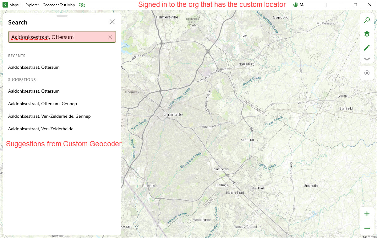
Putting the custom geocoder at the top of this list, and having users sign in to their accounts (in the same organization) is the only way to use a custom geocoder in Explorer.
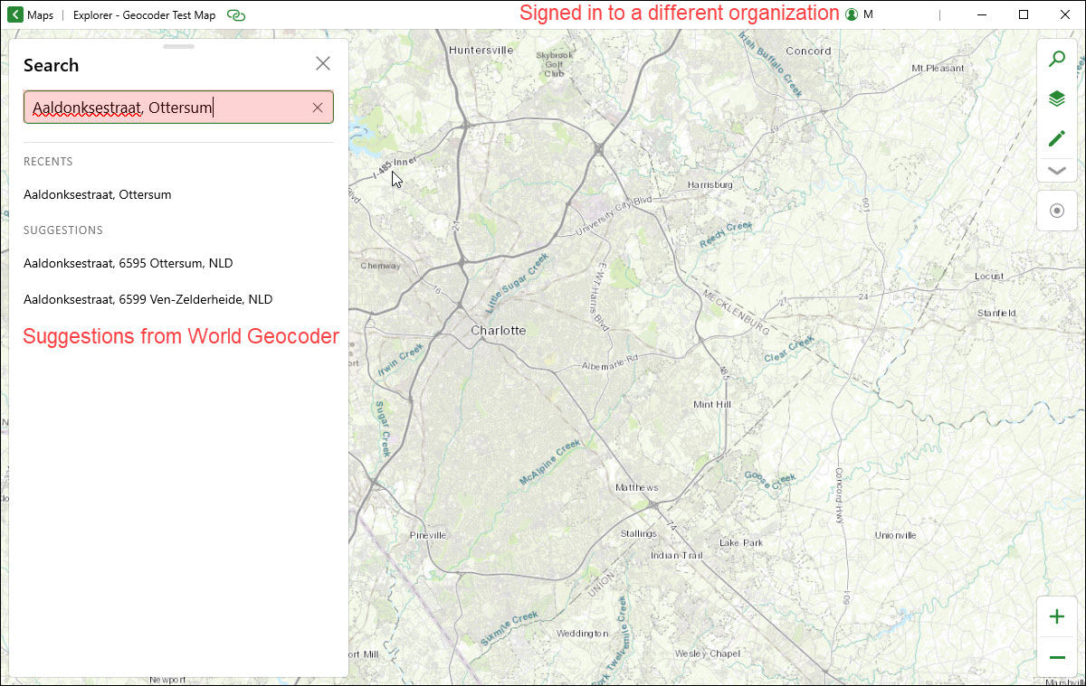
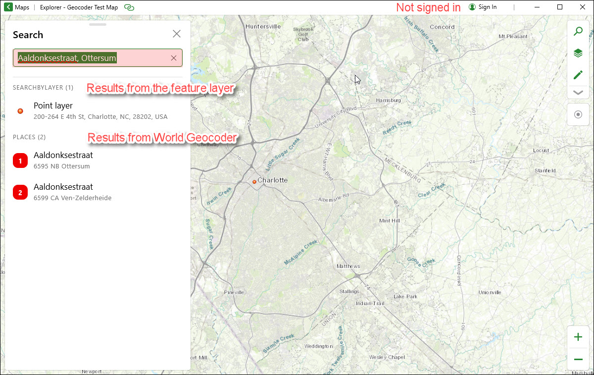
In case you are using a field from a feature layer on the map as the search source, although you won't see suggestions from the feature layer in Explorer (unlike the Map Viewer) the locations from the layer are actually returned in the results regardless even if you are not signed in or signed in to a different organization.


All the best,
MJ