- Home
- :
- All Communities
- :
- Industries
- :
- Education
- :
- Education Blog
- :
- How should a university or college GIS program be ...
How should a university or college GIS program be structured?
- Subscribe to RSS Feed
- Mark as New
- Mark as Read
- Bookmark
- Subscribe
- Printer Friendly Page
The title of this essay and this related video addresses a topic so wide in scope that a few paragraphs will not do it justice. Yet is an important topic in which my colleagues and I on the Esri education sector team are deeply immersed and concerned. Through campus visits and daily interaction with educators at all levels, we gain valuable insight on the challenges faced by and successes achieved by a wide variety of educational institutions, worldwide, and, with the community, cultivate what we believe to be best practices for course and program planning as we forge into the decade of the 2020s. Why do we care? First, we believe that the significant challenges our world is facing (energy, water, human health, natural hazards, climate, population change, biodiversity, sustainable agriculture) are all spatial in nature and can be understood and solved through the application of GIS. Second, we believe that GIS is a key tool for 21st Century critical thinking, spatial thinking, and inquiry. Our aim is to encourage educators, curriculum developers, and program planners to continually re-evaluate their programs and courses and to share best practices so that students in these programs will receive relevant and meaningful instruction and will become the leaders of tomorrow in business, government, nonprofits, and academia.
As you are well aware from being someone interested in GIS in education and reading GeoNet essays, the combination of rapid change in the job market, student and societal expectations, goals and purposes of education, educational technology, and GIS itself, GIS courses and programs should naturally evolve as well to keep up with these changes. While some foundational tenets of GIS will always be with us (such as datums, data models, data quality), even these topics do not need to be taught, and I would argue should not be taught in the same way that they were 20 years ago, or indeed, even a few years ago. We have summarized some of the conversations we have had with educators in a set of documents about "what constitutes a modern GIS curriculum" on GeoNet, which we intend to keep updating, that you are welcome to comment upon. Core elements in this modern curriculum should include web GIS, GIS-as-a-service protocols and capabilities, APIs and SDKs, setting up and maintaining a GIS server including system architecture, field data collection and tools, 2D and 3D mapping, spatial analysis including big data analytics, using real-time services and the IoT, interior space mapping including BIM, visualization and cartography, web mapping applications (including configuring apps such as dashboards), communicating with GIS (including multimedia maps such as story maps and other means of geo-communications), and societal considerations (location privacy, data quality, ethics, crowdsourcing).
One new program that I believe exemplifies these tenets is that of the Location Intelligence Program at North Park University. Location Intelligence combines aspects of natural and technical sciences, along with business principles and the latest in spatial technology, with a focus on preparing students for a wide array of careers. The program, as is evident in the images below, is forward-thinking in its courses such as business communications, developing web apps, and spatial programming. The very title of the program, Location Intelligence, speaks to a focus of breaking out a traditional audience for GIS and appealing to a wider array of disciplines, including social work, health, and business. I have been pleased to work with the program since 2018, and developed and am teaching a course entitled The Art and Science of Map Design: Geo-Visualization. To find out more about the LOCI program at North Park University, see these web resources, this official video from the university, and my video about the LOCI 3100 course along with a set of weekly course videos. I look forward to reading your comments and I salute you instructors, deans, and provosts for thinking creatively about how to mold your program for the future. And for you students reading this--use this essay as a springboard in your search for the type of geospatial program that will best meet your needs.

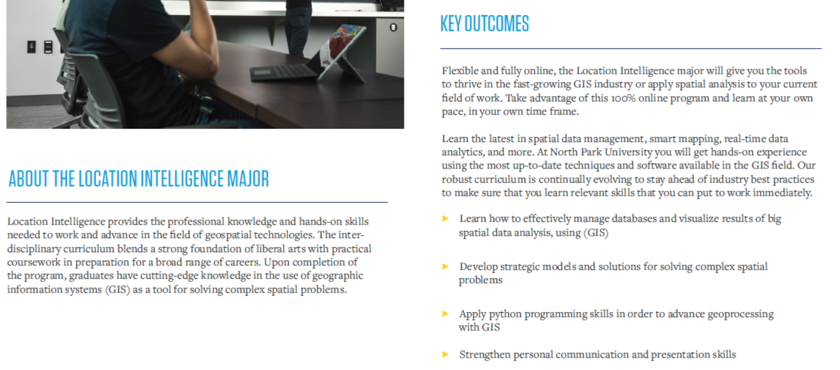
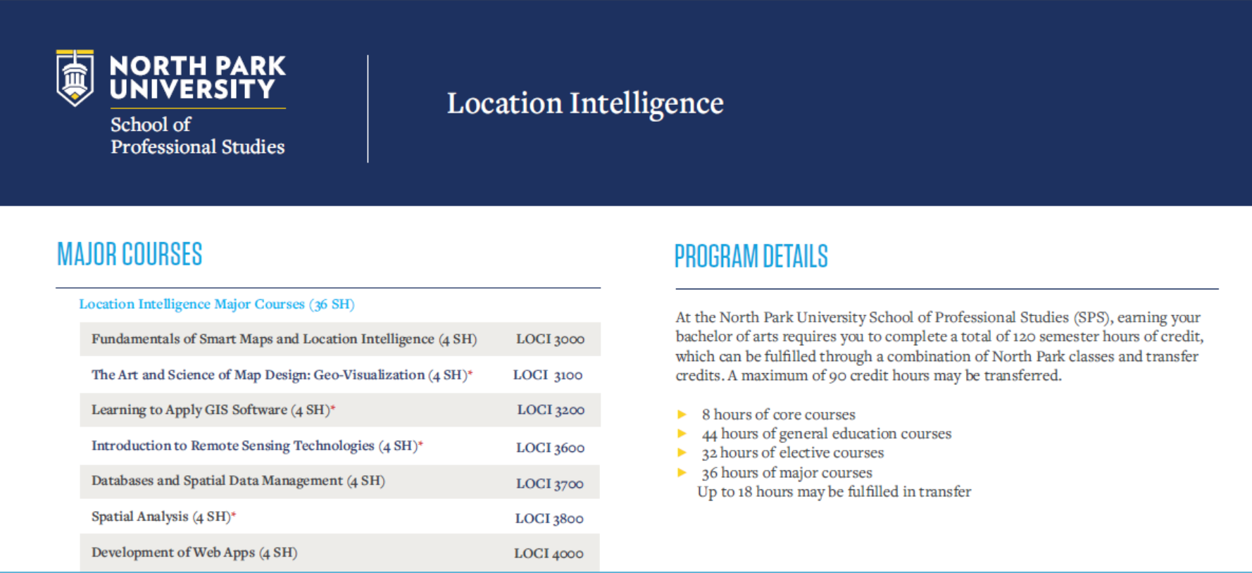
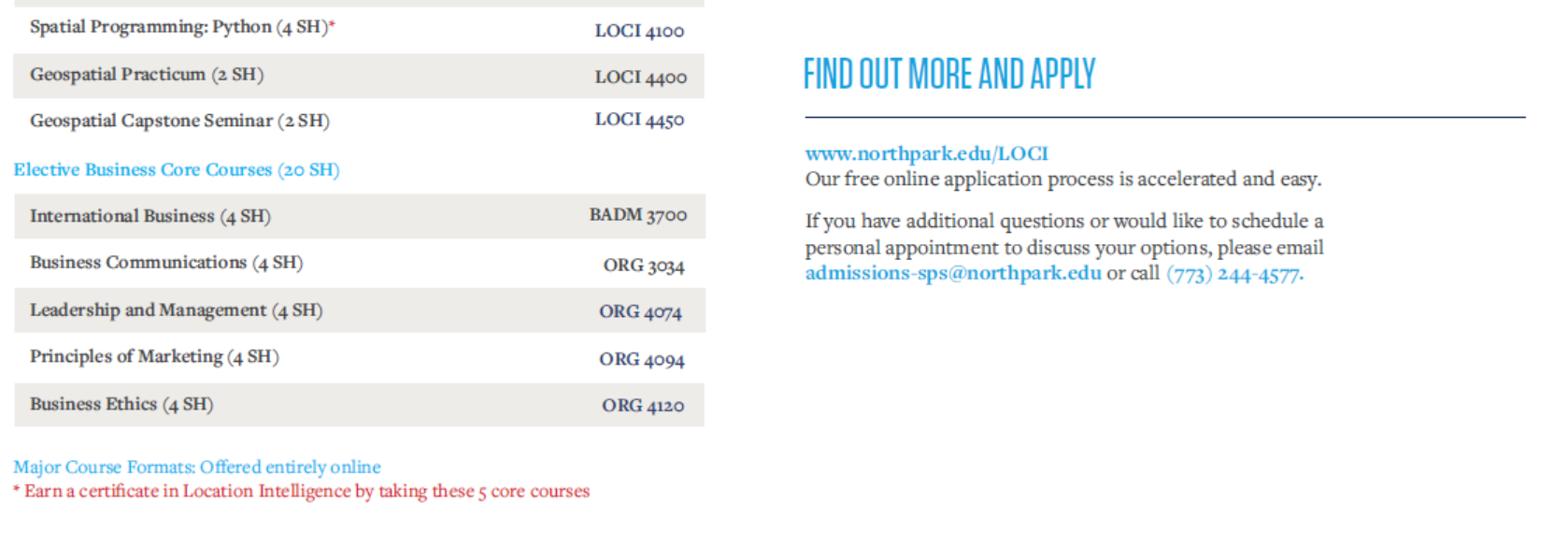
Description of the Location Intelligence program at North Park University.
You must be a registered user to add a comment. If you've already registered, sign in. Otherwise, register and sign in.
-
Administration
87 -
Announcements
87 -
Career & Tech Ed
1 -
Curriculum-Learning Resources
279 -
Education Facilities
24 -
Events
77 -
GeoInquiries
1 -
Higher Education
613 -
Informal Education
284 -
Licensing Best Practices
100 -
National Geographic MapMaker
39 -
Pedagogy and Education Theory
239 -
Schools (K - 12)
282 -
Schools (K-12)
302 -
Spatial data
39 -
STEM
3 -
Students - Higher Education
255 -
Students - K-12 Schools
142 -
Success Stories
44 -
TeacherDesk
1 -
Tech Tips
129
- « Previous
- Next »