- Home
- :
- All Communities
- :
- Industries
- :
- Education
- :
- Education Blog
- :
- Using OpenStreetMap Data in ArcGIS for Education
Using OpenStreetMap Data in ArcGIS for Education
- Subscribe to RSS Feed
- Mark as New
- Mark as Read
- Bookmark
- Subscribe
- Printer Friendly Page
OpenStreetMap is a free, editable map of the entire world that is being built by volunteers and released with an open-content license. OpenStreetMap is one of the most widely known and high quality citizen-science generated geospatial data sets in existence. There are many ways to use OpenStreetMap (OSM) data in education. You can analyze street layouts and urban and rural land use patterns at multiple scales using the OpenStreetMap online interface. You can also examine the data inside ArcGIS Online using this OSM map. You can also easily add OSM data to any ArcGIS desktop or online project because OpenStreetMap is one of the standard basemaps that are available from ArcGIS Online. Once the data is in ArcGIS, you can then use the advanced symbology, classification, and analytical capabilities that are a part of the ArcGIS platform.
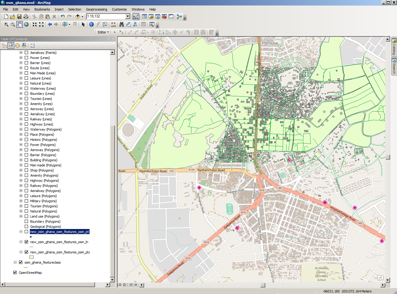
Another way to work with OpenStreetMap data is through the ArcGIS Editor for OpenStreetMap. I selected the OSM basemap, zoomed to the area in in Tamale, Ghana, that students had collected, and brought it into ArcMap, as shown below. From this point, you could apply symbology, create network datasets from OSM data, and even contribute data back to the OSM project. You can also create geodatabase features that you can share on ArcGIS Online.
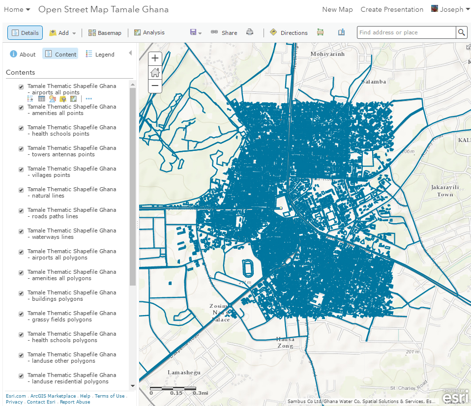
Another way to use the OSM data is to export OSM data directly to ArcGIS Online without going through ArcMap. Using these procedures on GitHub, I accessed the same area of Ghana, exported OSM data via KML format into ArcGIS Online. You can interact with the data via my map here.
Your students can even contribute to the content of OpenStreetMap. One way is through YouthMappers, led by Dr. Patricia Solis of Texas Tech University. The mission of YouthMappers goes beyond collecting map data--they seek to "cultivate a generation of young leaders to create resilient communities and to define their world by mapping it." Therefore, they are just as interested in nurturing youth who understand mapping, community, and geography as the data that they are collecting. In 2016 alone, 1,404 YouthMappers operating out of 57 university chapters in 19 countries made over 6 million map edits to OpenStreetMap in support of development and humanitarian projects and programs.
The data above came from the work of a collaboration between the YouthMappers chapter at the University of Cape Coast Ghana, where James Eshun is faculty advisor in the Department of Geography, and Dr. Patricia Solis' class at Texas Tech University. Dr Solis' class is a service learning course designed to engage small teams of students to learn more about development and humanitarian issues through mapping and collaborating internationally with peers in the YouthMappers chapters where USAID works. The mapping team on this project included Kwaku Antwi, Cole Edwards, Cheyenne Betancourt, Nick Wisinewski, and Kyler Allen. To find out more, see their story map.
You can start a new university chapter or affiliate your existing campus student group, organize mapping activities, add needed data to OpenStreetMap, collaborate with other chapters, and share results. Members of active chapters will be eligible to apply for leadership, recognition, and fellowships opportunities.
Give these procedures a try!
For more about Citizen Science and Esri, see the curated and updated Citizen Science resource here. For more about Citizen Science and Esri from an education standpoint, see my article in the Esri Insider.
You must be a registered user to add a comment. If you've already registered, sign in. Otherwise, register and sign in.
-
Administration
80 -
Announcements
80 -
Career & Tech Ed
1 -
Curriculum-Learning Resources
259 -
Education Facilities
24 -
Events
72 -
GeoInquiries
1 -
Higher Education
599 -
Informal Education
281 -
Licensing Best Practices
93 -
National Geographic MapMaker
33 -
Pedagogy and Education Theory
226 -
Schools (K - 12)
282 -
Schools (K-12)
274 -
Spatial data
35 -
STEM
3 -
Students - Higher Education
247 -
Students - K-12 Schools
129 -
Success Stories
36 -
TeacherDesk
1 -
Tech Tips
122
- « Previous
- Next »