- Home
- :
- All Communities
- :
- Developers
- :
- JavaScript Maps SDK
- :
- JavaScript Maps SDK Questions
- :
- Buffer not accurate
- Subscribe to RSS Feed
- Mark Topic as New
- Mark Topic as Read
- Float this Topic for Current User
- Bookmark
- Subscribe
- Mute
- Printer Friendly Page
Buffer not accurate
- Mark as New
- Bookmark
- Subscribe
- Mute
- Subscribe to RSS Feed
- Permalink
Hi all,
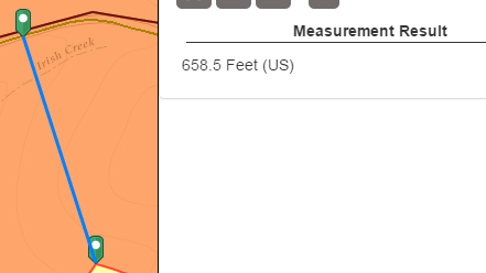
I am trying to buffer a road segment 200' on each side but it seems like the buffer is not returning me anything accurate. The buffer on each side is like 520' as it is now. Maybe wkid?
var extent2 = new Extent({
"xmin": -121.11087086999999, "ymin": 38.517479534000074, "xmax": -119.95226375799996, "ymax": 39.068026806000034,
"spatialReference": { "wkid": 4326 }
});
//Map
map = new Map("map", {
basemap: "topo",
extent: extent2
});
featureLayer.selectFeatures(selectQuery, FeatureLayer.SELECTION_NEW, function (targetGeometry) {
targetGeometry = graphicsUtils.getGeometries(featureLayer.getSelectedFeatures());
console.log(targetGeometry);
geometryService.union(targetGeometry, function (geometry) {
featureLayer.clearSelection();
//Buffer params
var params = new BufferParameters();
params.distances = [200];
params.unit = geometryService.UNIT_FOOT;
//Simplify features first
geometryService.simplify([geometry], function (simplifiedGeometries) {
params.geometries = simplifiedGeometries;
//do the buffer
geometryService.buffer(params, showBuffer);
});
}, function (err) {
console.log(err);
});
});- Mark as New
- Bookmark
- Subscribe
- Mute
- Subscribe to RSS Feed
- Permalink
I noticed that a similar issue exists on that ESRI sample. I wonder why.
<!DOCTYPE html>
<html>
<head>
<meta http-equiv="Content-Type" content="text/html; charset=utf-8">
<meta name="viewport" content="initial-scale=1, maximum-scale=1,user-scalable=no">
<title>Buffer</title>
<link rel="stylesheet" href="https://js.arcgis.com/3.18/dijit/themes/claro/claro.css">
<link rel="stylesheet" href="https://js.arcgis.com/3.18/esri/css/esri.css">
<style>
html, body {
height: 100%;
width: 100%;
margin: 0;
padding: 0;
overflow:hidden;
}
#leftPane{
color:#000;
width:250px;
padding-bottom:15px;
}
#map{
padding:0;
}
.details{
font-size:14px;
font-weight:600;
padding-bottom:20px;
}
button{
margin:2px;
cursor:pointer;
}
</style>
<script src="https://js.arcgis.com/3.18/"></script>
<script>
var map, tb;
require(["dojo/dom",
"dojo/_base/array",
"dojo/parser",
"dojo/query",
"dojo/on",
"esri/Color",
"esri/config",
"esri/map",
"esri/graphic",
"esri/dijit/Measurement",
"esri/geometry/normalizeUtils",
"esri/tasks/GeometryService",
"esri/tasks/BufferParameters",
"esri/toolbars/draw",
"esri/symbols/SimpleMarkerSymbol",
"esri/symbols/SimpleLineSymbol",
"esri/symbols/SimpleFillSymbol",
"dijit/layout/BorderContainer",
"dijit/layout/ContentPane",
"dijit/form/Button", "dojo/domReady!"
],
function(dom, array, parser, query, on, Color, esriConfig, Map, Graphic, Measurement, normalizeUtils, GeometryService, BufferParameters, Draw, SimpleMarkerSymbol, SimpleLineSymbol, SimpleFillSymbol){
parser.parse();
esriConfig.defaults.geometryService = new GeometryService("https://utility.arcgisonline.com/ArcGIS/rest/services/Geometry/GeometryServer");
esriConfig.defaults.io.proxyUrl = "/proxy/";
esriConfig.defaults.io.alwaysUseProxy = false;
//Setup button click handlers
on(dom.byId("clearGraphics"), "click", function(){
if(map){
map.graphics.clear();
}
});
//click handler for the draw tool buttons
query(".tool").on("click", function(evt){
if(tb){
tb.activate(evt.target.id);
}
});
map = new Map("map", {
basemap: "streets",
center: [-111.5, 39.541],
zoom: 7
});
var measurement = new Measurement({
map: map
}, dom.byId("measurementDiv"));
measurement.startup();
map.on("load", initToolbar);
function initToolbar(evtObj) {
tb = new Draw(evtObj.map);
tb.on("draw-end", doBuffer);
}
function doBuffer(evtObj) {
tb.deactivate();
var geometry = evtObj.geometry, symbol;
switch (geometry.type) {
case "point":
symbol = new SimpleMarkerSymbol(SimpleMarkerSymbol.STYLE_SQUARE, 10, new SimpleLineSymbol(SimpleLineSymbol.STYLE_SOLID, new Color([255,0,0]), 1), new Color([0,255,0,0.25]));
break;
case "polyline":
symbol = new SimpleLineSymbol(SimpleLineSymbol.STYLE_DASH, new Color([255,0,0]), 1);
break;
case "polygon":
symbol = new SimpleFillSymbol(SimpleFillSymbol.STYLE_NONE, new SimpleLineSymbol(SimpleLineSymbol.STYLE_DASHDOT, new Color([255,0,0]), 2), new Color([255,255,0,0.25]));
break;
}
var graphic = new Graphic(geometry, symbol);
map.graphics.add(graphic);
//setup the buffer parameters
var params = new BufferParameters();
params.distances = [ dom.byId("distance").value ];
params.outSpatialReference = map.spatialReference;
params.unit = GeometryService[dom.byId("unit").value];
//normalize the geometry
normalizeUtils.normalizeCentralMeridian([geometry]).then(function(normalizedGeometries){
var normalizedGeometry = normalizedGeometries[0];
if (normalizedGeometry.type === "polygon") {
//if geometry is a polygon then simplify polygon. This will make the user drawn polygon topologically correct.
esriConfig.defaults.geometryService.simplify([normalizedGeometry], function(geometries) {
params.geometries = geometries;
esriConfig.defaults.geometryService.buffer(params, showBuffer);
});
} else {
params.geometries = [normalizedGeometry];
esriConfig.defaults.geometryService.buffer(params, showBuffer);
}
});
}
function showBuffer(bufferedGeometries) {
var symbol = new SimpleFillSymbol(
SimpleFillSymbol.STYLE_SOLID,
new SimpleLineSymbol(
SimpleLineSymbol.STYLE_SOLID,
new Color([255,0,0,0.65]), 2
),
new Color([255,0,0,0.35])
);
array.forEach(bufferedGeometries, function(geometry) {
var graphic = new Graphic(geometry, symbol);
map.graphics.add(graphic);
});
}
});
</script>
</head>
<body class="claro">
<div data-dojo-type="dijit/layout/BorderContainer"
data-dojo-props="gutters:'true', design:'sidebar'"
style="width:100%;height:100%;">
<div id="map"
data-dojo-type="dijit/layout/ContentPane"
data-dojo-props="region:'center'">
</div>
<div id="leftPane"
data-dojo-type="dijit/layout/ContentPane"
data-dojo-props="region:'left'">
<div class="details">Pick a tool and draw on the map. The drawn graphic will be buffered based on the specified parameters.</div>
<button type="button" class="tool" id="line">Line</button>
<button type="button" class="tool" id="polyline">Polyline</button>
<button type="button" class="tool" id="freehandpolyline">Freehand Polyline</button>
<br/>
<button type="button" class="tool" id="polygon">Polygon</button>
<button type="button" class="tool" id="freehandpolygon">Freehand Polygon</button>
<br/><hr />
<div><b>Buffer Parameters</b></div>
Distance: <input type="text" id="distance" size="5" value="25" />
<select id="unit" style="width:100px;">
<option value="UNIT_STATUTE_MILE">Miles</option>
<option value="UNIT_FOOT">Feet</option>
<option value="UNIT_KILOMETER">Kilometers</option>
<option value="UNIT_METER">Meters</option>
<option value="UNIT_NAUTICAL_MILE">Nautical Miles</option>
<option value="UNIT_US_NAUTICAL_MILE">US Nautical Miles</option>
<option value="UNIT_DEGREE">Degrees</option>
</select><br />
<button type="button" id="clearGraphics">Clear Graphics</button>
<div id="measurementDiv"></div>
</div>
</div>
</body>
</html>
- Mark as New
- Bookmark
- Subscribe
- Mute
- Subscribe to RSS Feed
- Permalink
Alex,
Just add:
params.geodesic = true;
- Mark as New
- Bookmark
- Subscribe
- Mute
- Subscribe to RSS Feed
- Permalink
That works great with the ESRI sample ! Not too sure why it is not in my
app...
- Mark as New
- Bookmark
- Subscribe
- Mute
- Subscribe to RSS Feed
- Permalink
Alex,
Are you using an esri basemap?
- Mark as New
- Bookmark
- Subscribe
- Mute
- Subscribe to RSS Feed
- Permalink
Yes.
//Map
map = new Map("map", {
basemap: "topo"
});And the layer I am buffering is wkid 102100 (3857) (WGS84)
- Mark as New
- Bookmark
- Subscribe
- Mute
- Subscribe to RSS Feed
- Permalink
Alex,
In your code you seem to be missing:
params.outSpatialReference = map.spatialReference;- Mark as New
- Bookmark
- Subscribe
- Mute
- Subscribe to RSS Feed
- Permalink
Still not accurate. strange.
featureLayer.selectFeatures(selectQuery, FeatureLayer.SELECTION_NEW, function (targetGeometry) {
targetGeometry = graphicsUtils.getGeometries(featureLayer.getSelectedFeatures());
console.log(targetGeometry);
geometryService.union(targetGeometry, function (geometry) {
featureLayer.clearSelection();
//Buffer params
var params = new BufferParameters();
params.distances = [200];
params.unit = geometryService.UNIT_FOOT;
params.outSpatialReference = map.spatialReference;
params.geodesic = true;
geometryService.simplify([geometry], function (simplifiedGeometries) {
params.geometries = simplifiedGeometries;
//do the buffer
geometryService.buffer(params, showBuffer);
});
}, function (err) {
console.log(err);
});
});- Mark as New
- Bookmark
- Subscribe
- Mute
- Subscribe to RSS Feed
- Permalink
Alex,
The way I have found in my code to keep buffers accurate is to also use:
params.bufferSpatialReference = new SpatialReference({wkid:102003});
- Mark as New
- Bookmark
- Subscribe
- Mute
- Subscribe to RSS Feed
- Permalink
No luck. I am wondering if the union messes up the buffer
On Tue, Dec 20, 2016 at 2:28 PM, Robert Scheitlin, GISP <geonet@esri.com>