- Home
- :
- All Communities
- :
- Products
- :
- Imagery and Remote Sensing
- :
- Imagery Questions
- :
- Re: Exporting Tile Package Results in Pixelated Me...
- Subscribe to RSS Feed
- Mark Topic as New
- Mark Topic as Read
- Float this Topic for Current User
- Bookmark
- Subscribe
- Mute
- Printer Friendly Page
Exporting Tile Package Results in Pixelated Mess With No Data
- Mark as New
- Bookmark
- Subscribe
- Mute
- Subscribe to RSS Feed
- Permalink
- Report Inappropriate Content
Good day everyone,
I have received 656 GB of imagery in ECW format for our county and directed to create a tile package.
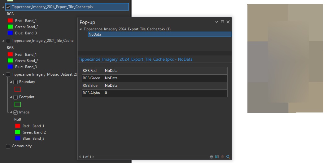
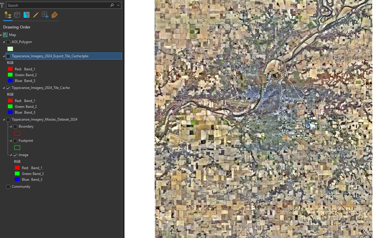
While I have no experience in working with this much data, I followed this guide and referenced this video as well as this USDA for instructions. I was able to create a Tile Cache that looks great using the 'Manage Tile Cache Tool' (Tilecache.jpg). However, after running the 'Export Tile Cache' Tool, I keep getting this pixelated abomination with no data in it's values. (ExportTileCache.jpg).
At this point, I have tried changing multiple variables in the process. For example tried using both cell size and scale levels in the 'Generate Tile Cache Tiling Scheme' tool, as well as creating a custom tile cache scheme, and then using the default AGOL/Google Maps/Bing Maps one when that did not work. I also tried repeating the below workflow but with a referenced mosaic to see if that would somehow help.
Any help would be greatly appreciated, as I feel like I am missing something obvious here.
For reference my workflow was as follows:
- Create Mosaic Dataset
- Add Raster to Mosaic Dataset
- Define Overviews
- Build Overviews
- Generate Tile Cache Scheme
- Manage Tile Cache (Came out looking good)
- Export Tile Cache (Where I am running into Errors)
- Share Package (Have not got this far)
Solved! Go to Solution.
Accepted Solutions
- Mark as New
- Bookmark
- Subscribe
- Mute
- Subscribe to RSS Feed
- Permalink
- Report Inappropriate Content
@tthomas9 the 4x is just a general estimate. ECW's are highly a compressed imagery format. It all depnds on the compression applied to the image to estimate the storage required
- Mark as New
- Bookmark
- Subscribe
- Mute
- Subscribe to RSS Feed
- Permalink
- Report Inappropriate Content
Hello @tthomas9 This could be a function of available storage or available RAM. The 656 gb ECW will blow up to a Tile cache of 4x the size and then you would need roughly the same size again to create the tile package. So I would be looking here to start with.
Cheers
Gordon
- Mark as New
- Bookmark
- Subscribe
- Mute
- Subscribe to RSS Feed
- Permalink
- Report Inappropriate Content
Thank you, that makes sense. I ran through my workflow with a smaller subset of the imagery and the tile cache turned out fine so that makes total sense.
Are the storage requirements / storage calculations documented anywhere? I am unable to find anything explaining the 4x size requirement.
- Mark as New
- Bookmark
- Subscribe
- Mute
- Subscribe to RSS Feed
- Permalink
- Report Inappropriate Content
@tthomas9 the 4x is just a general estimate. ECW's are highly a compressed imagery format. It all depnds on the compression applied to the image to estimate the storage required
- Mark as New
- Bookmark
- Subscribe
- Mute
- Subscribe to RSS Feed
- Permalink
- Report Inappropriate Content
@GordonSumerling Good to know, thank you. Are TIFF files the same was as far as the need to estimate about 4x? Reason I ask is that it may be possible to get this imagery in TIFF format as well.
Appreciate your help!
- Mark as New
- Bookmark
- Subscribe
- Mute
- Subscribe to RSS Feed
- Permalink
- Report Inappropriate Content
@tthomas9 generally we recommend clients receive imagery in Cloud Optimised Geotiff format. (COG). Yes it it is larger in size but hen it is compatable with more software tools and retains the native pixel value