- Home
- :
- All Communities
- :
- Products
- :
- Geoprocessing
- :
- Geoprocessing Questions
- :
- txt. to DEM - gaps in raster issue
- Subscribe to RSS Feed
- Mark Topic as New
- Mark Topic as Read
- Float this Topic for Current User
- Bookmark
- Subscribe
- Mute
- Printer Friendly Page
txt. to DEM - gaps in raster issue
- Mark as New
- Bookmark
- Subscribe
- Mute
- Subscribe to RSS Feed
- Permalink
Hi,
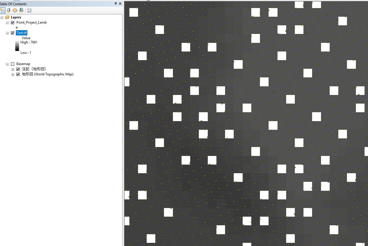
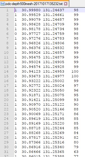
I am trying to create a DEM from 500m Gridded Bathymetry Data which is available as a .txt file (see JPG for the txt file format)
As the X Y data is lat long I used 'Create feature class from XY' and selected WGS 1984. I then used the 'Project (Data management)' tool to change the projection to 'Asia Lambert Conformal Conic' (based on the information below). I then used the Point to Raster tool and set cell size as 500. However the raster this produced has a lot of holes in (see pic), surely as the data is regularly spaced this should not happen. If anyone could point me in the right direction that would be great.
Meta data: 500m Gridded Bathymetry Data | Japan Oceanographic Data Center : JODC
"J-EGG Grid are based converting each zone into the plane coordinates of the meter scale using the Lambert Conformal Conic Projection by two standard parallels and is prepared as a 500m square grid. It is not a gridded data along the longitude and latitude. Data is only for waters and it does not include data on land"
Thanks for your time,
- Mark as New
- Bookmark
- Subscribe
- Mute
- Subscribe to RSS Feed
- Permalink
You should go for an interpolation method for creating the Raster out of the Point FC. An overview of the Interpolation toolset—Help | ArcGIS Desktop (Spatial Analyst license required).
You could try Topo to Raster—Help | ArcGIS Desktop. It interpolates a hydrologically correct raster surface from point, line, and polygon data. You could set much smaller cell size here or just accept the default cell size.
Think Location