- Home
- :
- All Communities
- :
- Products
- :
- Geoprocessing
- :
- Geoprocessing Questions
- :
- Run Raster calculator in Model builder
- Subscribe to RSS Feed
- Mark Topic as New
- Mark Topic as Read
- Float this Topic for Current User
- Bookmark
- Subscribe
- Mute
- Printer Friendly Page
Run Raster calculator in Model builder
- Mark as New
- Bookmark
- Subscribe
- Mute
- Subscribe to RSS Feed
- Permalink
- Report Inappropriate Content
Hi,
I want to run raster calculator in Model Builder but I want to add multiple data set and run he same formula.
Can anyone guide me,
Thanks
Nik
- Mark as New
- Bookmark
- Subscribe
- Mute
- Subscribe to RSS Feed
- Permalink
- Report Inappropriate Content
Hi Bik,
In the model builder we have inbuilt iteration functionality where we can call the rasters in the workspace.
Go through the link;
Examples of using iterators in ModelBuilder—Tools | ArcGIS for Desktop
- Mark as New
- Bookmark
- Subscribe
- Mute
- Subscribe to RSS Feed
- Permalink
- Report Inappropriate Content
Hi,
Thanks, but I don't know how to add the formula.
Because for example formula is NIR -R
So, in raster calculator which NIR and R need to choose because it is many images?
I am so sorry if I am not understand. I still stuck in this.
Thanks,
Nik
- Mark as New
- Bookmark
- Subscribe
- Mute
- Subscribe to RSS Feed
- Permalink
- Report Inappropriate Content
Hi,
The band (as images specified by you) specification like bandwidth depends upon sensor. What is your data source? For example like landsat, liss,spot etc...
this might help you;
- Mark as New
- Bookmark
- Subscribe
- Mute
- Subscribe to RSS Feed
- Permalink
- Report Inappropriate Content
Hi,
my sensor is MCA 6 with 6 bands
So if in one folder which data will be chosen since the data in one group.
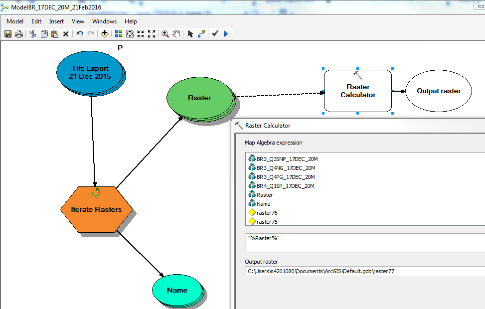
This is the example for one image, I am successfully did:
But the problem now how to do the same using iterate Rasters?
Thanks,
- Mark as New
- Bookmark
- Subscribe
- Mute
- Subscribe to RSS Feed
- Permalink
- Report Inappropriate Content
- Mark as New
- Bookmark
- Subscribe
- Mute
- Subscribe to RSS Feed
- Permalink
- Report Inappropriate Content
Step one: Make a model
Step two: Search for "Raster Calculator" in the search window (usually on the left side of the ArcMap Window)
Step three: drag the tool into the model builder box
Step four: double-click the tool and input your equations
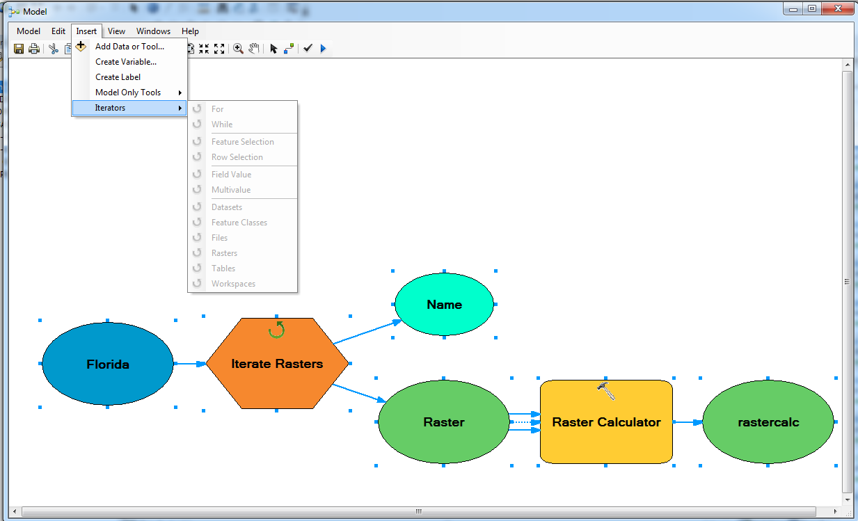
Bonus: Use the Iterate function to loop through multiple rasters
I found this on this link;
- Mark as New
- Bookmark
- Subscribe
- Mute
- Subscribe to RSS Feed
- Permalink
- Report Inappropriate Content

