Turn on suggestions
Auto-suggest helps you quickly narrow down your search results by suggesting possible matches as you type.
Cancel
- Home
- :
- All Communities
- :
- Products
- :
- Geoprocessing
- :
- Geoprocessing Questions
- :
- Re: Ordinary Least Square script/tool won't recogn...
Options
- Subscribe to RSS Feed
- Mark Topic as New
- Mark Topic as Read
- Float this Topic for Current User
- Bookmark
- Subscribe
- Mute
- Printer Friendly Page
Ordinary Least Square script/tool won't recognize projected input feature class
Subscribe
2425
2
04-01-2014 11:03 AM
04-01-2014
11:03 AM
- Mark as New
- Bookmark
- Subscribe
- Mute
- Subscribe to RSS Feed
- Permalink
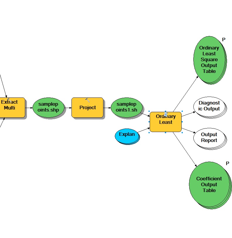
Running a model that iterates through three geostatistical analyses(kriging, spline, idw) and compares them on an NED dataset and outputs them into tables. Problem is when I project the sample points I want to collect elevation data from, then input them into the Ordinary Lease square tool, it won't recongnize that data as projected. Sorta stuck, help would be appreciated. Attached images for references
2 Replies
04-01-2014
03:14 PM
- Mark as New
- Bookmark
- Subscribe
- Mute
- Subscribe to RSS Feed
- Permalink
Hi Dan,
You appear to have the opposite problem. The data is using a geographic coordinate system. That is, it's in decimal degrees, while the tool wants data in a projected coordinate system like a UTM or State Plane zone.
Melita
You appear to have the opposite problem. The data is using a geographic coordinate system. That is, it's in decimal degrees, while the tool wants data in a projected coordinate system like a UTM or State Plane zone.
Melita
by
Anonymous User
Not applicable
04-22-2014
03:32 PM
- Mark as New
- Bookmark
- Subscribe
- Mute
- Subscribe to RSS Feed
- Permalink
Original User: TingLee
Hi Dan,
The traceback you see is a bug that had been fixed since 10.2. It�??s a missing error ID that we used caused the traceback. Sorry for bringing that trouble to you. The workaround I will suggest is to edit �??ErrorUtils.py�?� in your ArcGIS install directory, [ArcGIS dir]\Desktop10.1\ArcToolbox\Scripts. Locate to line 223, and replace
ARCPY.AddIDMessage("ERROR", 303, fieldName)
with
ARCPY.AddIDMessage("ERROR", 728, fieldName).
I'm assuming you are using 10.1 Service Pack 1, and the attached python script would work for you.
However, although that would fix the traceback problem, the error is actually indicating that the analysis fields or some of them are not existing in the input data. If you reselect the fields from the input data in the module, you won�??t encounter the traceback either.
Thanks,
Ting-Hwan
Geoprocessing Product Engineer
Esri | Redlands, CA