- Home
- :
- All Communities
- :
- Products
- :
- Geoprocessing
- :
- Geoprocessing Questions
- :
- Minus - A tale of 2 rasters - looking for troubles...
- Subscribe to RSS Feed
- Mark Topic as New
- Mark Topic as Read
- Float this Topic for Current User
- Bookmark
- Subscribe
- Mute
- Printer Friendly Page
Minus - A tale of 2 rasters - looking for troubleshooting ideas
- Mark as New
- Bookmark
- Subscribe
- Mute
- Subscribe to RSS Feed
- Permalink
I'm getting a strange clipped output and I cant figure out why.
I have a DSM and DTM from the same lidar
I'm doing a very simple "Minus" GP tool... and the output is not as expected
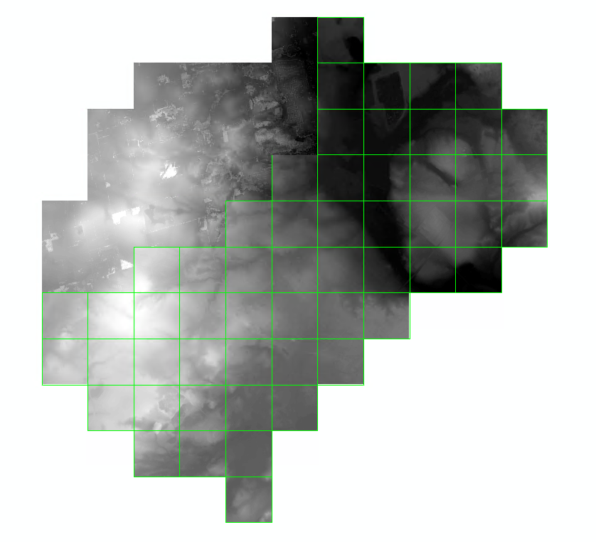
The only portion that comes back is the top left?!
Everything about the 2 input rasters is similar: projection, cell size, etc etc...
The results are perfect, i just cant get it to process the whole area. I'm using a very powerful computer.
This is ~20 sq km in total
Furthermore, I used just the DSM and a constant of 1, and the same area gets processed?
Any ideas why this may be happening?
Cheers
gp output
Solved! Go to Solution.
Accepted Solutions
- Mark as New
- Bookmark
- Subscribe
- Mute
- Subscribe to RSS Feed
- Permalink
Thanks all for the suggestions...
I tried all of them (except "snap raster" environment setting... not sure what that is) but I got the same results, only half being processed...
The suggestions did inspire me to try an alt route to my destination... and I did get there...
I used the Moasic to New Raster, to create 2 singular tifs, then used the minus on them and the results came out as expected.
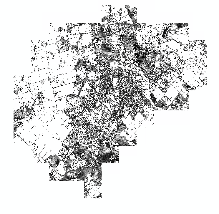
thanks all
- Mark as New
- Bookmark
- Subscribe
- Mute
- Subscribe to RSS Feed
- Permalink
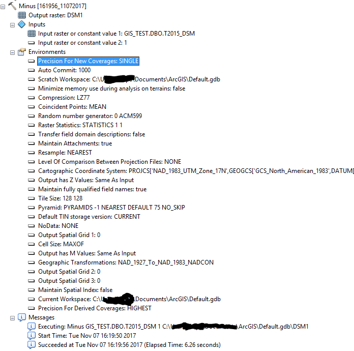
I'd use a workspace besides the Default C:\Usename\Documents\ArcGIS\Default.gdb one. Instead, make your own File Geodatabase and store it on a short file path. Don't ask me why, but for whatever reason using the Default geodatabase seems to lead to issues at times when working with raster data.
As for places where Minus may go awry, let me tag one of the raster experts:
Chris Donohue, GISP
- Mark as New
- Bookmark
- Subscribe
- Mute
- Subscribe to RSS Feed
- Permalink
Minus... is ringing a bell, but it supports all the Environment parameters, assuming that you set them within the Environments tab on the bottom right of the tool dialog (not just the general ones... I trust those less to behave nicely)
On a lark to rule out Minus issues, try Plus... and if that goes well, Times one of the rasters by -1 then plus that result with the other
- Mark as New
- Bookmark
- Subscribe
- Mute
- Subscribe to RSS Feed
- Permalink
It is strange that Minus or any other tool would only process a part of the data. To rule out any erroneous environment setting I would:
- Set the workspace to a valid fgdb (just as Chris Donohue, GISP suggested)
- Set the output coordinate system to the input SDE raster
- Set the extent to the input SDE raster
- Set the snap raster to the input SDE raster
- Set the cell size to the input SDE raster
You could try to run the calculation it in the Raster Calculator to see if the changes anything.
- Mark as New
- Bookmark
- Subscribe
- Mute
- Subscribe to RSS Feed
- Permalink
Thanks all for the suggestions...
I tried all of them (except "snap raster" environment setting... not sure what that is) but I got the same results, only half being processed...
The suggestions did inspire me to try an alt route to my destination... and I did get there...
I used the Moasic to New Raster, to create 2 singular tifs, then used the minus on them and the results came out as expected.
thanks all