- Home
- :
- All Communities
- :
- Products
- :
- Geoprocessing
- :
- Geoprocessing Questions
- :
- Is there a possibility in ArcMap to automatically ...
- Subscribe to RSS Feed
- Mark Topic as New
- Mark Topic as Read
- Float this Topic for Current User
- Bookmark
- Subscribe
- Mute
- Printer Friendly Page
Is there a possibility in ArcMap to automatically fill a given shape with smaller polygons of a given shape?
- Mark as New
- Bookmark
- Subscribe
- Mute
- Subscribe to RSS Feed
- Permalink
Like I have a rectangle (3x5m) as a vector layer... now I would like to fill this 3x5m rectangle optimal with smaller polygons in a given shape (1x2m rectangles).
I didn't find anything helpful yet....
- Mark as New
- Bookmark
- Subscribe
- Mute
- Subscribe to RSS Feed
- Permalink
I would like to place "the maximum nr" of 1x2 polygon in this space, not completely fill the polygon... means, in this example it should not place more polygons cause as you said, this would be an exceed of the boundary..
- Mark as New
- Bookmark
- Subscribe
- Mute
- Subscribe to RSS Feed
- Permalink
How many polygons are you talking about? and are they all 3 x 5?
- Mark as New
- Bookmark
- Subscribe
- Mute
- Subscribe to RSS Feed
- Permalink
about hundreds and they are in every kind of shape
- Mark as New
- Bookmark
- Subscribe
- Mute
- Subscribe to RSS Feed
- Permalink
The nr. of the given polygons should not matter, nor the size/shape...
I'm looking for an solution / feature like:
-check all polygons of layer A
-Fill each polygon of layer A with the max. possible nr of polygons 1x2m
- Mark as New
- Bookmark
- Subscribe
- Mute
- Subscribe to RSS Feed
- Permalink
I was going to say if it was only a couple dozen to just to it manually. Final question before I get mathematical. Are they all 4 corner rectangles
- Mark as New
- Bookmark
- Subscribe
- Mute
- Subscribe to RSS Feed
- Permalink
good luck... their is a body of literature out their which goes by several names... polygon packing .... is one. The problem isn't simple, particular since their size and shape is not fixed. For rectangular bodies, you can translate and orient the rectangle to the XY plane centered about the origin, then use X, Y subdivision to produce you packing.
For example, consider a polygon translated and oriented to the 0,0 origin ( a rigid affine transformation, just translation and rotation). A rectangle with a width of 10 and a height of 6 will have its center at 0,0 and the left and right edges at -5 and +5, and top and bottom at 3 and -3. It is simple math to figure out how to slice the polygon into chunks or rectangles in the X and or Y plane. Other shapes will be more complicated, but the affine transformation will put it into the best position to be subdivided.
I will be interesting to see what you come up with
- Mark as New
- Bookmark
- Subscribe
- Mute
- Subscribe to RSS Feed
- Permalink
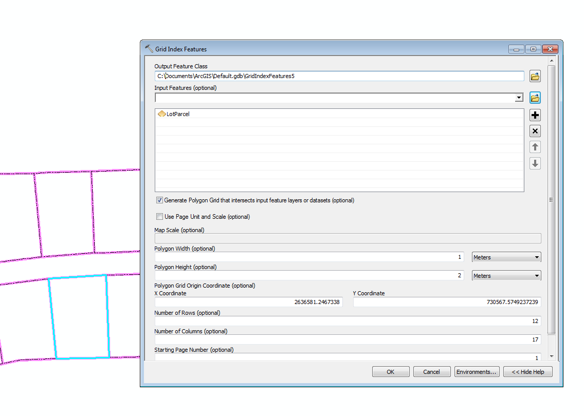
The best I can think is to run Grid Index Feature tool. On your polygons. You can specify exactly a 1 x 2 meter polygon. However they will be aligned north south etc.
Then use the Select by location tool to select all grids that intersect the boundary and delete them.
- Mark as New
- Bookmark
- Subscribe
- Mute
- Subscribe to RSS Feed
- Permalink
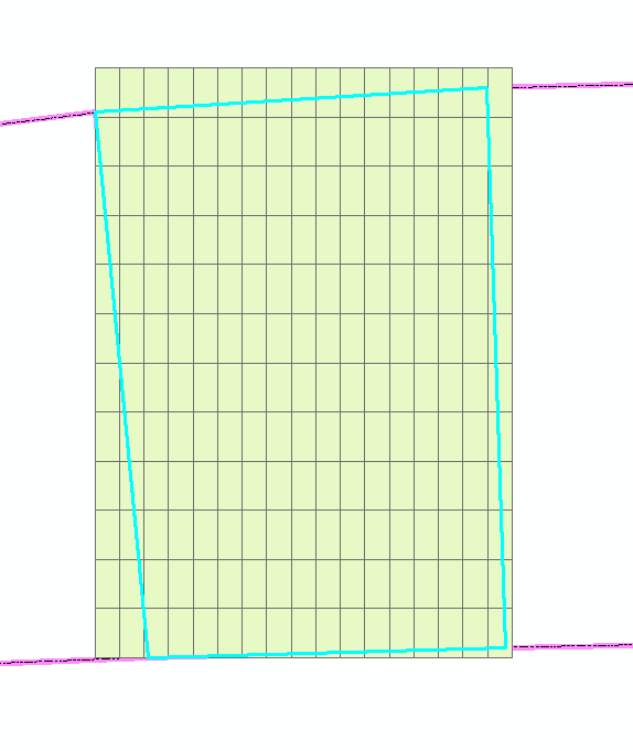
Thank you Robert, I tryed to do it with the gridindexfeature. Works kind of, except (as you said) for the North-South arrangement...and the arrangement is very important 
So far it is the best solution but I still not what I try to find...
I'll try to find out how to get the generated gridindex into the right arrangement.... What i further have is the aspect of the "to be filled polygons"..
so maybe I can integrate this aspect into the gridindex ?!...
Still thankful for your help
And if I find out something I'll let you know here
- Mark as New
- Bookmark
- Subscribe
- Mute
- Subscribe to RSS Feed
- Permalink
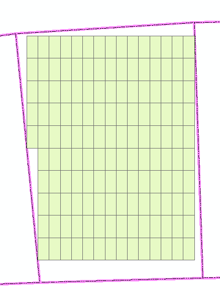
you still should be able to use rotation...
- Mark as New
- Bookmark
- Subscribe
- Mute
- Subscribe to RSS Feed
- Permalink
Hi, see if this gets you close:
http://arcgis.com/home/item.html?id=9398bd2232cb4c8490b0b05015364d28