- Home
- :
- All Communities
- :
- Products
- :
- Geoprocessing
- :
- Geoprocessing Questions
- :
- Re: How to split GPS data points into different ro...
- Subscribe to RSS Feed
- Mark Topic as New
- Mark Topic as Read
- Float this Topic for Current User
- Bookmark
- Subscribe
- Mute
- Printer Friendly Page
How to split GPS data points into different road function class (eg. Interstate, arterial etc.,)
- Mark as New
- Bookmark
- Subscribe
- Mute
- Subscribe to RSS Feed
- Permalink
So we have a lot of gps data points for a test vehicle which needs to be analyzed. My attribute table has a lot of columns like vehicle speed, acceleration etc., I have added XY dataset and all the points are visible and I can represent each of attributes in color codes over a base map. Is there any way to split the data points like when the vehicle was in Interstate, arterial, etc., so that I can do some statistical analysis on that split data.
Solved! Go to Solution.
Accepted Solutions
- Mark as New
- Bookmark
- Subscribe
- Mute
- Subscribe to RSS Feed
- Permalink
with a spatial join, attributes are not used, but the geometry is used. In essence, you can find the highway closest to a given point by spatially joining the polyline to the point
- Mark as New
- Bookmark
- Subscribe
- Mute
- Subscribe to RSS Feed
- Permalink
You can produce separate shapefiles using the SplitLayerByAttributes toolbox if you have data in a field that will allow for separation according to some class.
- Mark as New
- Bookmark
- Subscribe
- Mute
- Subscribe to RSS Feed
- Permalink
Hey Dan Patterson,
Thanks for the reply, The problem is I am not having the road function class as an attribute in the shape file. Is there a way to add that attribute automatically to the present shape file. Because It cant be done manually as its a big data file with almost 30000 points.
I have collected Road class map from the state department of transportation website. But I can use that as a overlay in a separate layer and it doesn't have any attributes. 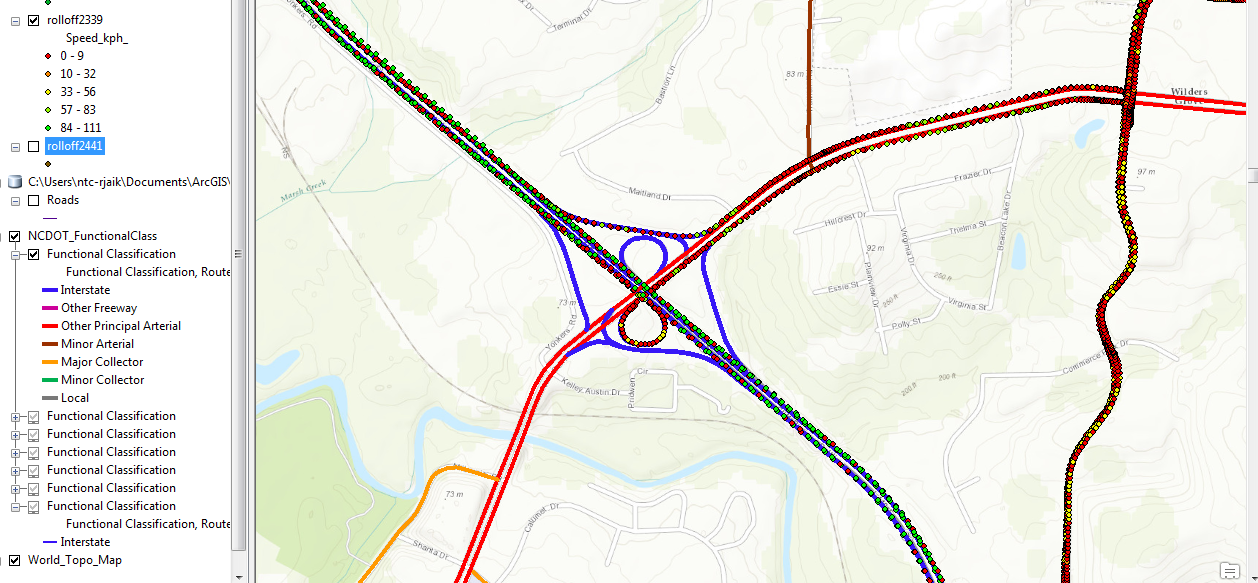
I am inserting the image for your reference. The road functional class now displays the different class of roads in different colors. I want to add this attribute to my shape file and split it accordingly. Is there a way to do it. Please help!
- Mark as New
- Bookmark
- Subscribe
- Mute
- Subscribe to RSS Feed
- Permalink
I am assuming that you have ruled out Joins and Relates or more specifically, the Spatial Join for some reason? or am I wrong?
- Mark as New
- Bookmark
- Subscribe
- Mute
- Subscribe to RSS Feed
- Permalink
hey,
I have tried that. But the thing is the road classification layer is not having any attribute table to match it to my current shape file. Is there any other way?
- Mark as New
- Bookmark
- Subscribe
- Mute
- Subscribe to RSS Feed
- Permalink
with a spatial join, attributes are not used, but the geometry is used. In essence, you can find the highway closest to a given point by spatially joining the polyline to the point
- Mark as New
- Bookmark
- Subscribe
- Mute
- Subscribe to RSS Feed
- Permalink
Hey,
I have tried it, Its taking a very long time. Maybe because both the datasets are big. Thank you for the help. Hope It works...
- Mark as New
- Bookmark
- Subscribe
- Mute
- Subscribe to RSS Feed
- Permalink
So do I...I failed to mention, that it is good practice to test procedures on small sets of data to see if they yield the correct results and to assess the time taken to run the procedure given a certain sample size... mea culpa
- Mark as New
- Bookmark
- Subscribe
- Mute
- Subscribe to RSS Feed
- Permalink
Hey,
Thanks a lot... It Worked!!!!
- Mark as New
- Bookmark
- Subscribe
- Mute
- Subscribe to RSS Feed
- Permalink
hey,
I am getting this error message when m trying to execute
this tool does not exist.
Failed to execute (SplitLayerByAttributes)