- Home
- :
- All Communities
- :
- Products
- :
- Geoprocessing
- :
- Geoprocessing Questions
- :
- Re: How to create multiple lines parallel to each ...
- Subscribe to RSS Feed
- Mark Topic as New
- Mark Topic as Read
- Float this Topic for Current User
- Bookmark
- Subscribe
- Mute
- Printer Friendly Page
How to create multiple lines parallel to each other based on points
- Mark as New
- Bookmark
- Subscribe
- Mute
- Subscribe to RSS Feed
- Permalink
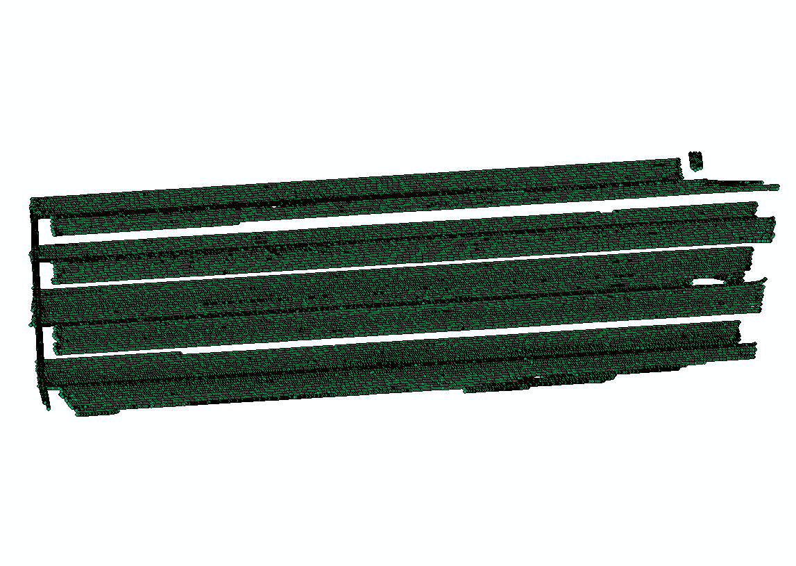
I have massive points like this and I want to generate multiple lines parallel to each other:
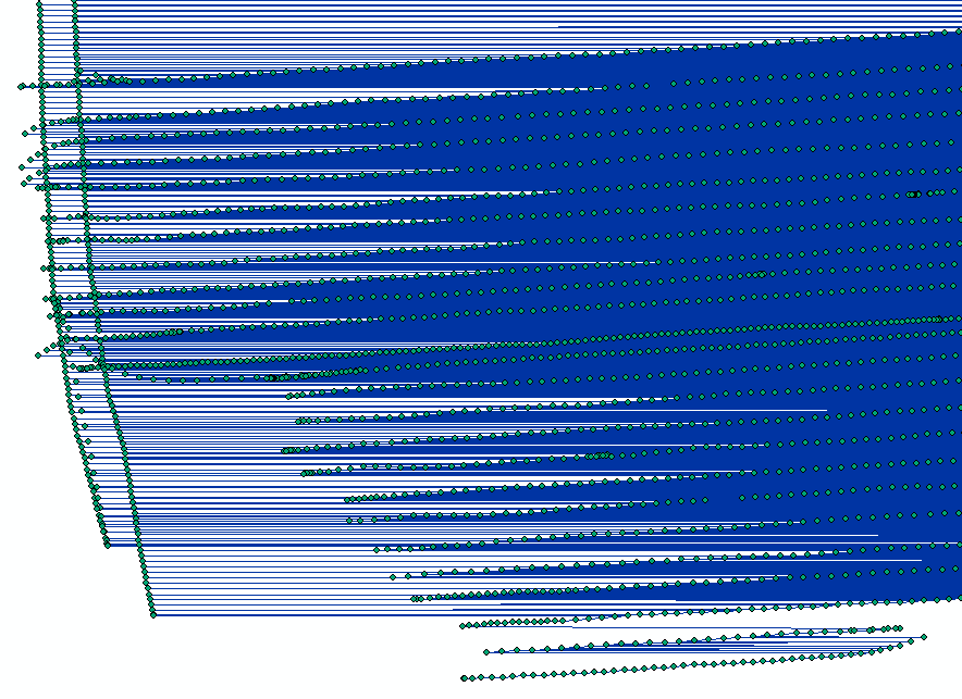
I tried `points to lines` but clearly the program is confused:
Is there a way to create multiple lines based on track points?
Solved! Go to Solution.
Accepted Solutions
- Mark as New
- Bookmark
- Subscribe
- Mute
- Subscribe to RSS Feed
- Permalink
coordinates and measures are out of bounds is a totally different issue. open a new dataframe and work with just that file to prevent muddying things up.
So your data are messed up as well? what happened? if this is from a gps, then it looks like you had some signal loss or something? ergo the year 2000 entries. How many have you got? just this one dataset or hundreds? A lot of these issues should be fixed up at the gps collection stage by starting and ending tracks and download them as such.
So now, I have suggested several things, but you appear to be following a different path which I can't follow since the data revelation is occuring in increments. Good luck
- Mark as New
- Bookmark
- Subscribe
- Mute
- Subscribe to RSS Feed
- Permalink
What did you specify for the line field? Points To Line—Help | ArcGIS for Desktop
If nothing, then it did as designed.... connect all the points.
You need a unique identifier to connect points to form one line from all the input points.
- Mark as New
- Bookmark
- Subscribe
- Mute
- Subscribe to RSS Feed
- Permalink
Just added one important information: I have the time these samples are collected!
- Mark as New
- Bookmark
- Subscribe
- Mute
- Subscribe to RSS Feed
- Permalink
time is good... if it tells you when a particular endpoint has been reached.
You could also determine the bearing between sequential points... when the bearing does a 180ish, then you know you have reached the end of the sequence and a new one has begun.
Lots of possibilities... just depends on what you have in terms of data and your programming skills since out of the box stuff won't work.
But... if you want to cheat a bit. why don't you just cut the line north south a teensie bit on both ends to essentiall cut the string into many pieces.... then use the MultiPartToSinglePart tool and amazingly you will have all kinds of lines with the start and end points just a tad off... but these were gps points weren't they, so no big deal I suppose. Quick, simple and a lot less work than some elaborate solution
- Mark as New
- Bookmark
- Subscribe
- Mute
- Subscribe to RSS Feed
- Permalink
Thanks Dan, I stick with the data and time that I am having, but as you can see, they are not uniform, which is probably why error `the coordinates or measures are out of bounds` occur. Also I notice both Date and Time are string field. Is there any way to connect them in time sequence so that `point to line` can run?
- Mark as New
- Bookmark
- Subscribe
- Mute
- Subscribe to RSS Feed
- Permalink
coordinates and measures are out of bounds is a totally different issue. open a new dataframe and work with just that file to prevent muddying things up.
So your data are messed up as well? what happened? if this is from a gps, then it looks like you had some signal loss or something? ergo the year 2000 entries. How many have you got? just this one dataset or hundreds? A lot of these issues should be fixed up at the gps collection stage by starting and ending tracks and download them as such.
So now, I have suggested several things, but you appear to be following a different path which I can't follow since the data revelation is occuring in increments. Good luck