- Home
- :
- All Communities
- :
- Products
- :
- Geoprocessing
- :
- Geoprocessing Questions
- :
- geodatabase creation with geoprocessing
- Subscribe to RSS Feed
- Mark Topic as New
- Mark Topic as Read
- Float this Topic for Current User
- Bookmark
- Subscribe
- Mute
- Printer Friendly Page
- Mark as New
- Bookmark
- Subscribe
- Mute
- Subscribe to RSS Feed
- Permalink
This geonet thing seems very strange. No doubt I'm posted this in some very inappropriate location. Sorry.
Anyway, I spent a couple days trying to figure out how to apply a subtype in a geoprocessing model. I've attached the tool and "ModelTest 2" - ignore the others. The model to create my geodatabase builds but results in an uneditable feature class. Everything but the subtype part works fine. I looked through tons of presentation on this topic but not once found any reference showing how to apply subtypes in a gp model.
See the export graphic and the attached model.
Please help. Thank you.
Solved! Go to Solution.
Accepted Solutions
- Mark as New
- Bookmark
- Subscribe
- Mute
- Subscribe to RSS Feed
- Permalink
is this the last part you are using in the model? Geoprocessing workflow for subtypes—Help | ArcGIS for Desktop
are you getting errors or is nothing happening or the results are not as expected?
- Mark as New
- Bookmark
- Subscribe
- Mute
- Subscribe to RSS Feed
- Permalink
is this the last part you are using in the model? Geoprocessing workflow for subtypes—Help | ArcGIS for Desktop
are you getting errors or is nothing happening or the results are not as expected?
- Mark as New
- Bookmark
- Subscribe
- Mute
- Subscribe to RSS Feed
- Permalink
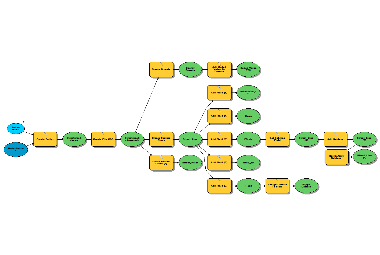
Dan, Thanks for helping with this. The doc your referenced helped me piece together the missing subtype component which was "Set Default Subtype".
One of my other issues was how to associate the subtype geoprocessing functions with the rest of the model. I attached them to my FCode Field (see below) rather than the Struct_Line Feature Class. I wasn't sure this was correct. Since it's working now, I assume this is correct.
Before the changes seen below, I was able to successfully build the geodatabase but it was not editable. Now I can edit the features. I've attached my current working model in case this helps anyone else out.
Greg