- Home
- :
- All Communities
- :
- Products
- :
- Geoprocessing
- :
- Geoprocessing Questions
- :
- Re: From Point to Gird, fishnet does not work
- Subscribe to RSS Feed
- Mark Topic as New
- Mark Topic as Read
- Float this Topic for Current User
- Bookmark
- Subscribe
- Mute
- Printer Friendly Page
From Point to Gird, fishnet does not work
- Mark as New
- Bookmark
- Subscribe
- Mute
- Subscribe to RSS Feed
- Permalink
Dear all,
I am done; I have spent half the day trying to figure out how how to get my point data to grid data. The data I use give information on sedimentary thickness for the entire world. However, the dataset is in point form. To merge it with other data (point data) I want to turn it into a grid.
I tried Fishnet but stating the number of rows and columns does not work, because the cells take such forms that the original points do not lie in the middle any longer. Stating the size of the cells also does not work, because Fishnet wants it in meters, but the original data gives the information in decimal degrees.
I also tried Grid Index Features. That seemed to work nicely, as I can state the size in dec. degrees. However, the original points are now at the corners of the cells and not in the middle where they belong.
I have attached the file with the data.
Please help me with this problem. It can't be that difficult but it is driving me to despair.
Thanks a lot, folks.
- Mark as New
- Bookmark
- Subscribe
- Mute
- Subscribe to RSS Feed
- Permalink
Hi CB,
I can see that there are multiple ways to do this.
You can get the same result by following these steps.
1. Add the point FC into the ArcMap. Make sure you select WGS 84 as Coordinate System of Input Coordinates.
2. Then use the Fishnet tool. The trick is that you would need to redefine the AOI; that is reshaping the bounding box. That way your point data extent would allow the polygon grids to have the point data as center point. See screenshot below.
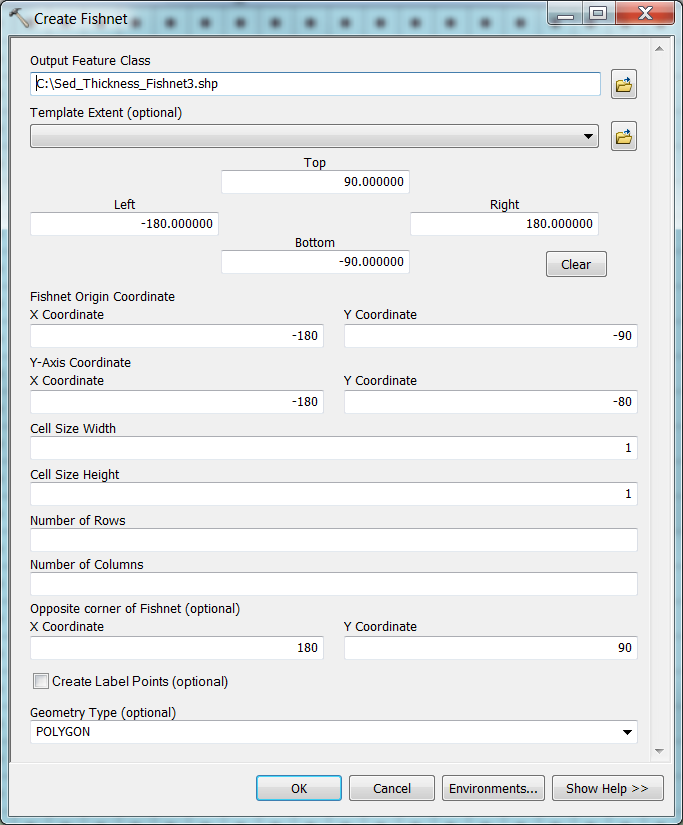
3. You can check “Create Label Points “if you want. But in this case, it’s unnecessary.
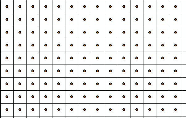
Result:
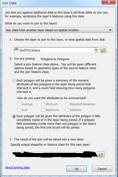
4. Once you have the fishnet, you can use the Join data geoprocessing tool to combine both attribute table -- the point data and the newly created polygon grid data-- (make sure you select “Join data from another layer based on spatial location”. This would allow you to create a new polygon dataset with all the point data attribute.
Right-click the Fishnet polygon layer in the TOC and select the Point Feature layer. In this example, the "SedThickness" is the point feature class.
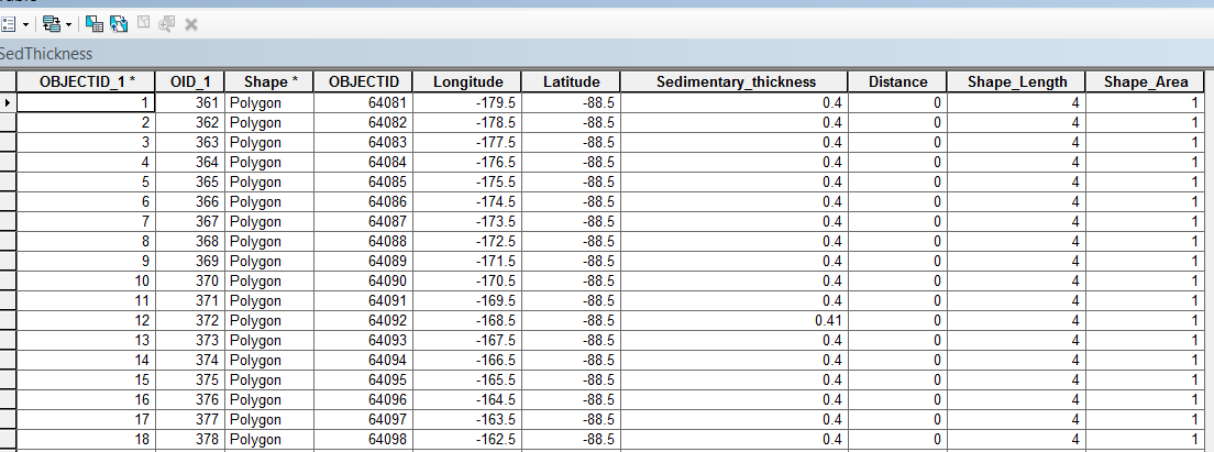
Final result is:
Note: You can follow the same process in ArcGIS Pro, no problem.
- « Previous
-
- 1
- 2
- Next »
- « Previous
-
- 1
- 2
- Next »