- Home
- :
- All Communities
- :
- Products
- :
- Geoprocessing
- :
- Geoprocessing Questions
- :
- Displaying XY Data, Points not displaying/projecti...
- Subscribe to RSS Feed
- Mark Topic as New
- Mark Topic as Read
- Float this Topic for Current User
- Bookmark
- Subscribe
- Mute
- Printer Friendly Page
Displaying XY Data, Points not displaying/projecting correctly
- Mark as New
- Bookmark
- Subscribe
- Mute
- Subscribe to RSS Feed
- Permalink
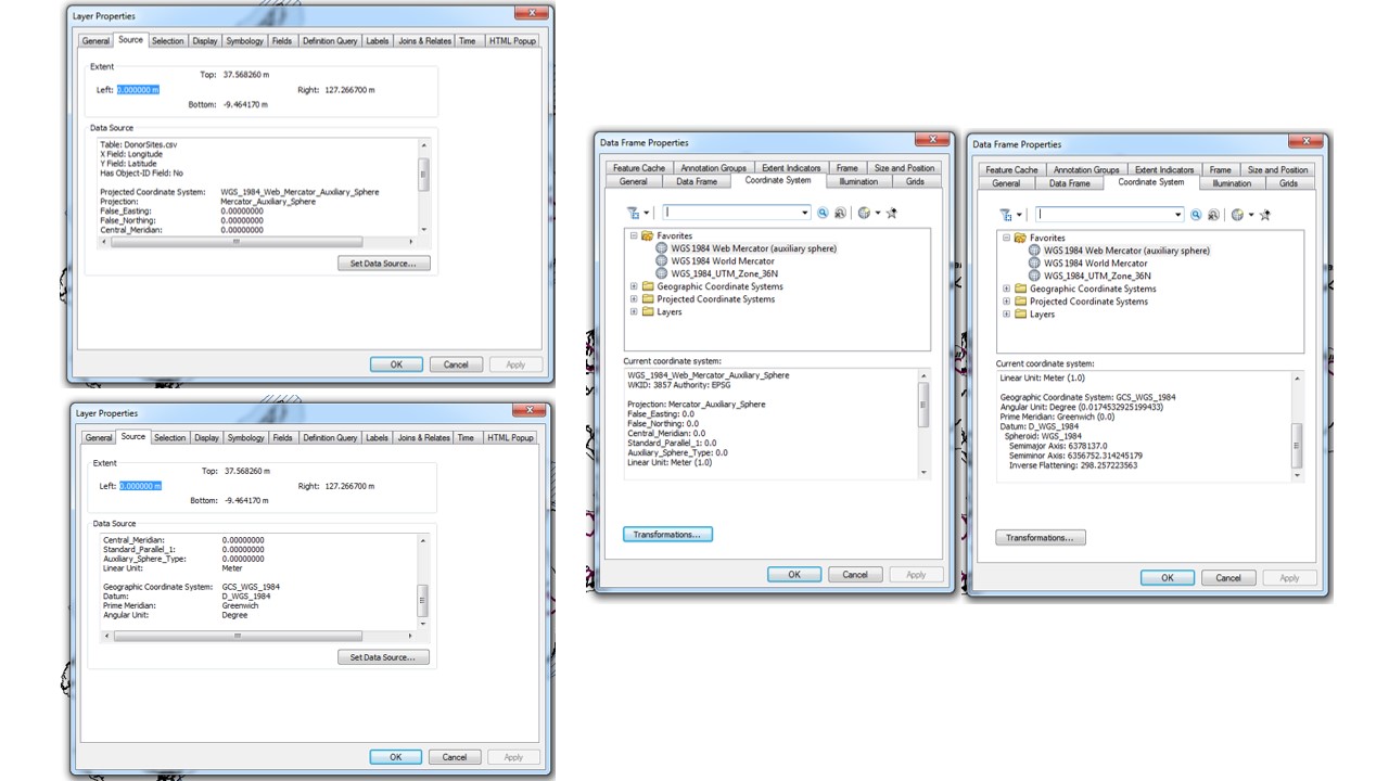
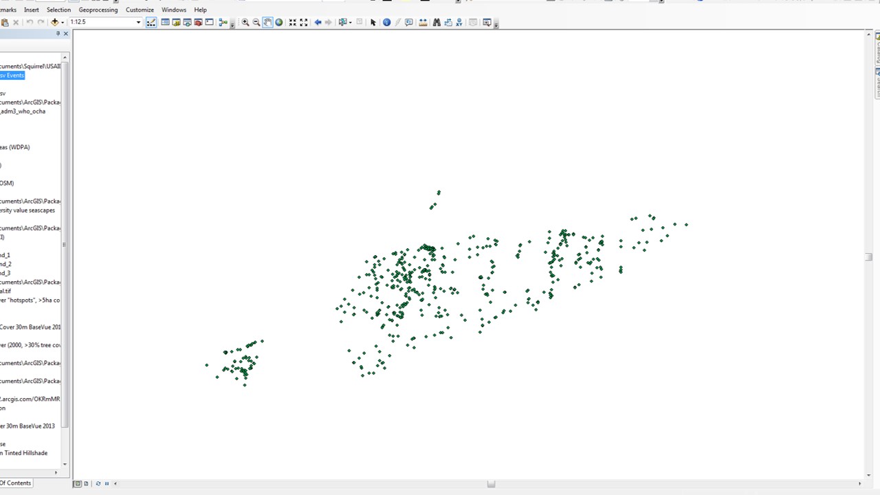
I added a csv file with lat and long coordinates, and am trying to display the XY data. The X field is set to longitude, and Y field to latitude, the coordinate system and projection match the data frame, and I have taken out spaces in the csv file. However, when the points load, they project incorrectly and off and away from the rest of the map. Please, see the attached image and provide any suggestions and explanations for how to fix this. Thank you!!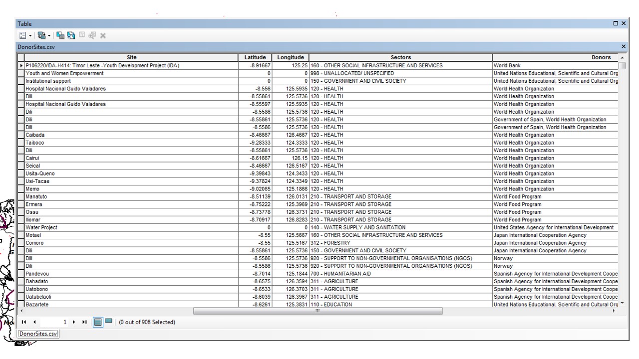
- Mark as New
- Bookmark
- Subscribe
- Mute
- Subscribe to RSS Feed
- Permalink
Those Longitude, Latitude values are in the eastern hemisphere just south of the equator and should have been defined as a Geographic Coordinate system... perhaps a GCS WGS-84 assuming they came from a gps or some other standard source.
The Web Mercator is a projected coordinate system (ie Google earth and others) and you can't set the csv data to it.
The csv data must be set correctly using the Define Projection tool THEN it needs to be projected to the web Mercator should you want to use that projection