Turn on suggestions
Auto-suggest helps you quickly narrow down your search results by suggesting possible matches as you type.
Cancel
- Home
- :
- All Communities
- :
- Products
- :
- Geoprocessing
- :
- Geoprocessing Questions
- :
- Re: Clipping inside vs outside.
Options
- Subscribe to RSS Feed
- Mark Topic as New
- Mark Topic as Read
- Float this Topic for Current User
- Bookmark
- Subscribe
- Mute
- Printer Friendly Page
10-17-2013
08:23 AM
- Mark as New
- Bookmark
- Subscribe
- Mute
- Subscribe to RSS Feed
- Permalink
- Report Inappropriate Content
Hi,
I have a large raster image, and a much smaller raster image located inside the larger one. I want to clip a hole in the larger one where the smaller image is. How do I do this? I came across the clip function: http://help.arcgis.com/en/arcgisdesktop/10.0/help/index.html#//009t00000048000000, which appears to be exactly what I want, but I can't seem to find the tool, even when I search for it... Any advice?
Thanks,
-Scott
Solved! Go to Solution.
1 Solution
Accepted Solutions
10-17-2013
08:51 AM
- Mark as New
- Bookmark
- Subscribe
- Mute
- Subscribe to RSS Feed
- Permalink
- Report Inappropriate Content
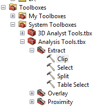
Sorry about that I thought you just wanted the clip tool , The clip function can be found under Data managment tools>Raster>Raster Processing>Clip
11 Replies
10-17-2013
08:36 AM
- Mark as New
- Bookmark
- Subscribe
- Mute
- Subscribe to RSS Feed
- Permalink
- Report Inappropriate Content
10-17-2013
08:42 AM
- Mark as New
- Bookmark
- Subscribe
- Mute
- Subscribe to RSS Feed
- Permalink
- Report Inappropriate Content
Hi,
It's not the clip tool I'm looking for (that only works with shapefiles I believe), but instead clip function, which allows me to clip inside or outside of my clipping area.
If you look at the picture on the link I posted above, that's what I'm trying to do.
It's not the clip tool I'm looking for (that only works with shapefiles I believe), but instead clip function, which allows me to clip inside or outside of my clipping area.
If you look at the picture on the link I posted above, that's what I'm trying to do.
10-17-2013
08:51 AM
- Mark as New
- Bookmark
- Subscribe
- Mute
- Subscribe to RSS Feed
- Permalink
- Report Inappropriate Content
Sorry about that I thought you just wanted the clip tool , The clip function can be found under Data managment tools>Raster>Raster Processing>Clip
10-17-2013
08:56 AM
- Mark as New
- Bookmark
- Subscribe
- Mute
- Subscribe to RSS Feed
- Permalink
- Report Inappropriate Content
Unfortunately still not what I'm looking for (Clip and Clip Function appear to be different). I don't want the standard "clip a larger object down to a smaller size", I want to clip a hole in a larger object, so that the extent of the larger object remains the same, but the values where the smaller object overlap are gone.
10-17-2013
09:05 AM
- Mark as New
- Bookmark
- Subscribe
- Mute
- Subscribe to RSS Feed
- Permalink
- Report Inappropriate Content
Just curious, essentially what you have described is Erase, correct? But such a function does not exist for rasters, is that not also correct? But one way may be that if you had a 'universe' polygon as the extent of the larger raster and erased an inner extent of the smaller raster, could you not use the result in a Clip Raster operation?
Enjoy,
Wayne
Enjoy,
Wayne
10-17-2013
09:10 AM
- Mark as New
- Bookmark
- Subscribe
- Mute
- Subscribe to RSS Feed
- Permalink
- Report Inappropriate Content
Erase does what I'd like, but not with rasters. I guess that workaround might be my best solution for right now. Thanks for your help.
10-17-2013
09:18 AM
- Mark as New
- Bookmark
- Subscribe
- Mute
- Subscribe to RSS Feed
- Permalink
- Report Inappropriate Content
Have a look at New Spatial Analyst Supplemental tools, v1.2
10-17-2013
09:30 AM
- Mark as New
- Bookmark
- Subscribe
- Mute
- Subscribe to RSS Feed
- Permalink
- Report Inappropriate Content
Now we're talking! Thanks Steve, this looks great. Any advice on using the toolbox? I downloaded it, and change the python scripts per the txt file, but whenever I try to open a tool it says "Invalid Tool. Unable to execute the selected tool."
10-17-2013
10:32 AM
- Mark as New
- Bookmark
- Subscribe
- Mute
- Subscribe to RSS Feed
- Permalink
- Report Inappropriate Content
Yes, those tools are cool...however, you may need the Spatial Analyst and a higher ArcGIS Desktop license to run any or all of the associated tools. For your requirements, Clip in Data Management (supported at all license levels) essentially does the 'Erase' function if you use the ClipGeometry option (the check box) and provide a geometry with a 'hole' in it - presumably that would be your 'smaller extent' you wish to remove.
Just have to be careful with the 'promoting pixel depth'...your output raster format has to be able to support that operation if that has effect...I used tif input along with the requisite polygon w/ a hole in it to mimic your requirement, and reset the raster properties on the added output in the map to not 'stretch' (to match symbology settings as in the original tif).
Someone may have already committed some tool 'magic' on the input ClipGeometry in the tool Gallery somewhere - sorry, I don't have time for it, and it's a simple thing really anyway to create it yourself. The main thing here is that the Clip tool supports 'erase' functionality...the tool(s) Steve posted far exceeds this functionality.
Enjoy,
Wayne
EDIT: So, actually Rodney had the 'answer' at post #4. (if you want to award him)