- Home
- :
- All Communities
- :
- Products
- :
- Data Management
- :
- Geodatabase Questions
- :
- Web Map edit not showing; applyEdits error
- Subscribe to RSS Feed
- Mark Topic as New
- Mark Topic as Read
- Float this Topic for Current User
- Bookmark
- Subscribe
- Mute
- Printer Friendly Page
- Mark as New
- Bookmark
- Subscribe
- Mute
- Subscribe to RSS Feed
- Permalink
My organization has two almost identical web maps on ago.
Each has several editable feature services from my local server.
The web maps are set to allow edits on these layers.
In one web map, I can get the edit dialog to popup, and I can successfully save an edit.
In the other web map, I cannot do this: Instead, I can click edit, hover the mouse over the map,
and although I see the prompt to 'Click to add a point. Press CTRL to enable snapping', nothing happens when I click.
I used ago assistant to ensure that there are no issues with the web map json.
I also verified the source mxd has no issues, reset field order, republished, and the service is ok too.
All is fine with the gdb schema.
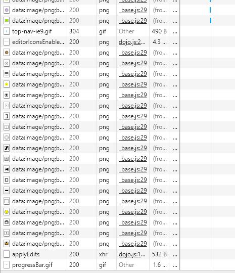
See the f12 network pics for the web map that can successfully edit, vs the one that can't.
The f12 console tab showed no errors for either web map.
Solved! Go to Solution.
Accepted Solutions
- Mark as New
- Bookmark
- Subscribe
- Mute
- Subscribe to RSS Feed
- Permalink
I tried editing the mxd directly, and got an error:
The create feature task could not be completed. Insufficient permissions[database.schema.fc]
found this thread:
- What SQLServer user permissions are needed to add features?
- Question asked by Greig McArthur on Apr 22, 2015
My GIS team has established a practice to maintain consistency in the publishing process:
Use the Database Connection authentication for the username that created the version in the mxd to be published.
So, all of the layers dragged in from arcCatalog into the mxd came from there.
The arcCatalog connection should be connected using the user's authentication, and the Geodatabase Connection Properties should be pointing to the version the user created.
This same arcCatalog connection should be registered with the server prior to publishing a service.
This is accomplished by using the 'Import', not 'Add' button of the 'Register Database' dialog of ArcGIS Server Properties.
Doing it in this manner will allow you to choose the exact arcCatalog connection that is consistent with the layer data sources in the mxd.
Suggested name format for the registered database is 'Instance_Username_Database_Version'
with that said, the thread above might imply that I also need to give that same user the appropriate privileges using arcCatalog.
Also, as the thread mentioned, only give the user 'Connect' privileges within sql server.
This was the solution.
- Mark as New
- Bookmark
- Subscribe
- Mute
- Subscribe to RSS Feed
- Permalink
I also see an error in the applyEdits from the preview pane of f12 tools:
- {error: {code: 400, message: "Unable to complete operation.",…}}
- error:{code: 400, message: "Unable to complete operation.",…}
- code:400
- details:["Internal error during object insert."]
- message:"Unable to complete operation."
- error:{code: 400, message: "Unable to complete operation.",…}
The applyEdits should return something like this instead, but its' not:
- {addResults: [{objectId: 1, globalId: "{C11CC1C1-1C-111C-CC1C-1C11C1C1}", success: true}],…}
- addResults:[{objectId: 1, globalId: "{C11CC1C1-1C-111C-CC1C-1C11C1C1}", success: true}]
- 0:{objectId: 1, globalId: "{C11CC1C1-1C-111C-CC1C-1C11C1C1}", success: true}
- globalId:"{C11CC1C1-1C-111C-CC1C-1C11C1C1}"
- objectId:1
- success:true
- 0:{objectId: 1, globalId: "{C11CC1C1-1C-111C-CC1C-1C11C1C1}", success: true}
- deleteResults:[]
- updateResults:[]
- addResults:[{objectId: 1, globalId: "{C11CC1C1-1C-111C-CC1C-1C11C1C1}", success: true}]
(Note, I changed the real object id and global id numbers for example's sake)
Looking at the AcrGIS Rest API, I found out that my feature service error code is 1017:
https://developers.arcgis.com/rest/services-reference/feature-service-error-codes.htm
https://developers.arcgis.com/rest/services-reference/apply-edits-feature-service-.htm
- Mark as New
- Bookmark
- Subscribe
- Mute
- Subscribe to RSS Feed
- Permalink
I have also tried different browsers, clearing cache and cookies.
I set left security open to everyone at the service level.
The web map is shared only to my organization, and further, to a group within my organization.
Still have same issue.
- I found out someone else had this same issue with no resolution:
- Found this thread:
- ApplyEdits to Feature Service causes Errors
- Question asked by Walter Dziuba on Apr 6, 2017
- ApplyEdits to Feature Service causes Errorshttps://community.esri.com/thread/193021-applyedits-to-feature-service-causes-errors
- I verified that I did have enabled create, delete, query, and update in my service.
- ApplyEdits to Feature Service causes Errorshttps://community.esri.com/thread/193021-applyedits-to-feature-service-causes-errors
- Found this thread:
- ApplyEdits missing attributes
- Question asked by Jillian Stanford on Nov 17, 2017
- Found this thread:
- JavaScript API 2.7 vs. 2.8 - FeatureLayer.applyEdits
- Question asked by Michael Leahy
 on Apr 2, 2012
- Found an ESRI technical support article:
- Problem: Unable to add new features to an ArcGIS Server feature service in ArcGIS Online
- https://support.esri.com/en/technical-article/000011836
- I do not want to try this because none of my gdb fc's include Z values in their geometry properties.
- https://support.esri.com/en/technical-article/000011836
- Problem: Unable to add new features to an ArcGIS Server feature service in ArcGIS Online
- Mark as New
- Bookmark
- Subscribe
- Mute
- Subscribe to RSS Feed
- Permalink
I tried editing the mxd directly, and got an error:
The create feature task could not be completed. Insufficient permissions[database.schema.fc]
found this thread:
- What SQLServer user permissions are needed to add features?
- Question asked by Greig McArthur on Apr 22, 2015
My GIS team has established a practice to maintain consistency in the publishing process:
Use the Database Connection authentication for the username that created the version in the mxd to be published.
So, all of the layers dragged in from arcCatalog into the mxd came from there.
The arcCatalog connection should be connected using the user's authentication, and the Geodatabase Connection Properties should be pointing to the version the user created.
This same arcCatalog connection should be registered with the server prior to publishing a service.
This is accomplished by using the 'Import', not 'Add' button of the 'Register Database' dialog of ArcGIS Server Properties.
Doing it in this manner will allow you to choose the exact arcCatalog connection that is consistent with the layer data sources in the mxd.
Suggested name format for the registered database is 'Instance_Username_Database_Version'
with that said, the thread above might imply that I also need to give that same user the appropriate privileges using arcCatalog.
Also, as the thread mentioned, only give the user 'Connect' privileges within sql server.
This was the solution.