Turn on suggestions
Auto-suggest helps you quickly narrow down your search results by suggesting possible matches as you type.
Cancel
- Home
- :
- All Communities
- :
- Industries
- :
- Education
- :
- Education Blog
- :
- Open-Ended Tools, Open-Ended Curricula
Open-Ended Tools, Open-Ended Curricula
Subscribe
322
0
06-28-2017 11:39 PM
- Subscribe to RSS Feed
- Mark as New
- Mark as Read
- Bookmark
- Subscribe
- Printer Friendly Page
- Report Inappropriate Content
06-28-2017
11:39 PM
I recently wrote about the connections between ePortfolios, innovative technologies, and the use of GIS in education, beginning with an interview with English professor and Executive Director of the Association for Authentic, Experiential, and Evidence-Based Learning (AAEEBL), Dr. Trent Batson. Besides believing in innovative technology as a vehicle for transforming how education is designed, Dr. Batson had these intriguing things to say about pedagogy:“Pedagogy is the wrong term for educators to be using regarding higher education for two reasons: it refers to teaching and therefore implies a teaching-centered approach to education, and, secondly, it refers to teaching children, not adults. It’s also a loaded term, associated with the behaviorist model that education has unwittingly perpetuated long after it fell out of favor with learning researchers.“
Behaviorism is a developmental theory that measures observable behaviors produced by a learner’s response to stimuli, and one reason for Batson’s statement may be that behaviorism is often associated with rote memorization and drill-and-practice. While these methods have some utility in education, they are often cited as the least effective ways to teach and learn. By contrast, learner-centered approaches to education have gained favor following pioneering work from Rogers, Vygotsky, Piaget, and Bloom, who showed that students actively construct their own learning.
Because GIS was created to be a problem-solving toolkit, it meshes well with problem-based learning and experiential learning that adhere to the learner-centered model. How can we foster this in the GIS based curricula that we develop through such venues as Esri Press, ArcLessons, YouTube Channel, and in our blog posts? We seek to provide hands-on, engaging, sound content that fosters skills, that addresses important issues, and that adheres to curricular content standards at the primary and secondary level and the Geospatial Technology Competency Model and to other vetted higher education models. However, none of these curricular pieces are intended to be the final destination. Rather, we always aim for these curricular pieces to spark ideas, to foster inquiry, to spur further investigations. To be sure, it is often valuable to start one’s journey in GIS education or with a particular task such as geocoding with a lesson that someone else has written. However, don’t get stuck there. If you as the instructor or one of your students wants to change scales, regions, classification, variables, or analytical techniques in these lessons, by all means, change them. Because GIS is an open-ended tool, it would be a shame if the lessons or activities were looked upon as closed!

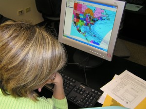
One of my all-time favorite moments as an educator came while I was examining ethnicity, median age, and other demographic variables by neighborhood in Denver with a classroom of middle school students using GIS. After a few students said, “what if we looked at New Mexico?” for the rest of the class period, the students were totally driving the inquiry, changing the location and next, even changing the variables! Curiously, since the students weren’t quite used to “driving”, they at first glanced at me often for approval. After I made certain that this was welcomed, the students blazed new ground. We were in terra incognita, outside the “box” of the lesson.
What are ways that you typically modify existing GIS-based curricula? What can we do on the Esri education team to provide you with the curricular pieces that would best foster a learner-centered approach?
-Joseph Kerski, Esri Education Manager
You must be a registered user to add a comment. If you've already registered, sign in. Otherwise, register and sign in.
About the Author
I believe that spatial thinking can transform education and society through the application of Geographic Information Systems for instruction, research, administration, and policy.
I hold 3 degrees in Geography, have served at NOAA, the US Census Bureau, and USGS as a cartographer and geographer, and teach a variety of F2F (Face to Face) (including T3G) and online courses. I have authored a variety of books and textbooks about the environment, STEM, GIS, and education. These include "Interpreting Our World", "Essentials of the Environment", "Tribal GIS", "The GIS Guide to Public Domain Data", "International Perspectives on Teaching and Learning with GIS In Secondary Education", "Spatial Mathematics" and others. I write for 2 blogs, 2 monthly podcasts, and a variety of journals, and have created over 6,500 videos on my Our Earth YouTube channel.
Yet, as time passes, the more I realize my own limitations and that this is a lifelong learning endeavor: Thus I actively seek mentors and collaborators.
Labels
-
Administration
58 -
Announcements
65 -
Career & Tech Ed
1 -
Curriculum-Learning Resources
226 -
Education Facilities
24 -
Events
60 -
GeoInquiries
1 -
Higher Education
557 -
Informal Education
272 -
Licensing Best Practices
64 -
National Geographic MapMaker
25 -
Pedagogy and Education Theory
206 -
Schools (K - 12)
282 -
Schools (K-12)
230 -
Spatial data
28 -
STEM
3 -
Students - Higher Education
240 -
Students - K-12 Schools
114 -
Success Stories
33 -
TeacherDesk
1 -
Tech Tips
92
- « Previous
- Next »