Fun with GIS 260: Student Work
- Subscribe to RSS Feed
- Mark as New
- Mark as Read
- Bookmark
- Subscribe
- Printer Friendly Page
Adults ask “What can K12 students do with GIS besides following step-by-step instructions to a pre-determined result?” Quite a lot, I suggest, if one examines the research and product from Esri’s competition for high school and middle school students.
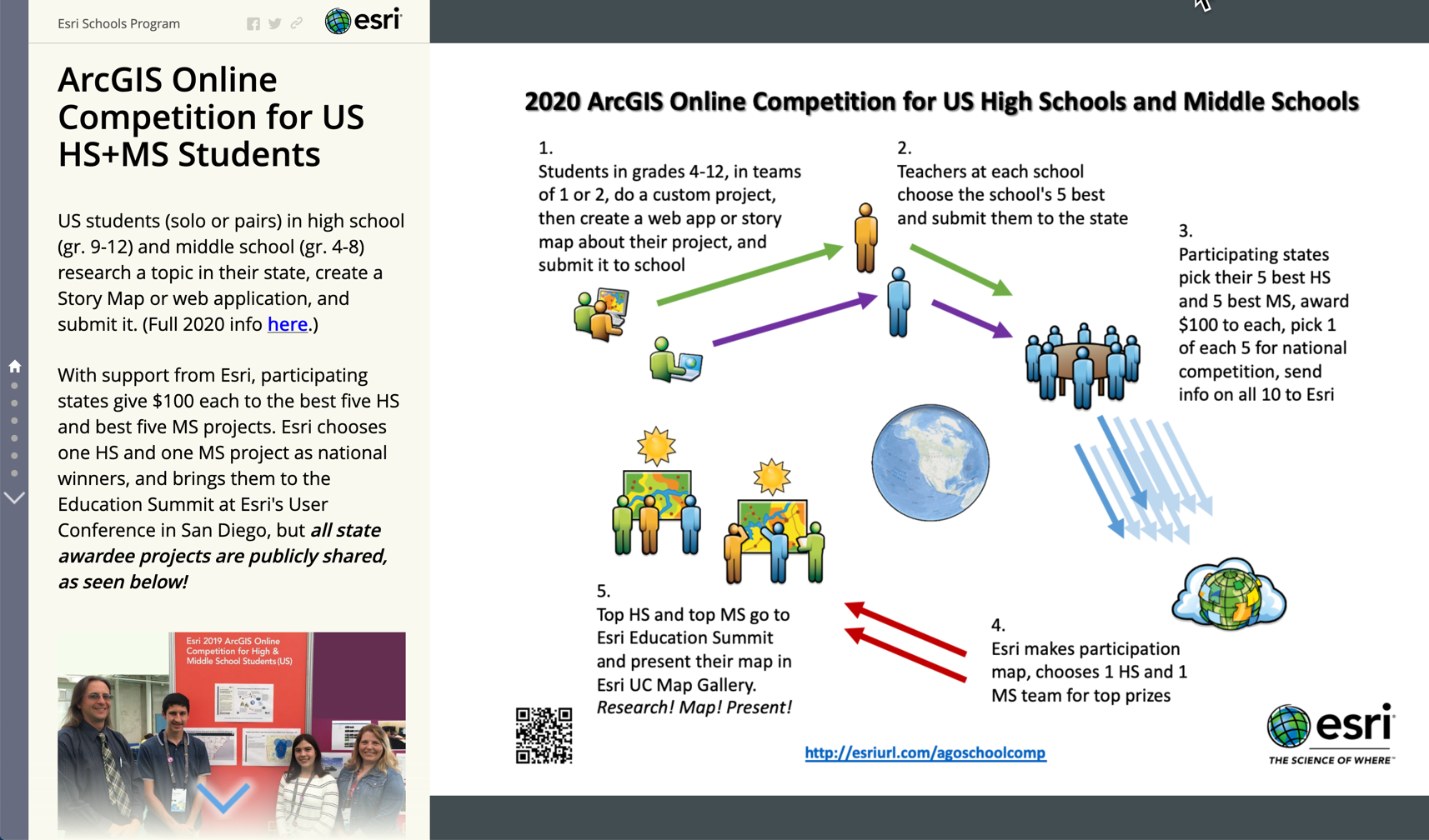
The ArcGIS Online Competition for US High School and Middle School Students is in only its fourth year, but already there are examples showing notable capacity. Students either solo or as a team of two research a topic in their state, and produce their result in a StoryMap or web app They are tasked with documenting their process and data, submitting it to their school for a first round of competition, which promotes to the state up to five for a second round of competition. The $100 awards earned by the top 5+5 at the state level are attractive, but nothing like the bragging rights and potential impact of elevation to the national level.

See the results from 2019, 2018, and 2017. Each year, the winner and honorable mention at both levels are highlighted, and links to the all state awardees are included.
The first three years show increasingly sophisticated presentations, but also more and more use of media from external sources. Therefore, we have tweaked the 2020 rules to limit external media, to emphasize student-generated content, particularly maps. We want to see what students can find, create, organize, and analyze about their world.
Students accustomed to independent research have shown that they can step out on their own, dig deeply, map powerfully, document carefully, and present impressively, heeding guidelines all the while, just like adults need to. Anyone anxious to see examples need only check the competition results. And students who wisely inspect what worked before will do well also to note carefully the 2020 constraints.
You must be a registered user to add a comment. If you've already registered, sign in. Otherwise, register and sign in.
-
Administration
78 -
Announcements
80 -
Career & Tech Ed
1 -
Curriculum-Learning Resources
259 -
Education Facilities
24 -
Events
72 -
GeoInquiries
1 -
Higher Education
596 -
Informal Education
281 -
Licensing Best Practices
91 -
National Geographic MapMaker
33 -
Pedagogy and Education Theory
226 -
Schools (K - 12)
282 -
Schools (K-12)
273 -
Spatial data
35 -
STEM
3 -
Students - Higher Education
246 -
Students - K-12 Schools
129 -
Success Stories
36 -
TeacherDesk
1 -
Tech Tips
119
- « Previous
- Next »