- Home
- :
- All Communities
- :
- Industries
- :
- Education
- :
- Education Blog
- :
- Fun with GIS 212: ArcGIS Online School Competition
Fun with GIS 212: ArcGIS Online School Competition
- Subscribe to RSS Feed
- Mark as New
- Mark as Read
- Bookmark
- Subscribe
- Printer Friendly Page
What do iron mines, a flooded town, a national historic park, and public access to state parks have in common? These were topics addressed by students in Esri's 2017 ArcGIS Online Competition for High School and Middle School. These four earned the top prize and honorable mention at high school (grades 9-12) and middle school (grades 4-8) levels, in a competition where everyone was restricted to showing something of interest inside their state.

The competition had three levels: school, state, and national. Schools could send no more than five entries to the state, and some schools had dozens of entries, so "Level One" was a real challenge for some teachers. At the state level, up to five entries at high school and up to five entries at middle school were awarded prizes of $100 each. All those entries were forwarded to Esri for collating, with each state choosing one high school and one middle school project for the final national competition.
Students could work singly or with a partner. They needed to do research and use ArcGIS Online to create a web app, map viewer presentation, or Story Map. Judges at each level looked for careful documentation, analytical thinking, self-generated data, and a compelling story presented well. These skill sets will serve students well going forward, in college, career, and civic life, but they take time and practice to build.

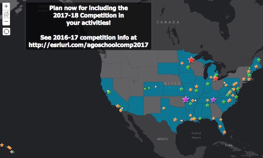
Many mentors and judges at school, state, and national levels are already looking forward to next year, expecting even more and stronger entries. Start planning now for the 2018 event, by checking out 2017's top four honorees, and all the other state awardees (see Map#2)!
You must be a registered user to add a comment. If you've already registered, sign in. Otherwise, register and sign in.
-
Administration
78 -
Announcements
80 -
Career & Tech Ed
1 -
Curriculum-Learning Resources
259 -
Education Facilities
24 -
Events
72 -
GeoInquiries
1 -
Higher Education
596 -
Informal Education
281 -
Licensing Best Practices
91 -
National Geographic MapMaker
33 -
Pedagogy and Education Theory
226 -
Schools (K - 12)
282 -
Schools (K-12)
273 -
Spatial data
35 -
STEM
3 -
Students - Higher Education
246 -
Students - K-12 Schools
129 -
Success Stories
36 -
TeacherDesk
1 -
Tech Tips
120
- « Previous
- Next »