If you’re studying GIS or geography, imagery and remote sensing skills can open the door to exciting opportunities in environmental analysis, disaster response, urban planning, conservation, and more. Satellite imagery helps GIS professionals monitor changes across the planet, uncover patterns in the environment, and better understand how places evolve over time.
One of the best ways to build these skills is through hands-on practice. With ArcGIS Living Atlas of the World, students can access ready-to-use imagery layers and work with real-world geographic data directly in ArcGIS.
Here are three Esri tutorials to get you started with applying imagery analysis in Living Atlas to help further your skills in your GIS journey.
Get Started with Imagery
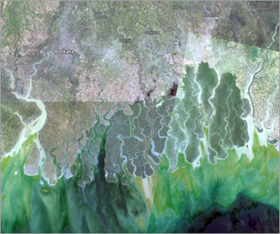
If you're new to image analysis, this is the perfect place to begin. In this tutorial, you'll explore Landsat imagery with the Esri Landsat Explorer web app and learn essential concepts about multispectral imagery. You'll monitor vegetation in the Sundarbans mangrove forest, visualize the growth of a city in China, inspect an oasis in Egypt, delineate flooded areas in Chad, and more. When you finish, you'll have a better understanding of the vast applications of multispectral imagery and be ready to explore the world on your own.
Try the Tutorial >
Explore Landsat imagery of a volcano eruption
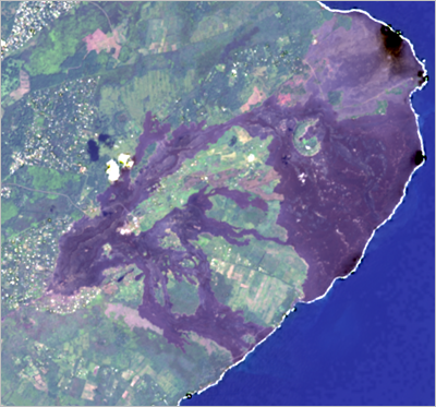
In this tutorial, you'll prepare and explore Landsat satellite imagery captured before, during, and after the eruption. Landsat is the longest running satellite program for Earth observation in the world. It has captured millions of images that provide continuous, global coverage over several decades, making Landsat an unparalleled resource for analysts and decision makers. You'll access this data as a ready-to-use online imagery layer available through ArcGIS Living Atlas of the World.
Try the Tutorial >
Monitor algae bloom in a lake
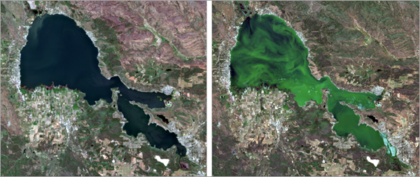
In this tutorial, you'll use Sentinel-2 satellite imagery from 2019 and 2024 to understand changes in the lake's algae activity. Algae produce chlorophyll during photosynthesis, so you'll monitor algae activity by analyzing chlorophyll concentrations. Sentinel-2 can detect chlorophyll concentrations through specific spectral bands, so it's an important dataset for early detection and environmental monitoring.
Try the Tutorial >
Imagery and remote sensing continue to play a growing role across the GIS industry. Imagery skills are increasingly valuable for students preparing for careers in GIS and geospatial technology. Check out the article The Future of the GIS Analyst: 4 Skills Every GIS Student Needs Before Graduating to know what skills will be relevant for the GIS analyst in the next 5–10 years.
------------------------------
Esri Tutorials Spotlight Blog Series
Here is a list of the previously published Esri Tutorials Spotlight blog posts:
