Turn on suggestions
Auto-suggest helps you quickly narrow down your search results by suggesting possible matches as you type.
Cancel
- Home
- :
- All Communities
- :
- Industries
- :
- Education
- :
- Education Blog
- :
- 5 Educational Activities Using ArcGIS Earth
5 Educational Activities Using ArcGIS Earth
Subscribe
1226
0
06-02-2016 11:59 PM
- Subscribe to RSS Feed
- Mark as New
- Mark as Read
- Bookmark
- Subscribe
- Printer Friendly Page
06-02-2016
11:59 PM
ArcGIS Earth, which arrived earlier this year, is a free, powerful tool to visualize the Earth in 3D. ArcGIS Earth runs via a program that you install on your computer (at the present time, Windows-only) and streams spatial data over the web. You can add data that you or your students create, or data that local, regional, national, and international organizations have created on a wide variety of themes. These themes include natural hazards, demographics, hydrography, ecoregions, energy, health, and much more. Indeed, because ArcGIS Earth can access data in the ArcGIS Online cloud, the number of layers available are vast, and expanding daily. Educators and students can also visualize data collected and stored on their own computers. Let's explore five activities that you can quickly and easily use in the classroom, at a wide variety of educational levels and disciplines.
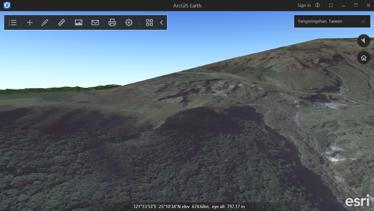
1. Study your community or region, or others around the world, using satellite imagery. Not long ago, my colleague in geography gave me a tour of Yangmingshan National Park in Taiwan, which contains sulfur deposits, fumaroles, venomous snakes, and at least 20 volcanoes. I can use ArcGIS Earth to teach about the physical geography of the park (shown in part, below).
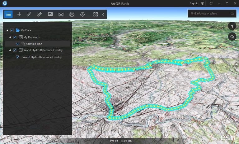
2. Teach about watersheds. In the example below, I added the World Hydro Reference overlay to ArcGIS Earth, changed the base map to a topographic base map, and highlighted the boundary of a watershed in western Colorado. Using this technique, you can teach students the relationship between watersheds, river drainage, and topography.
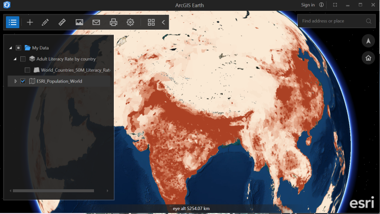
3. Investigate population density and world demographics. In the example below, I added the world population density layer. I can then add demographic data by country, location of major world cities, and other map layers to teach about world settlement patterns and why these patterns are important.
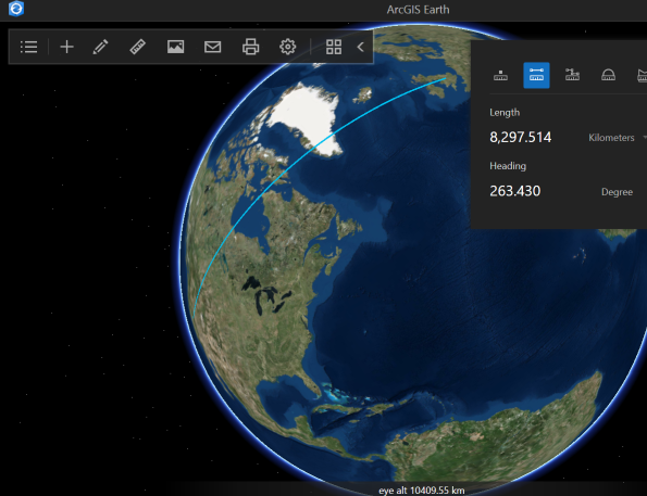
4. Teach about the shape and size of the Earth. Using the measurement tool in the example below, you can teach about Great Circle routes and much more about distances and the physical geography of the Earth.
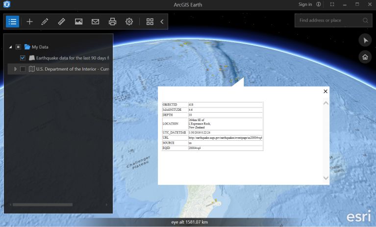
5. Study real-time data. In the example below, I am using the oceans base map and earthquakes from the last 90 days to study the relationship between tectonic activity and the ocean trench northeast of New Zealand.
Much more can be done, but I hope that these examples help you think about how you might use ArcGIS Earth in your own instruction or research.
You must be a registered user to add a comment. If you've already registered, sign in. Otherwise, register and sign in.
About the Author
I believe that spatial thinking can transform education and society through the application of Geographic Information Systems for instruction, research, administration, and policy.
I hold 3 degrees in Geography, have served at NOAA, the US Census Bureau, and USGS as a cartographer and geographer, and teach a variety of F2F (Face to Face) (including T3G) and online courses. I have authored a variety of books and textbooks about the environment, STEM, GIS, and education. These include "Interpreting Our World", "Essentials of the Environment", "Tribal GIS", "The GIS Guide to Public Domain Data", "International Perspectives on Teaching and Learning with GIS In Secondary Education", "Spatial Mathematics" and others. I write for 2 blogs, 2 monthly podcasts, and a variety of journals, and have created over 6,500 videos on my Our Earth YouTube channel.
Yet, as time passes, the more I realize my own limitations and that this is a lifelong learning endeavor: Thus I actively seek mentors and collaborators.
Related Articles
5 Educational Activities Using ArcGIS Earth
JosephKerski
Esri Alum
1 Kudos
0 Comments
Labels
-
Administration
80 -
Announcements
80 -
Career & Tech Ed
1 -
Curriculum-Learning Resources
259 -
Education Facilities
24 -
Events
73 -
GeoInquiries
1 -
Higher Education
599 -
Informal Education
281 -
Licensing Best Practices
93 -
National Geographic MapMaker
33 -
Pedagogy and Education Theory
226 -
Schools (K - 12)
282 -
Schools (K-12)
275 -
Spatial data
35 -
STEM
3 -
Students - Higher Education
247 -
Students - K-12 Schools
129 -
Success Stories
36 -
TeacherDesk
1 -
Tech Tips
122
- « Previous
- Next »
