- Home
- :
- All Communities
- :
- Products
- :
- Data Management
- :
- Data Management Questions
- :
- Re: Replacing Raster Values
- Subscribe to RSS Feed
- Mark Topic as New
- Mark Topic as Read
- Float this Topic for Current User
- Bookmark
- Subscribe
- Mute
- Printer Friendly Page
Replacing Raster Values
- Mark as New
- Bookmark
- Subscribe
- Mute
- Subscribe to RSS Feed
- Permalink
Hi,
I'm working on a Flood survey project and I'm using Arcgis 10.2.2. I have two topographic rasters and I have a problem in replacing raster values from a raster to another one. In a few words I have two rasters Ras1 (bigger area) and Ras2 (small area but laser scan data) and I want to replace the Ras1 with values of Ras2 as Ras2 should provide me with a more accurate data.
Is there any way to replace raster values in Ras1 with Ras2 of my chosen area in the image?
Thanks
Miquel
- Mark as New
- Bookmark
- Subscribe
- Mute
- Subscribe to RSS Feed
- Permalink
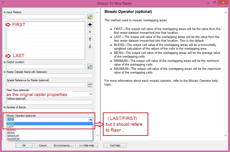
If they overlap and same spatial reference, use Mosaic To New Raster—Help | ArcGIS for Desktop tool and make the mosaic operator refer to Ras2 in your input raster sort, as the following picture.

- Mark as New
- Bookmark
- Subscribe
- Mute
- Subscribe to RSS Feed
- Permalink
The MosaicDataset Fan is back: You should create a MosaicDataset and load both. Where one has a higher resolution than the other - it will be used - thats the simple version. There is a lot you can set as properties, too. No need to calculate them into a new dataset, if you dont want to. Though thats an option, no doubt.
- Mark as New
- Bookmark
- Subscribe
- Mute
- Subscribe to RSS Feed
- Permalink
Thanks for the answer Gunter. My only issue is that I have no access to the right licence to create a Mosaic Dataset under Data Management. Therefore I will follow Abdullah and Dan's advice.
Really appreciate though
- Mark as New
- Bookmark
- Subscribe
- Mute
- Subscribe to RSS Feed
- Permalink
Thanks for the reply. Yes - it requires at least Standard licensing. If you work a lot with rasters it might be worth it just because of that. Hope you have success with the procedures described by Dan and Abdullah