- Home
- :
- All Communities
- :
- Products
- :
- Data Management
- :
- Data Management Questions
- :
- Re: Georeferencing problem
- Subscribe to RSS Feed
- Mark Topic as New
- Mark Topic as Read
- Float this Topic for Current User
- Bookmark
- Subscribe
- Mute
- Printer Friendly Page
- Mark as New
- Bookmark
- Subscribe
- Mute
- Subscribe to RSS Feed
- Permalink
Hello,
I am having a problem with ArcMap 10.5.
I have hundreds of tiff images georeferenced in 10.3 but when I add them in 10.5 I cannot see them in the correct position anymore.
Does anyone know what to do?
Solved! Go to Solution.
Accepted Solutions
- Mark as New
- Bookmark
- Subscribe
- Mute
- Subscribe to RSS Feed
- Permalink
I would check Map and Pro settings then to see if they are set to use Windows regional settings by default
- Mark as New
- Bookmark
- Subscribe
- Mute
- Subscribe to RSS Feed
- Permalink
Did you copy the supporting files (e.g. .aux, .ovr files) with the TIFF rasters, if any?
Have you created any custom Coordinate System for georeferencing in 10.3?
Think Location
- Mark as New
- Bookmark
- Subscribe
- Mute
- Subscribe to RSS Feed
- Permalink
All the files are in the folder (aux, ovr). No custom Coordinate System...RD New for Netherlands is used.
They appear fine and at the correct position in 10.3 and Arcgis Pro.
- Mark as New
- Bookmark
- Subscribe
- Mute
- Subscribe to RSS Feed
- Permalink
Does the issue persist if you try opening the image in a blank Map document (new MXD)?
What is the shift in the image (screenshots would be helpful)?
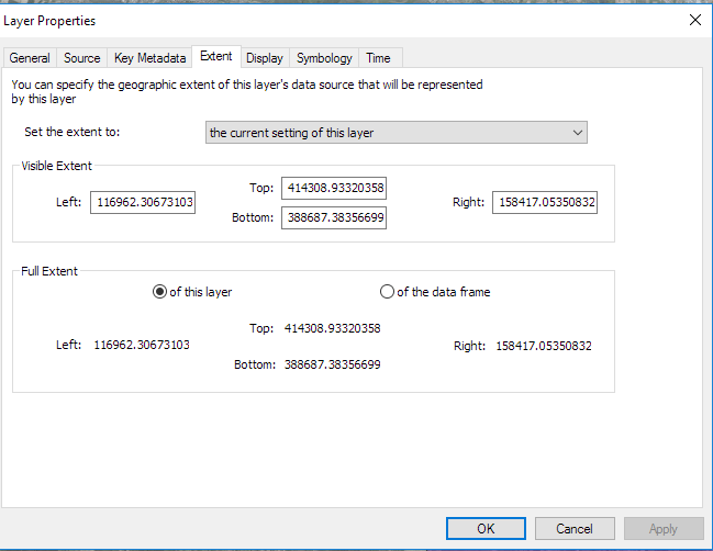
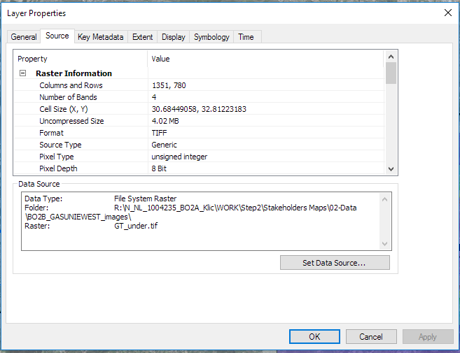
Does the Feature Extent (Layer Properties > Source tab) look fine?
Think Location
- Mark as New
- Bookmark
- Subscribe
- Mute
- Subscribe to RSS Feed
- Permalink
So this is what it looks like in 10.5: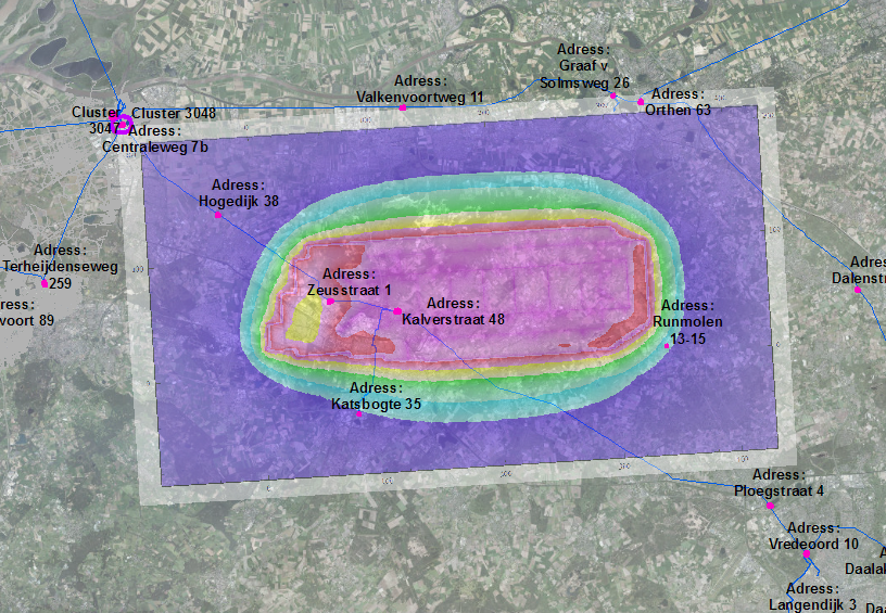
Should look like this:
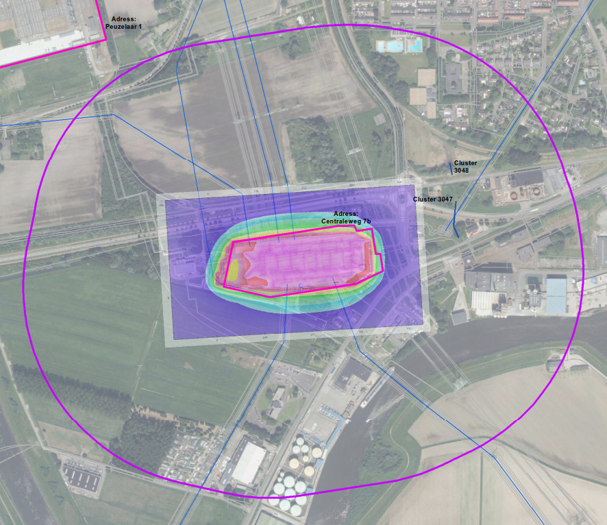
Extent:
- Mark as New
- Bookmark
- Subscribe
- Mute
- Subscribe to RSS Feed
- Permalink
So the image should be in the left corner of the image and much smaller.Where it says Centraleweg 7b.
The same thing if I open new mxd.
- Mark as New
- Bookmark
- Subscribe
- Mute
- Subscribe to RSS Feed
- Permalink
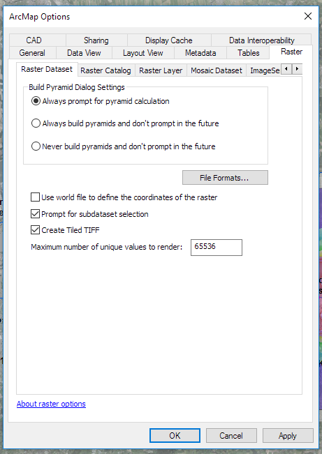
if you have a *.tfw file, .... see the checkbox about 'Use world file to define....'
perhaps 10.5 and 10.3 are toggled differently
- Mark as New
- Bookmark
- Subscribe
- Mute
- Subscribe to RSS Feed
- Permalink
Do the Data frame , Image and Base Map Have the same Datum?
- Mark as New
- Bookmark
- Subscribe
- Mute
- Subscribe to RSS Feed
- Permalink
Hello,
Yes it is the same.
- Mark as New
- Bookmark
- Subscribe
- Mute
- Subscribe to RSS Feed
- Permalink
So this is what it looks like in 10.5:

I can see a little rotation in the wrong place raster.
If your original raster had no rotation , that is mean the raster still the geo-reference saved. and is spatial reference problem .