- Home
- :
- All Communities
- :
- User Groups
- :
- Coordinate Reference Systems
- :
- Questions
- :
- Re: Raster Projecting Incorrectly
- Subscribe to RSS Feed
- Mark Topic as New
- Mark Topic as Read
- Float this Topic for Current User
- Bookmark
- Subscribe
- Mute
- Printer Friendly Page
Raster Projecting Incorrectly
- Mark as New
- Bookmark
- Subscribe
- Mute
- Subscribe to RSS Feed
- Permalink
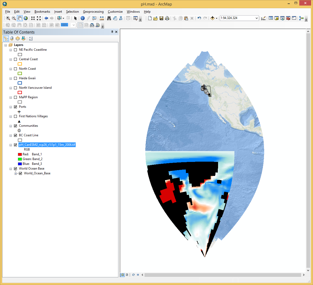
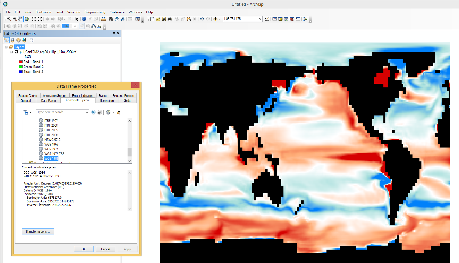
My map is in NAD1983 UTM Zone 9N. I am importing a raster that (when opened on it's own) looks fine and is in WGS84. When I add the raster to my map, it projects incorrectly. Any suggestions on how to start resolving this would be greatly appreciated. The raster was exported from Q.
- Mark as New
- Bookmark
- Subscribe
- Mute
- Subscribe to RSS Feed
- Permalink
So to 'fix' this, you need to know the real world extent of your input file in longitude/latitude coordinates.
The coordinate definition of WGS84 is wrong since the raw row/column format has to be translated
row/col long/lat
0,0 -180, 90
0, 192 180, 90
128, 96 0, 0 Greenwich, Equator
192, 0 -180, -90
192, 256 180, -90
so you have a cell size in the long/lat (ie X,Y) directions
I assume Q can't finish the provision of real world coordinates.
- Mark as New
- Bookmark
- Subscribe
- Mute
- Subscribe to RSS Feed
- Permalink
Luckily, my input is the entire earth surface with the western edge being at Greenwich. Do you know if there is a way to define this in ArcGIS without having to register points?
- Mark as New
- Bookmark
- Subscribe
- Mute
- Subscribe to RSS Feed
- Permalink
I'm also going to try to georeference in Q and then try Arc when I am back in the office tomorrow. Thanks again for your help.
- Mark as New
- Bookmark
- Subscribe
- Mute
- Subscribe to RSS Feed
- Permalink
I have the same issue. I know the real world extent of the file, how to update it?
- Mark as New
- Bookmark
- Subscribe
- Mute
- Subscribe to RSS Feed
- Permalink
That was actually my comment and should have had a "not" in there: ...the raster extents are not in decimal degrees...
- « Previous
-
- 1
- 2
- Next »
- « Previous
-
- 1
- 2
- Next »