Conservation GIS - Page 3

cancel
Showing results for 
Show  only  | Search instead for 
Did you mean: 

Latest Activity

(26 Posts)
by Anonymous User
Not applicable

!Hi all, we hope this will be a useful resource for gis technology notes of use to conservationists.  It is now part of the new "Conservation GIS" geonet community site.  This resource is planned to supplement the already great & growing technical exchanges useful for conservation GIS that happen on the SCGIS Listserver, the SCGIS Members Discussion Section, the Conservation GIS website, and several other more specialized support resources outlined in the list below:

-SCGIS LISTSERVER: free open access globally, email only,  text only, 5,000 members, text digest available

-SCGIS Discussions: On scgis.org, for SCGIS members only (membership is simple and cheap),  receives full SCGIS EMAIL LISTSERVER feed.

-Conservation GIS: Plain html website.  No interactive discussions but hosts number of multimedia tutorials & all video material & proceedings from SCGIS Conferences.  Important materials and future conservation publications will be relocated to the new GEONET Conservation GIS Community site.

-esri conservation program ArcGIS Online organization. 100 named publishers, easy to join, thousands of hosted data items, almost 100 specialist data sharing groups, growing list of open data portals.

-esri Github portal: (130 members, tons of python and javascript,  esri geoportal server open source )

-esri developer summit tech videos (31 videos covering many current topics in stats, open data, big data, 3D, API's, web)  (Note also that SCGIS members have access to the COMPLETE set of Esri Conference Technical Videos.)

-gis Stackexchange (hundreds of contributors)

-arcScripts: old-timers  remember how great this resource was before it was mothballed in 2010. Thanks to popular demand it has just been re-engineered and resurrected!

This new Geonet "Conservation GIS" section is anticipated to help provide more direct access to esri technical discussions, especially regarding mobile and offline field  technologies, as well as  a more collaborative platform for asking esri technical questions and finding technical resources relevant to conservation GIS problems.

Upcoming technology articles planned are:

  1. Current review of best laptop/field hardware for running ArcPro

  2. Step-by-step instructions for setting up and open source PostgreSQL rdbms for ArcGIS Server, for increased

     speed and capacity

  3. Easy conversion of your webmaps and storymaps to more secure https based services

  4. Setting up and running a combined GIS website and ArcGIS Server instance on a single moderate-cost Amazon machine.

There is also currently a Google Docs site being developed for SCGIS articles, guidebooks, info and resources.

Worth listing as well, are some of the active SCGIS social media groups and resources, including

- SCGIS main facebook page (475 members)

- SCGIS main linkedin page (2,505 members)

1. SCGIS Global Scholars (Facebook: 63 members, former scholars and friends)

2. SCGIS Scholars 2015 (Facebook: 26 members and friends)

3. SCGIS Scholars 2014  (Facebook: 30 members & friends)

4. SCGIS Scholars 2012

5. SCGIS 2011

6. SCGIS Zambia Chapter (Facebook: 41 members)

7. SCGIS Washington DC Chapter (google groups)

8. SCGIS Latin America super-chapter (google groups)

9. SCGIS Kenya listserver

more
3 0 2,021
by Anonymous User
Not applicable

From the Consciente storymap "Pay or Die"

I've been working on our new "Mapping for Advocacy" theme page, after I helped organize the 2018 SCGIS plenary event of the same name.  I hope to include storymap examples I find that have particularly strong narratives and techniques that conservationists can learn from to make their own stories more impactful.   Today's find is from the 2018 Esri "Storytelling with Maps" contest.   First place winner in the "Culture, History & Events" category was a storymap called "Pay or Die" from the El Salvadorean volunteer NGO Consciente.    My favorite quotes from this story:

During the last two decades, the Central-American country of El Salvador has become the deadliest region in the world that is not at war.”  

"This Storymap has told one story in two ways, backed by background and history, showing that both context and different perspectives on this problem matter if we are to understand and tackle it.

We should no longer only see one side of the story.

We should no longer think that what is far away doesn't concern us. Looking at the history reveals that often Western countries helped to create those problems in the first place."

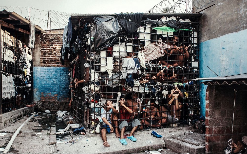
The structure of the storymap was to introduce the problem from a sequence of perspectives, that began with an alarming but not unfamiliar statement about global murder rates,  which then led to some surprising connections and relationships.  This approach worked very well in the call to action, namely that solving problems requires understanding them, and understanding requires one to look for the other viewpoints and never assume that what is far away is not related.  This is a good technique to make conservation stories more powerful, by including human aspects of rural community life that are affected by that natural environment,  and including effects and impacts from distant countries in your narrative.  Both are ways to build a connection to your issue, via the human interest angle, and via the notion that no one is so distant from your issue that they cannot do something about it right where they are.  The photos and images they used were similarly surprising and challenging, such as the one above showing the living conditions of young men jailed on suspicion of gang activity.  It's such a striking image that it took time for my mind to comprehend what my eye was seeing, and for that reason I'll never forget it.  This is a good example of a storymap that changed me, changed how I think about El Salvador, about immigration, and about the importance of objective, professional journalism. 

regards, charles convis

more
0 0 419
by Anonymous User
Not applicable

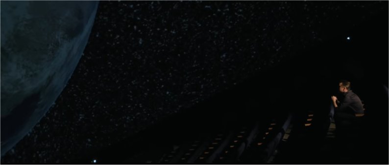
"Let Science Speak" is a new series of short films and podcasts about science advocacy. This campaign was created and led by an experienced team of filmmakers and producers who, in their own words, are fighting the "escalating efforts to suppress environmental science and silence scientists". "Our mission is to inform, engage, and unite America in the face of science censorship.” (Photo Above, Dr. John Foley, of the Calif Academy of Sciences, talks about the importance of sharing science stories)

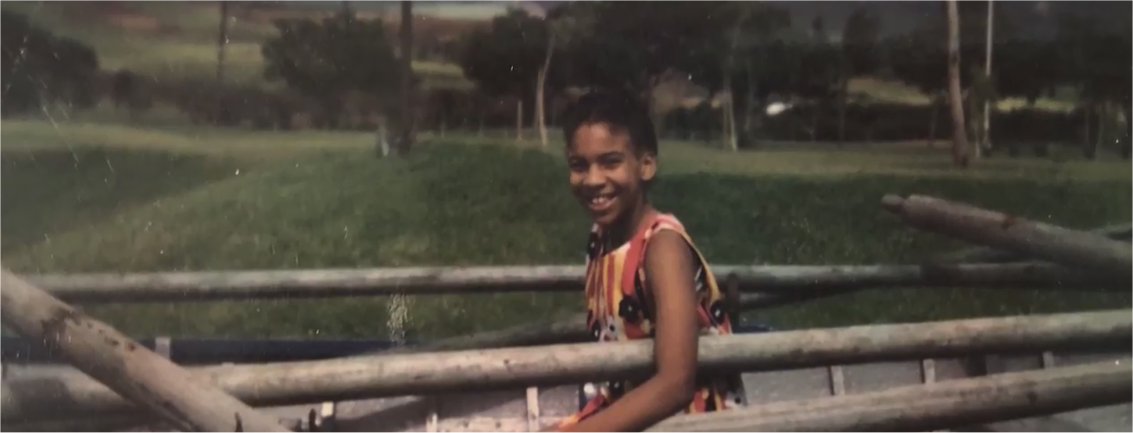
   Over on my new Maps for Advocacy page, I've created a carousel of these 6 wonderful films, with a bit of commentary on each one.  What is especially memorable to me is how each of these short films illustrates with power the fundamental concepts of successful advocacy communication, from story cycles of tragedy and reconciliation to accounts of childhood inspiration, struggle, connection and love.  Not surprisingly, Esri's own chief scientist Dr. Dawn Wright was included as one of the 6 featured scientists (pictured below as she talked about her first passion for the ocean while growing up in Hawaii)

more
0 0 344
by Anonymous User
Not applicable

This is the result of decades of work by the California Native Plant Society and Calif State Dept of Fish & Wildlife working in collaboration to create a highly detailed ecological vegetation basemap for the state of California, built on the "national vegetation classification standard" first created for the Esri/TNC/Univ Calif national parks ecological mapping project of the 1990's

more
0 0 181
RaquelPerez
Esri Contributor

Defending Elephants in Africa: Garamba National Park Combats Poaching with Technology, New Tools

Garamba National Park sits at the center of a zone of human conflict that spans decades. Dwindling numbers of animals and increasing sophistication of poachers has led to a conservation fight that has been forced to professionalize.

Armed groups involved in various conflicts in the Congo and neighboring South Sudan have decimated the park’s wildlife. By the early 2000s, these groups had killed the last northern white rhino in Garamba and other animals suffered severe losses. Less than a tenth of the elephants remain from the numbers recorded in the 1970s.

“Conflict exacerbates the difficulty and challenges of managing a protected area,” Naftali Honig, Anti-Poaching Information Coordinator for the African Parks Network and National Geographic Explorer, said. “These armed groups travel as much as a thousand kilometers to hunt the elephants in our park. We use GIS (geographic information systems) to analyze how they get here.”

With GIS, African Parks can analyze and monitor:

  • The movement of 50 elephants that have telemetric collars that allow rangers to track their location
  • The seasonal movements of pastoralists in the region
  • How patterns of wildfire are changing at a regional scale
  • Where trail systems are expanding
Read more on this CRUCIAL conservation effort now
You can also view the documentary The Protectors, Walk in the Ranger's Shoes now for a front-line perspective.

#Conservation #SaveTheElephants #Nonprofit #Global #Conflict #GIS 

more
1 0 287
by Anonymous User
Not applicable

more testing 

SCGIS 2017 WWF-Education for Nature Page (2017 main)

dSince 1994, the World Wildlife Fund - Russel E. Train Education for Nature program has providedhttp://www.conservationgis.org/scgis/2009/aasociety.htmlhttp://www.conservationgis.org/scgis/2009/aasociety.html scholarships for conservation training and education to 2,340 grantees from a long list of countries representing the "global south", where biodiversity issues are most pressing and capacity generally least available. Scgis has had a long history of support from EFN, dating back to 2003 when Nasser Olwero of Kenya and Aldo Farias of Chile and Patricio Pliscoff were first supported to become part of the SCGIS scholars program.

EFN and the SCGIS Scholarship Program share many common values, from the belief in the power of a single committed individual to change their country's conservation landscape, to the responsibility of professionals in countries with resources to give back and help mentor their colleagues in countries with limited access. 2017 marks the beginning of a closer relationship, with changes in SCGIS deadlines to permit more scholars to apply to EFN and providing more support resources to help scholars and chapters take advantage of their programs. The current list of countries in the global south eligible for EFN support is provided at the right. Scholars from these countries are eligible for EFN funding that will provide full support

more
0 0 195
11 Subscribers