Conservation GIS

cancel
Showing results for 
Show  only  | Search instead for 
Did you mean: 

Latest Activity

(26 Posts)
by Anonymous User
Not applicable

Why should GIS matter to Queer people? For the last two decades, cartographers, geographers, and scholars have been exploring the semantics of queer geography, an integrative approach to queer theory and spatial analytics that examines the social relationships of sexuality, place, and space.

Read more...

more
3 0 3,999
by Anonymous User
Not applicable

Tendai “Tee” Anna Nekatambe, Head Of Dept of Wildlife Management, Don Bosco Tech College,  Zimbabwe

Read more...

more
0 0 814
by Anonymous User
Not applicable

Oksana Savenko, Research scientist  Ukrainian Scientific Center of Ecology of the Sea (UkrSCES)

Read more...

more
0 0 776
by Anonymous User
Not applicable

Agnese Mancini,  Turtlewatch Egypt

Read more...

more
0 0 517
by Anonymous User
Not applicable

Navigation:  2018 Scholar Project    ReferenceProject   CommunitiesPage   ConservationGIS  Scgis.org

Maria Fernanda Gonzalez Perez, Monitoring & Evaluation Officer World Wildlife Fund Ecuador

World Wildlife Fund WWF Ecuador

Orellana Avenue E11-28 and Coruña Avenue, Orellana Building, office #701. Quito - Ecuador

Tel: +593 (2) 223 9181 /+593 (2) 252 0955

*-Main email:  Fernanda.Gonzalez-intern@wwfus.org     Skype: fernandagonzalez551        

http://www.wwf.org.ec/wwf_/conoce_al_equipo/


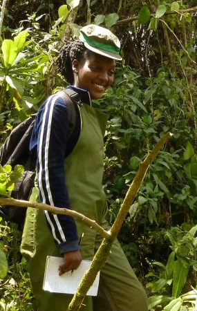
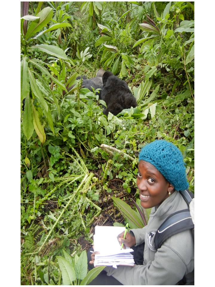
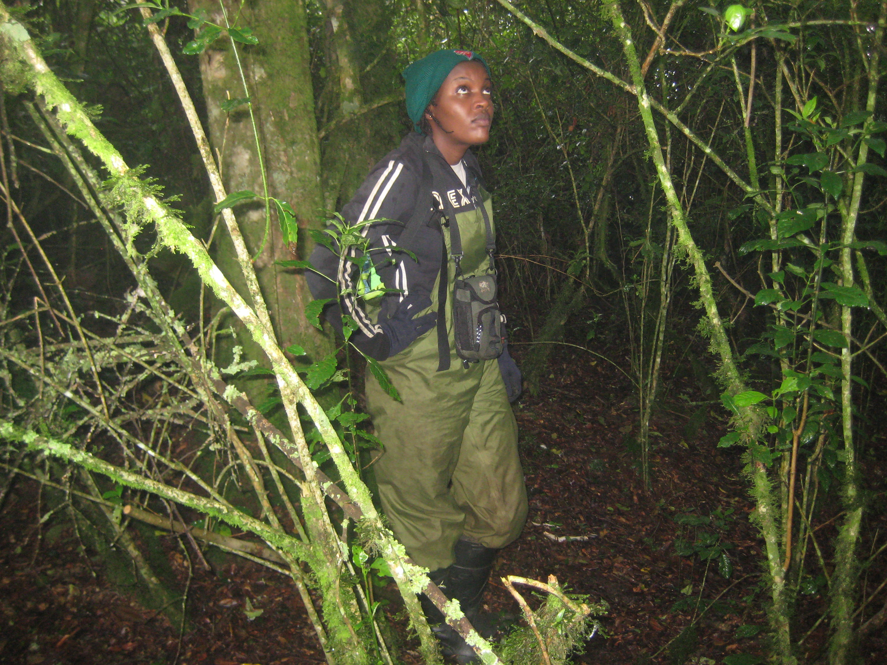
My name is Fernanda Gonzalez and I am a Humphrey Fellow for the 2017-2018 academic year. The Fellows program is a U.S. State Department program, which provides mid-career professionals with a non-degree program combining academic and professional experiences directly related to their professional responsibilities in their countries.  For several years, I have work closely with GIS experts to take decisions about natural resources management and project management.


I am a biologist with a Master of Science degree in Natural Resources Management from the Tropical Agricultural Research and Higher Education Center (CATIE). I have worked for seven years in both public and private organizations, researching a variety of areas including marine fauna conservation; freshwater biomonitoring; integrated watershed management; water for human consumption; and environmental education. 


In 2015, I joined the WWF- Ecuador as a Monitoring & Evaluation Officer.  During that time, I developed an integrated system to effectively track the results of different projects. My other principal responsibilities were reporting to donors; helping write proposals using the Open Standards methodology; evaluating the efficiency of the implementation of projects and building connections between the WWF in Ecuador and other such offices around the world.


During my fellowship year with the Humphrey Program, I will be taking some academic courses at the University of California, Davis, my host academic institution.  My main focus will be improving my M&E, not only those related to project management (design, budgeting and implementation), but also the expertise required to evaluate the impact of the conservation projects in the nature and in the people (local communities) related to it using GIS. Therefore, I am also interested in improving my GIS skills.


For the reasons mentioned above, I consider the GIS training a a great opportunity for me to learn more about different ways to incorporate GIS as a key decision tool in the conservation area, implement this knowledge when I go back to Ecuador. 


What is the history of your work in conservation and GIS? I have five years of experience in researching a variety of areas including marine fauna conservation, tourism, the freshwater biomonitoring with macroinvertebrates and water quality, watershed management, climate change, water for human consumption, and environmental education.


I am biologist with a Master of Science degree in Natural Resources Management from the Tropical Agricultural Research and Higher Education Center, Costa Rica. I have worked in both public and private organizations researching a variety of areas that are part of my professional interest including marine fauna conservation, tourism, the freshwater biomonitoring with macroinvertebrates and water quality, watershed management, water for human consumption, and environmental education. 


Although I have not worked directly manipulating the tool, the fact of knowing its importance and its capabilities/applications allowed me to be involved in the different GIS processes during my work experience.  Additionally, because of my work experience in natural resource management, I have always been related to GIS and GIS experts.


After my master's degree, I worked on the largest hydroelectric project in Ecuador, Coca Codo Sinclair, and I managed the hiring of a GIS expert for the team that I supervised. In this team, conformed by five professionals, we developed a management plan for the watershed. One of the components of the Plan was the identification of vulnerable areas (either by erosion, water generation, social factors) for conservation interventions (reforestation, agroforestry practices, protection of water sources, etc.). I worked hand in hand with the GIS expert to determine the factors and indicators that were included to build the vulnerability maps that he generated. Additionally, through one of his GIS works (water availability modelling using WEAP), the soil cover that produced more water was determined (forest and moor), as conservation practitioners, this result was fundamental to give us support for the measures we wanted to implement.


During my work at WWF Ecuador, a GIS expert was hired a year ago. Currently, He is still only working making simple maps for the locations of the projects of the Organization. In the last months, knowing the capabilities of GIS tools and as a M&E Officer, before I came to be part of the Humphrey Program, I initiate conversations with him to work together regarding the possibilities to evaluate the impact of the conservation efforts of WWF Ecuador using GIS.  In the future, I am interested in taking up this issue and work together in the evaluation of the impact of WWF Ecuador's conservation projects, and the general impact of the Organization through the indicators of the strategic planning goals.


History of your work with SCGIS or other conservation GIS: I have heard of SCGIS but I not been active in Ecuador since GIS has not yet been my focus.  However; I know Karen Beardsley and she has introduced me to SCGIS and let me know about the opportunities.  And through my work with WWF-Ecuador, my plan is to become involved with a local chapter upon your return after the Humphrey program year ends.


Work in  teaching & leadership   Early in my life, I discovered that one way to accomplish my dreams was studying.  Currently, for millions of people, to have the opportunity to share a classroom and learn not only from the lectures but also from the classmates, the professors and the education system is a privilege that not many people can have. Studying is not only important to develop a career and improve their living conditions, that of their families and society in general. 

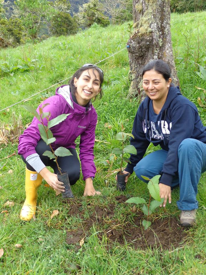
Study is always good, but sharing your studies with people from other countries is even better. Because of my career (Biology), I always have been involved with multicultural and international classmates and professors. During my master in Natural Resources Management (Costa Rica), I also had the opportunity to meet people from different backgrounds, that changed my perspective of things in several ways.  When I finished my master, I felt different, I had more empathy for others and, most important, I became a better person professionally and personally. After this process I wanted to keep working with nature but also with people and try to improve their live conditions if possible.

I can humbly mention that I consider myself a leader. One of my personal life missions, that was even stronger after my studies in Costa Rica, is to encourage and motivate people, to make them feel how important role their play in the society (no matter the place: family, classroom, workplace).  

I have not been a teacher of GIS; however, after my graduation as Biologist, I spent some time in a University in Quito (Ecuador) where I was teaching for one semester natural resources management with emphasis in fresh water ecosystems.  I also have been involved in environmental educational campaigns for different audiences, so I am familiar with education system and its important to create a better world for everyone.


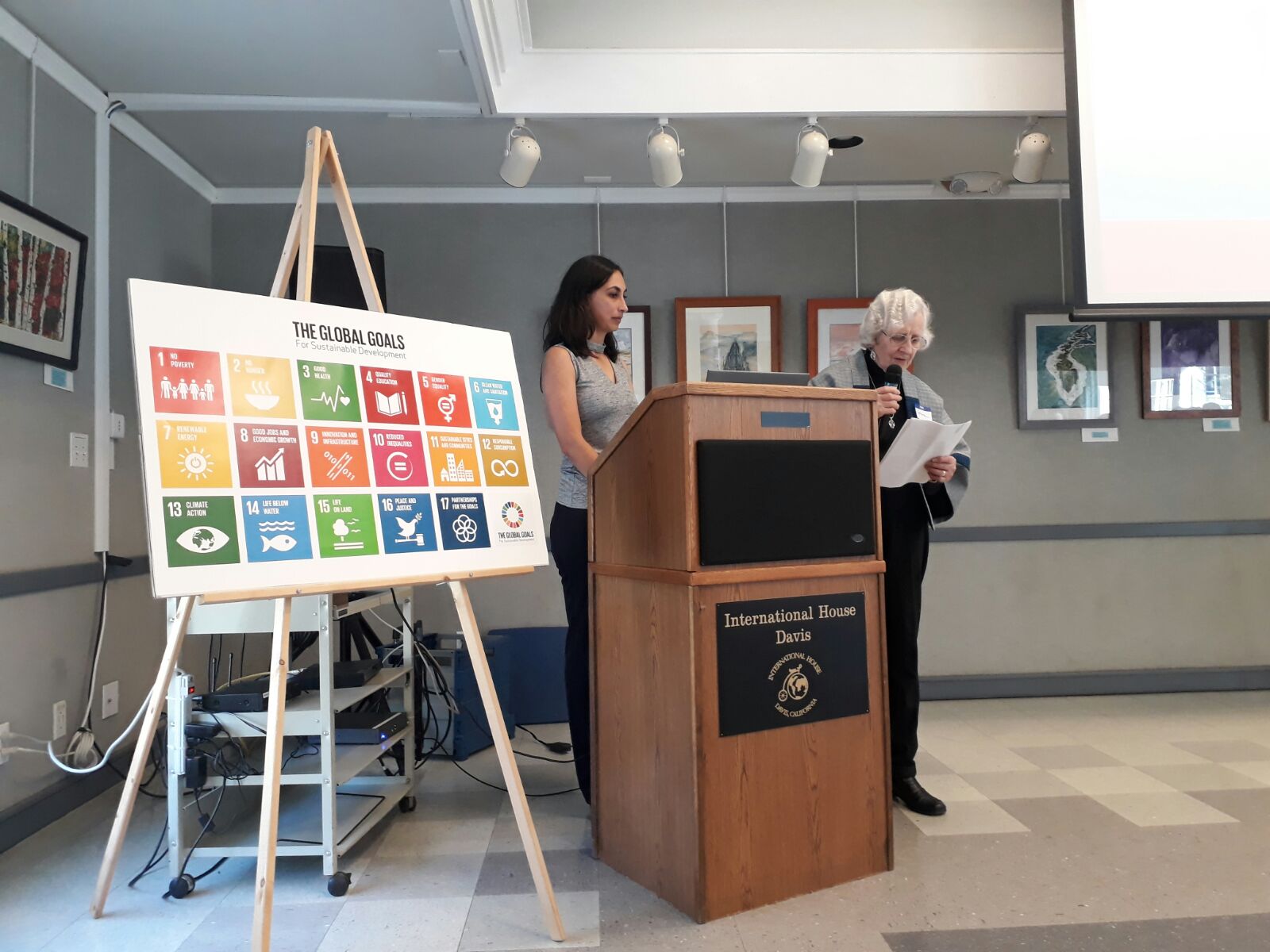
   During my Humphrey Fellowship Program in USA, in UC Davis, I also put together a simple proposal for an environmental sociologist professor how to teach classes with interactive and practical exercises in a learning by doing process using a methodology I learned in Ecuador.  Additionally, I had the opportunity to give a speech in Sacramento Community College and in the University.  The speeches were attended by students and staff of the institutions. It was such a nice opportunity to talk about my researches, work experiences and studies. It was very gratifying to find that the conference was well received, and that people felt inspired to continue their participation as staff in the College - University or, for the case of the students, to keep studying and be engaged with the Education System.


*-ORGANIZATION’S WORK: Please describe the work that your current organization does:


World Wildlife Fund (WWF) is one of the largest and most respected conservation organizations in the world. It has more than fifty years of experience. It works in more than one hundred countries and is supported by more than one million members worldwide. Its mission is to stop the degradation of the natural environment of the planet to build a future in which people live in harmony with nature. In this sense, WWF recognizes the high relevance of participatory work in conjunction with local populations, poverty and consumption patterns linked to its mission.


Aligned to the structure of the WWF Global Network and its Practices, WWF Ecuador has six Thematic Areas of Work: Fisheries, Human Footprint and Sustainable Cities, Communications, Forests and Freshwater, Ecotourism, and Oceans and Coasts. The technical thematic areas work in coordination with Communications, Planning and Financing, and Financial Administration and Operations.  In Ecuador, WWF works in four geographic regions of the country, the marine-coastal region and the Galapagos, the Choco (coast), the Andes and the Amazon. Its base office is located in Quito, although it also has a field office in the Galapagos.


WWF is a non-profit, non-governmental organization and its WWF fundraising strategy involves several sectors. Varieties of contributions range from contributions and grant agreements, fundraising campaigns, government grants. At the level of multilateral financing, WWF, in addition to the GEF funds, has experience working with the IDB, the World Bank, CAF, the United Nations System, GCF funds, among others.  With the money fundraised, WWF implements directly or indirectly (through local partners – grassroot organizations) projects to conserve nature and improve livelihood conditions of communities.


One of the main strengths of WWF at the global level and WWF Ecuador is its technical capacity. WWF Ecuador has competent, motivated and committed employees. In addition to the technical capacity, the Country Program has timely and efficient administrative and logistical services. As a Program, WWF Ecuador has 30 people as staff working full time in different areas.


Here are some features that add value to the Organization:

WWF is an organization that has a Global Network of offices and programs, which gives it an advantage by being able to connect the global with the local to work transversally in countries and cultures and with technical support from the different offices.

Strategic planning completed in 2017 with thematic areas and established impact goals. In addition to this planning, WWF Ecuador has a comprehensive robust monitoring and evaluation system and multi-thematic area that allows the efficient monitoring of projects (products, activities), the healthy relationship with donors, clear accountability and efficient execution of funds.

WWF Ecuador has a multidisciplinary, scientific and high technical capacity group, which is also supported by the planning, finance and administrative area.

Through its years of experience in Ecuador (since 1962) and in the world (since1960), WWF has knowledge of Ecuadorian territory and society, which facilitates interventions, participatory work and the empowerment of different interventions.

The presence in the different geographical regions generates a high scope and greater impact.

Due to its different thematic areas, WWF Ecuador has the capacity to carry out multidimensional interventions by comprehensively addressing conservation processes that are increasingly complex and require an approach through different perspectives.


Within WWF, I am biologist with a Master of Science degree in Natural Resources Management from the Tropical Agricultural Research and Higher Education Center, Costa Rica. I have worked in both public and private organizations researching a variety of areas that are part of my professional interest including marine fauna conservation, tourism, the freshwater biomonitoring with macroinvertebrates and water quality, watershed management, water for human consumption, and environmental education. 


In 2015, I joined the World Wildlife Foundation (WWF) as an Monitoring & Evaluation (M&E) Officer.  During that time, I developed an integrated system to effectively track the results of different projects. My other responsibilities were reporting to donors; helping write proposals; evaluating the efficiency of the implementation of projects and building connections between the WWF in Ecuador and other such offices around the world.


During my fellowship year with the Humphrey Program, I am interested in improving my M&E skills, not only from the project management perspective, but also learning how to evaluate the impact of conservation projects on nature and people.  It is my interest also to learn how to evaluate the impact of the Conservation Organization through: a) its goals of the strategic planning, and b) the proper measure of impact indicators of the projects executed; in both cases, GIS is a very useful tool.  Finally, I would like to learn more about climate change in terms of adaptation, resilience and mitigation, and how complex conservation problems can be addressed through a multidisciplinary and team work approach.


Specific responsibilities as a Monitoring and Evaluation Officer in WWF Ecuador:


Designed and implemented the M&E system of the Annual Operational Plan containing different conservation projects of the WWF within the areas of Fisheries, Forest & Freshwater, Ecotourism, Human Footprint and Sustainable Cities, Oceans & Coasts (mainstreaming axes: Climate Change and Gender).

Planned conservation projects, monitored activities and results and evaluated impact indicators.

Support to the design of the Strategic Plan of the Organization.

Responsible to report to the Ecuadorian government of all the interventions of the Organization.

Co-authored proposals and reports written to donors and the government of Ecuador.

Translated technical, administrative and legal documents.

Managed Disaster Assistance Program, working with communities affected by the April 2016 earthquake.

Made presentations on environmental topics and on-going projects of the WWF.

Provided technical support, including facilitation, for workshops and meetings.


During my Humphrey Fellowship Program, I am part of WWF-USA as a professional intern.  My principal roles during this time are:


Improving in the design, monitoring and evaluation of Green Climate Funds (GCF), Global Environmental Facility (GEF), and US government funded projects.

Capacity building regarding Climate Change, M&E and project design using the Project and Programme Conservation Standards (PPMS) in Latin American countries, like WWF Ecuador as a pilot process.  Regarding M&E, my role will be to work together with WWF Ecuador in the evaluation of the impact of the Organization using the goals of the Strategic Plan (some of them linked with GIS), and the impact indicators of the different conservation projects executed.

Improve the design of PPMS workshop for technicians that design and implement projects in WWF taking into consideration previous experiences and lessons learned.


what is the most unique and the most challenging about the conservation/GIS work that you do?   There is not a single ecosystem that has not been affected and that is not threaten by Climate Change and the over exploitation of Natural Resources.  Oceans, freshwater, forest, estuaries are facing the effects of this phenomenon, several species are currently in danger.  Humans are not either an exception of the consequences of it, there are several threats linked to it. Floods, extreme precipitation, drought and desertification are some examples that humans nowadays are dealing which create huge challenge regarding development, food security, access to water, among others.  Humans depend on natural resources and its ecosystem services to survive. However, due to complex causes, human has been modifying the planet in a rate not seen before. 


As Ecuadorian, I am proud to say that my country has one of the highest levels of biodiversity in the planet per meter square. Thanks to its location in the center of the world, Ecuador concentrates in a small territory the diversity of the planet, which is conjugated in the Andes, coasts, Amazon and the unique Galapagos islands.  Besides of its richness in the natural capital, we face complex environmental and social problems like mining in vulnerable/sensitive areas, overfishing, deforestation, change of land use caused by agriculture, poverty, lack of basic services, among others.


Ecuador is highly dependent on exports, mostly raw materials and commodities. The current year, 2017, has been difficult for the country because of the dollar appreciation and the Niño Costero phenomenon.  The Niño Costero caused some human casualties and the floods affected agricultural production and infrastructure.   Additionally, Ecuadorians during this year had to cope with the consequences of the last earthquake of April 2016.


All the considerations mentioned above are the ones that lead me to study and get involved in the process of natural resources management.  One the principal things that I have faced in Ecuador is the lack of governance and capacities in the in the Institutions.  Sometimes it is not the lack of technical solutions to improve the social an environmental condition of a place, it is more about the lack of: a) coordination between the stakeholders, b) technical capacities of the institutions, c) proper fundraising, d) participatory processes, e) clear roles and responsabilities between the parties, of among others (factors that are part of a good governance).


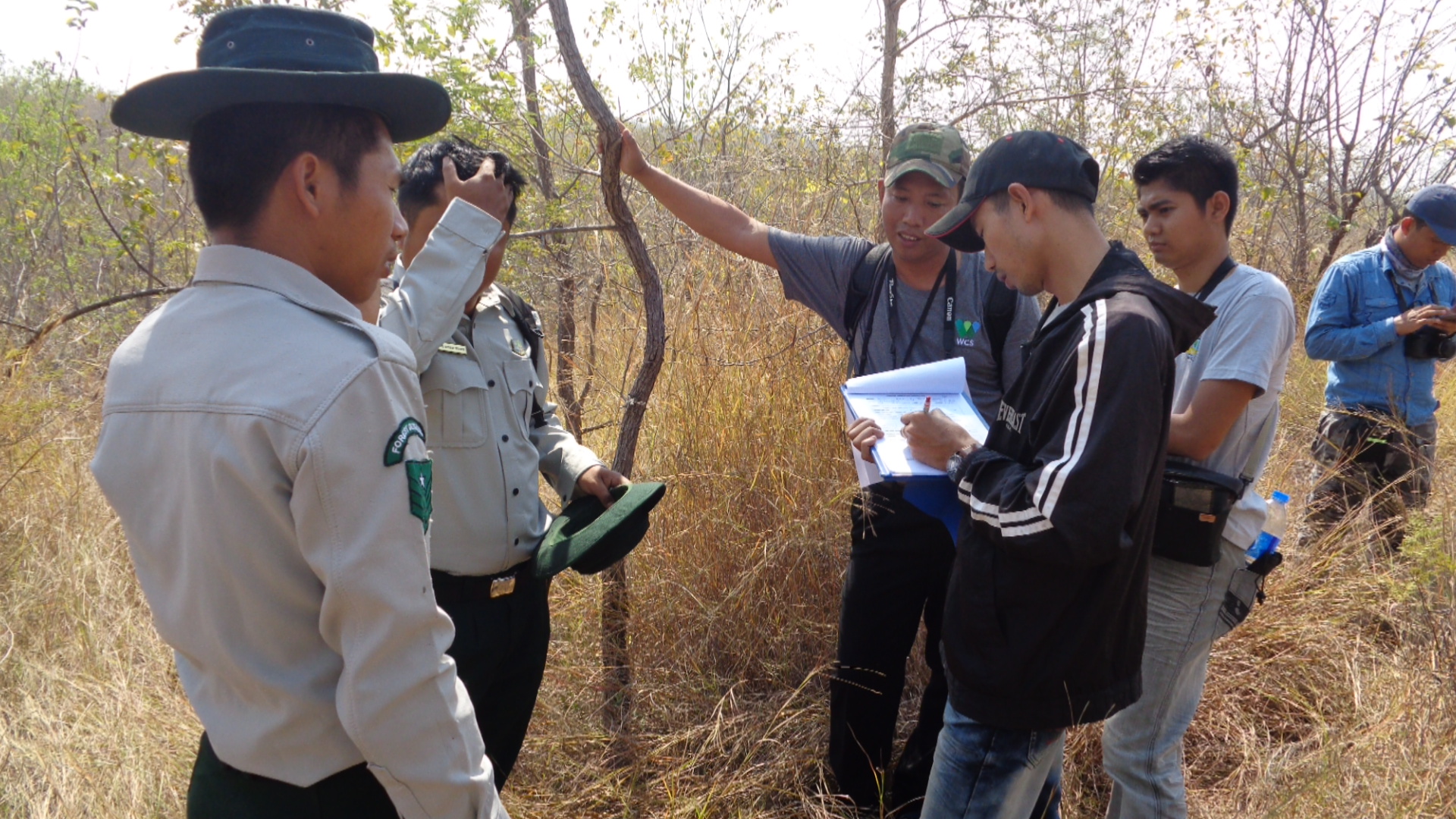
The same mentioned above happen with GIS in Ecuador. Despite its potential, the institutions I have been involved as professional, used to use GIS just to create simple maps to identify points in polygons. Additionally, for a lot of institutions, specially in rural areas, the familiarly of GIS is almost null, so there is an urgency of create capacities regarding GIS there too.  Therefore, I always worked closely with GIS experts and use the tool as a decision making tool and as research tool during the process management of natural resources.


2018  Title/Abstract of the paper you will present:

“GIS: A decision-making tool during the process of adaptive management of the Strategic Plan (2016-2025) of WWF Ecuador”

    The Strategic Plan of WWF Ecuador is a road map document where the mission, the different thematic areas and interventions of the Organization, for the next 8 years, were setting up. This document represents a big effort to improve the planning.  The Plan is a key piece to find partners with the same areas of interest, to help the fundraise perspective of the organization, to describe the thematic areas and geographic scope of interventions, but fundamentally, it will be the base of the evaluation of the different interventions of the Organization. 

    During the process of evaluation, indicators were created for the different impact goals of the Plan.  Some of the indicators were identified to be measured using GIS.  After the process of selecting the indicators linked with GIS, a methodology of measure was designed (baseline, creation of maps, timeframe, among others) . It is planned that after the baseline, the first evaluation of the Plan is going to be executed during 2020.

xResources  xWater  xReforestation xPlan  x2018Scholar x2018Talk  xScholar xTalk xWomen xLatinx xEcuador xLatinAmerica

more
1 0 866
by Anonymous User
Not applicable

Navigation:  2018 Scholar Project    ReferenceProject   CommunitiesPage   ConservationGIS  Scgis.org

Enathe Hasabwamariya, Student,  Antioch University USA/ Rwanda


<--PDF  Enathe 2018 Conference Talk MP4-->

 "About 60% of the world’s 660 primate taxa are threatened with extinction…Nyungwe National Park, a tropical montane forest in Rwanda, has a population of chimpanzees that face several threats, including bushmeat hunting, human wildlife conflict, and habitat degradation from forest fires and human encroachment….Preliminary results have shown that chimpanzees used areas adjacent to forest edges more than forest interior"


<-- Enathe Says "Hello" and talks about her work in GIS for Chimpanzee Conservation.

2018 Scholarship Program Storymap -->

 to analyze the distribution patterns of chimps in relation to park border regions of Nyungwe National Park, Rwanda (requires scgis membership)

<- 2018 Scholar Interview on her discovery of GIS, Primatology, the changes in Rwanda’ following the genocide, and the importance of GIS and communities of sharing like SCGIS in supporting these priorities.

2018 Conference Interview ---------> on how the Rwandan Genocide changed national feelings about wilderness

Enathe Hasabwamariya, Antioch University New England / Rwanda    

Antioch University New England

40 Avon Street

Keene, NH 03431

website:  www.antioch.edu

your email:   ehasabwamariya@antioch.edu    or   hassenny@gmail.com

Skype: enathe.hasabwe    Facebook: Hasabwe Enathe      WhatsApp: +250787254046

 (Scgis Years: yr18 )

   My interest in community leadership started when I was very young, at age 6, when I was living in an orphanage center with 300 kids, all survivors of the Rwandan Genocide, and I was in charge of all kids under 5. In this role, I helped them learn and practice their poetry, dances and other daily activities. During college, I was a class representative for four years. With my colleagues, we started a University of Rwanda Girls Leaders Forum (UR-GLF), where I was in charge of advocacy for girls on campus. In this position, I helped the counselling team by mentoring girls who had problems on campus, such as financial and social problems. Especially, we helped girls who had unwanted pregnancies on campus to get some financial and mental help.   My interest in conservation comes from growing up around Nyungwe National Park in Rwanda.  My main concerns were about the interaction between human and wildlife, which pushed me to study biology and conservation.     In 2014, I joined the Global Youth Biodiversity Network, a group of young people working with the UN/ Convention on Biological Diversity to advocate for Biodiversity. In this network we attend several UN meetings on Biodiversity, to represent young people from different countries. Currently, I am a focal point to the Global Youth Biodiversity Network in Rwanda.  During my Master’s degree at Antioch, for a period of one year, I served as a student representative in the Environmental Studies Department, where I attended monthly faculty meetings. I also organized several social events to connect students with faculty members. 


photo: Tracking Chimpanzees

The most unique thing about my conservation work is that I am one of the fewest Rwandan professional primatologists in Rwanda. Rwanda is a very rich in different primate species, however there is a lack of primate research taking place in the country. This makes it challenging for students who are interested in studying primate conservation. Rwanda is a small landlocked country, with a very high population density (400-1000people/km2). It is home to a lot of biodiversity, including the endangered mountain gorillas and chimpanzees. In my work the most challenging thing, is the lack of trainings in conservation GIS, and the lack of data, including primate research data and GIS data. The local University doesn’t have enough capacity to train teachers and students about conservation GIS.  As a primatologist, I am a member of the African Primatological Consortium for Conservation (APCC), which has given me opportunities to attend several meetings and trainings on primate’s conservation, including the use of SMART/CyberTracker and GPS data collection, basic GIS and other new technologies used in conservation. I also serve as a member of the Primate Specialist Group/Africa Section, of the IUCN Species Specialist Group (2016-2020).


photo: studying mountain gorillas

  Nowadays the work of conservation requires a lot of technical skills including GIS and Remote Sensing.      For example, during my current project, GIS analysis helps me to develop land use/ land cover base maps and statistics to determine cover type and matrix surrounding Nyungwe Forest. Rwandan conservationists need GIS skills to understand land use related problems and human-wildlife conflicts. However, there is a lack of effective training for young Rwandan conservationists, lack of funding to attend different trainings. Trained GIS experts can help park managers and different policy makers to make effective decision regarding land use management and biodiversity conservation.   Through SCGIS, I am really excited to potentially take part in a range of conservation GIS trainings both at Esri and at the University of California, Davis, and to attend my first GIS conferences. I have heard about both the Esri and the SCGIS conferences and they sound like amazing experiences to meet other people who are working in my field of conservation and to build my technical GIS skills. This training will help me to improve my skills in GIS and help me finish my project on chimpanzee conservation and land use planning around Nyungwe National Park, Rwanda.     That is why I am applying for the SCGIS scholarship, to attend the Specialized SCGIS training at University of California-Davis, to attend the Esri trainings, to attend for the first time ever the Esri International User’s Conference and the SCGIS Conference. This is an incredible opportunity for me.  This training will help me to improve my skills in GIS and help me finish my Master’s project on chimpanzee conservation and land use planning around Nyungwe National Park, Rwanda. This training is a great opportunity for me, since I want to develop my career in conservation and apply GIS as a tool to help increase our knowledge of biodiversity hotspots and impacts of land cover and land use change on wildlife habitats. 


History:  My first introduction to GIS was during college at the University of Rwanda, where I took a class on introduction to GIS. Since then, I became very interested after learning its application and value to conservation biology. In 2012, I started using GIS, working with the International Gorilla Conservation Program, on a water use survey project in collaboration with local communities living around protected areas in Virunga massif, Rwanda. I collected GPS points of every household I surveyed and the location of water sources both inside and outside the park. In 2014, I worked with the Wildlife Conservation Society (WCS-Rwanda) on a chimpanzee habituation project for tourism in Nyungwe National Park, Rwanda. In 2015, I used GIS for a fisheries project, where I helped map all the lakes in Akagera National Park in order to study fish biodiversity in those lakes. Currently, I am using GIS in my Master’s project to understand the ranging patterns of chimpanzees in relation to forest edges and human activities in Nyungwe National Park, Rwanda.


About your home:  Rwanda is a very small landlocked country with a very high population density in Africa. The country’s biodiversity is mostly found inside protected areas, which are all surrounded by a very high human population (between 400-1000hab/1km2) whose survival rely on forest resources. This high density increases the pressure on the park and wildlife inside the park, including the endangered chimpanzees. Similar to other natural forests fragments surrounded by different land use types, NNP is subject to edge effects of differing extent and magnitude, dependent on shape, size, aspect and edge contrast (type of surrounding land use). During my research in Nyungwe, chimpanzees were found using areas adjacent to humans, destroying beehives in the search for honey. GIS skills help to understand the land use changes and its impact on biodiversity conservation. However, the lack of trained GIS experts is a challenge to conservation in many developing countries.


About your organization:  Antioch University New England, is one of the five campuses of Antioch University, founded in 1964. It is one of the first University to have an interdisciplinary program in Environmental Studies. The mission of Antioch University is to offer learners transformative education in a global context that fosters innovation and inspires social action.  I am currently finishing Masters student in Environmental Studies program, Conservation Biology Concentration at Antioch University New England.


Local SCGIS work: I am new to the SCGIS, the first time I heard about it was from friends here on campus, but then I was connected to it through my friend and mentor through the African Primatological Consortium for Conservation (APCC), Janet Nackoney, who is leading the SCGIS, Washington, DC chapter.


Local Community Work:  My first experience teaching was in 2014, when I was an intern for WWF-Madagascar, with my colleagues. We taught French and English to local villagers in Beheloke. During this internship, I also helped develop a tool book on eco-tourism. We wrote five eco-guide books in French and English.   


2018 Conference Presentation Title / Abstract:

“Influence of forest edges and human activities on the ranging patterns of chimpanzees”

   About 60% of the world’s estimated 660 primate taxa are threatened with extinction, and more

than 75% have declining populations due to human pressure (Estrada,2017). Growing human

populations and the resulting anthropogenic pressures, such as habitat fragmentation, are the

strongest threats to primates living in tropical forests. Nyungwe National Park (NNP), a tropical montane forest in Rwanda, has a population of chimpanzees that face several threats, including bushmeat hunting, human wildlife conflict, and habitat degradation from forest fires and human encroachment. Considering that NNP is surrounded by very high human population density, there is a need to understand how people and chimpanzees interact in order to develop effective conservation strategies. The main objectives of this research are to assess the use of forest edges by chimpanzees along the border of NNP and determine the influence of human activities on chimpanzee ranging patterns. For this study, we designed transects perpendicular to the forest edges, and recorded chimpanzee signs along those transects. Vegetation Sampling was done to understand the habitat type along the edges and in the forest interior. To determine the influences of human activities on chimpanzee ranging patterns, transects parallel to edges were set outside the forest and chimpanzees movement was mapped. I expected that chimpanzees would use forest edges more than forest interior, following food and nesting trees availability. Preliminary results have shown that chimpanzees used areas adjacent to forest edges than forest interior. In this study, chimpanzees nesting trees were highly abundant between 300-500 meters from forest edges with seemed to influence chimpanzee movement. Regarding the influence of human activities, chimpanzees were found in areas adjacent to beehives and were found destroying people’s beehives. The time shortage was a limitation to this study, thus in the future, I would like to use GIS to understand how different land use types/matrix around Nyungwe influence chimpanzee movement outside the park. This will help the park managers on how to prevent chimpanzee-human conflicts.


xPark  xPrimate xHabitat   xForest  xHumanWildlife  xConflict  x2018Scholar x2018Talk  xScholar xTalk  xRwanda  xAfrica xWomen xPOC

more
1 0 1,055
by Anonymous User
Not applicable

Navigation:  2018 Scholar Project    ReferenceProject   CommunitiesPage   ConservationGIS  Scgis.org

Dr. Maria Cecilia “Ceci” Passadore Real

 2018 Conference Presentation

Storymap Project<--Ceci 2018 Interview on her origins as one of the first women working in marine biology in her country.

2018 Scholarship Training Program Storymap ->

 on the La Plata River Dolphin (in spanish). The La Plata River Dolphin, Pontoporia blainvillei  is the only river dolphin to inhabit salt water estuarine & marine habitats. It is listed as "in danger of extinction" by IUCN, in part due to its restricted distribution and vulnerability to incidental capture during fishing

<-PDF  2018 Conference Presentation: MP4->

 “Ecogeographic and anthropogenic drivers of dolphin distribution: informing future spatial conservation planning in a marine protected area”

2018 Scholar Profile

Dr. Maria Cecilia “Ceci” Passadore Real

 CONTACT: Apto. 301, Edificio Aquiles, calle Peru y esquina Rambla C. W

illiman, Punta del Este, Maldonado, C.P. 20100, Uruguay.

*-Main email: cecipass8@gmail.com

 http://www.cebel.org.au/ (this is the link to CEBEL were I did my PhD studies. The links to my personal details within CEBEL and Flinders University are: http://www.cebel.org.au/people-phd-students-cecilia-passadore/ and http://www.flinders.edu.au/people/cecilia.passadore)

Skype etc:whatsapp = +59899819218; skype= cecilia.passadore   email: cecipass8@gmail.com

 Ceci Introduction & Thanks to SCGIS

   I was born in a seaside city, which certainly contributed to my interest in the ecology and conservation of marine ecosystems. I pursued a Bachelor and a Master’s degree in biological science in Uruguay, specializing in biological oceanography and ecology, respectively; and a PhD in Australia. I have worked in topics related to conservation at several levels and institutions since I graduated from my Bachelor in 2004.   Between 2004 and 2012, I worked in ecology and conservation of large marine vertebrates in Uruguay, with emphasis on their interaction with fisheries. As an intern in the area of Pelagic Resources at the National Administration of Aquatic Resources (DINARA), I had the opportunity to work on the development of Plans of Action for the Conservation of Chondrichthyes and Seabirds within the Uruguayan fisheries. Then, I worked in the National System of Protected Areas (SNAP), where I contributed to the identification of priority species for conservation in Uruguay, mainly of marine mammals. These documents were the first generated for these species in Uruguay and laid the basis for research priorities and conservation strategies to be implemented in the near future.


    I’ve been always particularly interested in marine mammals, however, in Uruguay there was no policy that promoted neither cetacean research nor its conservation. In 2004 we created Cetáceos Uruguay, a non profitable group integrated by students and just graduated scientists from the Science Faculty. The aim of this group was to strengthen the cetacean research and conservation in Uruguay. Between 2004 and 2012, several bachelors, master and doctoral thesis were performed in the frame of different projects developed by the group. During this period, my research aimed at identifying the magnitude and distribution patterns of their interactions (both by-catch and depredation) with fisheries (artisanal and industrial) as well as identifying the fishing practices and environmental processes that affect them. During my master's thesis, which dealt with the interaction between pelagic longline fisheries and marine mammals, I analysed a database containing data that spanned over ten years through GIS and quantitative and statistical analysis techniques (e.g. Generalized Linear Models). Furthermore, I have worked on environmental education projects that aimed to promote the conservation of coastal ecosystems in Uruguay. In 2006, as a member of the Environmental Education Program of Cetáceos Uruguay, and together with other biologists belonging to other NGOs, we created the ARENAS project. We worked in workshops to motivate and train more than one hundred teachers to conduct firsthand investigation activities in coastal environments near their schools. We followed the activities of more than a thousand children from all over the Uruguayan coast. Three years later, based on the needs of teachers, our ideas and inspired by the research activities of children, we edited the book: “Uruguayan coastal ecosystems: a guide to know it” (TRIMBLE M.; RÍOS M.; Passadore C.; SZEPHEGYI M.; NIN M.; GARCÍA OLASO F.; FAGÚNDEZ C.; LAPORTA P., 2010. Ecosistemas costeros uruguayos: una guía para su conocimiento (2010). Ed. 1, Montevideo, Editorial Imprenta Monteverde, v. 1, p. 335, ISBN: 9974-98-056-3). To edit this book we made an arduous compilation of information about the coast, both published and original, and consulted and asked for help of dozens of scientists from our country. I consider ARENAS project as one of the most important things that I have done in relation with conservation of coastal ecosystems, which was possible to be done thanks to team work, interdisciplinary and the confidence generated among biologists and teachers. The book will remain as an environmental education tool to know Uruguayan coast for several years, not only for school level but also for upper educational levels.


   In 2013 I moved to Australia to pursue a PhD and finished it in December 2017. My PhD investigated the demographics and spatial ecology (e.g. individuals’ home range and distribution patterns of the population) of southern Australian bottlenose dolphins inhabiting Coffin Bay, an area located within a multiple use marine park. Using GIS and species distribution models in R, I identified areas of high probability of dolphin occurrence in relation to ecogeographical and anthropogenic variables, and evaluated the relevance of current sanctuary zones for their protection. The findings of my PhD highlight the importance and conservation value of the inner waters of Coffin Bay for southern Australian bottlenose dolphins, and provide the basis for guiding future monitoring and spatial conservation planning of the species within South Australia’s marine parks.


Although I am not currently working for any particular organization right now because I’ve just returned to Uruguay after 5 years abroad doing a PhD, I want to continue working with GIS to produce essential knowledge on the spatial ecology of marine mammal species to inform for their management and conservation within Uruguayan waters. Despite the limitations in Uruguay to do research on marine mammals, throughout my career I’ve tried to generate opportunities, projects, network and take advantage of the scarce information available to improve the knowledge of these poorly known species. For example, during my master, I used data obtained by the observers program of the longline tuna fishery and GIS to determine the spatial distribution of marine mammal’s bycatch and generate distribution maps of orcas (Orcinus orca) as this species is the one that preys upon the fishery catch. Now, I want to use a new source of data, i.e., records by observers working on oil prospection surveys in Uruguayan waters since 2013, to determine the distribution of several marine mammal species in relation a variety of oceanographic and physiographic variables, and to identify priority areas for marine mammals. Currently, Uruguay requires spatial information of endangered species, particularly in the marine environment, to identify target areas for management and to establish marine protected areas. I believe that by participating in your course, I will be able to improve my skills in the use of GIS and do a more comprehensive job in determining the spatial patterns of marine mammals and their threats in Uruguayan waters. This will help to better inform marine spatial planning in my country. Furthermore, I want to highlight that I will share with colleagues from Uruguay (and the region) involved in GIS and conservation the new knowledge gained during your training. 


Local SCGIS work: In Uruguay there is no formal local SCGIS chapter, however, there is an informal network of GIS exchange. I’ve been in contact and worked together with people who participate in this informal exchange network since I was a master student at Faculty of Sciences in Uruguay and a member of Cetaceos Uruguay. I did my master thesis on the interaction of longline fisheries and marine mammals, during this period I mainly interacted with Philip Miller who was the first one from Uruguay to undertake the SCGIS course. I’ve also worked together in research and conservation with María Nube Szephegyi, Mariana Rios and Caterina Dimitriadis in several research and environmental education projects. In fact Caterina helped me to complete this application form and Maria gave me some advice. They are connected to the SCGIS chapter in Latin America and last year a course was organized in Uruguay; however, I was unable to attend because I was studying in Australia. I am interested in getting involved with the Latin America chapter because I feel it will be a great opportunity to network with GIS users in the region. Now that I’m back again in Uruguay I’m trying to be again involved with using GIS applied for conservation, especially in the marine environment and focusing in marine mammals. I’m currently trying to learn together with Caterina how to work and obtain information from satellite images using GIS. This is useful for her current research on the spatial dynamics of fisheries and for myself as I am writing a project to look at cetacean distribution (using data collected during oil prospection surveys done since 2013) in Uruguayan waters in relation to oceanographic and physiographic variables (SST, chlorophyll a, presence of fronts and oceanographic features, depth, slope, presence of canyons, etc.) to generate information useful for marine spatial conservation planning, which is currently an urgent need in Uruguay.


Local Community work: My teaching and leadership experience has been mainly oriented towards ecology and conservation topics.

As a leader of ARENAS Project, I participated in the organization of workshop and training of school teachers in the ecology, functioning and conservation of coastal ecosystems. We gave teachers tools to perform activities with their children and engage them in the conservation of coastal environments in Uruguay. We encouraged teachers to do environmental education activities at their schools inspired in answering questions on the functioning of coastal ecosystems; we also joined them during fieldwork activities with the children to learn together about their local environment.

My teaching experience related to GIS is mainly through sharing my knowledge in using ArcMap with colleagues and helping them in an informal way. Currently, I’m supervising a Bachelor student who is looking at cetacean distribution (using data on cetacean surveys) in waters off the Southern Ocean in relation to oceanographic variables. She has no previous experience in GIS and I’m teaching her how to use the software, prepare the data to generate maps, and obtain information from shapefiles (e.g. calculate distance between points and polygons, obtain point data from rasters, etc.).

Also I’ve lead several research projects, including my PhD project, in which I had to write the project, get funding, gather and analyse the data, select and train volunteers to help during fieldwork, administrate the budget, write reports, do presentations for local communities, conferences and managers of marine parks, produce outreach materials, interact with reporters, and produce scientific publications.


What is the most challenging about the conservation/GIS work that you do?   When I started my career as I biologist there was no policy that promoted marine mammals’ research or conservation in Uruguay, and there were no head scientist involved in this topic. This shortcoming motivated me and a group of recent graduates to create the group Cetáceos Uruguay in 2004. The aim of this group was to strengthen the cetacean research and their conservation. Within this group I participated and lead several research and environmental education projects, where I learned to work both as a team and independently. Working there I developed skills in project design, fundraising, writing reports and scientific papers, learned to work together to strengthen team’s shortcomings, I improved my inter-personal skills, etc. Although we have had the support and advice from national and regional scientists, the limited funding for salaries forced the group to disintegrate a few years later (i,e, 2012). After that, I continued my studies and went to Australia to pursue a PhD in ecology of dolphins. The PhD project that I did allowed me to deepen on identifying priorities for conservation and management actions needed in areas where human pressure are increasing. Now I’m back in Uruguay, where there is still limited researchers involved in cetacean research. I want to keep working with cetaceans in my home country, particularly in relation to marine spatial planning and conservation using GIS, and want to engage the future generations to do so too.


In my country it has always been a challenge to obtain data from the marine environment, especially far from the coast. During my masters, I worked with the pelagic longline fisheries to gain some insights of marine mammal species using offshore waters and understand their interaction with fisheries. However, the data was restricted to the spatio-temporal extent of this fishing fleet, and the information on the distribution of marine mammals is still scarce, which prevents informed management or their inclusion as focal species of conservation within Marine Protected Areas. Uruguayan waters are currently facing a new challenge, the oil and gas exploration within its waters. Since 2013, the oil prospection surveys started and they have an observer program that is collecting valuable information on marine mammals across Uruguayan waters. Although this data is mandatory delivered to governmental institutions (e.g. Ministry of the Environment), the information has not been analysed yet nor integrated into a GIS to serve as a tool for marine spatial planning. Although oil and gas prospections could be a threat to marine mammals, I see as an opportunity the fact that their observers are collecting data in offshore waters of Uruguay and feel that this should be used to inform for the conservation of our marine environment.


*-Current GIS expertise:   For example, in one chapter of my PhD thesis I used ArcMap 10.3.1 to create spatial layers at 500 x 500 m grid cell resolution of response (presence-absence of dolphins) and explanatory variables (i.e. water depth, SST, salinity, water visibility, vessel encounter rate) that were obtained in situ with GPS location and included in tables. Particularly, the location of dolphin groups (point layers) and survey tracks (line layers) were imported into ArcMap to create a binary presence-absence grid of dolphins while taking into account survey effort. A grid layer of survey effort (km2) was generated by adding a 500 m buffer on either side of the line transect surveyed. Survey coverage was quantified by calculating the total amount of area surveyed on-effort within each grid. Every grid where a dolphin group was sighted was defined as a presence. Grids with survey effort higher than the mean, and with no presence of dolphins, were considered true absences. To generate raster layers of the environmental data (i.e. water depth, SST, salinity, water visibility and pH) collected in situ, the point data was interpolated in ArcMap using the Ordinary Kriging function and a spherical semivariogram model (500 m cell size) within the Spatial Analysis Tools (see map below). The vessel encounter rate for each grid cell was calculated in ArcMap as the number of vessels sighted divided by the survey effort (km2) per cell (see map below). I combined the tables of each variable based on their grid ID to generate a single table containing values for each variable per grid. I also created raster maps for each variable. These rasters and table were then used to run distribution models in R.

Ecogeographical and anthropogenic variables considered in the modelling of southern Australian bottlenose dolphins (Tursiops cf. australis) presence in Coffin Bay by season. Columns from left to right correspond to: austral spring, summer, autumn, and winter. Each line corresponds to a variable, from top to bottom: encounter rate of vessels, sea surface temperature (SST), salinity, water visibility, and pH.


*-How are you currently learning GIS? I’ve learnt GIS by attending courses available, asking colleagues and looking at forums and online help videos. In 2011, I took an online course to learn the basics of ArcMap 9. In 2013, I attended a 5 day workshop called ‘An Introduction to Using GIS in Marine Mammal Research’ where I’ve learnt to do the type of analysis mentioned in the previous question; and also attended an introductory workshop about Marine Geospatial Ecology Tools (MGET).  Most of the time, I learn byasking colleagues who have more experience than me and/or that have been students in the SCGIS program, like Philip Miller, Mariana Ríos, María Nube Szephegyi and Caterina Dimitriadis. In fact, Caterina encouraged me to apply for your SCGIS training grant.


Plan for the next year: In 2018, I plan to make an agreement with the Ministry of the Environment to access these data on marine mammals and generate a GIS on species distribution that will contribute to marine spatial planning and management. I want to develop species distribution models of marine mammals in relation to a variety of explanatory variables (e.g. SST, Chlorophyll a, presence of oceanographic features such as eddies and fronts, depth, slope, presence of canyons, distance to coast, etc.), and integrate distribution maps of every species to identify important areas for marine mammals within Uruguayan waters. Currently I’m trying to get the approval from the Ministry of the Environment to access the data collected during oil prospection surveys, and I am writing proposals to obtain the funding to do the analysis. Being able to participate in the SCGIS training will help me improve my skills in using GIS, integrating satellite data on the marine environment with species data, and generate valuable information for the marine spatial planning in Uruguay, particularly for the National System of Protected Areas.


2018 Paper Title & Abstract:

“Ecogeographic and anthropogenic drivers of dolphin distribution: informing future spatial conservation planning in a marine protected area”

Information on which ecogeographic and anthropogenic variables affect species distribution is fundamental for understanding their ecology, and informing spatial conservation planning. Such spatial information is lacking locally, regionally and nationally, for most marine top predators in Australia, including those inhabiting multiple use marine parks. In this study, we used ArcMap 10.3.1. and an ensemble modelling approach in R, combining five different species distribution modelling methods, to investigate the spatio-temporal distribution of southern Australian bottlenose dolphins (Tursiops cf. australis) in relation to a variety of ecogeographical and anthropogenic variables within the inner and outer areas of Coffin Bay, Thorny Passage Marine Park, South Australia. The analysis is based on data collected during systematic boat-based surveys in Coffin Bay between September 2013 and October 2015. Models of dolphin distribution for the entire Coffin Bay area indicated that distance to sanctuary zones was the most important variable influencing dolphin presence. Models for the inner area, where the sanctuaries are placed and a large proportion of dolphins are year-round residents, indicated that the main drivers of dolphin distribution were water depth, and distance to land and oyster farms. Overall, areas of high probability of dolphin presence in the inner area were associated with shallow waters (2 – 10 m), located within 1,000 m of land and 2,500 m of oyster farms. Despite the seasonality in environmental conditions and human activities in the study area, dolphins showed no temporal variability in their distribution patterns. Sanctuary zones covered areas from low (0.04) to high (0.89) probability of dolphin’s presence, but the majority of areas of highest probability of presence fell within multiple use areas where human activities are allowed. Our results should support future spatial conservation decisions targeting dolphins in South Australia, and the modelling approach followed can be used to gain inference on the habitat requirements of inshore dolphins elsewhere.

xMarine  xDolphin  xMammal xPlan xPark xSpecies xDistribution  x2018Scholar x2018Talk  xScholar xTalk xWomen   xLatinx  xUruguay  xLatinAmerica

more
0 0 955
by Anonymous User
Not applicable

Navigation:  2018 Scholar Project    ReferenceProject   CommunitiesPage   ConservationGIS  Scgis.org

Dirga Daniel;  GIS and Database Officer, WWF INDONESIA

xWildlife xPark  xMarine  xProtectedArea xFisheries  x2018Scholar x2018Talk  xScholar xTalk xIndonesia xAsia

Graha Simatupang Tower II C7-11,  Jl T.B. Simatupang No.Kav 38

Jati Padang Pasar Minggu, Jakarta Selatan, DKI Jakarta Indonesia

*-Main email:  media@wwf.id

Skype : daniel.dirga whatsapp : 085725385681

your email: daniel.dirga@gmail.com, ddaniel@wwf.id

 (Scgis Years: yr18 )

I have a responsibility as a World Wildlife Fund GIS Officer with scope areas of Maluku and West Papua Province. My main responsibility is to lead spatial analysis and research related to our core program such as marine spatial planning policy, marine protected area and fisheries. I am working collaboration with provincial and local partner. Essentially, my job is engaging with local government, academic institution and local community to support policy maker and regulation in our implementation area.  As a working group team together with 20 institutions, we are in progress to finalize marine spatial planning document of West Papua. This program includes collecting data from field, analysis through spatial and non-spatial method, and assist provincial government to arrange marine space utilization. I am responsible to lead GIS working team and ensure working group support in line with marine spatial planning document. Relevant with marine protected area program, I am responsible working with community collecting monitoring data of ecosystem and social-economy, and assist local community in understanding and implementing conservation program as our bottom-up approach in initiation of marine protection area.


I have been interested in SCGIS Training since I heard it from my colleague. This training is so special because this is the only training be run in five weeks. Based on the material offered, this training will start with basic understanding about using ArcGIS for GIS work. This section is very important since using software to help our GIS work need a full of understanding about the software. And I hope I can explore more tools in ArcGIS especially relevant tools for conservation analysis. Working in the group is very interesting from me since I can learn much from other participants. Their experience and problems could be the same as my problem or maybe in the future I will meet the same problem. I hope this training give an extensive portion for sharing and discussion time among the participant.


I am also very interested in building my network with people who have interest in GIS and spatial conservation especially in east Indonesia. We already started small group comprised student who want to know about GIS and spatial analysis in West Papua. Now I am currently in progress to build a GIS team that are going to collaborate with universities in West Papua in contributing to Marine Spatial Planning at provincial levels. One of my goal is to introduce mapping technology and application as one of fun scientific activities and to stimulate them to do beneficial small research to solve their problem and support positive actions among them. I hope what I learn from this training can be adopt to our program and can be shared to our friends, colleague, and community. With advanced knowledge in GIS I am sure that we can increase our effort for conservation in effective and efficient ways. 


Your Organization: Indonesia is one of the most diverse nations in marine diversity and species. Almost east of Indonesia includes in coral triangle boundary nearly has 600 different species of reef-building corals alone, the region nurtures six of the world’s seven marine turtle species and more than 2000 species of reef fish. Coral triangle also supports large populations of commercially important tuna, fueling a multi-billion-dollar global tuna industry. Over 120 million people live in the Coral Triangle and rely on its coral reefs for food, income and protection from storms (Coral Triangle fact sheet, WWF). Fast population and economic growth have fueled unsustainable coastal development and boosted demand for expensive marine resources. These factors have a negative impact on food security, employment opportunities, and the standards of living of people dependent on marine resources for their livelihoods. Conservation efforts is one of the top priority program to ensure sustainable of natural resources and protect the marine diversity and species from extractive and destructive impact.


With the same Since 1993, WWF-Indonesia began working with the aim of restoring the balance of marine ecosystems, supporting sustainable fisheries practices and protection of endangered marine species. -Indonesia Marine Program Office spread from Aceh to Papua, precisely in Paloh, West Kalimantan; Wakatobi, Southeast Sulawesi; Small Kei Islands, Banda Sea; Ambon, Maluku; Kupang, NTT; Sausapor, and Wasior, West Papua. In 2014, the WWF-Indonesia Marine Program changed its name to the WWF-Indonesia Coral Triangle Program, prioritizing working areas in 3 seascapes, the Sulu-Sulawesi Sea Landscape, the Sunda Banda Marine Landscape and the Bird's Head Seascape.


In achieving the targets, WWF-Indonesia uses the Blue Economy approach and fosters partnerships with central government, local government, non-governmental organizations (NGOs), corporations, academics and the public (urban and local communities), to realize responsible utilization of marine resources and sustainable, and equitable welfare of the Indonesian people. Five programs of WWF-Indonesia Coral Triangle Program are:

Ongoing marine utilization, ecosystem maintenance, and conservation of habitats and species in priority sites in key landscape areas, including indigenous peoples' conservation areas and local communities, and high-value conservation areas; Good governance related to good ecosystem (water, food, energy) and prosperity with Blue Economy approach; Good management of key commodities for transformation of production and distribution systems that support sustainability; Changes in ethics or lifestyle become more environmentally friendly in order to achieve a reduction in carbon footprint; and economic transformation by strengthening the role of communities in the development of sustainable practices.


Until today, WWF-Indonesia has been involved in conservation activities in approximately 3.8 million hectares out of a total of 15.8 million hectares of Indonesia's Conservation Area. In the last few decades, WWF-Indonesia has supported the establishment of 735 thousand hectares of Indonesian Marine Conservation Area. In affecting the industrial sector, through the Seafood Savers scheme - a WWF-Indonesia initiative to support responsible and sustainable fisheries practices - 508.5 tons of seafood or 2.8 percent of total seafood production throughout Indonesia, is in the process of acquisition Marine Stewardship Council (MSC) certificate - an independent institution that has its work program in developing standards for fisheries practices.


WWF-Indonesia's approach to the implementation of conservation programs has four major objectives includes:

  1. Protection of coastal and marine areas as important areas of importance for endangered species and management of fish stocks within the Water Conservation Area and the Network of Conservation Areas in order to generate ecological, socio-economic and cultural benefits;
  2. Increased responsible fishery practices and fisheries management through developing partnerships with the private sector in implementing market-based incentive models and ecosystem-based approaches;
  3. Develop an effective monitoring and evaluation system to measure the biophysical and socio-economic changes that occur, and provide information on adaptive management for managers and decision makers;
  4. Effective collaboration and coordination with NGOs, governments, communities and academia to support the conservation of the Banda Sea Landscape.

The four long-term goals of conservation are very important to the region. This approach is consistent with the concept of Conservation Efforts which also includes the dependence of small island developing nations on healthy marine and coastal and sustainable use of marine resources, especially in the fisheries and tourism sectors. Basically, conservation effort is designed to promote human welfare, the sustainability of the world's wealth and natural resources for multi-stakeholder use; providing clean water, food, energy, and protecting people's livelihoods.


Your work at your organization:  I started my professional career with local non-government organization (NGO) named TERANGI as an GIS and spatial intern for more than three months. I am continuing my career with WWF Indonesia in 2015 as a marine spatial planning assistant in Marine Conservation Science Team. We are part of Coral Triangle Directorate focusing for marine and fisheries issues. In my team, we are working to support Marine Protected Area initiation in regional level. This study includes advanced spatial analysis, remote sensing analysis and spatial ecology analysis. The result of these studies produces science decision support for policy in regional level. We have done MPA design study in Maluku Tenggara Barat, Sulawesi Tenggara, Maluku Barat Daya, Kota Tual, and Wes Kalimantan. All of this design had been adopted as a regional regulation of MPA initiation from governor. Below maps of MPA Boundary in Maluku Province which includes in our research output.


Figure 1. Marine Protected Area in Maluku Province. WWF Indonesia has been working in 8 MPA in this area includes no (1) Pantai Peneluran Penyu Pulau Buru, (2) Buano Island,  (7) Teluk Sawai, (8) KKP Seram Bagian Timur, (11) Kur Tayando, TAM,  (13) KKPD Maluku Tenggara,  (16) KKP3K Pulau Kecil Yamdena and (17) Maluku Barat Daya


Figure 2. MPA Network study based on spatial analysis to support MPA Network policy in Maluku Province.


Besides the MPA initiative, we are responsible for all of science support. Along with my team, we do a big project to analysis a conservation gap in WWF -Indonesia. Land-seascape analysis with Conservation Science Unit WWF-Indonesia forest Team, we conduct a spatial analysis includes land and sea all of Indonesia. While in Sunda-Banda seascape level, we are working with University of Queensland to find a conservation priority gaps. This research was expected to give information and recommendation for policy makers and especially for WWF-Indonesia in forming an effective conservation strategy and area.

Figure 3. Conservation Gap analysis to support MPA initiation in SBS Seascape based on spatial analysis and larva connectivity analysis


In my third year in WWF Indonesia, I join a new project under USAID SEA Project working in East of

Indonesia. In this project, I am responsible for all of GIS work and all of related spatial support. In this project, I am focusing my work to collect data from baseline survey, participatory mapping, and aerial survey. This data then used to support MPA, Fisheries and tourism program in our project area. In second fiscal year, we are continuing our work to analyze the data for best design of MPA, Fisheries regulation and tourism regulation in our site area.


Another spatial work in our project is Marine Spatial Planning of West Papua. This program includes collecting dana, manage data and analyze the data for spatial space utilization and become a regional policy for marine utilization in West Papua Province.


*-HISTORY: I am classified as a new comer in conservation issue because conservation is not common as a research and study in my university. Join with TERANGI Foundation is my starting point as a conservation practitioner because I learned that my GIS can give beneficial contribution to conservation issue and community-related program. After that, I join with WWF Indonesia and this chance give me deeper to GIS Conservation because all my work is related to conservation issues. I became interest with conservation issue because GIS hold an important way to support conservation effort. Besides my personal passion grow and I want to be a part of people who want to safe earth, animal and environment.

It is very satisfying if our study and recommendation become a public policy, regulation and endorse by national/regional government and can encourage more people include in conservation effort. Now in my personal project, I am trying to introduce GIS in regional university in Maluku and West Papua and trying to


Local SCGIS work: I am not involved in local SCGIS chapter because I think there is no SCGIS community in my country. But I am very happy involved with local community especially GIS community working with conservation issues. Unfortunately, GIS community with conservation issues is not very common in my country. I have several friends who have a same passion working with GIS Conservation issues but not become a community. We are usually keep contact by whatsapp and talking about marine conservation issue in our country. In my personal project, I am starting to go to local university to introduce GIS and conservation and encourage the young student to do small research project with GIS technique. I have been involved with Pattimura University in Ambon and Papua University in West Papua. But we are now in our early project and still struggling to establish this community.


Local Community work: In my second year working with WWF, I involved deeply working with community by our new project to initiate marine protected area and marine spatial planning. I engaged with leaders of community and local government for training and discussing about conservation issue and GIS works. I use participatory mapping as a media to documenting community aspiration and compose the best recommendation conservation model in their area. Participatory mapping is our tools for transfer knowledge, strengthen communication among the stakeholder and community.

I have many experiences teaching GIS and related work to our partner and community. I am involved as a facilitator for increasing the capacity of local community in monitoring their customary forest for orangutan and other species key using android monitoring tools kit. This innovative approach has brought a positive social value to local community and strengthen their awareness for biodiversity protection.


What is the most challenging about the conservation/GIS work that you do?    Introducing GIS and conservation is a challenging because this issue is not commonly knowing by people. But technology of GIS grow fast with many people can access and GIS can be useful for public. Rapid growing of GIS technology had been applied in many sector of public likes transportation, online map, and decision support. Unfortunately, this technology known well in several cities with fluent internet access and good signal. Many places in Indonesia doesn’t has a good internet access and electricity so that only several public can use GIS technology. Conservation issues implemented in remote area which far from fluent internet signal and information technology. Because of that, implement application of GIS technology is quite challenging due to lack of internet and information access.

But talking about conservation is very easy if we can analyze and show it in GIS technology. Map is the easiest media talking about natural resources, strategy of conservation and sharing knowledge to local people about conservation issues. Local people is easier to understand if we can show the information by map. Because of that, participatory mapping is one of our favorite technique to work with GIS. From our several experiences, it is helpful if the participatory mapping can be go further with advanced technique and can be access with apps gadget but can be run in offline mode. 


Plan for the next year:  I will devote my focus towards with society and technology. I will involve with project to support spatial technology approach. I will try to analyze the spatio-temporal data of east Indonesia area related to recommendation of marine spatial planning in regional level. I will be focusing to solve spatial problem by deriving algorithms, programming and geoapps/software to find solution for complex problems. I believe that spatial knowledge will give more contribution for decision making of conservation issues.

Related to program involved in local SCGIS Chapter and conservation GIS Community, I have a vision to establish a smart community in east Indonesia especially in Papua. Papua had left behind in term of development and technology and very far from accessing information. It is a call for me applying hub approach that connect people and make the community more efficient to solve the problem around them. Start from youth community, I believe this initiative will bring a beneficial impact. I will dedicate my time to set up small community and getting involved with local academic event to open the networking, increases the amount of people directly involved and striving to be sustainable with this initiative.


For long term plan, I will focus to develop a local community and engaged with national government as a support for GIS and conservation issue in national scale. Focus in marine and conservation issue, together with NGO and government, we will develop more technical tools and research to enhance design of Marine Spatial Planning in national level and Marine Protected Area in regional and national level. In our organization, I will contribute for our Strategic Plan to ensure GIS program implement and has a safe budget in project area.


GIS work: I start learning GIS when I am in university in Geography Faculty. When I was graduated from university, I work with GIS enroll several GIS Workshops likes web GIS and Remote Sensing analysis. In my early career, I develop my skill in Web GIS and programming when I apply as an intern in TERANGI Foundation. The director of TERANGI, Mr.Safran give me lot of knowledge to increase my Web GIS and basic programming. Until today, Mr. Safran always be my mentor and together we regularly meet up to do small project related to Web GIS and GIS Project. In my free time, I usually enroll online course from web or other sources especially in course related to coding and Web GIS.   My networking in GIS Community help me a lot too. I always get an update of software, technique and others relevant issue in GIS in my GIS community. We usually keep contact by facebook group, whatsapp and mailing list. Sometimes when I found a problem in my analysis or GIS technique, I share my problem in group and the member always give a good respond to solve the problem.   Besides, I regularly attend national symposium, congress or others related education events to meet other GIS practitioners and academics. This event also gives big contribution to my GIS learning because I can share my experience and get a new learning. This event also gives me a chance to meet academics institution likes professor or lecture to discuss further about relevant issue in conservation and GIS project.


2018 Paper Title & Abstract:

“Incorporating social-cultural data and ecology data for Marine Protected Area Initiation in South Sorong, West Papua”

   South Sorong located in West Papua Province has a high biodiversity with 76171 hectares of mangrove and as a nursery ground of fish with high economy values. But this ecosystem is under pressure and more degraded from over the function of land and extractive activity. Establish Marine Protected Area (MPA) is the solution to keep the function of ecosystem services in this area. Identification of MPA location, boundary and size is still challenging because a lot of local community and indigenous people live in this area. Customary law and local knowledge of community is one of the best data to design MPA and to ensure the customary right of local community was accommodate in MPA. We identified a lot of social-cultural data during participatory mapping and running spatial analysis combine with ecological and fisheries data. The result show that best location of MPA located in Yahadian District covers 141.772 hectare and Saifi District covers 13.556 hectare. This boundary of new MPA had accommodate customary law and local customary rights and protect 30% of primary mangrove, 30% of primary wet land and 40% of traditional fisheries.

more
0 0 708
by Anonymous User
Not applicable

Navigation:  2018 Scholar Project    ReferenceProject   CommunitiesPage   ConservationGIS  Scgis.org

Alexandru Ciutea,  GIS collaborator,  Greenpeace Romania

xForest  xAdvocacy  xChapter xRomania  x2018Scholar x2018Talk  xInterview2018  xScholar xTalk xeurope 

<-pdf  2018 SCGIS Conference Presentation mp4->

 Primary Forests Potential Map of Romania” 

"The largest areas of old-growth, or virgin forests from the temperate region of the European Union can be found in the Carpathian Mountains of Romania A lot of these forests are endangered by logging activities, which are intensifying. "

<- 2018 Interview on the first time he learned about SCGIS and his origins working in conservation & mapping

2018 Scholarship Program Storymap   --> 

on the Primary Forest Potential Map of Romania 

Alexandru Ciutea, GIS collaborator,  Greenpeace Romania

dCalea Șerban Vodă, no. 176, Sector 4, Bucharest, Romania                                        Alex says Hello & Thanks to SCGIS

*-Main email: info.romania@greenpeace.org

 http://www.greenpeace.org/romania/ro/

Skype etc:Skype: Alex Ciutea    email: aciutea@greenpeace.org

*-ORGANIZATION’S WORK: Greenpeace Romania was established ten years ago, in 2007. Currently we are conducting two campaigns, one related to energy and climate change and another one about forest protection. In the past years we were also working on campaigns related to nuclear energy, sustainable agriculture, shale gas or gold mining.

The forest campaign is focused on two main topics: primary (or old-growth) forests and illegal loggings investigation. Romania has the largest areas of old-growth forests in the temperate region of the European Union. Because in Romania currently there is no comprehensive inventory, we are working on the mapping of the remaining old-growth forests. An important step in this direction is the “Primary Forests Potential Map of Romania” project. After this preliminary mapping, that was done using GIS and remote sensing techniques, the aim will be to officially recognize these forests by validating them in the field, and put them under strict protection. On this note, we talked with the Romanian ministry of the environment and they agreed to use our map and do the field validation of the forests. The validated forests will be included in the official national inventory and will be strictly protected. Because of much wider resources, the Romanian authorities have the best capability of field-validating old-growth forests, but with the help of experts, Greenpeace also does it. This was the case in 2016, when we field-mapped three ancient forests within a project called “Romanian Forest Rescue station”.d

Another important project regarding primary forests was the Romanian Forest Rescue Station, which took place in 2016. The goal was to map three ancient forests situated near Vidraru Lake, in the Carpathian Mountains. Greenpeace volunteers from all around Europe helped in the field validation of the forests. After the field survey, we submitted the study to the Romanian authorities for the purpose of including the charted forests in the official national inventory.

The other part of the forest campaign consists on reducing the amount of illegal logging. A good example of our work in this direction is the implementation of an online platform (salvezpadurea.ro) where anyone can report an illegal logging, considering some known indicators.

Greenpeace is also known for using nonviolent direct action to raise the awareness about a certain topic or to actually stop an ongoing activity. In 2017 we did actions related both to the forest and energy campaign.

 *-ROLE IN THE ORGANIZATION: I began working for Greenpeace in August 2016, as a volunteer for the Romanian Forest Rescue Station. The aim was to map three ancient forests situated in the Carpathian Mountains of Romania. I was part of a small, multinational GIS team that was responsible for preparing and coordinating the field trips, organizing and analyzing the collected data. Personally, I was in charge of preparing the maps for the field trips and also coordinate the team responsible for the plot establishment (because the area of the forests is large, we established some plots to be analyzed in the field). After the field surveys, I was responsible for creating the final maps that were attached to the study that was submitted to the authorities. I was also responsible for the documentation and mapping of the forest destruction, being able to create a map showing the extensive logging of the old-growth forests in the area.


            Between February and September 2017, I coordinated the “Primary Forests Potential Map of Romania” project, also being one of the two authors of the study. The purpose of the map is to identify the last remaining old-growth forests in Romania using remote sensing and GIS techniques. We called it a “potential map” because primary 
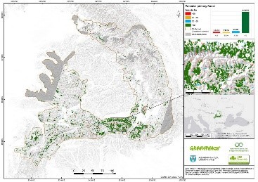
forests can be precisely identified only in the field studies, but an estimation of their location and extent can be done using remote sensing and GIS techniques. I was also responsible for processing and analyzing the satellite images (the so called remote sensing part of the study). The study was conducted in collaboration with specialists from Eberswalde University (Germany), which helped with the filtering and analysis of the polygons resulted from the satellite image analysis. We identified almost 300.000 hectares of potential primary forest. You can visualize the complete study and the methodology here. After the official launch of the map we talked with the Romanian ministry of environment and they were willing to use our map and do the field validation of the forests.  

            Beside these projects, I am involved in the illegal logging investigation unit of Greenpeace Romania. Using satellite images and the available information provided by the authorities, I am monitoring forest logging and searching for illegal activities. I am also involved in a project called “Forest Guardians”, which will be implemented in 2018 and exploits the idea of participatory mapping. Basically, we designed a smartphone app where any user can help in identifying forest loggings comparing multiple sets of high resolution satellite images.


*-HISTORY:   My first contact with GIS was during my bachelor's degree, while being a geography student. During my studies, I was involved in some projects and organizations related to GIS. For example, I was involved in a project with the purpose of creating a digital database of all the rivers in Romania, on a 1:25,000 scale. My role, beside the actual GIS work, was to teach younger students some GIS techniques, like digitizing, in order for them to being able to help with the project. Basically, my work related with both conservation and GIS began with my involvement in Greenpeace.

*-Current GIS expertise:

In 2016 I finished my masters in Geomatics, where I learned a lot about GIS and remote sensing. I have recently published an article based on my master thesis which you can visualize here (http://www.primanatura.ro/en/utilizarea-imaginilor-satelitare-sentinel-2-in-identificarea-padurilor-...). In this article I described an algorithm which proposes an automated method for the identification of old-growth forests, on a smaller scale (a small mountain range in Romania). For this project I used mainly ArcGIS Desktop, but also other software like Global Mapper, SNAP and SEN2COR (for Sentinel 2 satellite images processing).

The above mentioned research was the starting point of another study called “Potential primary forest map of Romania”, conducted this year by Greenpeace Romania. I was the coordinator of the project and one of the two authors of the study. This project was a real opportunity to improve my GIS and remote sensing skills. I learned a lot about object based classifications and satellite image processing and analyzing. You can visualize the complete study and methodologyhere. We choose to use a semi-automatic algorithm (a fully automatic one being very hard to implement) which combined methods like object based classification and visual interpretation of multispectral satellite images (Sentinel 2). I used softwares like eCognition Developer for the object-based analysis and ArcGIS Desktop for data filtering and map creation.

Coordinating the GIS team working on the “Primary Forest Potential Map of Romania” project was one of the most challenging and inspiring experiences. I worked with volunteers from Romania, but also from Germany. Aside the actual GIS work, I had to travel to Germany to establish an official collaboration with Eberswalde University. There, among many great people, I met with Pierre Ibisch, Professor for Nature Conservation, which kindly offered his support.

In 2016 I was a volunteer in a project called Romanian Forest Rescue Station, being part pf the GIS team. I did a lot of office work but also a lot of field work, using Topcon GPS devices and working a lot with ArcPad. I will give more details about the camp and my work there in the following sections.

Currently I am a PhD student and also I work with Greenpeace Romania as a GIS collaborator. I learned a lot of GIS in the university, during my masters and I am doing GIS related research during my PhD. Most of this research is also related to Greenpeace.

            Greenpeace had a major contribution in improving my GIS skills. For example, in December 2017, I participated in an international Mapping skillshare, which took place in Netherlands and was organized by Greenpeace. There we had the chance to present and discuss technical aspects of our work and share GIS knowledge and skills. Also, we wanted to promote and to emphasize the importance of using GIS in Greenpeace projects.

In October 2017 I participated in the SCGIS Russia conference in Sankt Petersburg. There I had the opportunity to learn a lot of things related to GIS, by participating in workshops and sessions and also by meeting with many passionate GIS enthusiasts.  I had the opportunity to present our work related to the primary forests potential map, share the methodology and receive useful feedback. I stayed in Russia only for three days, but in that time I had the opportunity to meet with many passionate GIS people, working on very interesting projects and also participate in some truly inspiring workshops.

In December 2017 I participated in an international mapping skillshare, organized by Greenpeace International. I had the opportunity to meet my colleagues from all around the globe and share knowledge. There I ran a workshop, presenting some sources of satellite imagery that could be used in investigations.

Currently I am leading a small, but very passionate, GIS team of Greenpeace volunteers. Together we are doing the GIS work in Greenpeace Romania.


            I think the most effective way to learn and to improve your GIS skills is by participating in such events and be part of communities like SCGIS. I could take as reference the SCGIS conference in Russia or the mapping skillshare in Netherlands, for example. There, in a few days, I can say I learned a huge amount of things related to GIS and I meet many wonderful and passionate people. Not only that these meetings changed my life, but also I think they were really important for the future of GIS and eventually for the protection of the environment in Romania. I could only imagine the things I would learn, the people I would meet during a few weeks of trainings and conferences in California.

What is the most unique and the most challenging about the conservation/GIS work that you do?

Greenpeace is known for using nonviolent direct action, so besides working with GIS and doing research, I am also a Greenpeace activist. Sometimes these two roles are intertwining in a very harmonious way. That being said, in some cases I found myself going on an action as a result of my GIS research I have previously done. The best example is an action that took place in August 2017, when we stopped an illegal logging that was destroying a primary forest. Using Sentinel 2 satellite images, I have been monitoring some primary forests and searching for signs of logging. Fortunately, the temporal resolution of Sentinel 2 satellites is good enough for doing useful change detection analysis. Therefore, in August 2017 I spotted an unusual change in the canopy of a forest I have been monitoring. This turned up to be an actual illegal logging. We decided to put an end to it before it is too late and the forest would have been destroyed completely. On that note, we actually went into the forest and stopped the logging as it was taking place. Leaving my office chair for taking part in direct actions is by far the most unique part of my work. It is a real motivation knowing that the GIS work we are doing is sometimes materializing in direct actions.

*-What do you hope to achieve in your conservation GIS work over the next year?

            For Greenpeace Romania, 2017 was a turning point when it comes of using GIS in the organization. This was the first year when the organization decided to really make use of GIS and start a serious GIS project, like the “Potential Primary Forests Map of Romania”. The new GIS capabilities were very useful in the investigations as well. Of course that, over the next years, we want to extend the GIS capabilities in our office. We would like to continue the work we started in 2017, but also we want to begin new projects:

  1. We plan to continue the work on the primary forest map and improve it. We were also planning of developing an algorithm for old-growth forest identification that would be easy to implement on wider areas and different regions of the globe, with more accurate results. The protection of the old-growth forests is of serious concern not only in Romania, but also for the entire Europe. Currently, conservationists in Europe are working on a strategy regarding the protection of old-growth forests (more details here). Old-growth forests cannot be protected if we do not know their location, so their identification is a very important step. In June 2017 I participated in the European Beech Forest Network Workshop in Germany, where we discussed the old-growth forest strategy. There, I presented the Potential Primary Forests Map of Romania, which was considered a very important step for the future of the protection of the old-growth forests across Europe. We agreed that an algorithm for the old-growth forest identification for all Europe should be developed. Thus, the existing algorithm can be improved, but this is very challenging task and I am hoping that the participation in the SCGIS conferences and trainings will be of real benefit for the protection of the old-growth forests in Europe.
  2. Another important project that we started in 2017 is called “Forest Guardians”. Using a smartphone app with a good looking user interface and high resolution satellite images we plan to involve everyone into the monitoring of the forests using remote sensing techniques. The app will be launched in March 2018 and will be based on the idea of participatory mapping. This is a still in development project and if it all goes well we plan to extend the capabilities of the app and the monitored area. For this app we are using very high resolution, on demand, satellite images, which are expensive. On that note, I would like to explore cheaper alternatives, like drones or other remote sensing platforms. I would really like to raise this subject in the SCGIS community and discuss about how we could practically implement these alternatives.
  3. A similar, but independent project for 2018, will be the implementation of an online platform with basically the same purpose, namely illegal logging activities detection using remote sensing data, but on a much wider area. In addition, besides using free remote sensing data for logging detection, this platform will also provide much more information, like wood transport and logging authorizations. A similar platform, designed by the Romanian authorities already existed, but it was recently shut down with no perspectives of recovery.
  4. A very important objective for 2018 will be the increasing of the international collaboration, including the collaboration between Greenpeace GIS units worldwide. An important step in this direction was the mapping skillshare we had in December, in Netherlands. There we build the bases of a global community of Greenpeace mappers, called Global Mapping Hub. This was a very important meeting for the future of GIS in Greenpeace Romania, because the increasing international collaboration will have a positive impact on our national projects as well. Also, on my turn, I can get involved and share my experience in other campaigns and GIS projects around the world. Therefore, I think that being involved in the SCGIS community will be very beneficial for Global Mapping Hub also.

For me it would be life changing to be part of the SCGIS community, as a member or as a volunteer. As I said before, participating in the SCGIS Russia conference was one of the best experiences of my life. This experience gave me the motivation and the willingness to be more connected to the SCGIS community in my region. And I can say I was really excited to see that Romania’s southern neighbor, Bulgaria, has a SCGIS chapter and that they kindly offered their support and cooperation. My first contact with SCGIS Bulgaria was done through Prof. Dr. Stefan Stamenov and I can say it was a really warm welcome and I hope, the start of a new and fruitful collaboration.


2018 Paper Title & Abstract: Primary Forests Potential Map of Romania

            The largest areas of old-growth, or virgin forests from the temperate region of the European Union can be found in the Carpathian Mountains of Romania (Jan Knorn et al., 2012). A lot of these forests are endangered by logging activities, which are intensifying. Cataloging a forest as virgin or quasi-virgin can only be done in the field studies, however an estimation of the location and extent of these forests can be done using GIS and remote sensing techniques. This kind of estimation could be very useful when planning the future field studies.

            It is very possible that the methodology and thus the map will be improved until June 2018, but the topic remains the same. 

more
0 0 1,150
by Anonymous User
Not applicable

Return to SCGISReturn to 2018 ScholarsGo to scgis.orgGo to Conservation GIS 

Thin Myo Thu: Deputy Technician (GIS/RS) Wildlife Conservation Society(WCS)-Myanmar Program

No.12(B-21, 22), Narnattaw Road, Shwe Kainnayi Housing, Kamayut Township, Yangon,  Myanmar

*-Work phone with country and area code: +951535711

*-Main email: wcsmyanmar@wcs.org

https://myanmar.wcs.org/ , https://web.facebook.com/WCSMyanmar

Skype: tmyothu, https://web.facebook.com/tmyothu

email:  tthu@wcs.org


Current GIS capability/expertise: I started my career as Deputy Technician(GIS/RS) for Wildlife Conservation Society (WCS-Myanmar Program) based in Tanintharyi Region, Southern part of Myanmar since October 2014 when I was in third year physics in bachelor of Science. I had finished my degree on 15th October 2015, University of Dawei, Myanmar. Before I joined WCS I pursued as technical provider in mapping services when I have been doing GIS and RS in 2011 for my own business. My main responsibility is technical support for the development of participatory Land-use mapping to implement protected areas management system for Forest Department,  marine spatial sea-use plan for Department of Fishery, as well as GIS database management, remote sensing and data integration to monitor deforestation and degradation and any update for forest cover changes and detection.   My learning on GIS is not enough for my career. So, I always do self-teaching by using ESRI GIS Tutorial of nearly 2.5GB data with many exercises and ArcGIS Desktop help. I also learned freely available online GIS Courses such as ESRI, Udemy, ESRI MOOC and Lynda .There are also numerous task specific tutorials available from independent contributors on online platforms such as YouTube. I also participate and learn in regional workshops and training sessions. Since 2016, I have learned new techniques from my new REDD+ Technical Advisor who expert in IT and GIS. My ArcGIS Desktop Single License is provided by my organization head office in Bronx, New York.

*-ORGANIZATION’S WORK: Please describe the work that your current organization does: Wildlife Conservation Society (WCS) is a world leader in on-the-ground wildlife conservation, currently overseeing about 500 projects in 60 countries of 16 priority regions, home to more than 50% of the world’s biodiversity. Our Mission is “WCS saves wildlife and wild places worldwide through science, conservation action, education, and inspiring people to value nature”. Our Vision is “WCS envisions a world where wildlife thrives in healthy lands and seas, valued by societies that embrace and benefit from the diversity and integrity of life on earth”. WCS Myanmar has been working in Myanmar since 1993.WCS was the first international organization to initiate a long-term program in the country. Ever since, we conduct biological surveys, monitor populations of key wildlife species, aid in the establishment of protected areas, and assist protected area staff with trainings on landscape management.Our organization works across eleven project sites in three landscapes: Northern Forest Complex, Irrawaddy River and Southern Forest Complex.  

With 6 offices, our presence is distributed all over the country. Through two liaison offices we maintain close collaboration with government decision makers and international partners, and additional 4 field offices allow us to directly engage with nature conservation in the most valuable and unique landscapes in the Indochina region.WCS Myanmar working counterpart with Government of Myanmar by having Memorandum of Understanding (MOU) with two particular ministries: Ministry of Natural Resources and Environmental Conservation (MONREC) and Ministry of Agriculture, Livestock and Irrigation, Forest Department and Department of Fisheries. WCS-Myanmar Program are also collaborate to conserve the tiger and elephant in National Tiger Action Plan for Myanmar and Myanmar Elephant Conservation Action Plan with other partner organizations. Wildlife Conservation Society – Myanmar Program, also working in partnership with Turtle Survival Alliance (TSA) and the Myanmar Forest Department (FD) and greatly successful captive-breeding program at facilities in Myanmar has produced thousands of hatchling Burmese star tortoises since efforts were initiated less than 10 years ago. Captive-breeding has been so successful that a reintroduction program was launched in 2013 to re-establish viable wild populations of star tortoises at Minzontaung Wildlife Sanctuary (MWS). More recently, WCS Marine Program has been working to bring contemporary concepts to Myanmar - to support our goal to create a sustainable ocean economy. Myanmar’s vast marine resources are an integral part of our future development. This strategy presents the results of a significant effort to understand the opportunities and challenges associated with our ambitious sustainable ocean economy goal.WCS has been providing financial and technical support these two ministries to manage protected areas, undertaking applied research, communities to conserve wildlife and their habitats.

     There are three main landscape in WCS Myanmar Program. Southern Forest Complex landscape is located in Southern part of Myanmar where is my duty station and included one protected area where is called Tanintharyi Nature Reserve Project. My current role with WCS is to provide technical support for both terrestrial and marine conservation management. Key responsibilities include (1) work with communities for participatory land-use mapping for sustainable resource management, (2) supporting the government’s Forest Department on protected area management, (3) work on marine spatial planning with the Department of Fisheries, (3) remote sensing and data integration for land cover mapping and  deforestation and degradation monitoring, and (4) overall cartographic service provision and database management. My main responsibility is to lead the team which provides spatial support to our work as well as develop and provide maps such as village land use zoning maps, Tiger and Elephant camera trap survey maps, Tortoise distribution maps, forest management maps for regional forest department and GIS technical support for WCS field staff and regional forest department and I work closely with WCS senior technical staff. My area of expertise is in participatory land use mapping, GIS database management, remote sensing, data integration and giving GPS/GIS training to regional forest department, Tanintharyi Nature Reserve Project and other Local Civil Society Organizations (CSO). I have to provide at least one time annually GPS/GIS training to core GIS team in my landscape, regional forest department, regional environmental conservation department, Tanintharyi Nature Reserve Project and other relevant Local Civil Society Organizations. Examples of the application of my work are to create village land use map, deforestation and threat maps, ranger patrol maps, and other maps that used for planning and management of protected areas and forest department and analysis map for the university students in our region. I am looking for new opportunities to develop my skills in GIS, particularly in new GIS technologies.


*-HISTORY: I have been working full-time as a Deputy GIS Technician for the WCS-Myanmar Program since 2014. I am based in the Southern Forest Complex landscape, where we work in support of regional and national government, civil society, local communities, with particular focus in the Tanintharyi Nature Reserve. Through my work, I have realized the importance of nature conservation and how GIS/RS techniques can support conservation works, with the potential to analyze habitats for endangered species, spatial distribution and migration patterns of wildlife, and support data and information for protected area management. Key conservation species for our program include endangered species such as tiger, elephant and tapir inhabit in this region. My team develops and supports the village land use zoning process, supports the regional Forest Department with forest management, and provides general GIS technical support and capacity building for our work. My area of expertise is in participatory land use mapping, GIS database management, remote sensing, data integration and providing GPS and basic GIS training to regional forest department, protected area staff, and other local organizations. Examples of the application of my work are to create, review and refine village land use maps, assess deforestation and land-cover changes from remote sensing, and identify threats, support protected area rangers with patrol maps using the Spatial Monitoring and Reporting Tool (SMART) system, and many other maps that are used for planning and management of protected areas and forest lands. I lead the team of three core staff who provide technical support to the government’s Forestry and Fisheries Departments, as well as local University students and local civil society groups. I also represent WCS in our partnership with OneMap Myanmar project for which we support technical capacity of the Tanintharyi Regional government. Since 2014, I regularly provide basic GIS training to regional forest department, protected area staff, local organizations, and local University students.


I am really ambitious to make this team the strongest GIS Team in the WCS regional program, by building our capacity and improving efficiency of all our team members. I also have experience applying mapping tools on-the-ground, as I worked together with WCS staff for mapping village utilization zones that can help to reduce conflicts between communities and conservation managers. Prior to WCS, I ran a small business as a consultant providing mapping services where I produced maps and provided technical support regional government institutions.I have also experience two times as a translator and assistant trainer in QGIS and RS training by English language at FFI Dawei office in July and August 2014 before I joined to WCS. After joined to WCS, I supported as a translator and assistant trainer in QGIS and Data management training by FFI in English language at Ecodve Dawei office in Dec 2015 again. I could well understand and translate to clarify between local trainees and foreign trainer in all of training. I also got the chance to attend three international training, workshops and seminars where my English has developed further. Especially during the recent Marine GIS training using QGIS in University Malaysia Terengganu, where I was selected the Ocean Teacher Global Academy (OTGA) scholarship program.In that training, I could follow and understand with instructors without difficulties. I have also been improving in understanding and speaking in English language and many technical terms by learning from freely available online GIS Courses such as those from ESRI, Udemy, ESRI MOOC and Lynda and closely working with our regional REDD+ Technical Advisor and some Senior Advisor who are the expert in IT, GIS and conservation field from foreign countries. I also regularly participate and learn in regional workshops and training sessions and I also collaborate with other GIS experts from partner organizations in GIS field for my region. Before I joined to WCS, I ran a small business as a consultant providing mapping services. I had provided various maps and assisted to regional government institutions. I also have provided basic GIS training to regional forest department, Tanintharyi Nature Reserve Project and other Local Civil Society Organizations (CSO). I am really ambitious to make this team of strongest GIS Team of WCS regional programs by building the capacity and improve efficiency to the team members. I also have many experiences for using GIS technique as I worked together with WCS staff for mapping village utilization zones that can reduce conflicts between communities and conservation, especially protected area managers. WCS are now working with several communities on Community Based Natural Resources Management approaches, which the foundation is mapping and agreeing village utilization zones.


Local SCGIS chapter: There is no SCGIS chapter in Myanmar. However, I am an active member in the GIS communities of Myanmar and our region with frequent meetings and workshops with other relevant conservation NGO, INGO organizations, Local Civil Society organization, regional Government institutions and University. I am also a member of Myanmar GIS community on Facebook as well as other GIS groups, such as Myanmar GeoInformatics Society Group, Myanmar Google Earth Engine Group and OpenStreetMap Myanmar Group. For the very first time, we held a GIS practitioners meet up event on 14th August 2017 at OneMap Myanmar Dawei office in my region. Main aim of GIS meeting were to connect to other GIS practitioners in Dawei, share news and update, ask questions and find help. I hope to help establish a Myanmar SCGIS chapter since the GIS groups on social media have greatly expanded, both in numbers of members and in technical capacity.


I have taken on teaching and leadership responsibilities after joining WCS Myanmar Program. Below is a summary:

Participatory Village Land use mapping: Conducted land use zoning map in 52 villages in my landscape.

GIS mapping: Developing and providing maps for village land use zone, deforestation and threat maps, ranger patrol maps, and other maps that used for planning and management of protected areas and forest department and analysis map for the university students in our region and for all WCS projects and programmes in Myanmar.

Collaboration: Meeting, consulting and sharing other partner agencies, government institutions and university to develop and update GIS data , maps and technologies

Land use planning: Analysing satellite images, maps, data and government plans  to compare past and present land use and forest cover, and make projections for future land use;

Field survey: I have been involving in various kinds of data collection and verification in the field.

Training: GIS and GPS training are the below list;

Participatory land use field mapping on job training  at Tanintharyi Nature Reserve Project(TNRP)(November-2014)

GPS Training at Forest Department, Dawei District (14th Feb 2015)

Sharing knowledge on job training to  two GIS assistants of  Southern Forest Complex Landscape (ArcGIS and RS) (Aug- 2016)

Participatory land use mapping on job training using ArcGIS  at TNRP(Feb-2016)

Participatory land use field mapping and using GPS on job training  at TarKaPaw(CSO), Dawei (April-2016)

GPS mobile application training at Forest Department, Tanintharyi Region(Nov-2016)

Collaboration with One Map Myanmar, Oil palm review in Yephyu Township(Capturing

Images using UAV and image processing (Orthomosaic)(Feb-2017)

Using GPS and Topo Map in SMART training at Lampi Marine National Part(Feb-2017)

GPS and QGIS training in  Environmental Conservation Department, Tanintharyi Region(Mar-2017)

Participatory Land use mapping training using ArcGIS at  TarKaPaw(CSO),Dawei (Jul-2017)

ArcGIS intensive training at TNRP(Sep-2017)

Participatory Land use mapping and data management refreshment training using ArcGIS at TarKaPaw(CSO), Dawei (Nov-2017)

GPS on job training at Forest Department ,Thetyetchaung township, Dawei district(Dec-2017)


What is the most unique and the most challenging about the conservation/GIS work that you do: GIS support is very important for WCS Myanmar and requires the interaction of multiple groups. My role requires that I interact with community members and leaders, NGO and civil society, development agencies, and both State and indigenous governments. Each requires a different level of engagement, I must constantly adapt to the current environment. Most of these interactions are in extremely remote places with limited resources. The broad scope of stakeholder support requires an equally broad scope of data. Due to the accessibility issues these questions must be answered using remote sensing and spatial analysis. The current methods I use for to be improved for better performance. In Myanmar, Government institutions, supported by NGOs, need to use land-use monitoring techniques to manage land-use change, land-encroachment and leakage outside the boundaries of Land Concessions. Likewise data distribution methods must be established to meet the broad range of partner requirements. While GIS techniques are advancing world wide, only very few can effectively use these tools in our country. My work in supporting the Government is therefore very important and very interesting, and we are aiming also to develop new tools, such as online platforms. We are creating and friendly with web-based platform for our program and our regions which is an exciting an innovative new development in my role, and also very challenging.


   This scholarship program is an ideal platform to support my country's needs and I believe that I could effectively apply my knowledge in our conservation fields as well as to develop our country. I will use the knowledge to support our organization, the Myanmar government, local group, as well as University students and applied research for data gaps. After returning from the SCGIS scholarship, I will aim to teach the rest of my team useful skills and techniques acquired during the training. As a focus project I seek to develop a web-based GIS Platform to access our 20 years of biodiversity data collected by field research staff but not yet made easily accessible. The skills and techniques from this learning experience will help me to bring scientific data into our servers and make them available on web-based maps, to improve the management of conservation areas using near real- time technology. I also have plans over the next year upon completion of the course are to; improve the existing GIS technical support to our government and civil society partners and to better organize our data base system. I also intend to conduct and hold events such as the GIS users meet-up and knowledge sharing, set up a GIS online sharing group in local language - where people have the opportunity to improve the capacity and exchange lessons and experience on social media group.


The conservation importance combined with the geographic, social, and political challenges of the regions I work in require Even though I have been working in GIS career for three years for an internal organization in Wildlife Conservation, I have been using only the techniques which I learnt from basic GIS training and self-taught skills. I have received only three short international trainings specifically on GIS for conservation. My learning on GIS is not sufficient for my responsibilities or my desire to teach others about new techniques. I hope I will be selected by this scholarship so that I could bring new GIS techniques to share with my team that are providing GIS and Remote Sensing support to government, civil society, community and Universities. I know that SCGIS is a non-profit organization that assists the conservationist like us worldwide through building community, providing knowledge and supporting individuals using spatial science for the conservation of natural resources. More than just training, I hope to get experience from GIS specialists who attend the SCGIS Annual Conference and The Esri User Conference.  I also plan to share my knowledge widely to my colleagues, trainees and the new generation, so that  they can build their skills. Since there are few GIS/RS experts in Tanintharyi region, I could also share my knowledge to regional goverment institutions and


As a GIS/RS technician with WCS in Myanmar for three years, I lead a team with broad responsibilities for conservation GIS. We collect data, make maps, use geoprocessing tools, and perform basic spatial analysis. We support the Myanmar government, local communities, civil society, and Universities. Much of my work is self-taught, and I also do lots of training for others. The SCGIS scholarship is very important for me to learn GIS for conservation and web-based GIS, and to gain experience from GIS specialists from around the world who attend this training course and conference. My participation in this event will not benefit just only myself but also my whole team at WCS regional program and our many partners. I strongly believe that if selected for the Scholarship program, I would try my best to get the most out of the program. I would try to learn as much as I can and return this knowledge to my country. Finally, the scholarship program supports my desire to support the development of my country and also protect the natural heritage of Myanmar.

*-Title of the paper you will present: The roles of GIS and Remote Sensing in detecting deforestation and mitigating development impacts in Tanintharyi Region, Myanmar.

*-Abstract/summary of the paper you will present: National and Regional development plans, economic growth, social poverty, agricultural land expansion, people landlessness and a legacy of civil war resulting in mixed administrative areas makes conservation in the Tanintharyi Region of southern Myanmar a great challenge. Myanmar is in rich biodiversity and Taninthayi region located in the south of country. It is covered with rain forests inhabiting global endangered  species. In the south,  Dawei District area is one of the most important area to be given high priority for conservation because of its rich biodiversity. Dawei District located in Tanintharyi Region and lies between 14° 11' 13.8300'' N and 98° 12' 34.3224'' E. Local indigenous groups are numerous in the area with a strong tradition of protecting their natural environment. Following decades of isolation Myanmar is in rapid transition with very high economic growth and natural resources and land are threatened by this growth aided by National and Regional development plans, social poverty, agricultural land expansion and other factors. Urgent measures are needed to protect the area. We are therefore supporting the gathering of all spatial information about the physical and natural environment and biodiversity, land-classification-forest type and development plans. These data are used by local communities and organizations to support their conservation and land protection. We are using Geographic Information System (GIS) and Remote Sensing to monitor land-use changes in and around existing and proposed protected areas, to map hot spots of illegal activities are, to analyze how areas are affected, and to guide action. Deforestation and land clearance are the main threats that we monitor as well as illegal fishing and poaching. Because of competing land requirements, most of conservation areas in Myanmar have been affected by excising land for settlement, agriculture and converted for economic development purposes. We aim to use GIS and Remote Sensing to detect areas where land has been grabbed or cleared illegally, which may have been illegally granted to companies or individuals and can provide an alarm quickly on time to national Government institutions to take action against illegal development and unplanned deforestation. GIS and remote sensing also provides a visually engaging opportunity to share information about the impact and danger of these practices to all stakeholders.


more
0 0 487
11 Subscribers