- Home
- :
- All Communities
- :
- User Groups
- :
- Conservation GIS
- :
- Blog
- :
- Dr. Cecilia Passadore Real, Uruguay
Dr. Cecilia Passadore Real, Uruguay
- Subscribe to RSS Feed
- Mark as New
- Mark as Read
- Bookmark
- Subscribe
- Printer Friendly Page
Navigation: 2018 Scholar Project ReferenceProject CommunitiesPage ConservationGIS Scgis.org
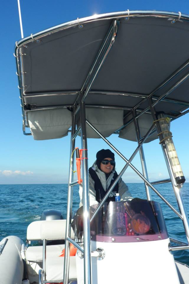
Dr. Maria Cecilia “Ceci” Passadore Real
2018 Conference Presentation
 <--Ceci 2018 Interview on her origins as one of the first women working in marine biology in her country.
2018 Scholarship Training Program Storymap ->
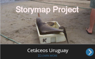
on the La Plata River Dolphin (in spanish). The La Plata River Dolphin, Pontoporia blainvillei is the only river dolphin to inhabit salt water estuarine & marine habitats. It is listed as "in danger of extinction" by IUCN, in part due to its restricted distribution and vulnerability to incidental capture during fishing
 <-PDF
<-PDF 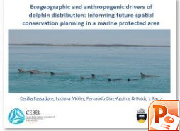 2018 Conference Presentation: MP4->
“Ecogeographic and anthropogenic drivers of dolphin distribution: informing future spatial conservation planning in a marine protected area”
2018 Scholar Profile
Dr. Maria Cecilia “Ceci” Passadore Real
CONTACT: Apto. 301, Edificio Aquiles, calle Peru y esquina Rambla C. W
 illiman, Punta del Este, Maldonado, C.P. 20100, Uruguay.
*-Main email: [email protected]
http://www.cebel.org.au/ (this is the link to CEBEL were I did my PhD studies. The links to my personal details within CEBEL and Flinders University are: http://www.cebel.org.au/people-phd-students-cecilia-passadore/ and http://www.flinders.edu.au/people/cecilia.passadore)
Skype etc:whatsapp = +59899819218; skype= cecilia.passadore email: [email protected]
Ceci Introduction & Thanks to SCGIS
I was born in a seaside city, which certainly contributed to my interest in the ecology and conservation of marine ecosystems. I pursued a Bachelor and a Master’s degree in biological science in Uruguay, specializing in biological oceanography and ecology, respectively; and a PhD in Australia. I have worked in topics related to conservation at several levels and institutions since I graduated from my Bachelor in 2004. Between 2004 and 2012, I worked in ecology and conservation of large marine vertebrates in Uruguay, with emphasis on their interaction with fisheries. As an intern in the area of Pelagic Resources at the National Administration of Aquatic Resources (DINARA), I had the opportunity to work on the development of Plans of Action for the Conservation of Chondrichthyes and Seabirds within the Uruguayan fisheries. Then, I worked in the National System of Protected Areas (SNAP), where I contributed to the identification of priority species for conservation in Uruguay, mainly of marine mammals. These documents were the first generated for these species in Uruguay and laid the basis for research priorities and conservation strategies to be implemented in the near future.

I’ve been always particularly interested in marine mammals, however, in Uruguay there was no policy that promoted neither cetacean research nor its conservation. In 2004 we created Cetáceos Uruguay, a non profitable group integrated by students and just graduated scientists from the Science Faculty. The aim of this group was to strengthen the cetacean research and conservation in Uruguay. Between 2004 and 2012, several bachelors, master and doctoral thesis were performed in the frame of different projects developed by the group. During this period, my research aimed at identifying the magnitude and distribution patterns of their interactions (both by-catch and depredation) with fisheries (artisanal and industrial) as well as identifying the fishing practices and environmental processes that affect them. During my master's thesis, which dealt with the interaction between pelagic longline fisheries and marine mammals, I analysed a database containing data that spanned over ten years through GIS and quantitative and statistical analysis techniques (e.g. Generalized Linear Models). Furthermore, I have worked on environmental education projects that aimed to promote the conservation of coastal ecosystems in Uruguay. In 2006, as a member of the Environmental Education Program of Cetáceos Uruguay, and together with other biologists belonging to other NGOs, we created the ARENAS project. We worked in workshops to motivate and train more than one hundred teachers to conduct firsthand investigation activities in coastal environments near their schools. We followed the activities of more than a thousand children from all over the Uruguayan coast. Three years later, based on the needs of teachers, our ideas and inspired by the research activities of children, we edited the book: “Uruguayan coastal ecosystems: a guide to know it” (TRIMBLE M.; RÍOS M.; Passadore C.; SZEPHEGYI M.; NIN M.; GARCÍA OLASO F.; FAGÚNDEZ C.; LAPORTA P., 2010. Ecosistemas costeros uruguayos: una guía para su conocimiento (2010). Ed. 1, Montevideo, Editorial Imprenta Monteverde, v. 1, p. 335, ISBN: 9974-98-056-3). To edit this book we made an arduous compilation of information about the coast, both published and original, and consulted and asked for help of dozens of scientists from our country. I consider ARENAS project as one of the most important things that I have done in relation with conservation of coastal ecosystems, which was possible to be done thanks to team work, interdisciplinary and the confidence generated among biologists and teachers. The book will remain as an environmental education tool to know Uruguayan coast for several years, not only for school level but also for upper educational levels.
In 2013 I moved to Australia to pursue a PhD and finished it in December 2017. My PhD investigated the demographics and spatial ecology (e.g. individuals’ home range and distribution patterns of the population) of southern Australian bottlenose dolphins inhabiting Coffin Bay, an area located within a multiple use marine park. Using GIS and species distribution models in R, I identified areas of high probability of dolphin occurrence in relation to ecogeographical and anthropogenic variables, and evaluated the relevance of current sanctuary zones for their protection. The findings of my PhD highlight the importance and conservation value of the inner waters of Coffin Bay for southern Australian bottlenose dolphins, and provide the basis for guiding future monitoring and spatial conservation planning of the species within South Australia’s marine parks.
Although I am not currently working for any particular organization right now because I’ve just returned to Uruguay after 5 years abroad doing a PhD, I want to continue working with GIS to produce essential knowledge on the spatial ecology of marine mammal species to inform for their management and conservation within Uruguayan waters. Despite the limitations in Uruguay to do research on marine mammals, throughout my career I’ve tried to generate opportunities, projects, network and take advantage of the scarce information available to improve the knowledge of these poorly known species. For example, during my master, I used data obtained by the observers program of the longline tuna fishery and GIS to determine the spatial distribution of marine mammal’s bycatch and generate distribution maps of orcas (Orcinus orca) as this species is the one that preys upon the fishery catch. Now, I want to use a new source of data, i.e., records by observers working on oil prospection surveys in Uruguayan waters since 2013, to determine the distribution of several marine mammal species in relation a variety of oceanographic and physiographic variables, and to identify priority areas for marine mammals. Currently, Uruguay requires spatial information of endangered species, particularly in the marine environment, to identify target areas for management and to establish marine protected areas. I believe that by participating in your course, I will be able to improve my skills in the use of GIS and do a more comprehensive job in determining the spatial patterns of marine mammals and their threats in Uruguayan waters. This will help to better inform marine spatial planning in my country. Furthermore, I want to highlight that I will share with colleagues from Uruguay (and the region) involved in GIS and conservation the new knowledge gained during your training.
Local SCGIS work: In Uruguay there is no formal local SCGIS chapter, however, there is an informal network of GIS exchange. I’ve been in contact and worked together with people who participate in this informal exchange network since I was a master student at Faculty of Sciences in Uruguay and a member of Cetaceos Uruguay. I did my master thesis on the interaction of longline fisheries and marine mammals, during this period I mainly interacted with Philip Miller who was the first one from Uruguay to undertake the SCGIS course. I’ve also worked together in research and conservation with María Nube Szephegyi, Mariana Rios and Caterina Dimitriadis in several research and environmental education projects. In fact Caterina helped me to complete this application form and Maria gave me some advice. They are connected to the SCGIS chapter in Latin America and last year a course was organized in Uruguay; however, I was unable to attend because I was studying in Australia. I am interested in getting involved with the Latin America chapter because I feel it will be a great opportunity to network with GIS users in the region. Now that I’m back again in Uruguay I’m trying to be again involved with using GIS applied for conservation, especially in the marine environment and focusing in marine mammals. I’m currently trying to learn together with Caterina how to work and obtain information from satellite images using GIS. This is useful for her current research on the spatial dynamics of fisheries and for myself as I am writing a project to look at cetacean distribution (using data collected during oil prospection surveys done since 2013) in Uruguayan waters in relation to oceanographic and physiographic variables (SST, chlorophyll a, presence of fronts and oceanographic features, depth, slope, presence of canyons, etc.) to generate information useful for marine spatial conservation planning, which is currently an urgent need in Uruguay.
Local Community work: My teaching and leadership experience has been mainly oriented towards ecology and conservation topics.
As a leader of ARENAS Project, I participated in the organization of workshop and training of school teachers in the ecology, functioning and conservation of coastal ecosystems. We gave teachers tools to perform activities with their children and engage them in the conservation of coastal environments in Uruguay. We encouraged teachers to do environmental education activities at their schools inspired in answering questions on the functioning of coastal ecosystems; we also joined them during fieldwork activities with the children to learn together about their local environment.
My teaching experience related to GIS is mainly through sharing my knowledge in using ArcMap with colleagues and helping them in an informal way. Currently, I’m supervising a Bachelor student who is looking at cetacean distribution (using data on cetacean surveys) in waters off the Southern Ocean in relation to oceanographic variables. She has no previous experience in GIS and I’m teaching her how to use the software, prepare the data to generate maps, and obtain information from shapefiles (e.g. calculate distance between points and polygons, obtain point data from rasters, etc.).
Also I’ve lead several research projects, including my PhD project, in which I had to write the project, get funding, gather and analyse the data, select and train volunteers to help during fieldwork, administrate the budget, write reports, do presentations for local communities, conferences and managers of marine parks, produce outreach materials, interact with reporters, and produce scientific publications.
What is the most challenging about the conservation/GIS work that you do? When I started my career as I biologist there was no policy that promoted marine mammals’ research or conservation in Uruguay, and there were no head scientist involved in this topic. This shortcoming motivated me and a group of recent graduates to create the group Cetáceos Uruguay in 2004. The aim of this group was to strengthen the cetacean research and their conservation. Within this group I participated and lead several research and environmental education projects, where I learned to work both as a team and independently. Working there I developed skills in project design, fundraising, writing reports and scientific papers, learned to work together to strengthen team’s shortcomings, I improved my inter-personal skills, etc. Although we have had the support and advice from national and regional scientists, the limited funding for salaries forced the group to disintegrate a few years later (i,e, 2012). After that, I continued my studies and went to Australia to pursue a PhD in ecology of dolphins. The PhD project that I did allowed me to deepen on identifying priorities for conservation and management actions needed in areas where human pressure are increasing. Now I’m back in Uruguay, where there is still limited researchers involved in cetacean research. I want to keep working with cetaceans in my home country, particularly in relation to marine spatial planning and conservation using GIS, and want to engage the future generations to do so too.
In my country it has always been a challenge to obtain data from the marine environment, especially far from the coast. During my masters, I worked with the pelagic longline fisheries to gain some insights of marine mammal species using offshore waters and understand their interaction with fisheries. However, the data was restricted to the spatio-temporal extent of this fishing fleet, and the information on the distribution of marine mammals is still scarce, which prevents informed management or their inclusion as focal species of conservation within Marine Protected Areas. Uruguayan waters are currently facing a new challenge, the oil and gas exploration within its waters. Since 2013, the oil prospection surveys started and they have an observer program that is collecting valuable information on marine mammals across Uruguayan waters. Although this data is mandatory delivered to governmental institutions (e.g. Ministry of the Environment), the information has not been analysed yet nor integrated into a GIS to serve as a tool for marine spatial planning. Although oil and gas prospections could be a threat to marine mammals, I see as an opportunity the fact that their observers are collecting data in offshore waters of Uruguay and feel that this should be used to inform for the conservation of our marine environment.
*-Current GIS expertise: For example, in one chapter of my PhD thesis I used ArcMap 10.3.1 to create spatial layers at 500 x 500 m grid cell resolution of response (presence-absence of dolphins) and explanatory variables (i.e. water depth, SST, salinity, water visibility, vessel encounter rate) that were obtained in situ with GPS location and included in tables. Particularly, the location of dolphin groups (point layers) and survey tracks (line layers) were imported into ArcMap to create a binary presence-absence grid of dolphins while taking into account survey effort. A grid layer of survey effort (km2) was generated by adding a 500 m buffer on either side of the line transect surveyed. Survey coverage was quantified by calculating the total amount of area surveyed on-effort within each grid. Every grid where a dolphin group was sighted was defined as a presence. Grids with survey effort higher than the mean, and with no presence of dolphins, were considered true absences. To generate raster layers of the environmental data (i.e. water depth, SST, salinity, water visibility and pH) collected in situ, the point data was interpolated in ArcMap using the Ordinary Kriging function and a spherical semivariogram model (500 m cell size) within the Spatial Analysis Tools (see map below). The vessel encounter rate for each grid cell was calculated in ArcMap as the number of vessels sighted divided by the survey effort (km2) per cell (see map below). I combined the tables of each variable based on their grid ID to generate a single table containing values for each variable per grid. I also created raster maps for each variable. These rasters and table were then used to run distribution models in R.

Ecogeographical and anthropogenic variables considered in the modelling of southern Australian bottlenose dolphins (Tursiops cf. australis) presence in Coffin Bay by season. Columns from left to right correspond to: austral spring, summer, autumn, and winter. Each line corresponds to a variable, from top to bottom: encounter rate of vessels, sea surface temperature (SST), salinity, water visibility, and pH.
*-How are you currently learning GIS? I’ve learnt GIS by attending courses available, asking colleagues and looking at forums and online help videos. In 2011, I took an online course to learn the basics of ArcMap 9. In 2013, I attended a 5 day workshop called ‘An Introduction to Using GIS in Marine Mammal Research’ where I’ve learnt to do the type of analysis mentioned in the previous question; and also attended an introductory workshop about Marine Geospatial Ecology Tools (MGET). Most of the time, I learn byasking colleagues who have more experience than me and/or that have been students in the SCGIS program, like Philip Miller, Mariana Ríos, María Nube Szephegyi and Caterina Dimitriadis. In fact, Caterina encouraged me to apply for your SCGIS training grant.
Plan for the next year: In 2018, I plan to make an agreement with the Ministry of the Environment to access these data on marine mammals and generate a GIS on species distribution that will contribute to marine spatial planning and management. I want to develop species distribution models of marine mammals in relation to a variety of explanatory variables (e.g. SST, Chlorophyll a, presence of oceanographic features such as eddies and fronts, depth, slope, presence of canyons, distance to coast, etc.), and integrate distribution maps of every species to identify important areas for marine mammals within Uruguayan waters. Currently I’m trying to get the approval from the Ministry of the Environment to access the data collected during oil prospection surveys, and I am writing proposals to obtain the funding to do the analysis. Being able to participate in the SCGIS training will help me improve my skills in using GIS, integrating satellite data on the marine environment with species data, and generate valuable information for the marine spatial planning in Uruguay, particularly for the National System of Protected Areas.
2018 Paper Title & Abstract:
“Ecogeographic and anthropogenic drivers of dolphin distribution: informing future spatial conservation planning in a marine protected area”
Information on which ecogeographic and anthropogenic variables affect species distribution is fundamental for understanding their ecology, and informing spatial conservation planning. Such spatial information is lacking locally, regionally and nationally, for most marine top predators in Australia, including those inhabiting multiple use marine parks. In this study, we used ArcMap 10.3.1. and an ensemble modelling approach in R, combining five different species distribution modelling methods, to investigate the spatio-temporal distribution of southern Australian bottlenose dolphins (Tursiops cf. australis) in relation to a variety of ecogeographical and anthropogenic variables within the inner and outer areas of Coffin Bay, Thorny Passage Marine Park, South Australia. The analysis is based on data collected during systematic boat-based surveys in Coffin Bay between September 2013 and October 2015. Models of dolphin distribution for the entire Coffin Bay area indicated that distance to sanctuary zones was the most important variable influencing dolphin presence. Models for the inner area, where the sanctuaries are placed and a large proportion of dolphins are year-round residents, indicated that the main drivers of dolphin distribution were water depth, and distance to land and oyster farms. Overall, areas of high probability of dolphin presence in the inner area were associated with shallow waters (2 – 10 m), located within 1,000 m of land and 2,500 m of oyster farms. Despite the seasonality in environmental conditions and human activities in the study area, dolphins showed no temporal variability in their distribution patterns. Sanctuary zones covered areas from low (0.04) to high (0.89) probability of dolphin’s presence, but the majority of areas of highest probability of presence fell within multiple use areas where human activities are allowed. Our results should support future spatial conservation decisions targeting dolphins in South Australia, and the modelling approach followed can be used to gain inference on the habitat requirements of inshore dolphins elsewhere.
xMarine xDolphin xMammal xPlan xPark xSpecies xDistribution x2018Scholar x2018Talk xScholar xTalk xWomen xLatinx xUruguay xLatinAmerica
You must be a registered user to add a comment. If you've already registered, sign in. Otherwise, register and sign in.