- Home
- :
- All Communities
- :
- Products
- :
- ArcGIS Web AppBuilder
- :
- ArcGIS Web AppBuilder Questions
- :
- Re: WAB: attribute table not loading
- Subscribe to RSS Feed
- Mark Topic as New
- Mark Topic as Read
- Float this Topic for Current User
- Bookmark
- Subscribe
- Mute
- Printer Friendly Page
- Mark as New
- Bookmark
- Subscribe
- Mute
- Subscribe to RSS Feed
- Permalink
Hello everyone,
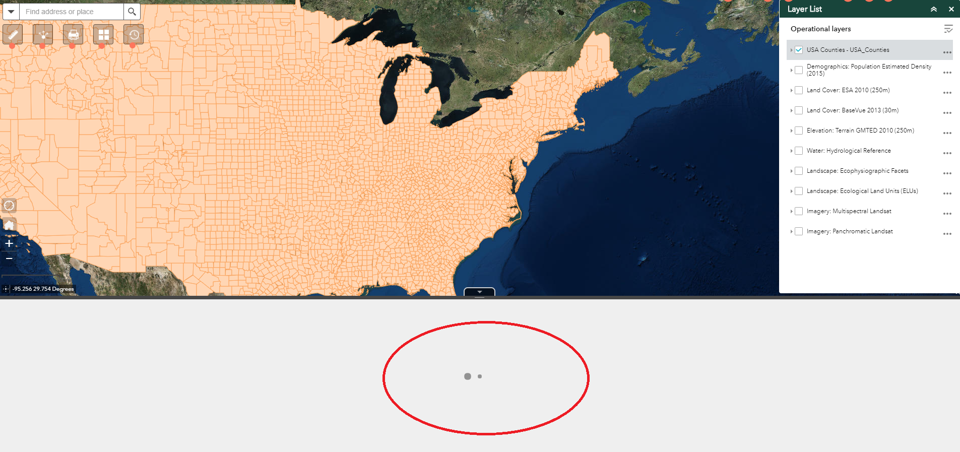
Recently, I have been having issues in my WAB-based web application when trying to view the attribute table of any layer in it, no matter whether that data is pulled from AGOL or from a local shapefile. Keep in mind that I am testing this with data where there is a small number of features in it. The attribute table (attached image) show a buffering/loading GIF and no table is pulled up. Do you have any idea what can be causing this? I checked my remote server and RAM is running at 40%, CPU < 10% so does not seem to be related to any overhead issue. Any help troubleshooting is much appreciated!
Solved! Go to Solution.
Accepted Solutions
- Mark as New
- Bookmark
- Subscribe
- Mute
- Subscribe to RSS Feed
- Permalink
You should test 2.7 and see if the issue goes away
- Mark as New
- Bookmark
- Subscribe
- Mute
- Subscribe to RSS Feed
- Permalink
What errors are present in the browsers web console?
- Mark as New
- Bookmark
- Subscribe
- Mute
- Subscribe to RSS Feed
- Permalink
Basically, no matter what data source I use/upload, when I click on View Attribute table from the Layer List widget, I get the following error in the Console portion of the dev tools on Chrome: 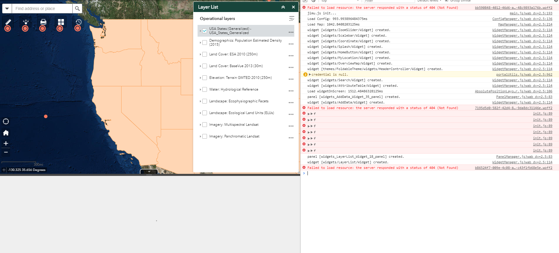
- Mark as New
- Bookmark
- Subscribe
- Mute
- Subscribe to RSS Feed
- Permalink
So it looks like you have not added .woff2 as a mime type in your web servers mime types (this is not the main issue though). I need to see what one of the >>f error has under it.
- Mark as New
- Bookmark
- Subscribe
- Mute
- Subscribe to RSS Feed
- Permalink
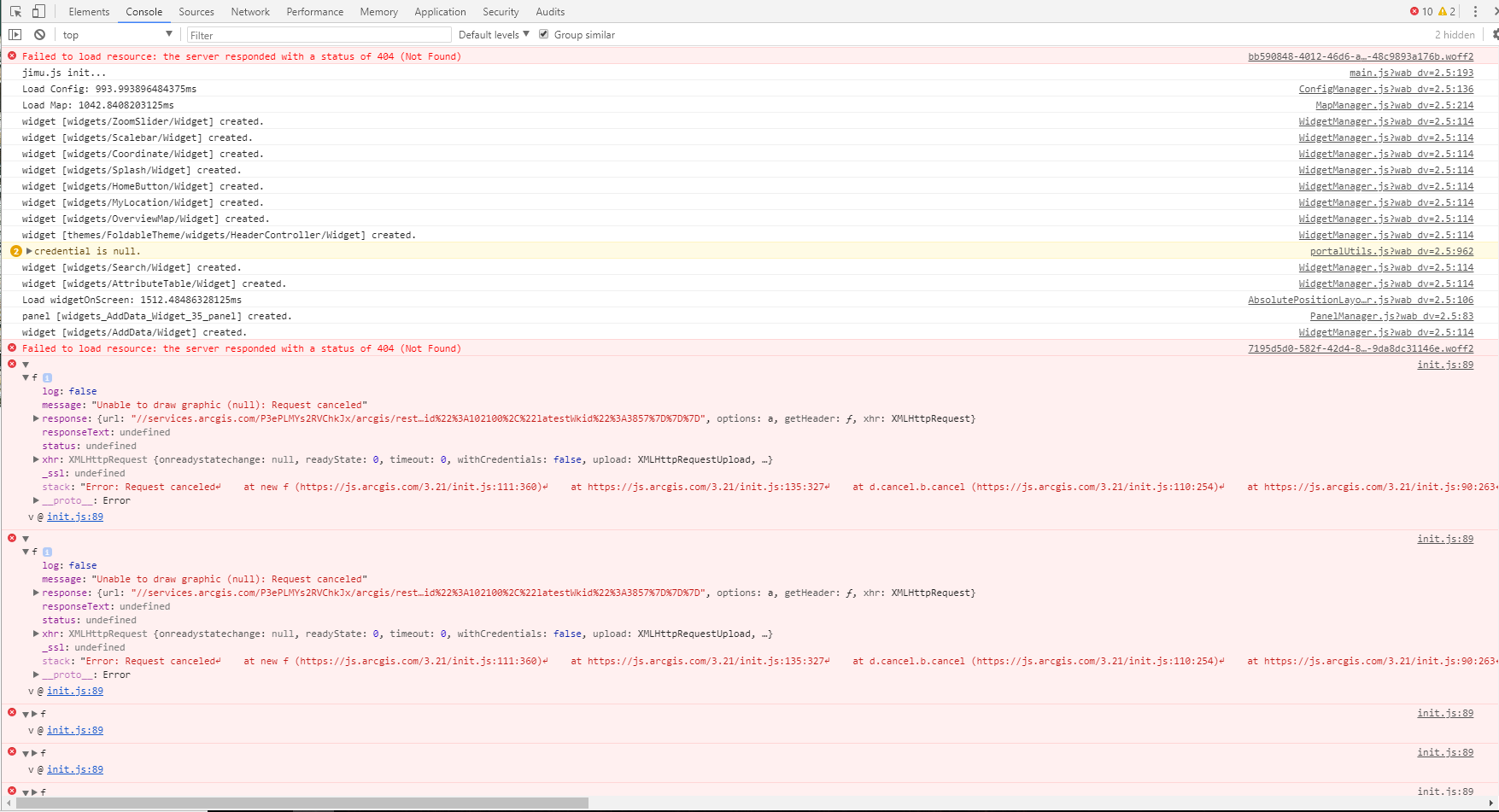
Thanks! How would I correct the (minor issue) addition of .woff2 as mime type? I am not familiar with what that is...I am using it off a WAB dev edition (2.5) customized template. Here is the expanded version of 2 of the >>f errors:
- Mark as New
- Bookmark
- Subscribe
- Mute
- Subscribe to RSS Feed
- Permalink
See this thread where I answer that:
https://community.esri.com/thread/181961-wab-error-on-startup-in-initjs
- Mark as New
- Bookmark
- Subscribe
- Mute
- Subscribe to RSS Feed
- Permalink
But that should not be the source of errors in my dev tools and why the attribute table won't open correct?
- Mark as New
- Bookmark
- Subscribe
- Mute
- Subscribe to RSS Feed
- Permalink
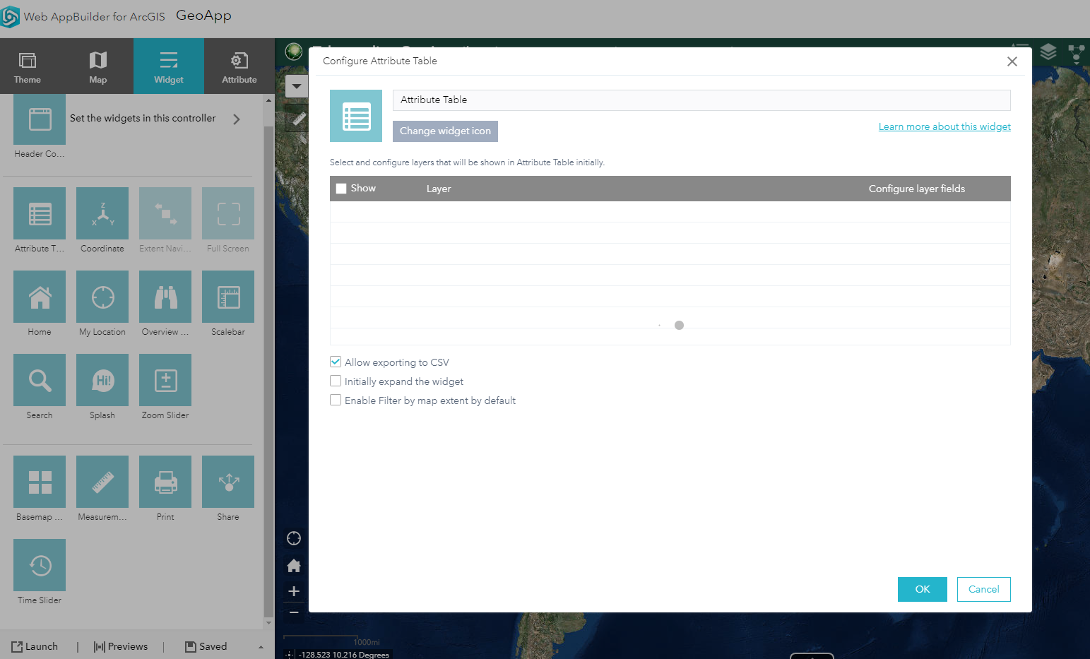
Correct the woff2 mime type is not the main issue the main issue is the failure to draw the graphics from the url that is listed in the error. Has the permission level for that feature changed lately? Can you go into the AT widget settings dialog and uncheck "Enable Filter by map extent by default" and test again?
- Mark as New
- Bookmark
- Subscribe
- Mute
- Subscribe to RSS Feed
- Permalink
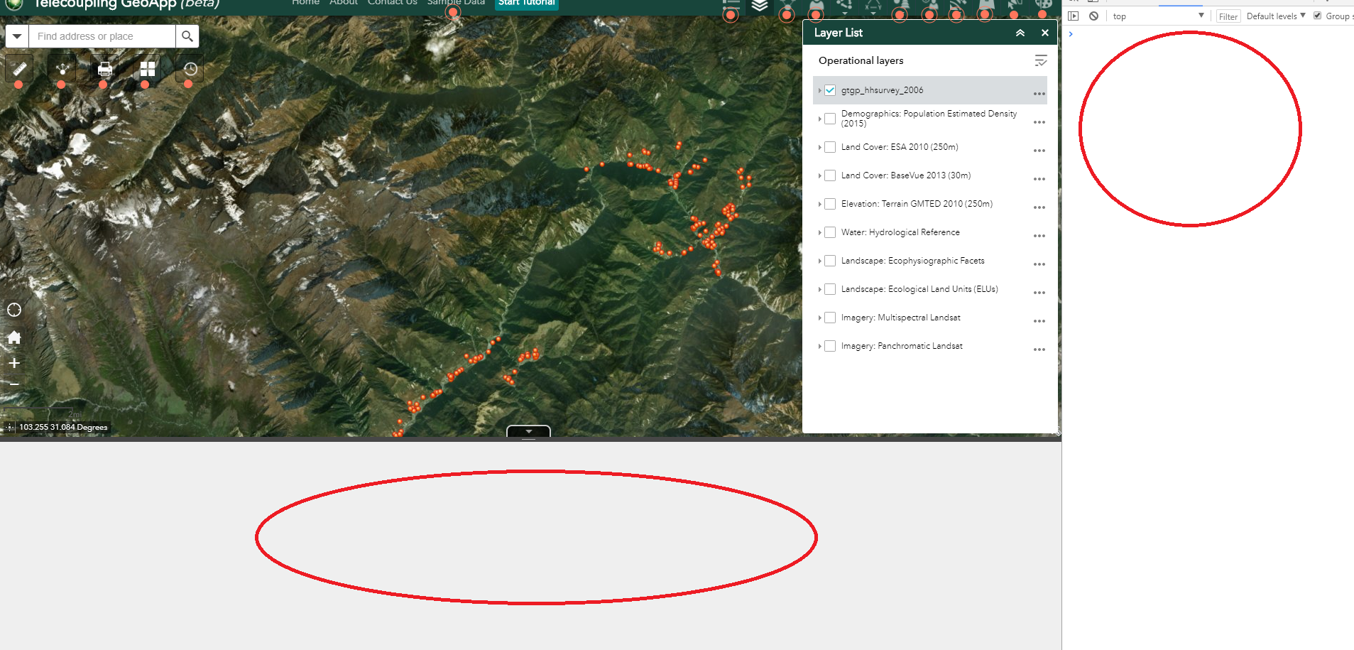
Sure. That option was already unchecked (see image 1 below).
The specific resource was just pulled for example from LivingAtlas using the Add Data Widget...I just picked US countries to pick one. However, when I use the Add Data and pick a zipped shapefile from my local PC, and then click on View Attribute Table from the Layer List, it still buffers not loading and I do not get any errors in the console...(image 2).
- Mark as New
- Bookmark
- Subscribe
- Mute
- Subscribe to RSS Feed
- Permalink
You should test 2.7 and see if the issue goes away