- Home
- :
- All Communities
- :
- Products
- :
- ArcGIS Utility Network
- :
- ArcGIS Utility Network Questions
- :
- ArcGIS Pro 2.5: “add tier” tool fails and end up w...
- Subscribe to RSS Feed
- Mark Topic as New
- Mark Topic as Read
- Float this Topic for Current User
- Bookmark
- Subscribe
- Mute
- Printer Friendly Page
ArcGIS Pro 2.5: “add tier” tool fails and end up with 999999 error,
- Mark as New
- Bookmark
- Subscribe
- Mute
- Subscribe to RSS Feed
- Permalink
ArcGIS Pro 2.5: “add tier” utility network tool fails and end up with 999999 error,
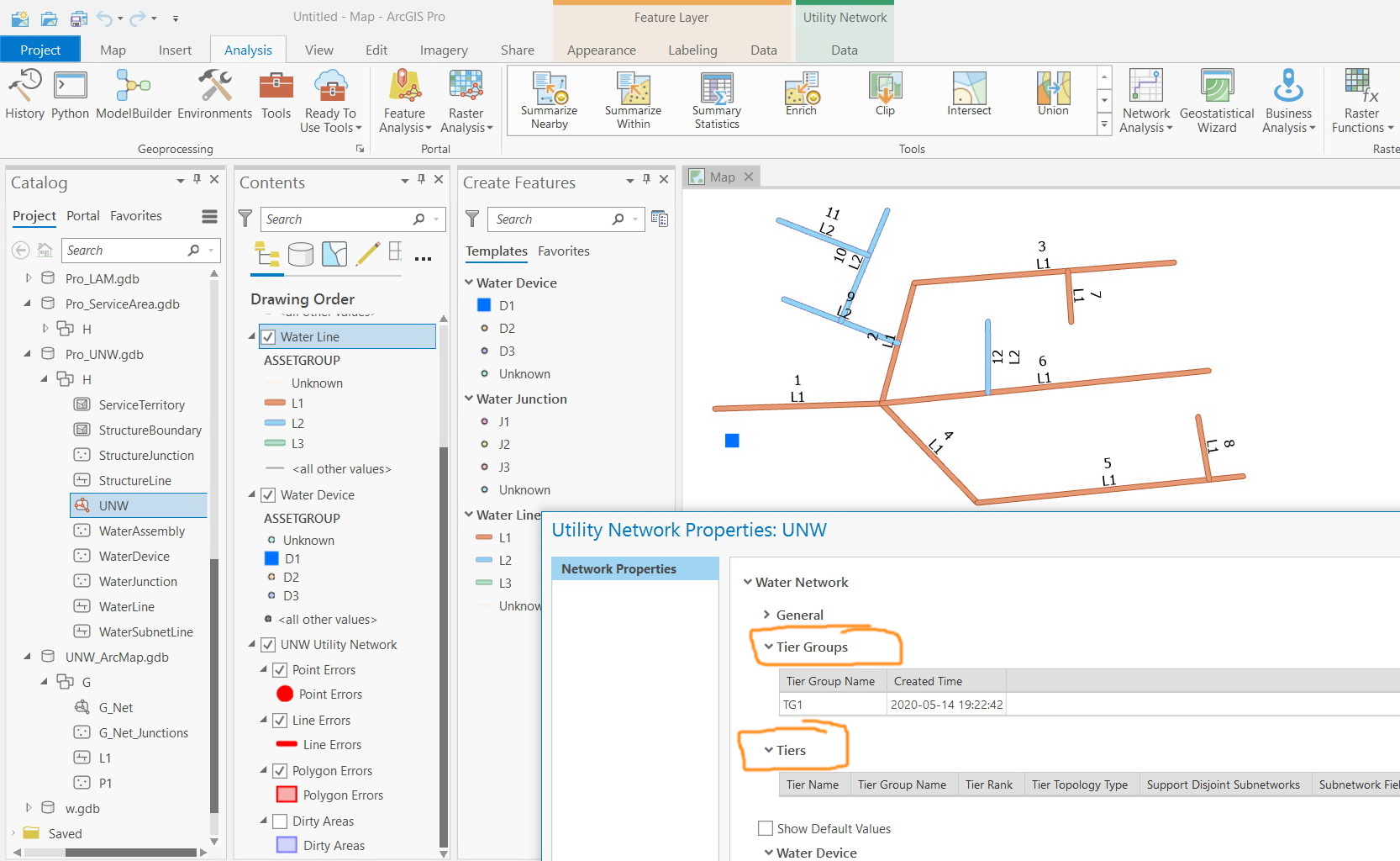
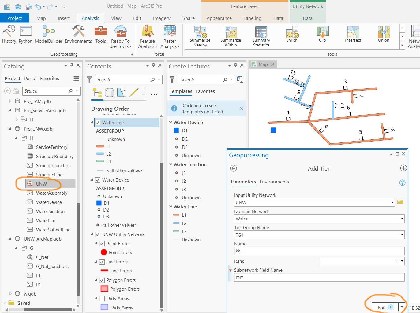
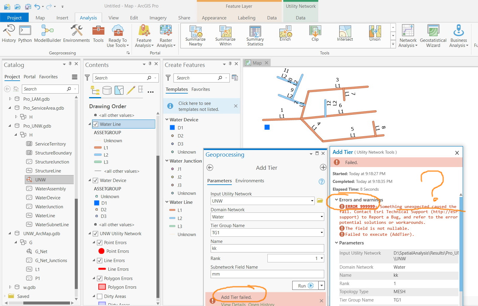
I couldn’t figure out why “add tier” utility network tool fails and end up with 999999 error.
Jamal Numan
Geomolg Geoportal for Spatial Information
Ramallah, West Bank, Palestine
Solved! Go to Solution.
Accepted Solutions
- Mark as New
- Bookmark
- Subscribe
- Mute
- Subscribe to RSS Feed
- Permalink
You can't add the first tier when you already have data.
From the help Add Tier—Utility Network Toolbox | Documentation :
Tiers should be added before appending data in the utility network feature classes. If data is appended prior to adding a new tier, an error will occur.
- Mark as New
- Bookmark
- Subscribe
- Mute
- Subscribe to RSS Feed
- Permalink
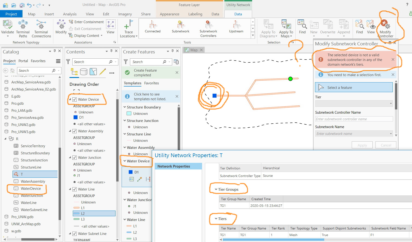
I got the error below when using the “modify controller” tool
Jamal Numan
Geomolg Geoportal for Spatial Information
Ramallah, West Bank, Palestine
- Mark as New
- Bookmark
- Subscribe
- Mute
- Subscribe to RSS Feed
- Permalink
Did you configure your tier? Set Subnetwork Definition—Utility Network Toolbox | Documentation
- Mark as New
- Bookmark
- Subscribe
- Mute
- Subscribe to RSS Feed
- Permalink
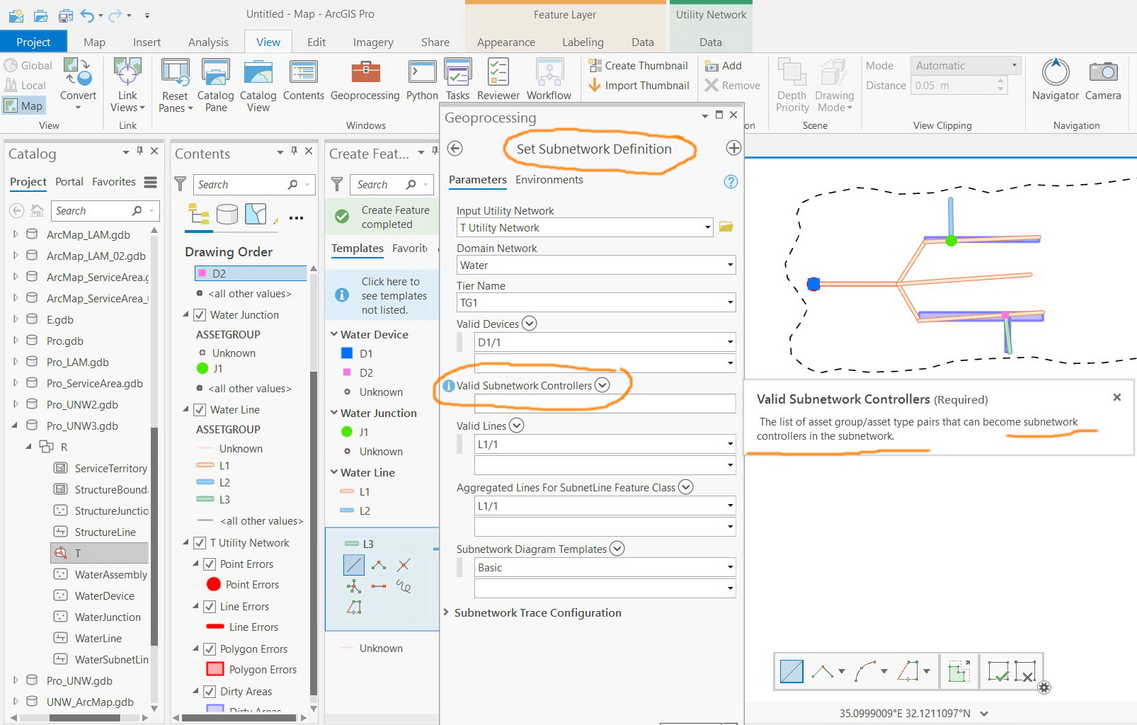
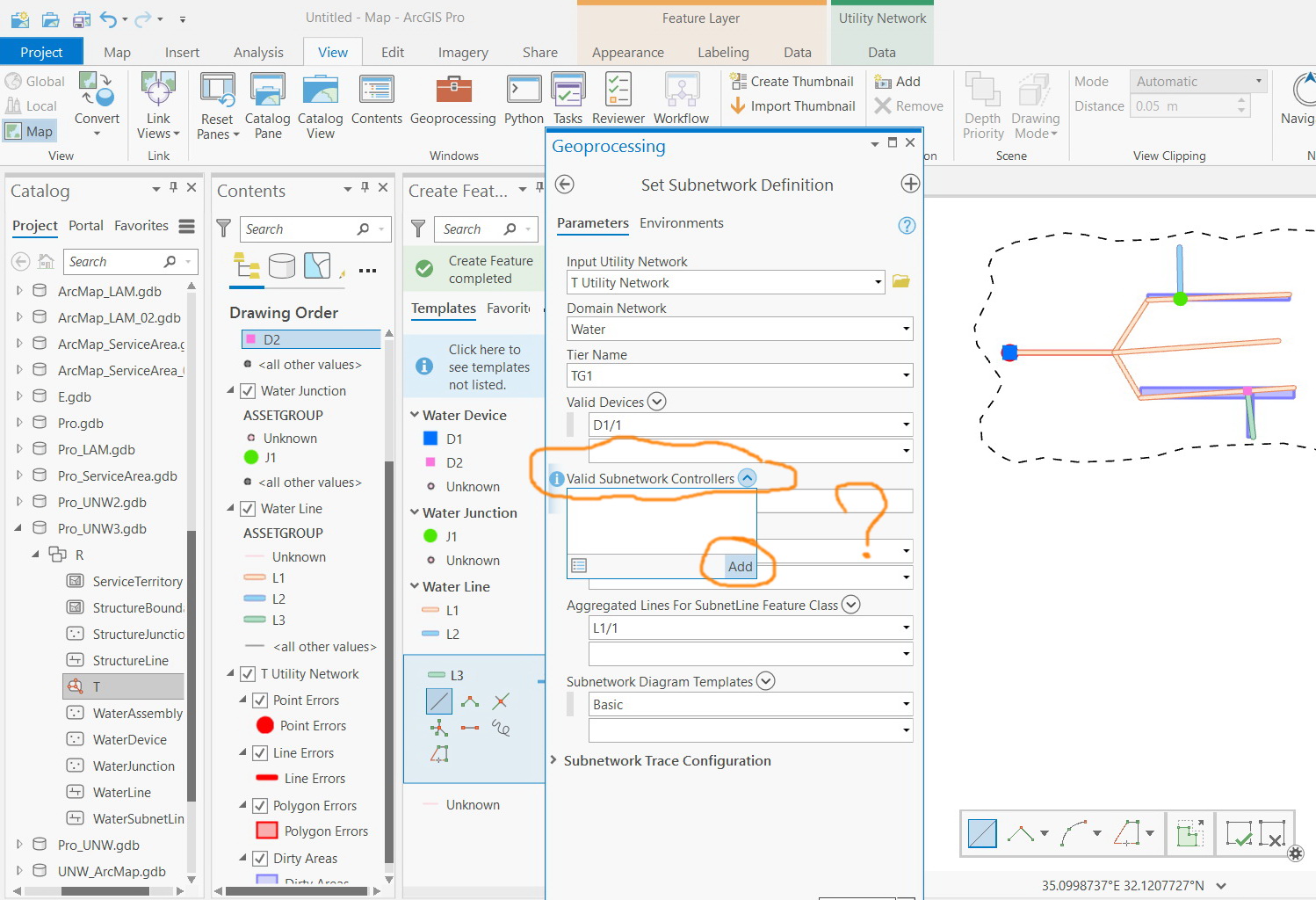
I found out that in order to perform “set subnetwork definition” tool, the “set subnetwork category” tool needs to be performed first.
I would appreciate if you could elaborate a little bit regarding what is reported in red when it comes to water network business. What does it mean in this sense?

Jamal Numan
Geomolg Geoportal for Spatial Information
Ramallah, West Bank, Palestine
- Mark as New
- Bookmark
- Subscribe
- Mute
- Subscribe to RSS Feed
- Permalink
As the error states, you need assign a terminal configuration to the asset group/type that is at least two terminals, and directional if partitioned.
- Mark as New
- Bookmark
- Subscribe
- Mute
- Subscribe to RSS Feed
- Permalink
Many thanks Michael for the input.
In case network represents water, and the source represents reservoir, businesswise, what does it mean to have two termianls?
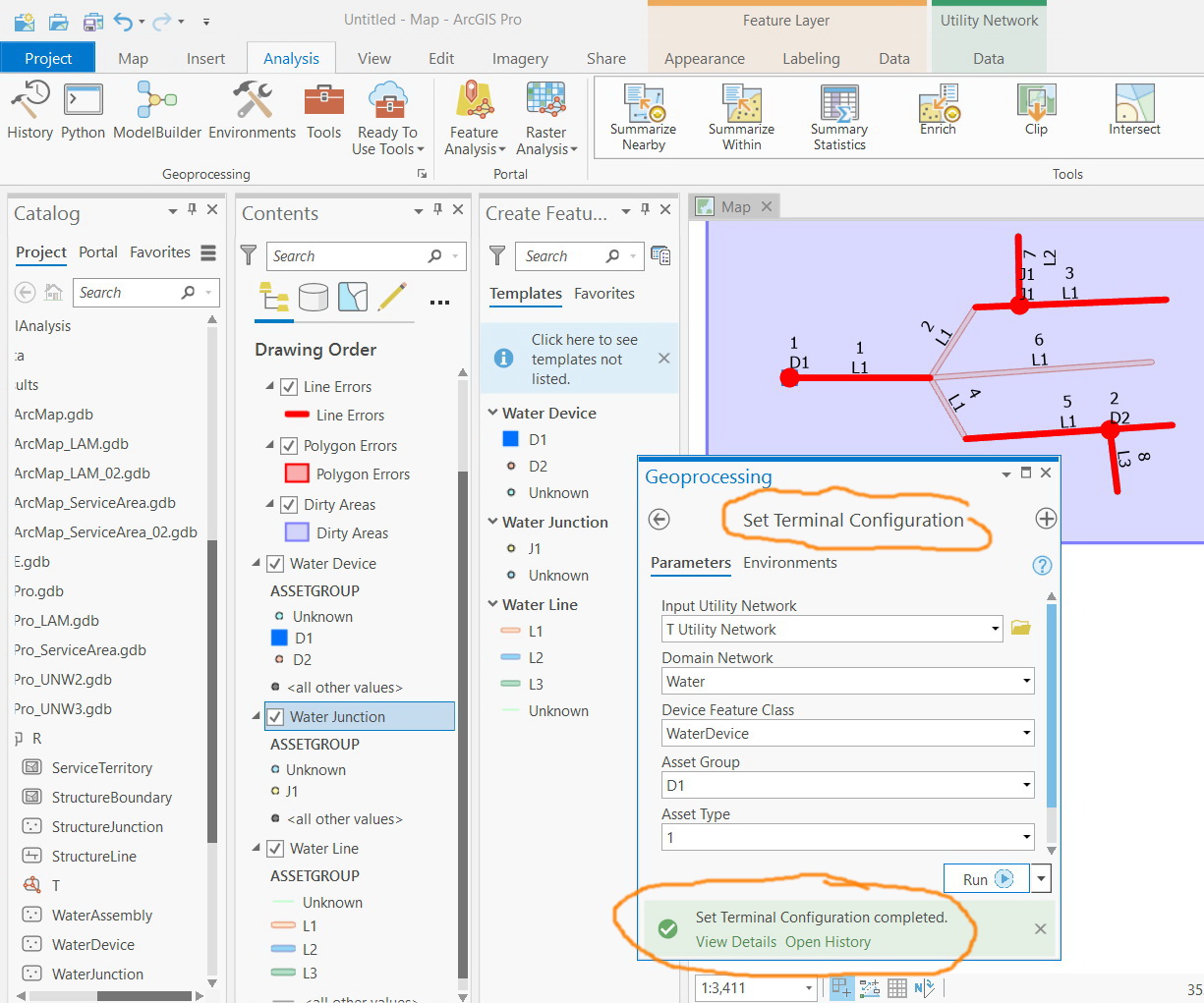
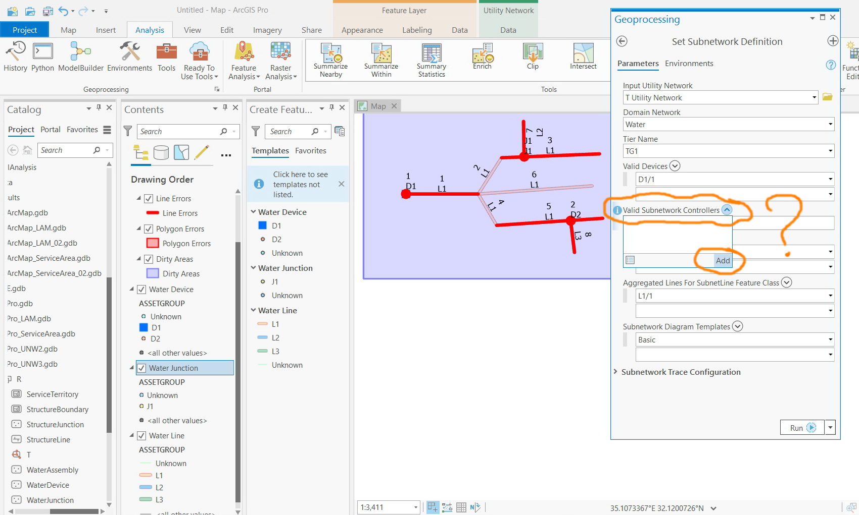
The “set terminal configuration” tool is performed, nevertheless, the “valid subnetwork controllers” list is still empty.
What could be the issue here?
Jamal Numan
Geomolg Geoportal for Spatial Information
Ramallah, West Bank, Palestine
- Mark as New
- Bookmark
- Subscribe
- Mute
- Subscribe to RSS Feed
- Permalink
Where does the water leave the reservoir? I would guess it would be a gate, pipe, or turnout. Are you modeling the reservoir as a point? You could use upstream and downstream as the terminals name.
Michael Miller | ArcGIS Solutions
Esri | 1325 Morris Dr. Suite 201 | Chesterbrook, PA | USA
T 909 793 2853 x5926 | M 484 885 4051 | mmiller@esri.com<mailto:mmiller@esri.com> | esri.com<http://esri.com/>
Esri ■■■■■■ The Science of Where ®
- Mark as New
- Bookmark
- Subscribe
- Mute
- Subscribe to RSS Feed
- Permalink
Thanks Michael
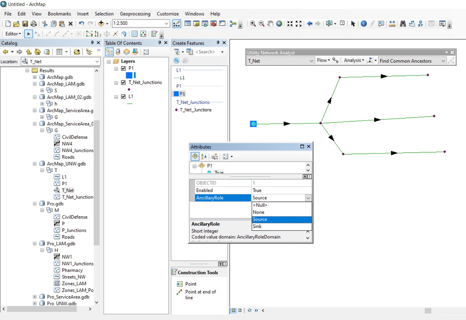
I’m coming from the ArcMap school. We used to set the reservoir (represented as point) as a source and that’s all. The reservoir is connected to pipe and thus the flow in the pipes is determined.
What is the equivalent stuff that I need to apply in Pro in order to get the flow\direction configured and thus the trace can be performed?
Jamal Numan
Geomolg Geoportal for Spatial Information
Ramallah, West Bank, Palestine
- Mark as New
- Bookmark
- Subscribe
- Mute
- Subscribe to RSS Feed
- Permalink
Set the terminals on your reservoir point.