- Home
- :
- All Communities
- :
- Products
- :
- ArcGIS Survey123
- :
- ArcGIS Survey123 Questions
- :
- Re: pulldata function is not showing correct value...
- Subscribe to RSS Feed
- Mark Topic as New
- Mark Topic as Read
- Float this Topic for Current User
- Bookmark
- Subscribe
- Mute
- Printer Friendly Page
pulldata function is not showing correct values consistently
- Mark as New
- Bookmark
- Subscribe
- Mute
- Subscribe to RSS Feed
- Permalink
We're working on a water monitoring survey that has site names associated with lat/longs. The survey user selects a site name which uses the pulldata function to pull the location (latitude/longitude) and display it on a map within the survey. The site code is also automatically selected.
On the original form, it works beautifully; however, we've since added two sites to the survey (monitoring sites change) and, for these new sites, instead of pulling the site name and listing it in the monitoring site name column in the survey results, it lists the latitude/longitude code as entered into the XLS forms. In addition, the site does not appear in the site list on our web map app. All of the original sites appear as they should, and the new sites were entered exactly the same as the old.
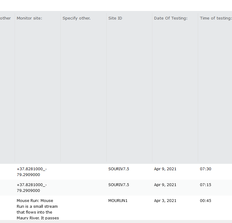
I've attached a screenshot showing how the site displays on our survey results.
Has anyone come across a problem like this before? Any help would be greatly appreciated!
Thank you.
- Mark as New
- Bookmark
- Subscribe
- Mute
- Subscribe to RSS Feed
- Permalink
Hi. It is hard to say without having a look at the XLSForm, but it looks to me like the problem is not caused by pulldata(). I think the problem is caused by the selection you are making on the sitecode list. When you originally published the survey, a new coded value domain was generated for your list. Then, you added new entries in your list and republished, but the coded value domain was not updated (this is by design how Connect works today). Elements in your XLSForm list that have corresponding values in your coded value domain show descriptions in the table. The ones that dont, show values.
Again, a long shot without looking at the XLSForm, but this could explain the problem.
- Mark as New
- Bookmark
- Subscribe
- Mute
- Subscribe to RSS Feed
- Permalink
Thank you!
Sherri Tombarge
- Mark as New
- Bookmark
- Subscribe
- Mute
- Subscribe to RSS Feed
- Permalink
You have to update manually or republish.
A number of people have asked for the domains to be in sync. See my list here
To get the idea going.
Upvote here https://community.esri.com/t5/arcgis-survey123-ideas/have-an-option-where-survey123-dropdown-list-an...
Hope that helps